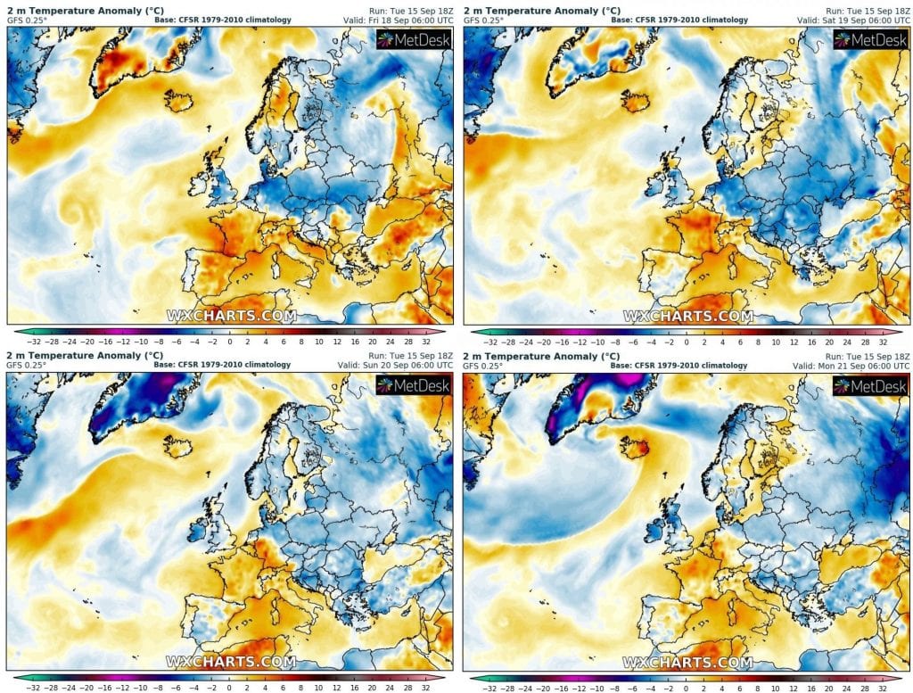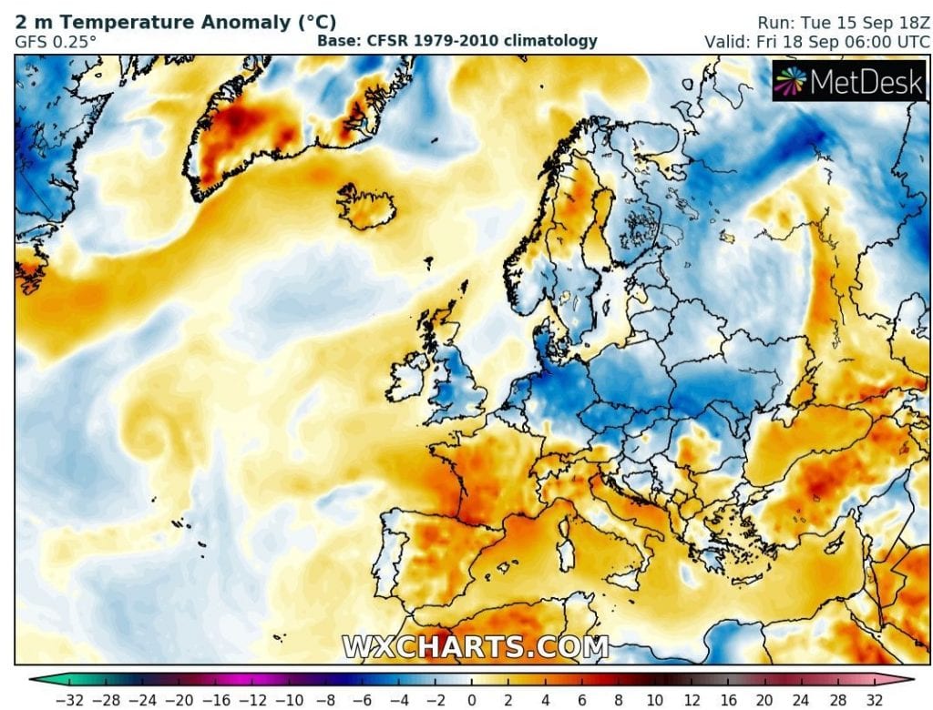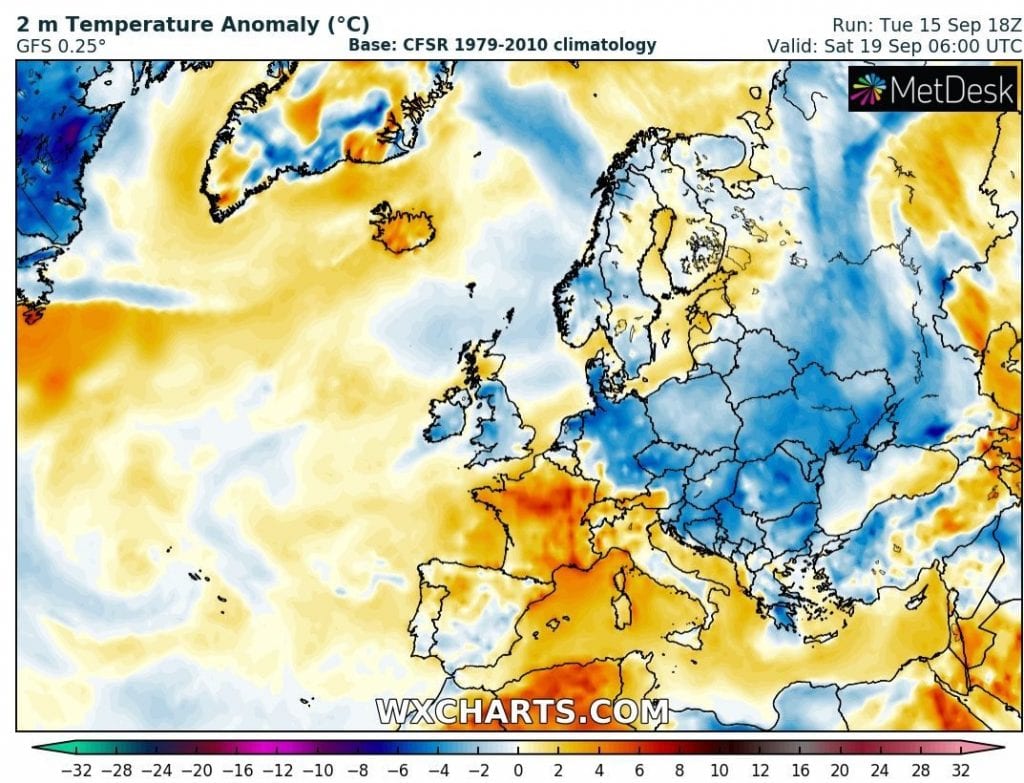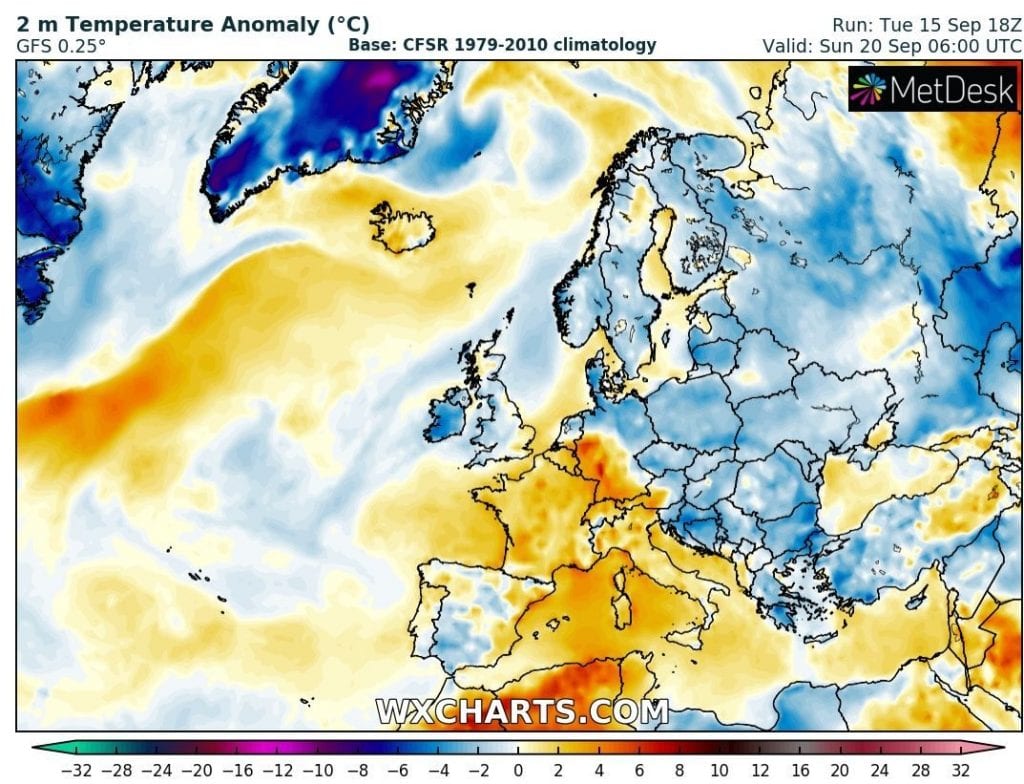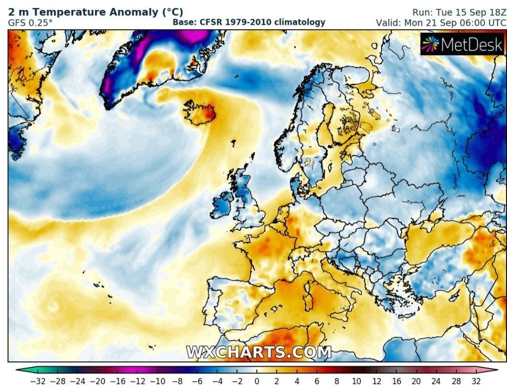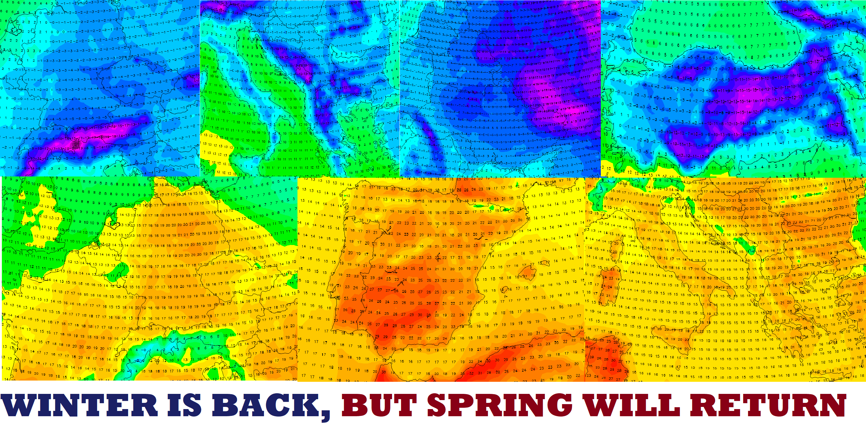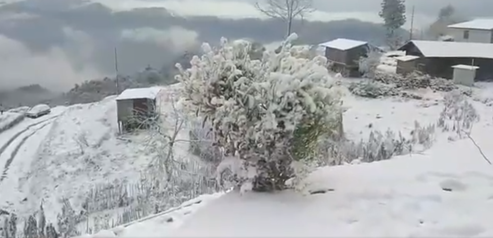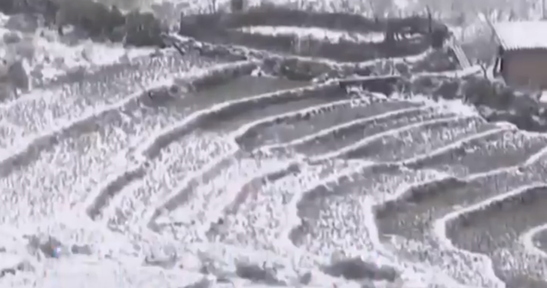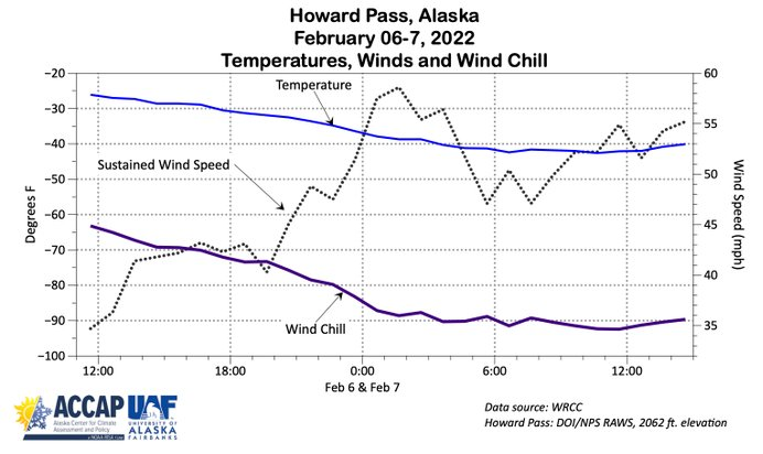

Arctic blast finally hits East-Central, East-Central Europe, Baltic states and parts of Balkan mainly after transition of cold front to south from Wednesday to Thursday 16.-17. September 2020.
Cold nights will come mainly in dry air after front – on Friday and at the weekend, with possible frosts around -2°C (0/-4°C) in Carpathian basins and valleys and Ukraine and +5/0°C in colder parts of lowlands and basins in Germany, Poland, Czechia, Slovakia, Hungary, Baltic states, Belarus, Ukraine and Balkan. Near this temperatures can occur ground frosts in lower areas from Berlin to Moscow and from Helsinki to Sofia.
Air mass below 0°C in 850hPa hits Estonia, Latvia, Lithuania, Poland, Belarus, Ukraine, Moldova and European Russia during these days. Frosts and ground frosts are possible in little warmer (+5°C in 850 hPa), but much drier air subsequently.
Next week after cold blast will return warmer, later probably summer weather (above +25°C in lowlands). It could be last summer days of the year if Atlantic hurricane season will bring the next remnants over Europe in early October.
For protect your harvest and flowers we recommend to watch current national forecasts mainly on Friday and at the weekend in hit countries.
T2 m anomaly in Europe at 6:00 in the morning from Friday to Monday 18.-21. September 2020