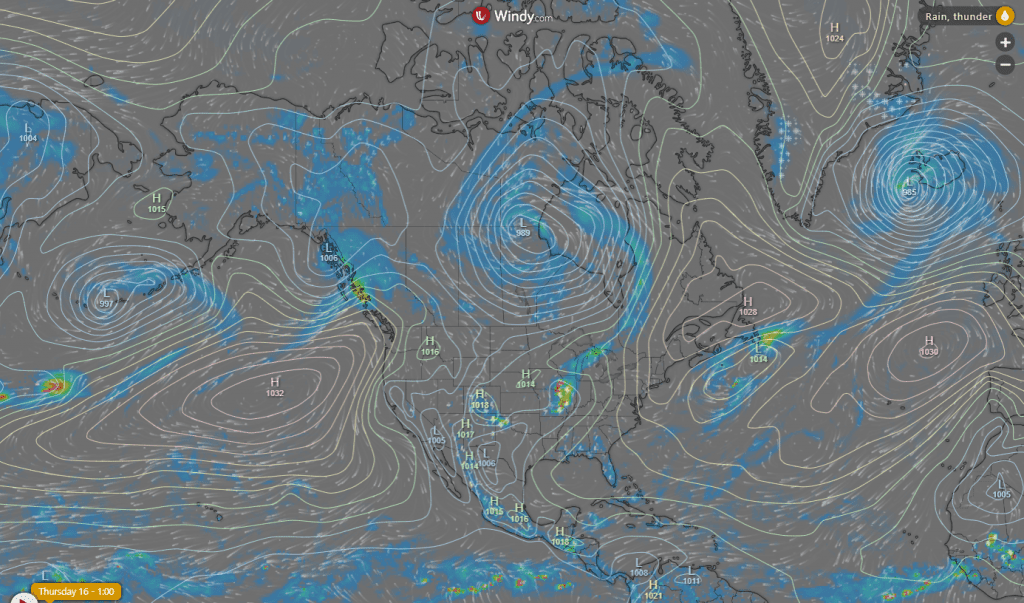
Anomalous pressure field with almost linked Hawai and Azore high, deep cyclones above Canada and NW Europe and strong Arctic high /https://www.severe-weather.eu/global-wehttps://www.severe-weather.eu/global-weather/arctic-ocean-ice-melt-transpolar-faather/arctic-ocean-ice-melt-transpolar-fa/ and weaker hurricane conditions over North Atlantic /https://mkweather.com/2020/07/15/atlantic-is-this-season-very-dry-for-early-hurricanes//, but too with extreme heatwaves returning from Southwest and South US /https://mkweather.com/2020/07/13/southern-us-is-facing-excessive-heatwaves-death-valley-128f-54c-texas-and-new-mexico-116f-47c-in-northeast-and-central-canada-heavy-storms-and-local-flood-are-expected// above Midwest /https://www.accuweather.com/en/severe-weather/severe-storms-to-hammer-midwest-plains-and-parts-of-east/777364/ to Northeast US and Canada /https://www.accuweather.com/en/weather-forecasts/heat-humidity-to-make-comeback-in-northeast-late-this-week/777282/; https://www.wunderground.com/article/forecast/regional/news/2020-07-15-hot-humid-summer-heat-increase-return-to-midwest-east (Northeast had heatwaves too, such as 70% of US during last period and heatwaves held here more than 20 days in row!). Between two linked heatwaves is situated in very warm and humid air powerful cold front, which is bringing in Wednesday and will bring during next days further severe T-storms over area. Summer 2020 is in North America full of extremes, meanwhile in Europe colder and more rainy.
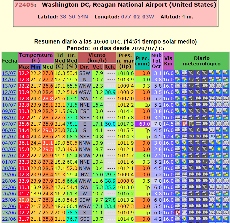
Washington D.C. with 20 consecutive days above 90°F / 32°C, if will be over 90 degrees Thursday and Friday too, it will be longest heatwave in city since 1872
America is sweating. To so long period with extreme hot weather don´t forget neither eldest people. If it will come true and in Thursday and Friday will be again over 90 degrees, history will be overwritten and Washington D.C. could declare the longest heatwave in the modern history, minimally from the start of meteorological measurements. Warmer were for now only periods in 1980 and 1988.
Cold front with T-storms can mainly in northern regions line of extremely hot days interrupt, but heatwaves soon will return – at the weekend again anomalous temperatures are expected. Chicago is waiting in Saturday 94°F, Indianapolis in Sunday 93°F, Philadelphia in Monday +97°F, New York in Monday 95°F and Boston at the turn of the weeks 91°F. Nights will be too very warm, afternoons with possible T-storms.
Severe T-storms are expected during next 48 hours in Great Lakes area and Texas, in late week they will move to Northeast, Central and SW Canada had to be prepared too
Accuweather.com and wunderground.com are closely monitoring situation around severe T-storms in US and Canada – firstly (Thursday and Friday) are expected from Midwest to Greatlakes area and in the south of Central Canada, later (Saturday and Sunday) in hot and humid air on in line across Northeast up to Labrador.
It seems, that North America has really bigger “happines” to extremely weather phenomenas in July 2020 than Europe and that the next days and weeks will be very hot not only regardning temperatures, but too severe damages and potential health and lives risk during severe T-storms and deadly ongoing heatwaves.


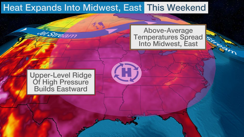


Graphical weather predictions from Accuweather.com and Wunderground.com of upcoming extreme week in US and Canada

