As of 12:00 UTC, June 26, 2025, Invest 95E is an organizing tropical disturbance located in the Eastern Pacific Ocean, south of Mexico. Forecasters are closely watching this system for potential development into a tropical depression or tropical storm over the coming days, with long-range signs pointing to possible hurricane formation.
📍 Current Stats:
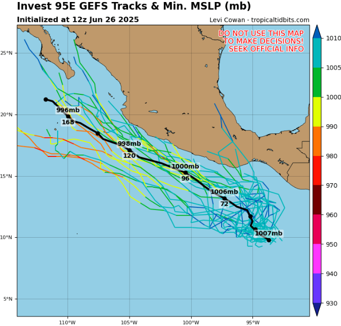
- Location: 10.0°N, 94.4°W
(Several hundred kilometers south-southwest of southern Mexico) - Maximum Sustained Winds: 25 knots (46 km/h or 29 mph)
- Minimum Central Pressure: 1007 hPa
- Radius of Maximum Winds: 100 nautical miles (~185 km)
- Gust Data & Circulation Radius: Not yet determined
🌀 Development Outlook
- Invest 95E is situated over very warm sea surface temperatures (~29–30 °C), with moderate wind shear and increasing low-level convergence—conditions favorable for gradual development.
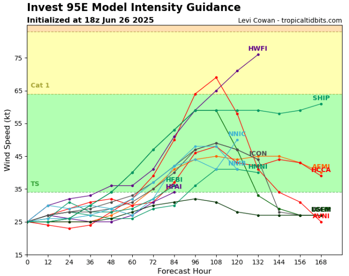
- Over the next 48–72 hours, the system may become a tropical depression, with a high chance of further intensification.
- Long-range model guidance suggests cyclonic strengthening, possibly reaching tropical storm or even hurricane status if it remains offshore long enough.
🧭 Steering & Track
- The system is expected to track west-northwest, roughly parallel to the southern coast of Mexico.
- If it shifts closer to land, heavy rainfall and rough surf could affect coastal regions from Chiapas to Guerrero.
- If it remains at sea, it may intensify further before turning out to sea.
⚠️ Key Concerns
- Potential for tropical storm or hurricane development
- Heavy rainfall threat for southern Mexico if the system nears land
- Maritime hazards including increasing wave heights and gusty winds
Summary: Invest 95E is showing signs of development and could be the next named storm or hurricane in the Eastern Pacific. While it currently poses no immediate threat, coastal regions of Mexico should monitor its progress closely.
Source: https://www.tropicaltidbits.com/storminfo/#95E


