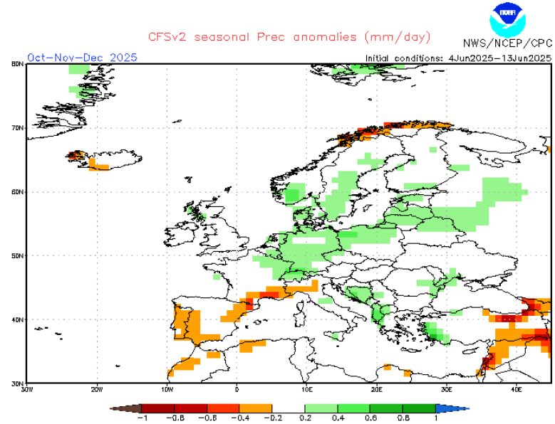
As Europe approaches the critical transition months of November and December 2025, weather forecasts indicate a substantial increase in precipitation across much of the continent. The seasonal models point to above-average rainfall and snowfall during this period, raising the question: will Europe experience a rainy late autumn, or will the wet conditions herald an early onset of winter snow?
Forecast Overview: Abundant Precipitation Across Europe
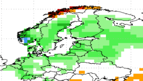
According to the latest climate projections, Europe is expected to see significantly higher than normal precipitation in late autumn and early winter. This enhanced moisture availability stretches broadly across Western, Central, and Eastern Europe, affecting a wide range of countries from France and Germany to Poland and Russia.
Cloud Cover and Temperature: A Key Balancing Act
One of the most important factors influencing whether this precipitation falls as rain or snow is the anticipated increase in cloudiness. Extensive cloud cover tends to act like a blanket, trapping heat near the surface and moderating temperatures. This could result in milder-than-average temperatures for many regions during November and December.
- Mild temperatures combined with abundant moisture will most likely lead to prolonged periods of rain and wet conditions, particularly at lower elevations and in western and central Europe.
- However, in northern and eastern Europe, and at higher altitudes, temperatures may still drop low enough for precipitation to fall as snow, signaling the start of a potentially early snowy winter season.
Regional Differences: Rain vs. Snow
- Western and Central Europe (France, Germany, Benelux):
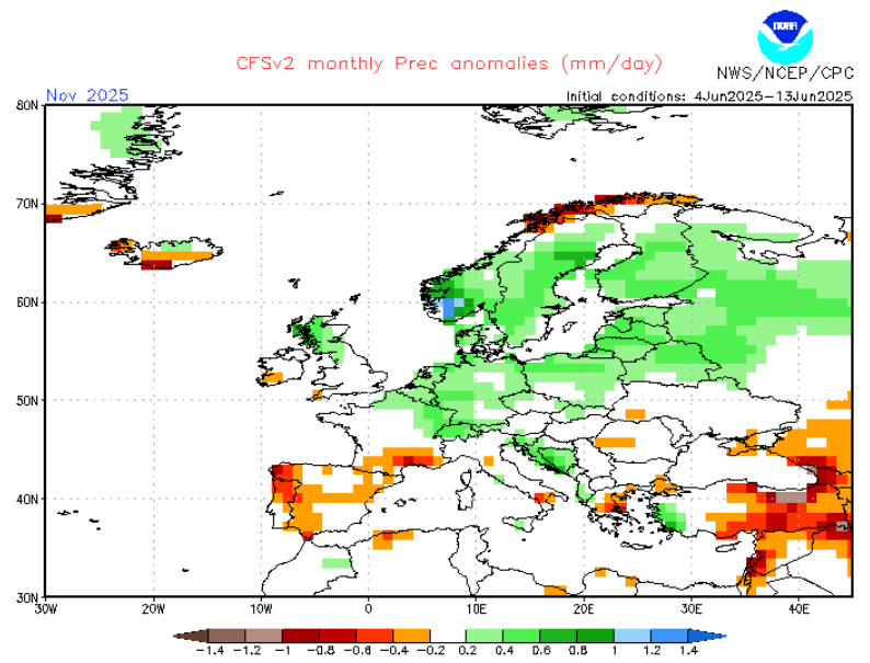
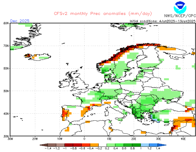
With abundant cloudiness and mild air masses, these areas may experience persistent rain and wet weather well into December, delaying the first significant snowfall to later in the season. - Northern and Eastern Europe (Scandinavia, Poland, Baltic States, Russia):
Colder air masses here increase the likelihood that much of the precipitation will fall as snow, possibly marking the beginning of winter with early and sustained snow cover. - Mountainous regions (Alps, Carpathians, Pyrenees):
Higher elevations are expected to see snowfall accumulating earlier than usual, contributing to a potentially robust winter snowpack.
Implications
- Agriculture and Water Management:
Rain-dominated autumn conditions can replenish water supplies but may also hinder harvesting and soil preparation. Conversely, early snow can protect winter crops but challenge transportation and infrastructure. - Energy and Infrastructure:
Milder but wet weather may reduce heating demand temporarily but increase risks of flooding. Early snowfalls could strain road and rail networks, requiring prompt response measures.
Conclusion: Dual Possibility for Autumn-Winter Transition
The forecast paints a picture of a wetter than normal late autumn and early winter, but whether that translates into predominantly rainy conditions or an early snowy winter largely depends on the balance of cloud-induced mildness and the encroachment of colder air.
Europe may well experience a rainy late autumn in the west and center, while the north and east brace for early snow, creating a diverse and dynamic seasonal transition in the final months of 2025.
Detail.


