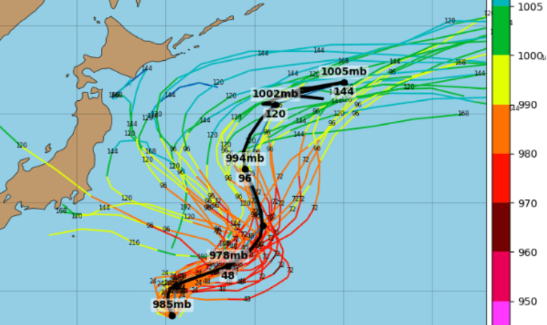
July 3, 2025 – Tokyo, Japan — Tropical Storm Mun, the sixth named storm of the 2025 Western Pacific typhoon season, is currently located approximately 1,098 km (683 miles) south-southeast of Yokosuka, Japan. The storm is moving northward at a speed of 17 km/h (9 knots), with maximum sustained winds of 65 km/h (40 mph) and significant wave heights reaching 4.6 meters (15 feet).
Storm Development and Forecast
Mun intensified from a tropical depression to a tropical storm on July 2, 2025, and is expected to continue its north-northwestward trajectory over the next 24 to 36 hours. Meteorological models suggest that the storm will follow a classic “S-type” track, influenced by the surrounding monsoon trough and subtropical ridge patterns. Intensity forecasts indicate that Mun may reach peak winds of 110–130 km/h (68–81 mph) within the next 72 hours .
Impacts on Japan
While Mun is not forecasted to make landfall, its expansive rainbands are likely to affect southern and central Japan, including regions such as Kyushu, Shikoku, and western Honshu. Residents in these areas should remain vigilant for potential heavy rainfall, strong winds, and the possibility of localized flooding and landslides.
Safety Recommendations
Authorities advise the public to monitor updates from the Japan Meteorological Agency (JMA) and local government sources. It’s recommended to secure outdoor objects, avoid coastal areas due to high surf, and prepare for possible disruptions to transportation services.
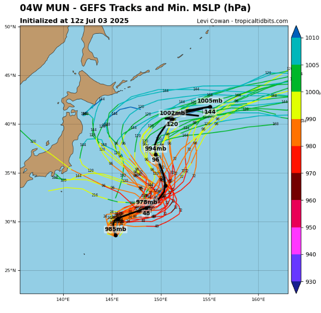
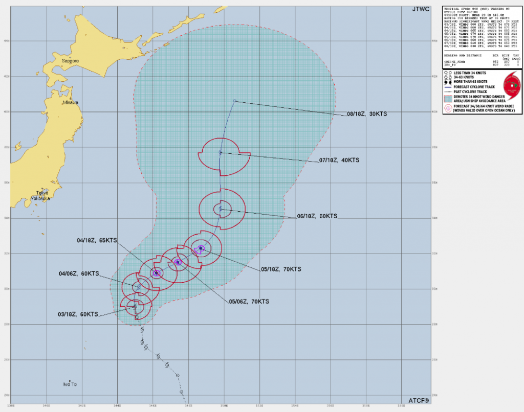
Source: https://www.tropicaltidbits.com/storminfo/#04W
Detail.


