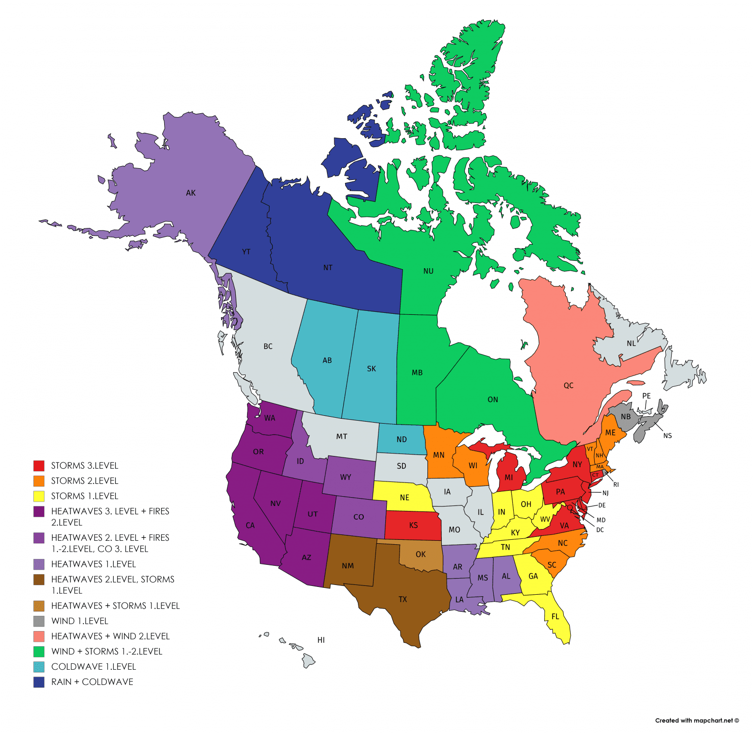
2 different worlds: Fires in Southwest (already in LA) and heavy storms still in eastern half of US
Situation with the starting excessive heatwave in West and ending severe stormy period in eastern half of US is detailed monitored by American meteorological services.
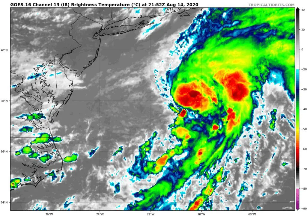
Meanwhile, over Atlantic, 2 new tropical storms have formed , but fortunately, high impact to East Coast is for now not expected /https://www.weathernationtv.com/news/tropical-depression-11-has-formed-in-the-atlantic/https://www.weathernationtv.com/news/tropical-depression-11-has-formed-in-the-atlantic//,
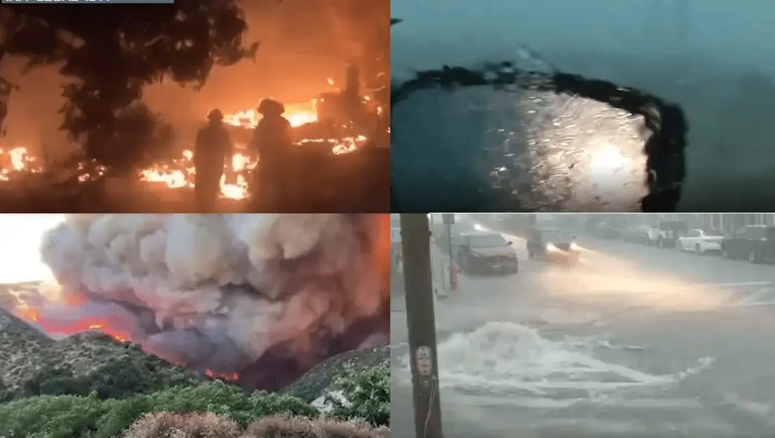
Attention is now concentrated to fires in west, mainly Southwestern part – wildfires have started threaten Los Angeles and situation is very bad across other states, too.
In contrary, Midwest, Plains, East Coast, Mid-Atlantic and Northeast are bothered by powerful T-storms, with the biggest potential damages across Mid-Atlantic during the weekend (see Mkweather warnings below).
Heatwave over west half of continent will be all next week intensified and above eastern half of US will move very cold Arctic air, with temperatures below average. Storms in many regions will be weaker, but in Midwest, this constellation of circulation is very favorable to tornado outbreak. We will monitor the situation and will bring the fresh news during the weekend and the next week.
There are a few videos from LA County/Colorado/Batimore respectively, from Weather Nation (Wednesday – Friday 12.-14. August 2020):
Mkweather warnings for the weekend 15.-16. August 2020:

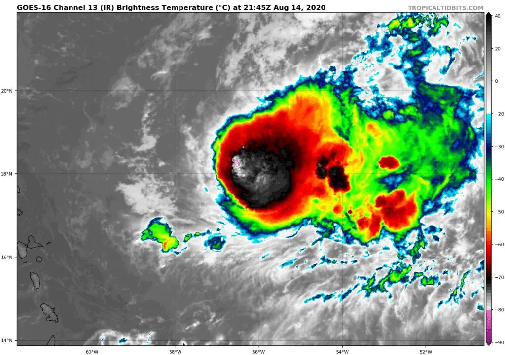
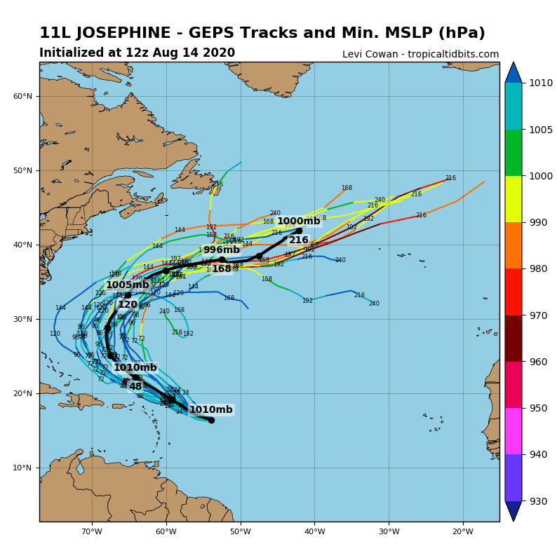
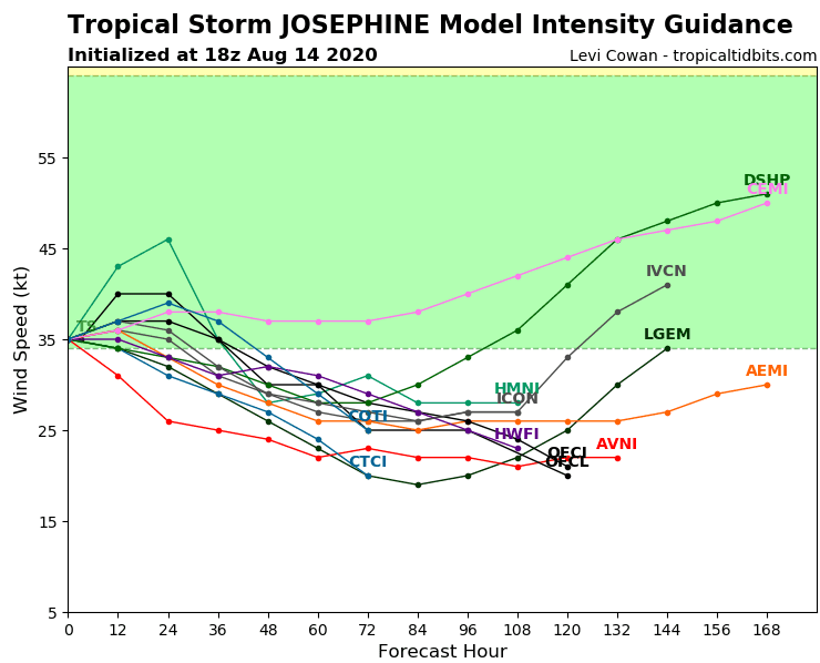
Tropical storm Josephine documentation /tropicaltidbits.com:
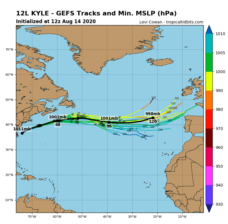
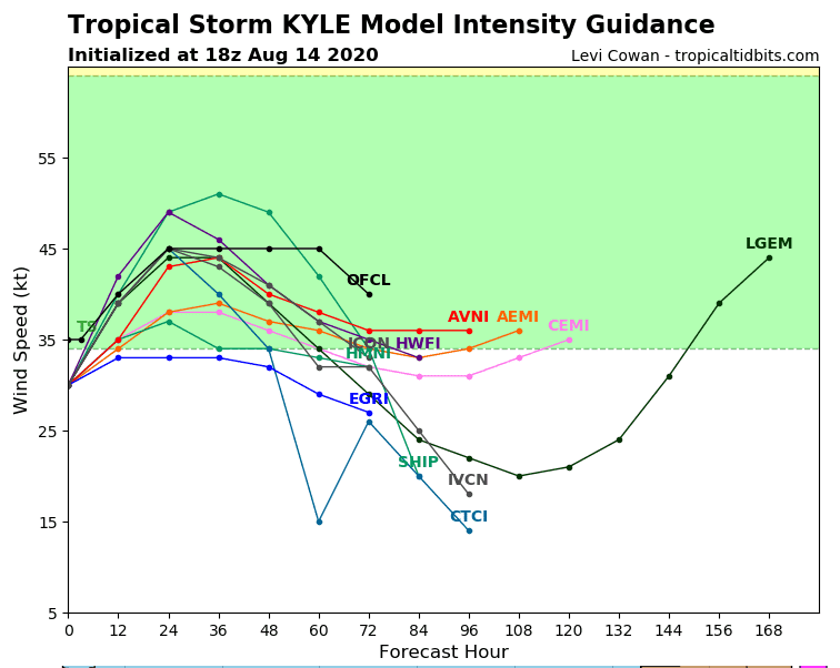
Tropical storm Kyle documentation /tropicaltidbits.com:
Additional materials from Accuweather:


