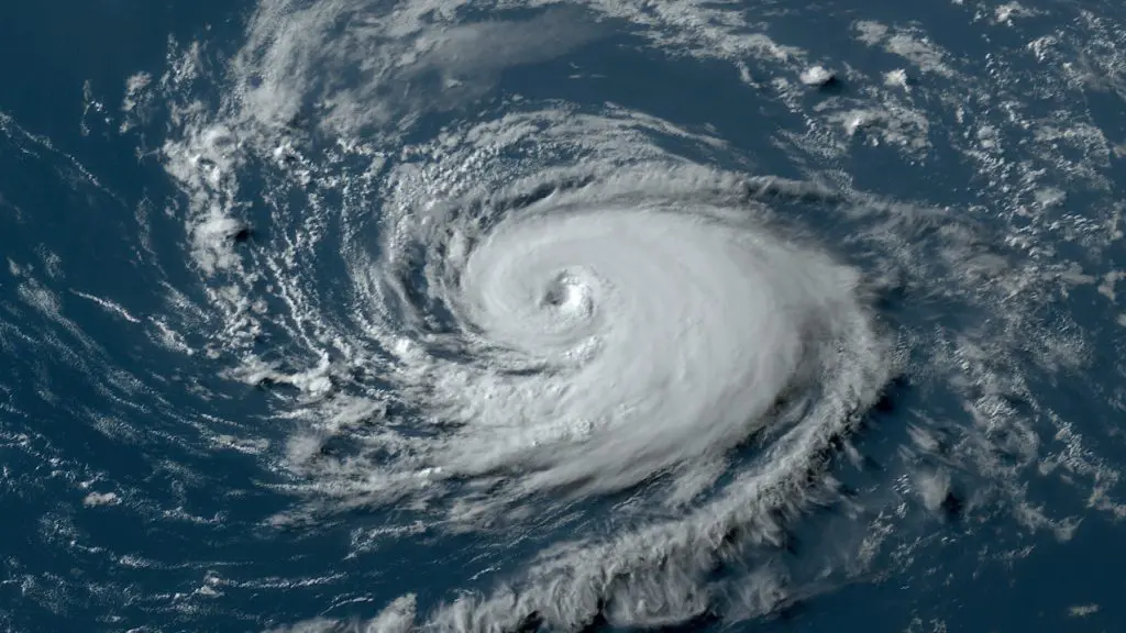
2025 Atlantic Hurricane Season Starts Quietly Busy — Warm Waters Fuel Expectations Ahead
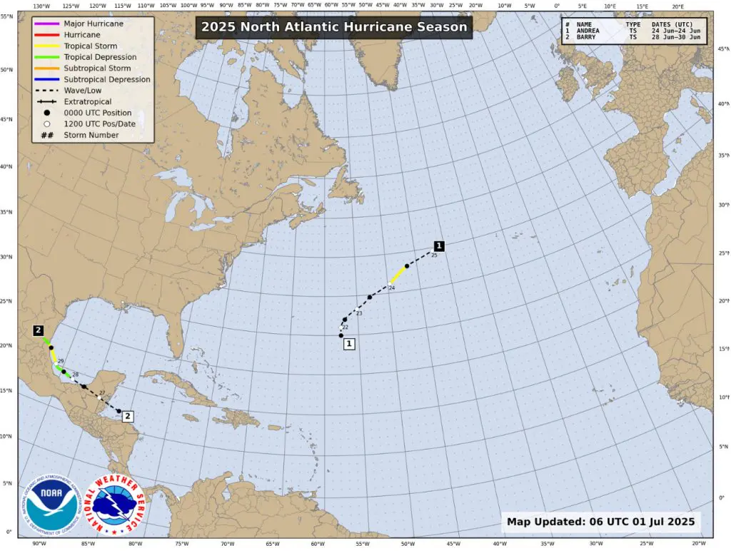
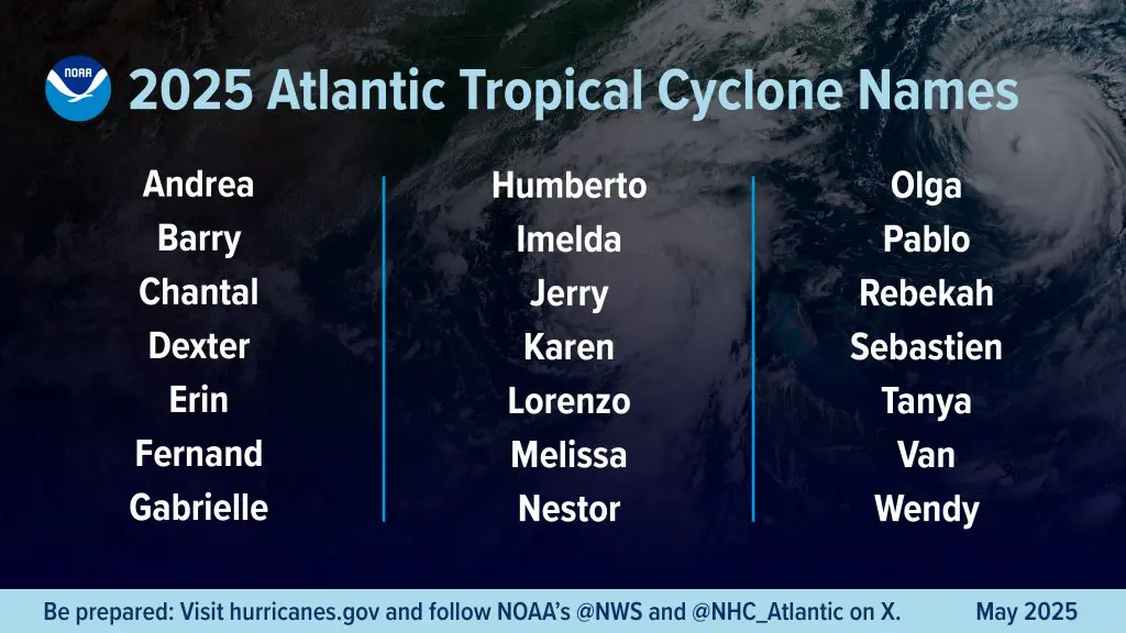
As of July 9th, 2025, the Atlantic hurricane season has seen three named systems: Tropical Storm Andrea (formed June 24th), Tropical Storm Barry (June 28–29th), and Tropical Storm Chantal (July 4–6). That tally slightly exceeds the historical average for this date, which typically sits around two named storms by early July. Andrea and Barry were short-lived and remained relatively weak, each generating minimal Accumulated Cyclone Energy (ACE). Chantal arrived on the heels of flash flooding in the Carolinas, marking a more impactful event. This early-season activity suggests the basin is tracking modestly ahead of climatology—with activity likely to ramp up soon.
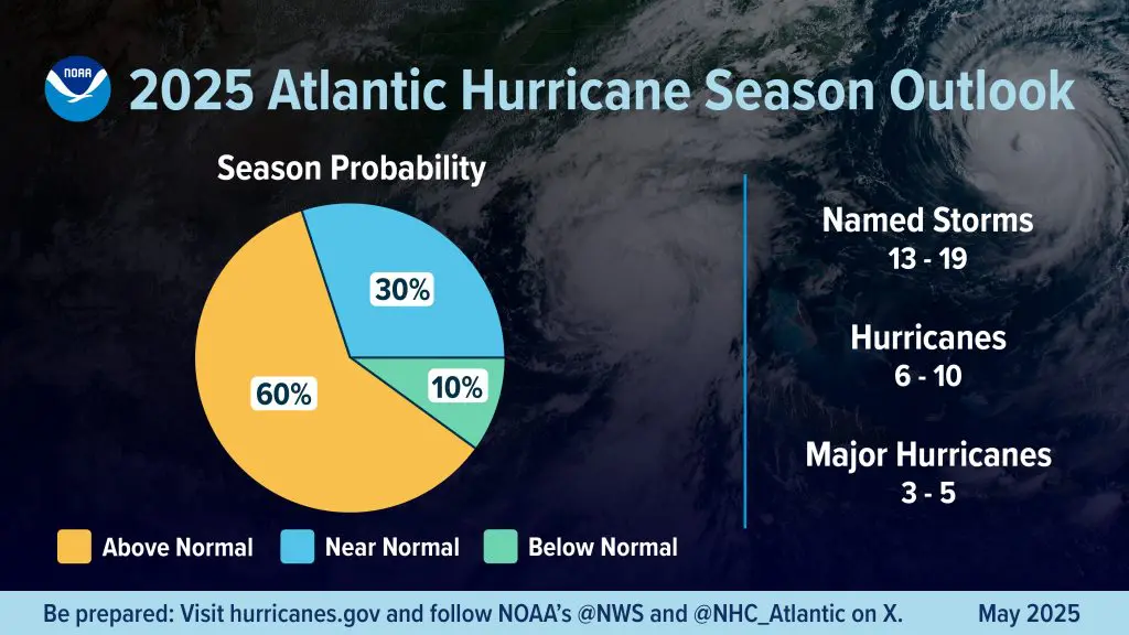
Seasonal outlooks remain in agreement that 2025 will be above-normal. NOAA assigns a 60% probability for above-average activity, forecasting 13–19 named storms, 6–10 hurricanes, and 3–5 major hurricanes (Category 3+). Colorado State University projects similarly active conditions—around 17 named storms, 9 hurricanes, and 4 major hurricanes—compared to 2024, which featured 20 named storms and 7 hurricanes, including several strong landfalls. Compared to the average count of 14 named storms and 7 hurricanes (1991–2020 baseline), this suggests a busier-than-normal season is unfolding—with potential for hurricane frequency to surpass last year’s pace.
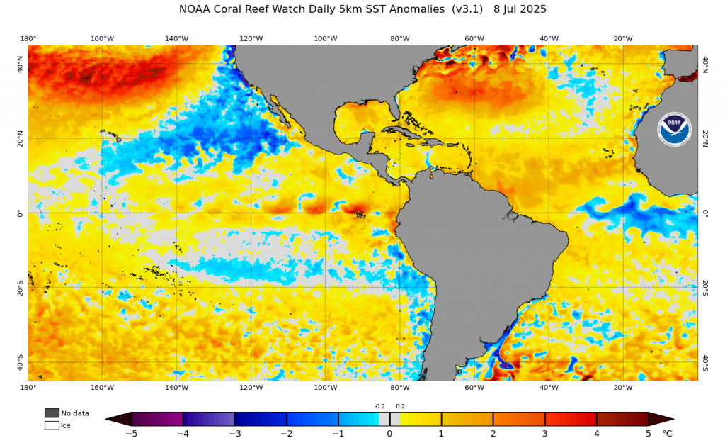
Sea surface temperature (SST) anomalies are a key driver of this heightened forecast. The Gulf of Mexico and western Atlantic currently show SSTs 1–1.5 °C above the 1991–2020 mean, while the Main Development Region is also warmer than average, though slightly cooler than 2024 values. Warm water provides the “fuel” for storms, especially when combined with moist atmospheric profiles. Equally important are low vertical wind shear—favored by current ENSO-neutral to possible La Niña conditions—and a robust West African monsoon, both enhancing tropical cyclone development.
Another significant meteorological influence has been frequent Saharan dust outbreaks, which have suppressed early development by introducing dry air over the Atlantic. This likely helped explain the slow initial pace despite warm waters. However, as Saharan Air Layers decrease and moisture returns, models suggest storm formation will accelerate—especially into August and September, the climatological peak. Additionally, large-scale systems like the Bermuda High and Central American Gyre may steer more hurricanes toward the U.S. Gulf and Southeast coasts during mid-to-late summer.
ENSO’s current neutral phase, with a 30–33% chance of a La Niña developing later this year, hints at further favorable trends. La Niña typically reduces wind shear over the Atlantic, enhancing storm potential. Given the warm SST backdrop and expected ENSO shift, the latter half of 2025 may bring heightened hurricane activity and landfall risk.
Looking ahead, hurricanes are forecast to continue forming through the peak months (August–October), with the ACE index projected at 95–180% of median. Should La Niña emerge, activity may shift toward the upper end of forecasts, increasing chances for major hurricanes. Still, early storms like Andrea and Barry—though weak—provided critical real-world data to refine models and forecast systems like NOAA’s upgraded HAFS.
Longer-term, climate change is expected to alter hurricane climatology. Warmer global SSTs contribute to more intense storms, heavier precipitation, and faster intensification rates, though overall storm frequency may not significantly change. The consensus is clear: future Atlantic seasons are likely to yield fewer but stronger storms, with heightened risks of rapid intensification and destructive rainfall. This year’s early activity, warm seas, and model signals may mark the beginning of a climate-influenced era of more dangerous hurricane seasons—placing a premium on preparedness and adaptive resilience.