July Storms Unleash Flash Floods and Lightning Tragedy Across Northeast U.S.
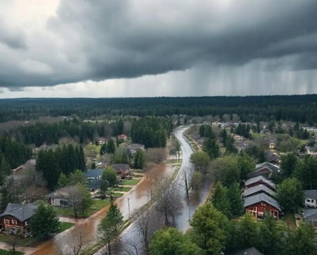
Between July 15th and 17th, a series of slow-moving thunderstorms drenched the Northeast U.S., prompting an unprecedented wave of flash flood warnings across New York, New Jersey, Pennsylvania, and Connecticut. Central Park recorded a staggering 67 mm (2.64 in) of rain in just over an hour on the evening of July 15, making it the second-wettest hour in the park’s 156‑year observational history. That deluge overwhelmed subway tunnels designed to manage only 44 mm (1.75 in) per hour, submerging platforms and stranding commuters. Meanwhile, Union County in New Jersey saw even more extreme amounts—152 mm (6 in) fell in just over an hour— forcing officials to declare a state of emergency. Flash flood alerts have now exceeded historical averages by mid‑July this year, marking what many meteorologists say is an extraordinarily active season.
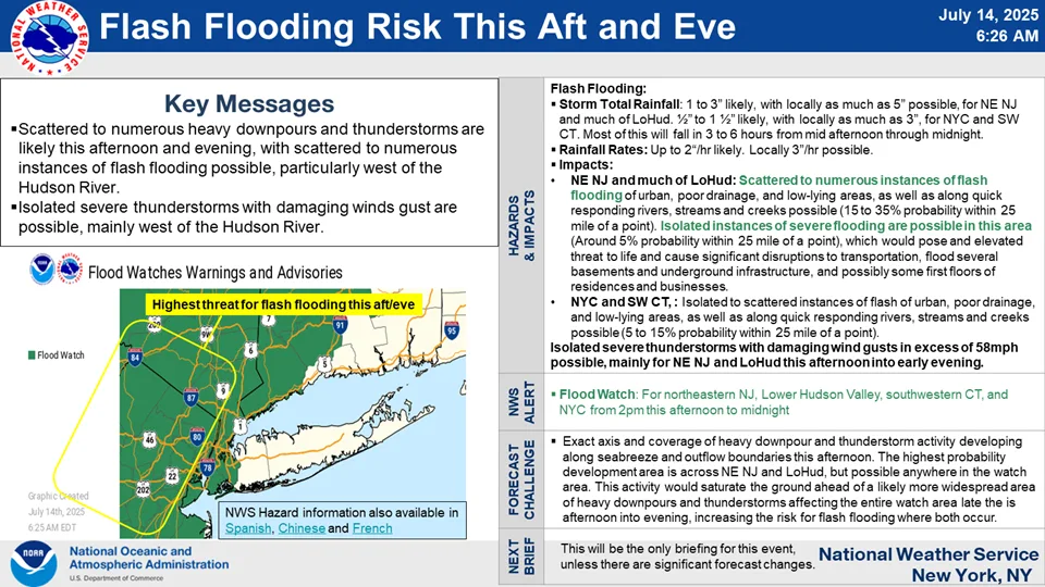
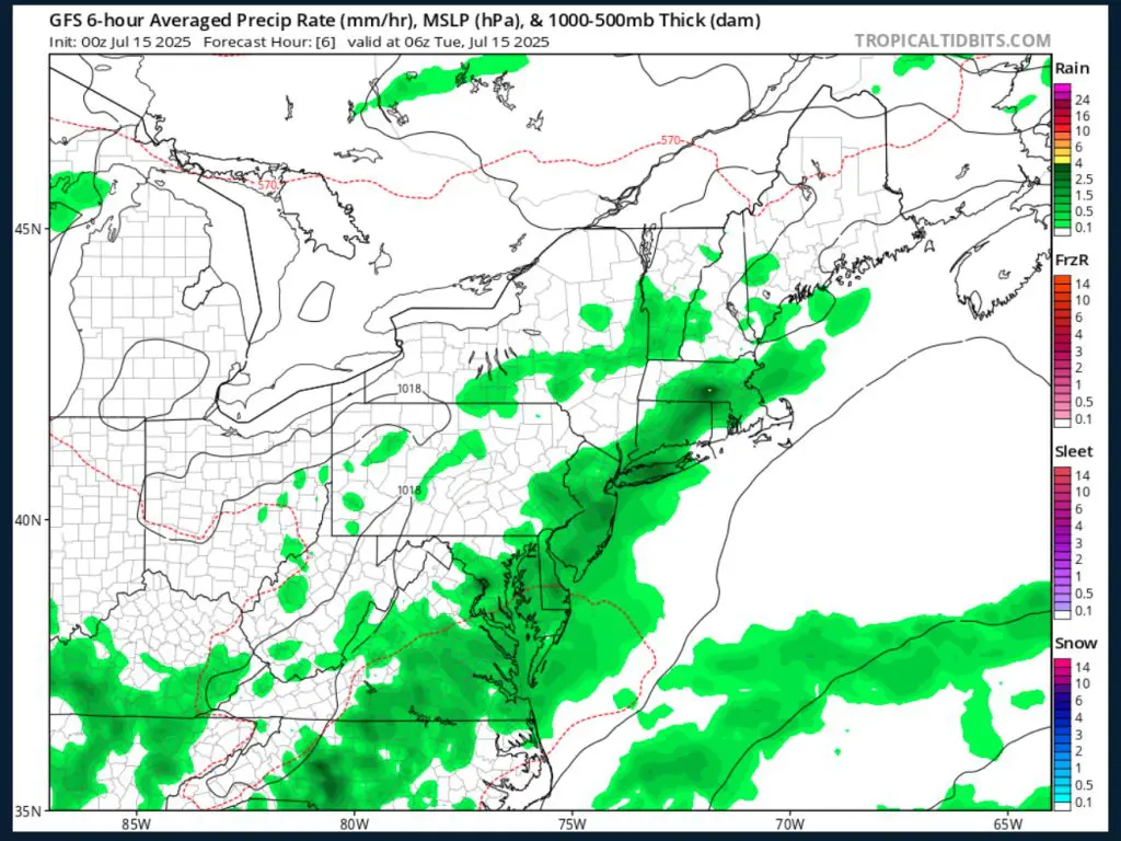
Meteorological analysis points to a warm, moisture-laden air mass sitting atop a slow-moving cold front— a potent combination that fueled repeated, high-intensity thunderstorm cells. The region had also experienced unseasonably high heat earlier in July, with several days in the upper 20s to low 30s °C (80s–90s °F), which elevated daytime evaporation. That set the stage for afternoon storms to tap into deep atmospheric instability and moisture convergence. As a result, storms dumped intense rain repeatedly over the same neighborhoods, leading to widespread flooding in low-lying urban and suburban areas.
In New York City, the floodwaters coursed through subway stations, closing 20 major subway stationsand delaying another 16, and flooding cables, signals, and causeway entrances. Airports —including JFK, LaGuardia, and Newark— reported delays affecting some 2,000 flights. On July 15th, two women were tragically killed in Plainfield, New Jersey, when a vehicle was swept into Cedar Brook during the storm. Additionally, a lightning strike in New Jersey on July 16th claimed another life, adding to concerns around summer storm hazards. Infrastructure damage from water, debris, and electrical disruptions is still being assessed.
Early damage estimates remain preliminary, but industry analysts anticipate hundreds of millions of dollars in combined insured and uninsured losses. Major insurers have already flagged this event as one of the most damaging flash-flooding incidents for the region this summer, with payouts expected for residential property damage, vehicle losses, subway infrastructure, and airport disruptions. Local governments have activated state emergency funds and opened cooling/flood shelters, with the New Jersey Emergency Management Agency coordinating rescue operations and recovery efforts.
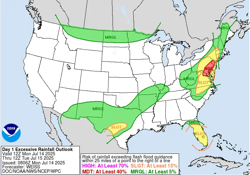
Forecast models suggest that while the slow-moving cold front will move Atlantic-ward by July 18th, scattered storms and flash-flood watches remain possible through July 19th. Drier and more stable air is expected to return by July 20th, though temperatures will likely stay above seasonal averages into late July. Climatologists warn that such train-burst storms —where multiple heavy-cell thunderstorms drop massive amounts of rain over the same area— are becoming more frequent in the Northeast. This reflects broader trends: 2025 is already one of the most active years for flood warnings since records began in 1986.
Long-term climate studies indicate that flash floods in the Northeast are increasing in both frequency and intensity, driven by warming sea surface temperatures and greater atmospheric moisture— roughly 7% more water vapor per °C of warming. The July 15th–17th storms echo the July 2023 floods, which caused $2.2 billion in damages and 11 deaths in Vermont and New York. As summer progresses, experts stress that urban planners and emergency services must adapt swiftly to manage the growing risk of devastating, short-duration flood events fueled by a changing climate.


