Next 12 days in the USA: frosts, snow, cold and winter conditions regionally
Forecasts for USA and Canada hasn´t been changed a lot, since last update /https://mkweather.com/2020/10/10/deadly-coldwave-in-the-usa-between-15-25-october-temperatures-up-to-15f-24c-and-windchill-24c-31c-expected// and until 25. October, and then at the end of a month, the USA and Canada is waiting very cold conditions furthermore.
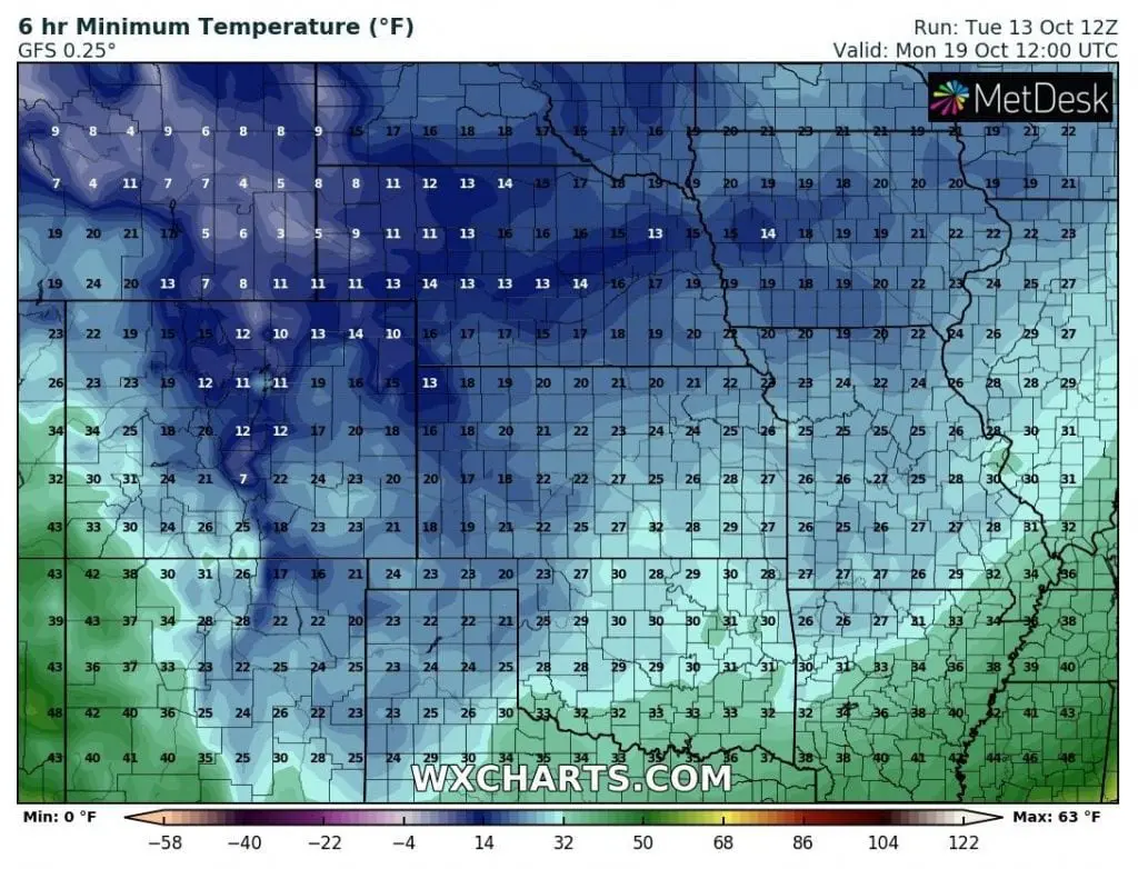
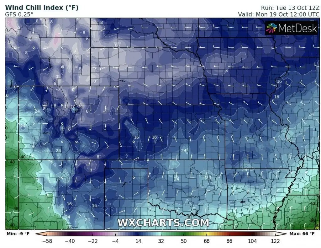
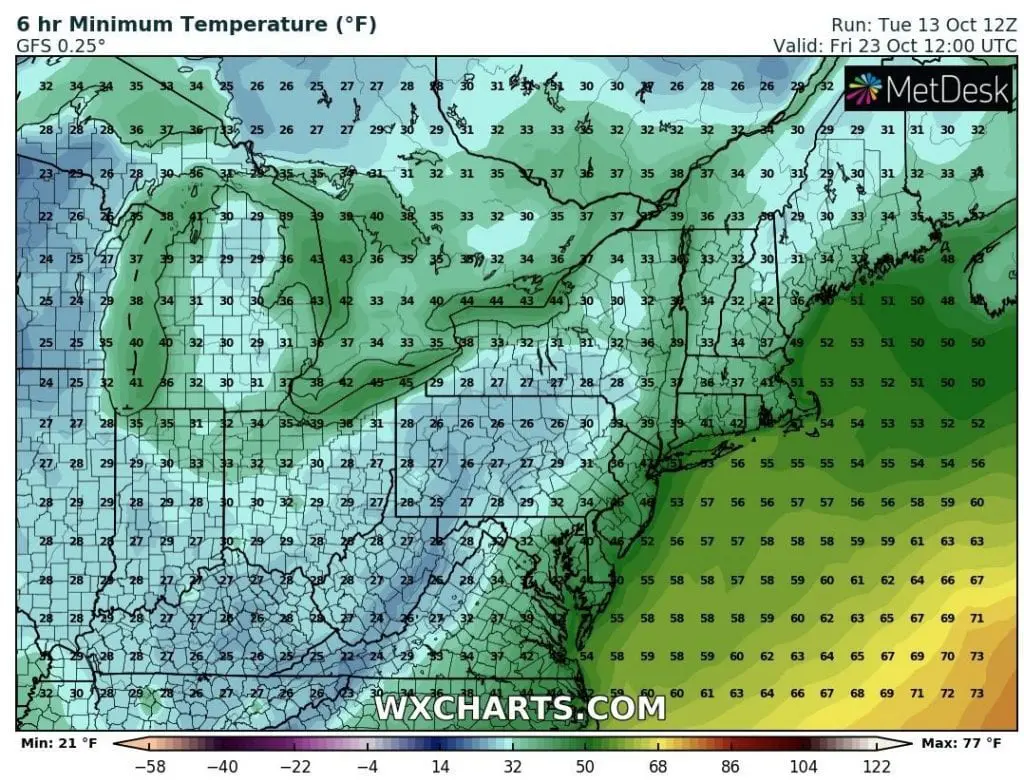
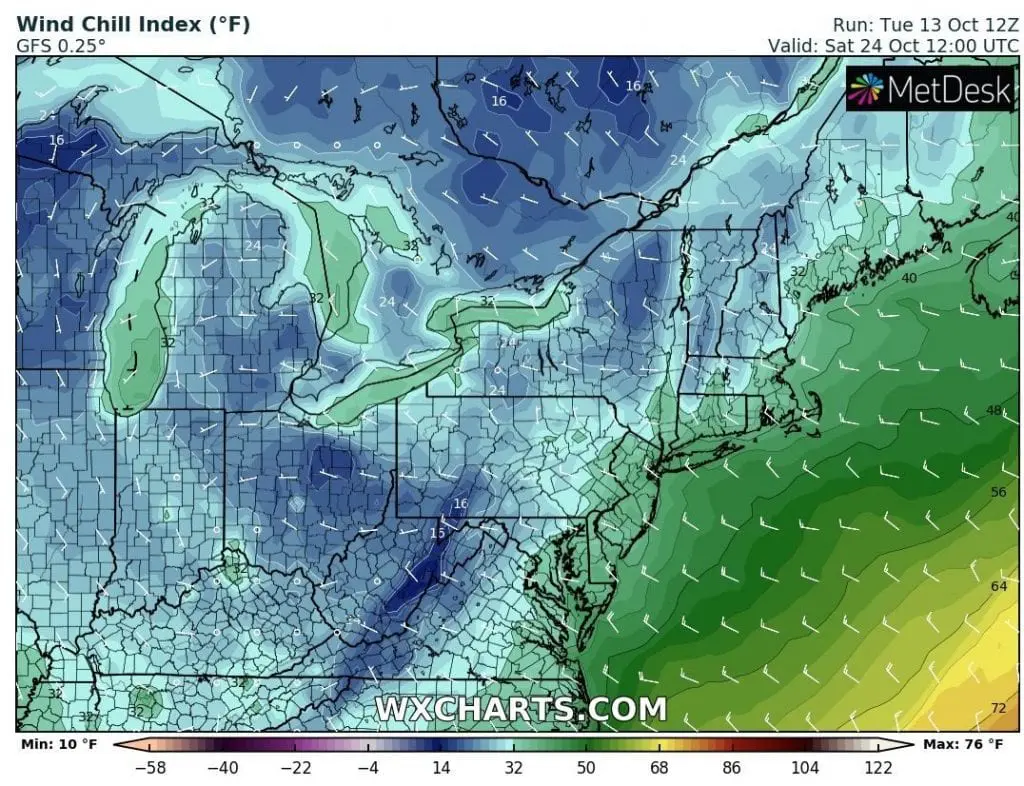
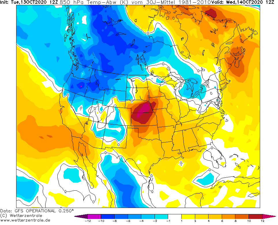
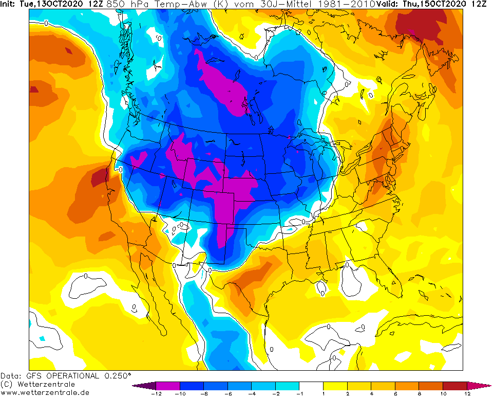
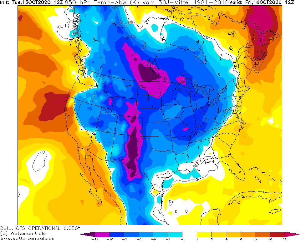
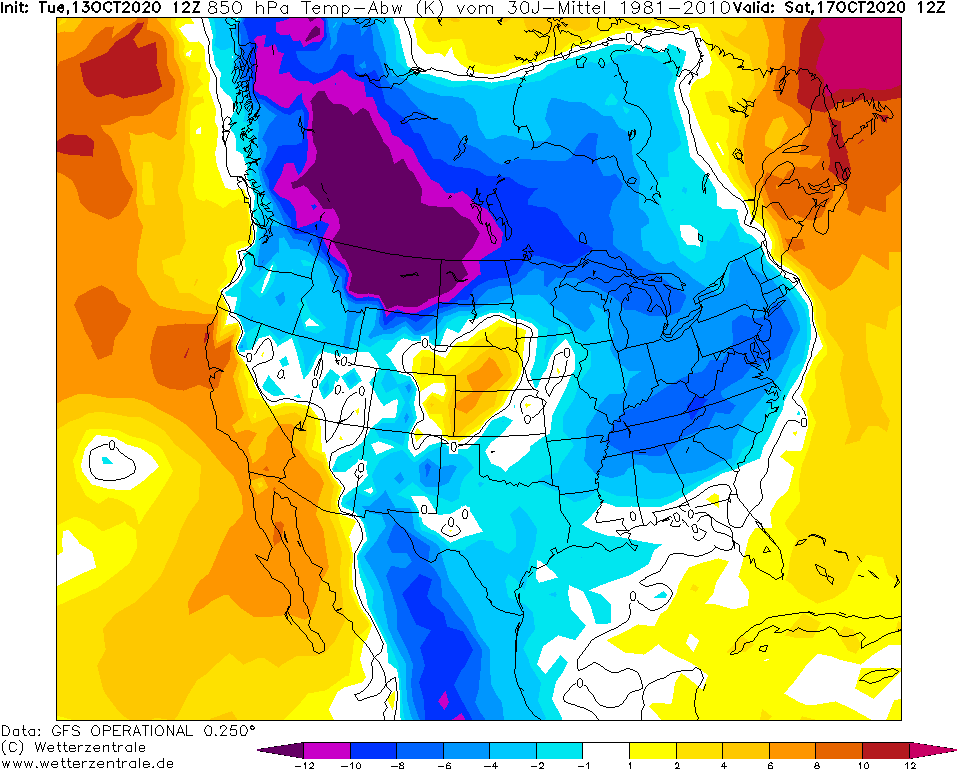
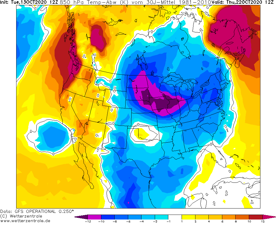
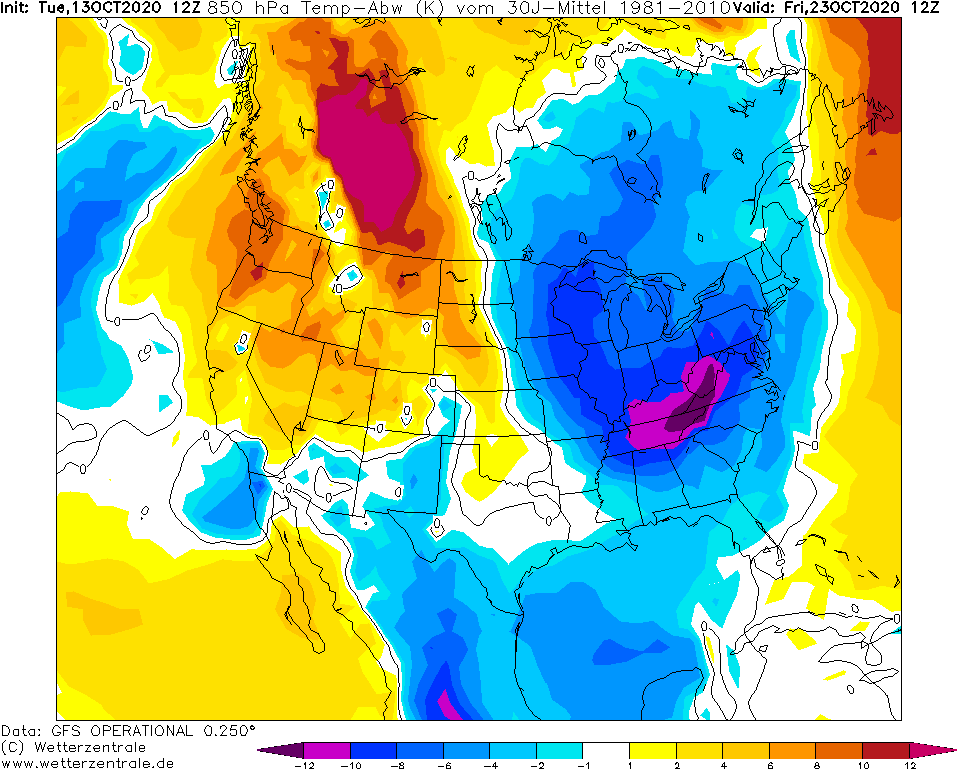
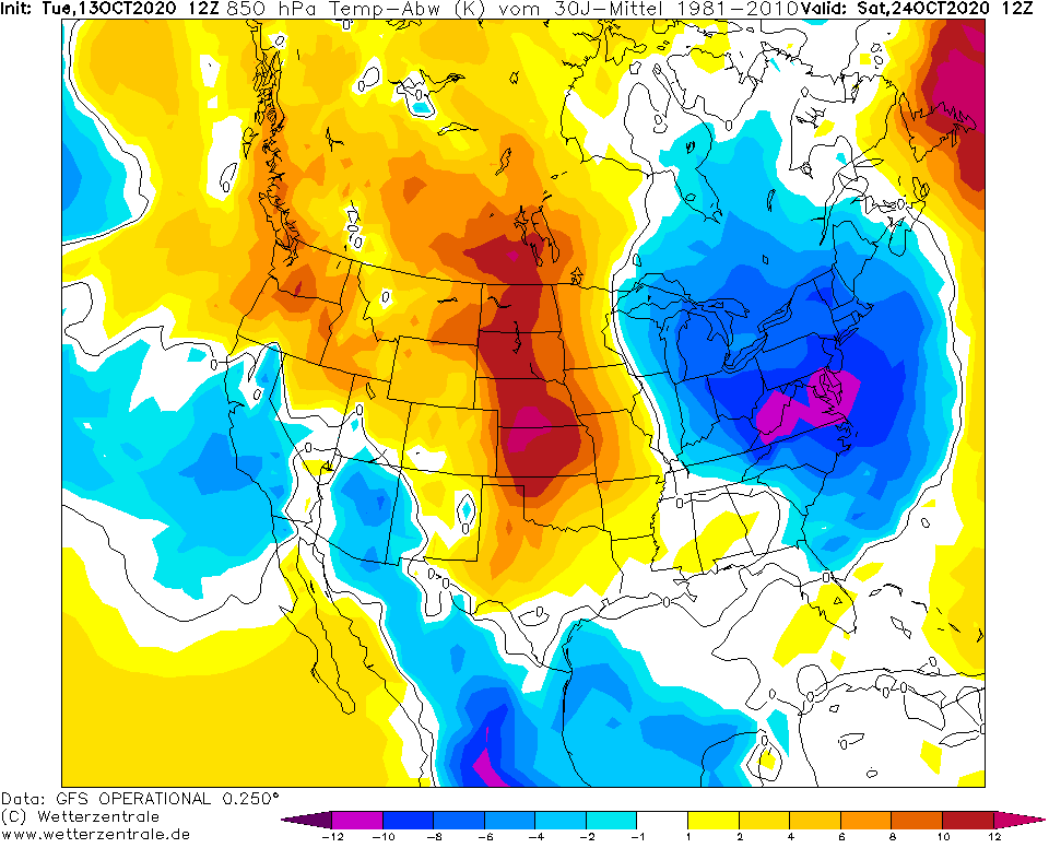
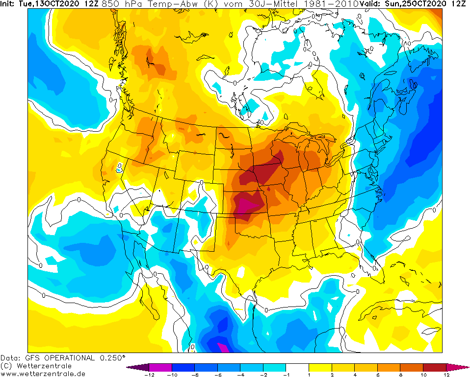
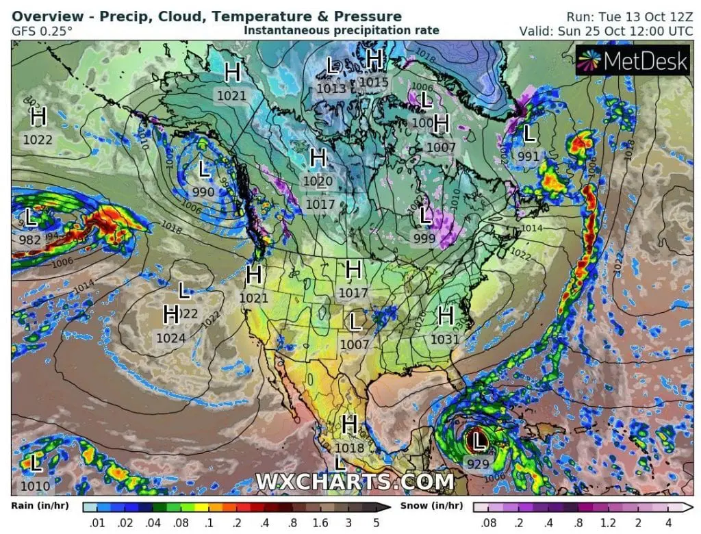
Cold air will be shifting from Wednesday, 14. October to Sunday, 25. October over the territory of USA from northwest to southeast and east with strong frosts, snow, regionally winds and near snow cover a few days in some states with winter conditions.
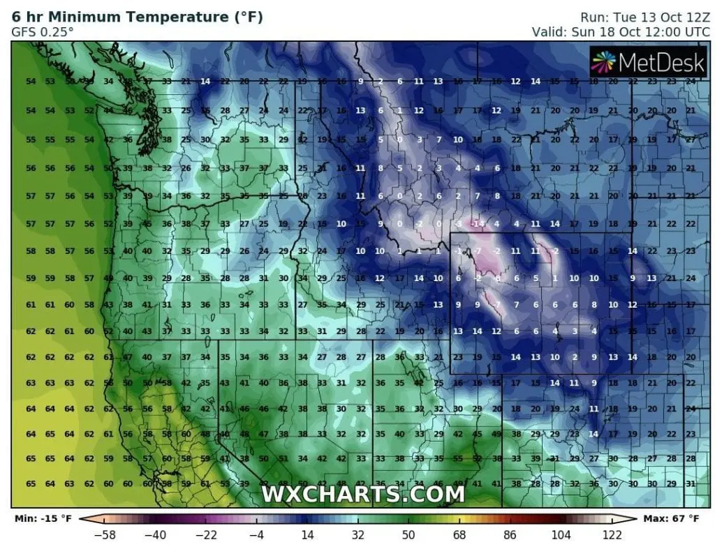
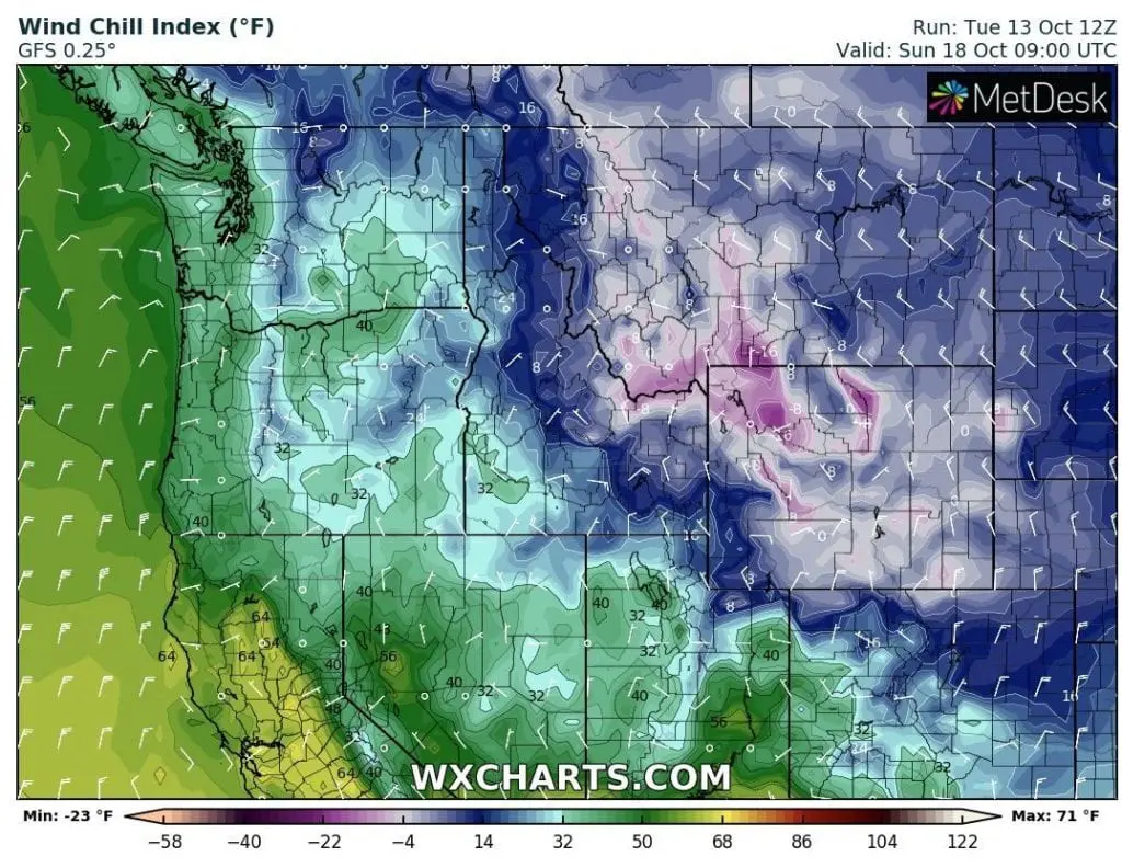
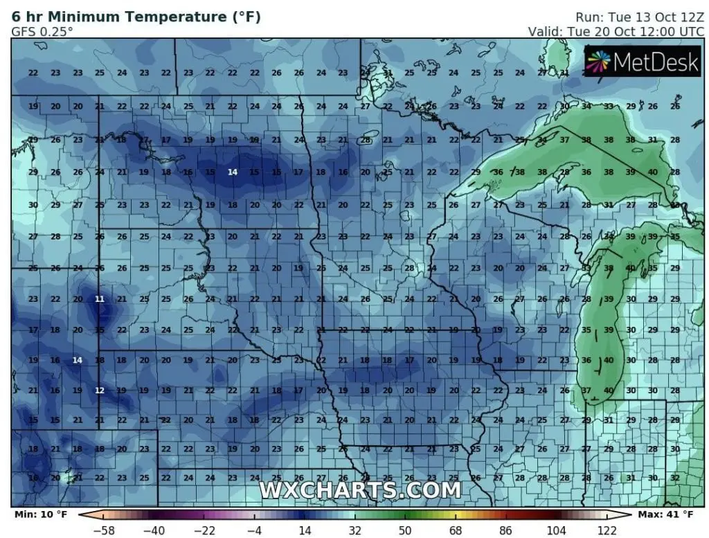
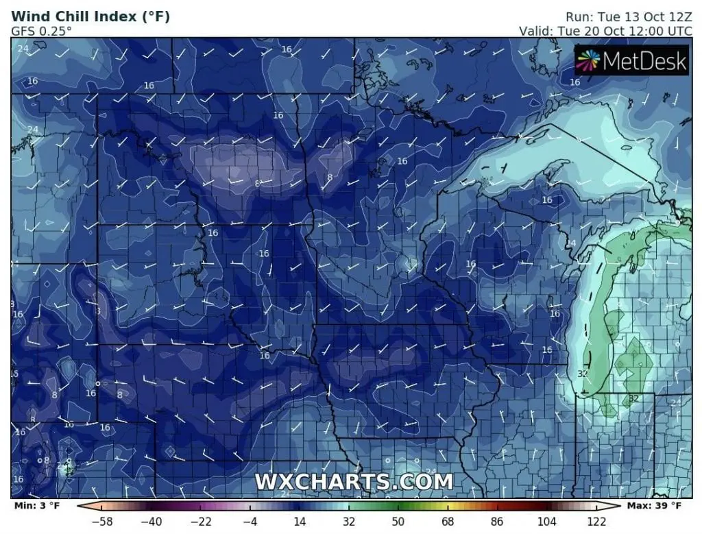
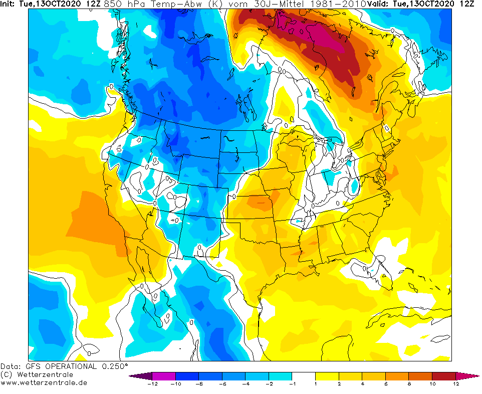
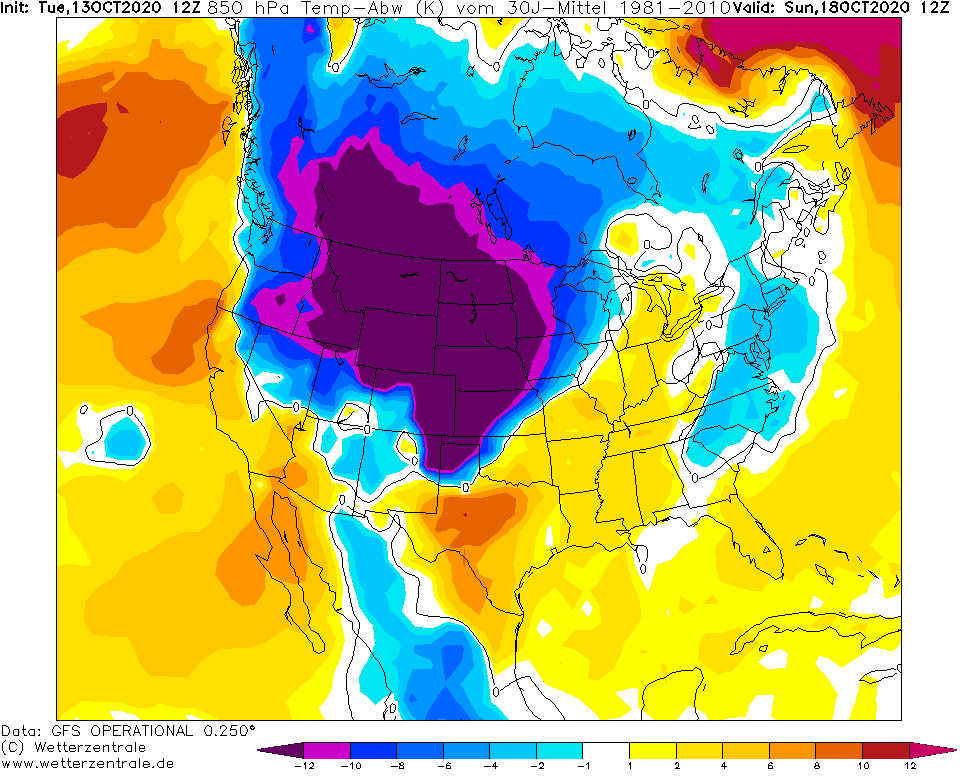
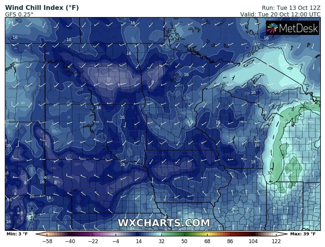
The coldest expected conditions has shifted from Tuesday, 20. October to Sunday, 18. October, with -15°F / -26°C minimum temperature and -23°F / -31°C windchill in mountainous areas in Wyoming and Montana.
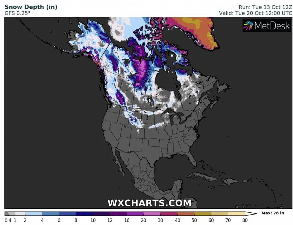
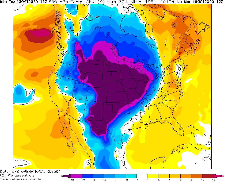
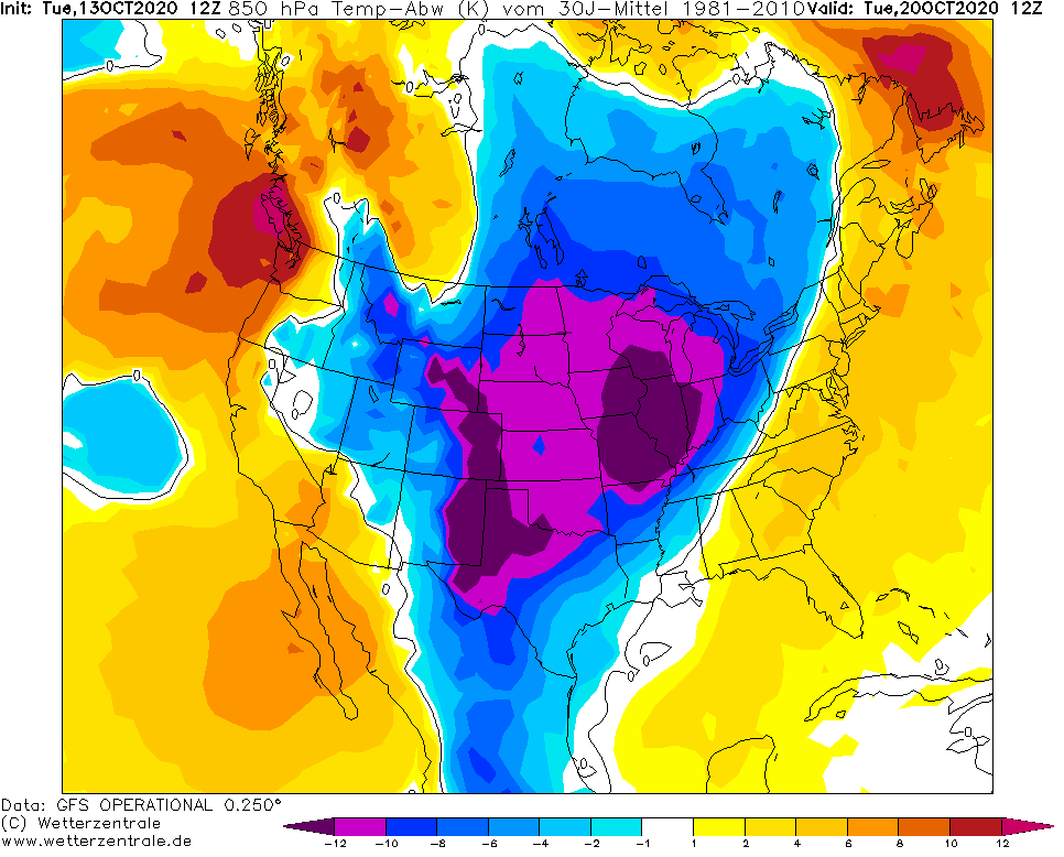
Snow-related conditions however should hits parts of Michigan, Wisconsin, Minnesota, North Dakota, South Dakota, Iowa, Montana, Wyoming, Colorado and northern Illinois, until Tuesday, 20. October.
Snowy conditions will persist almost above all provinces of Canada, too, with blizzard conditions in parts of Northern and Central Canada during the next days /https://mkweather.com/2020/10/09/north-and-central-canada-hits-blizzard-11-14-october-usa-then-floods-extreme-cold-arctic-air-until-19-10//.
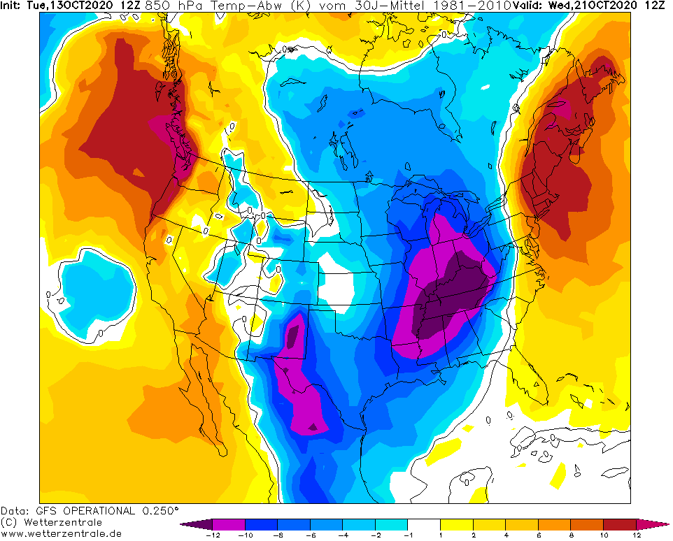
Some snowfall should hit higher elevated parts of Northeast, too, with possible snow showers in lower areas, too.
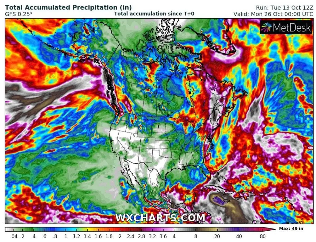
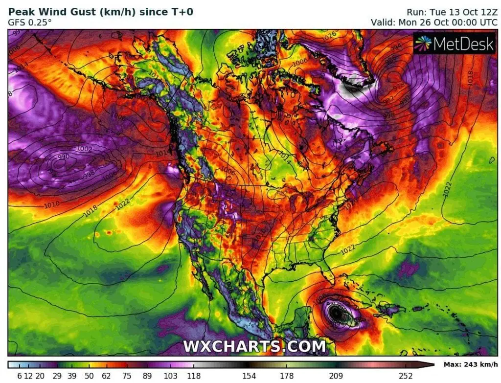
Strong winds will be concentrated in mountainous areas in Central US, Great Lakes area, Northern Plains and Northeast, regionally with winter-like weather and blizzard conditions, mainly in the mountains.
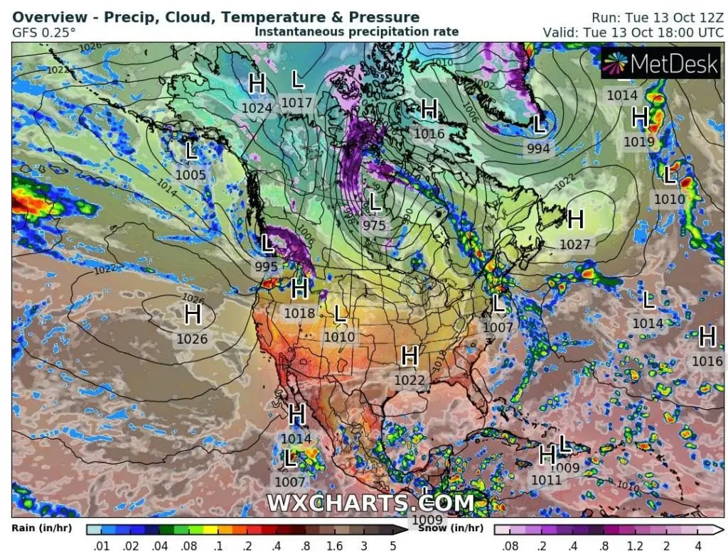
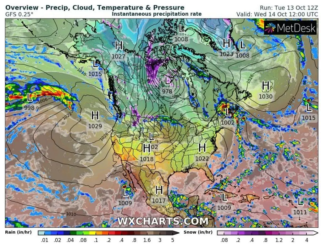
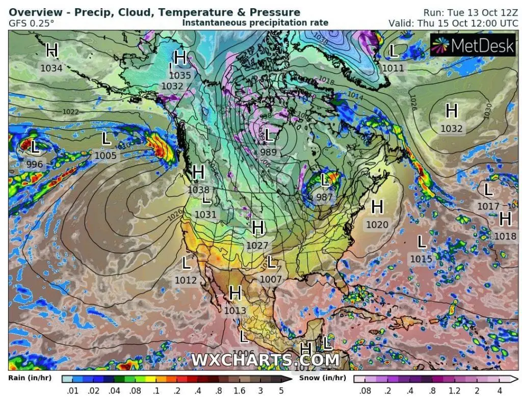
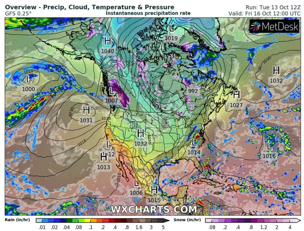
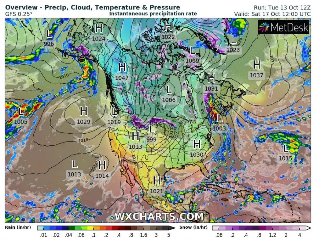
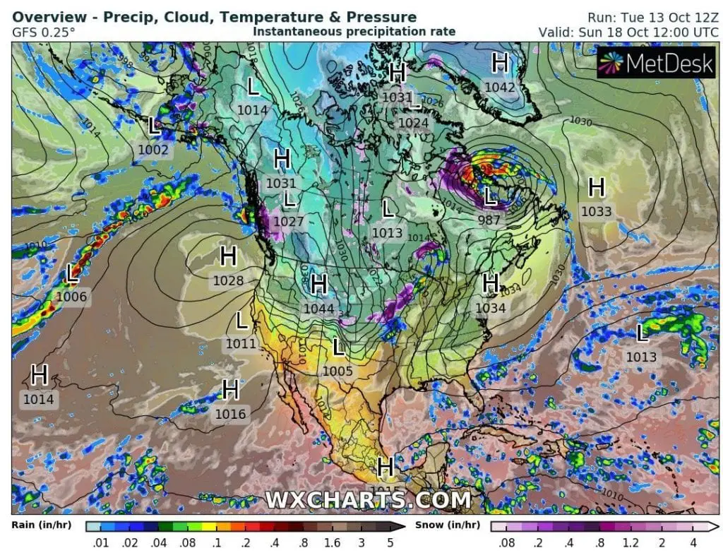
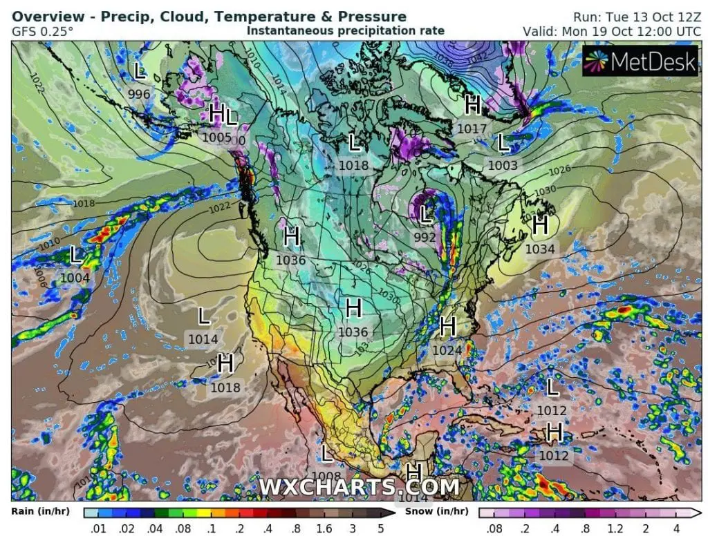
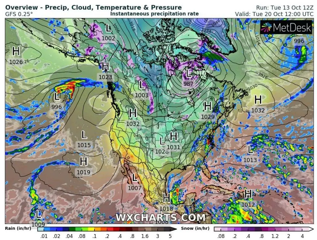
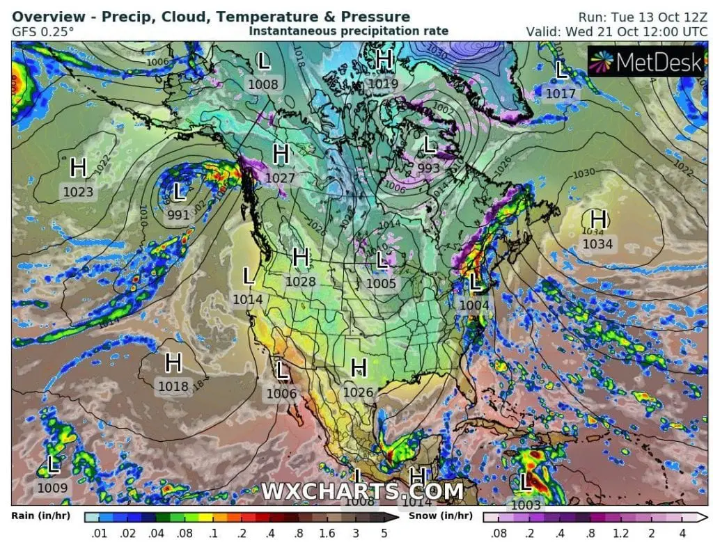
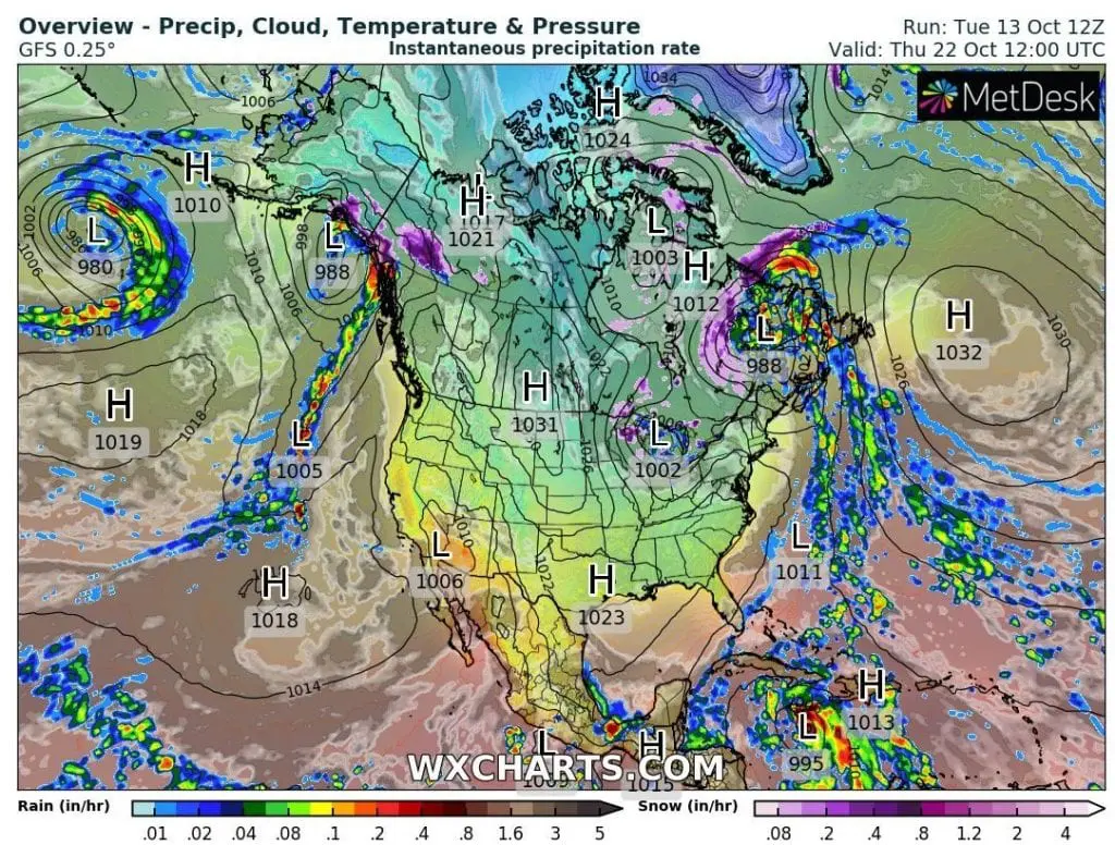
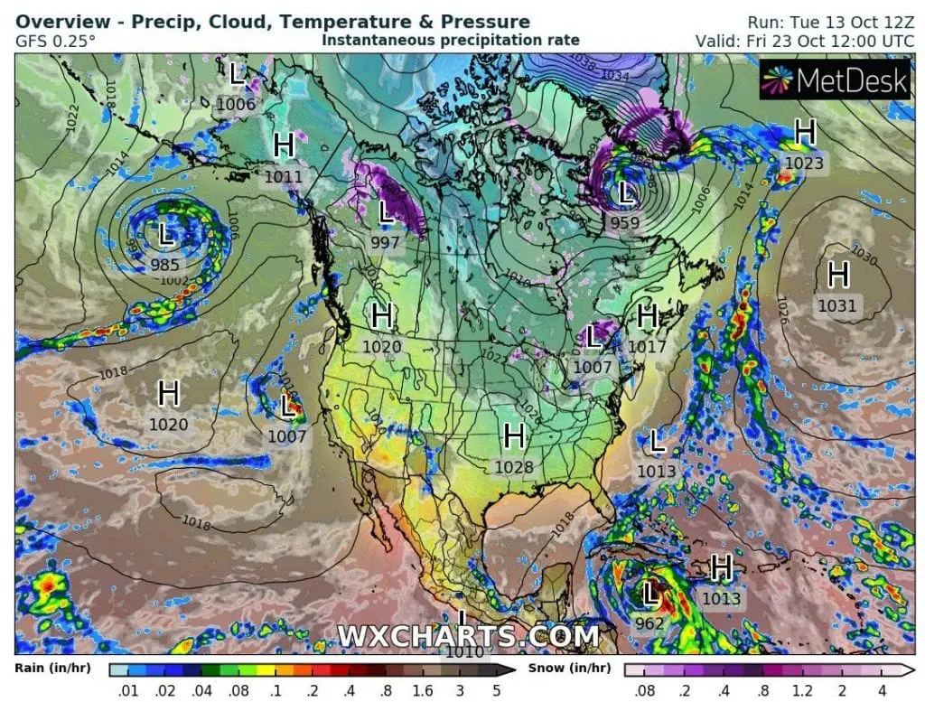
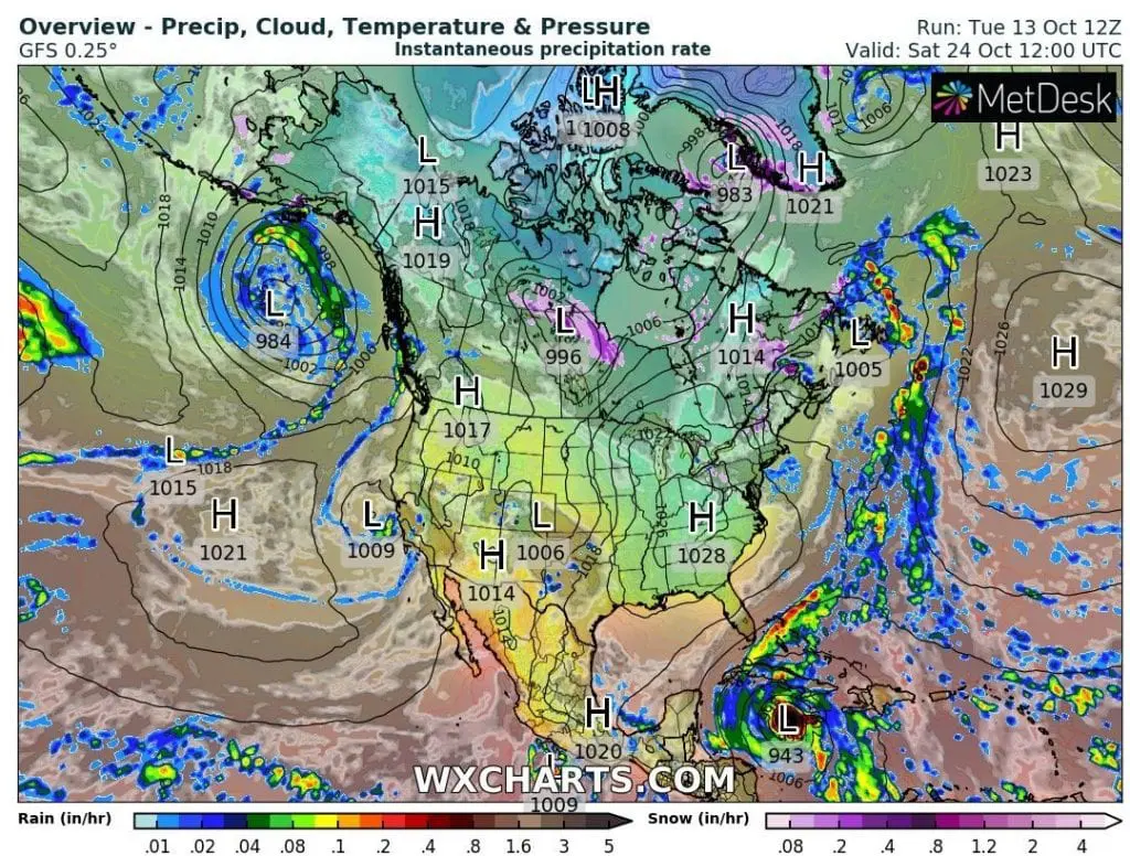
In maps below are forecasted minimum temperatures and windchill in northern regions of the USA during the coldest day during the period until 25. October and temperature in 850 hPa anomalies and pressure/precipitation fields maps for period 13.-25. October 2020, which document power of incoming coldwave.
Infographics: wxcharts.com, wetterzentrale.de: