During NAO- phase (negative phase of North Atlantic Oscillation) or AO- phase (negative phase of Arctic oscillation – NAO equivalent for Northern Hemisphere), stormtracks of Icelandic cyclones are shifted to the south, with powerful cold blasts in subtropical and tropical zones, where extremely cold air mixes with hot tropical air masses.
Since 20. November 2020, transition to strong NAO- / AO- phase with peak these days and before Christmas 2020 is continuous and besides severe floods in Middle East /https://mkweather.com/2020/12/02/iran-widespread-floods-and-first-frosts// and Mediterranean /https://mkweather.com/2020/12/08/italy-the-level-of-the-river-rose-from-05-to-12-meters-during-the-night-extreme-floods//, extreme tornado event has appeared in Saudi Arabia at the weekend.
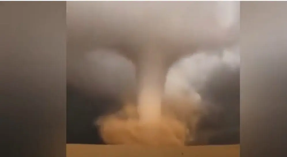
On Saturday, 5. December 2020, according to local meteorological authorities hit Sakaka in Al Jawf Province extremely huge tornado, what was one of the hugest tornadoes recorded in the country in all-time history.
Tornado was rotating around itself at a speed of more than 200 km/h and was moving horizontally at a speed of 37-75 km/h.
After floods in Saudi Arabia from last weeks /https://mkweather.com/2020/12/02/saudi-arabia-deserts-changed-into-lakes/; https://mkweather.com/2020/11/23/floods-in-desert-saudi-arabia-cold-and-rainy-forecast-for-middle-east//, situation will be more calm next period, although with severe floods in more northern regions such as Lebanon, Israel, Syria, Iraq and Iran.


