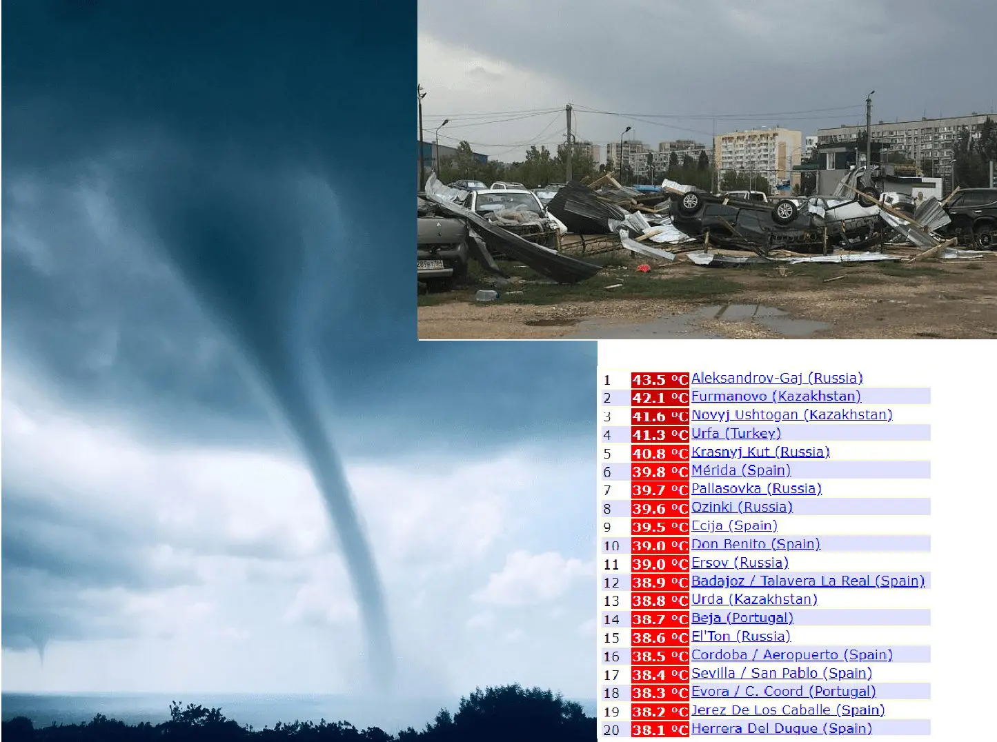
Crazy weather in Russia: After +44°C arrived destructive tornadoes, temperature stopped only 1,7°C below national record from deadly 2010
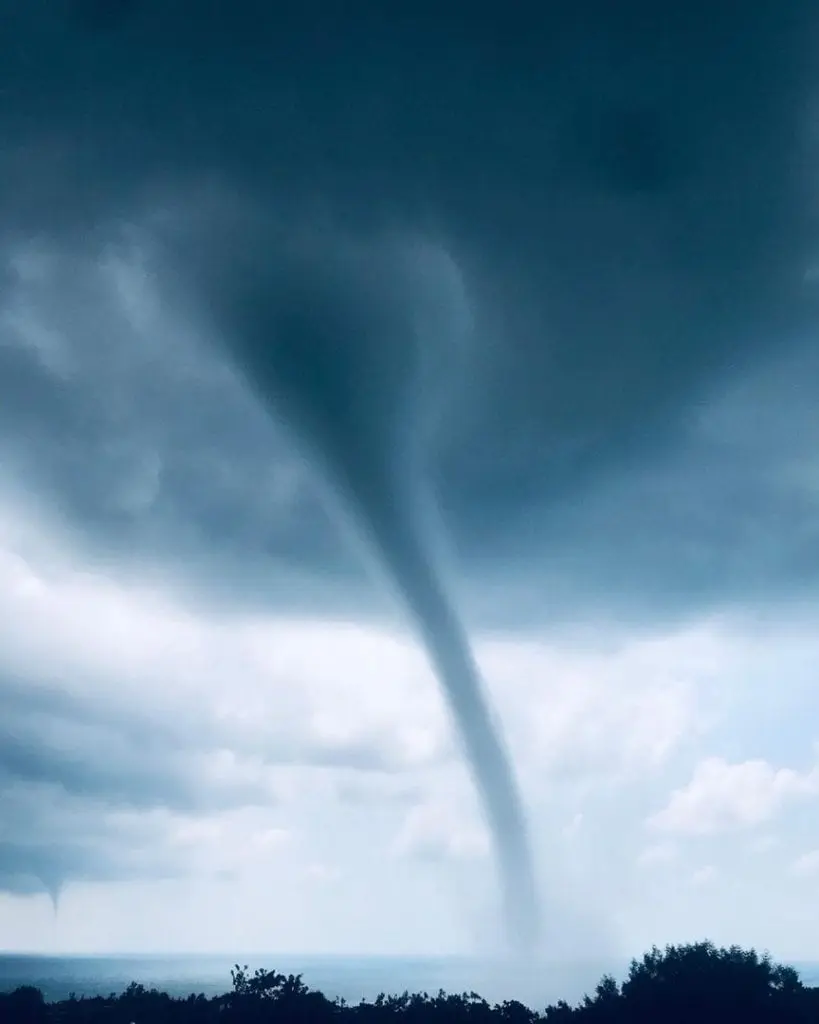
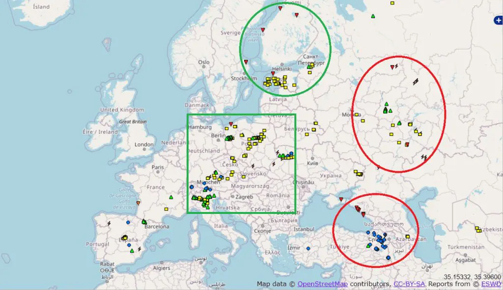
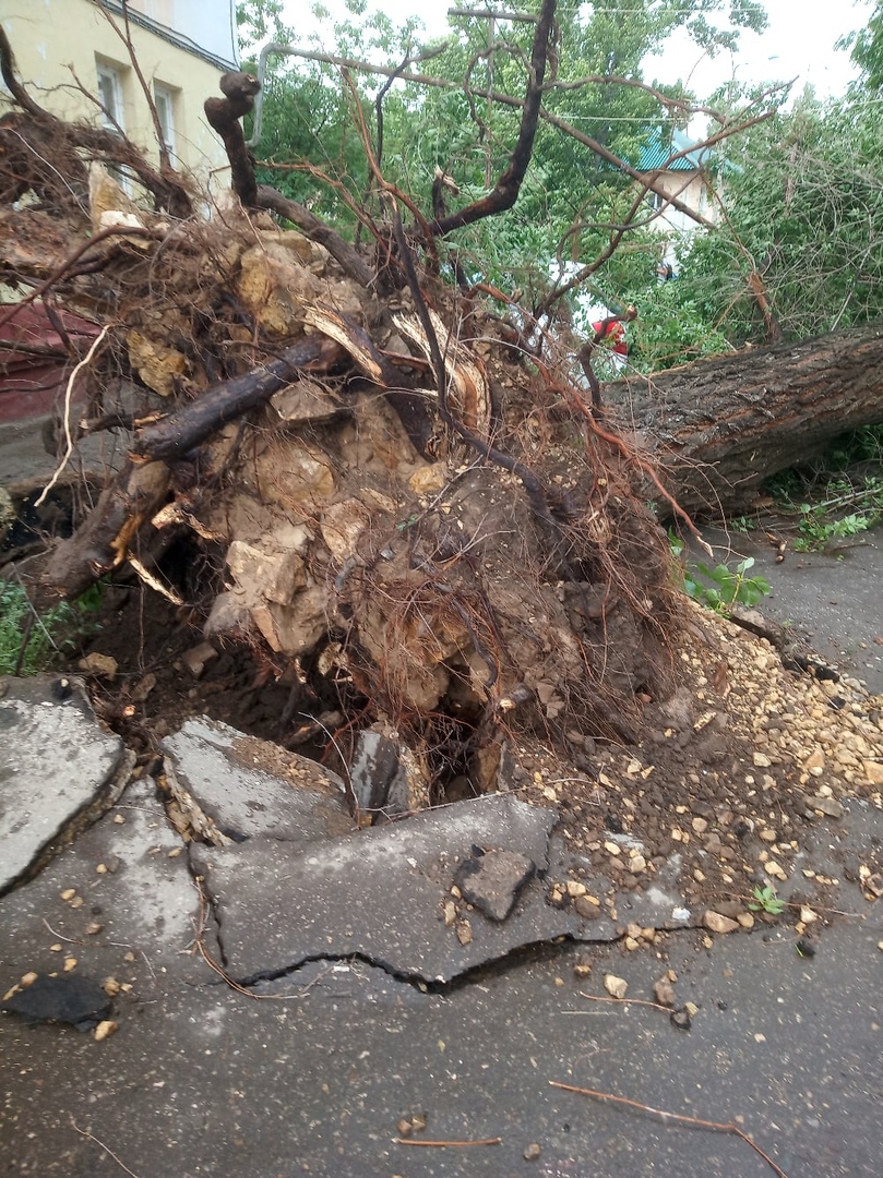
Powerful cold front, which brought to Europe fresh colder air during last days is already on the borders of Europe and Asia. Before its shift out of territory of Europe it snatched to commit severe damages not only in western and central parts of continent, but too in eastern Europe Russia and Turkey. Turkey hit heavy rains with severe floods and landslides, Ukraine reported hailstorms and strong wind and Estonia with Finland strong winds and rerely tornadoes. Tornadoes hasn´t been rarely in Russia – in Black sea region appeared several cases and some cases were according to ESWD reported from central regions too. Tornadoes and severe winds brought to european Russia severe damages and before arrival of whirlwind temperatures had reached anomalous values, for which hadn´t shamed neither Spain, Middle East or Northern Africa.
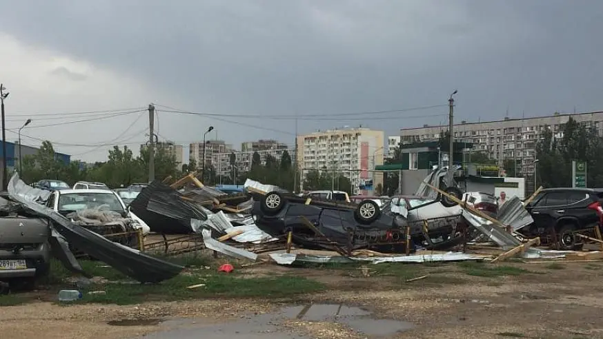
 https://saratov24.tv/news/v-saratovskuyu-oblast-prishel-shkvalistyy-veter-fotoreportazh-/
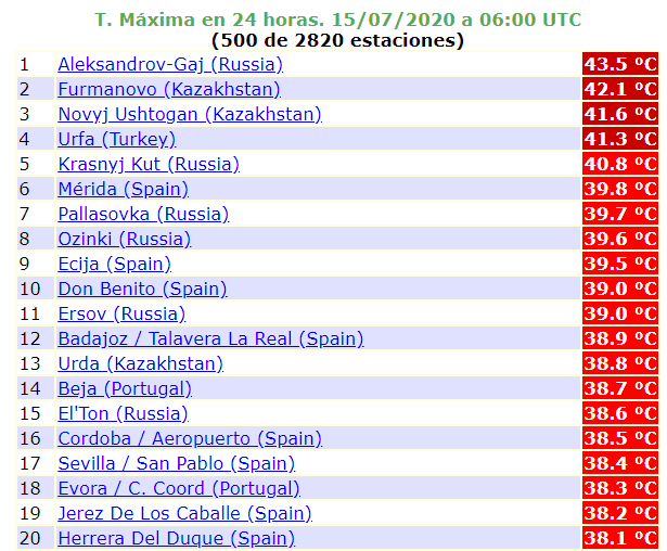
Severe damages arrived after anomalous heat – in the southern european Russia meteorologists measured +43,5°C
Extremely hot weather bothered the region during the whole last week – before arrival of cold front meteorologist measured +36,5°C in Armenia, +38,8°C in Azerbayijan, +40,3°C in Georgia (only cca 3°C below absolute temperature records), +43,1°C in Kazakhstan and +44,2°C in Turkey. In this time, cold front was bringing heavy times above Central Europe and Italy – during the weekend was the worst situation in Poland, Czech republic, Austria and northern Italy.
In Russia anomalous heatwave peaked only in Tuesday, with maximum temperature in Aleksandrov-Gaj +43,5°C. This temperature is only 1,7°C below national record 45,2°C from 12. July 2010 – the year, when Moscow and all Russia were in devasting smoke and smog from wildfires /https://en.wikipedia.org/wiki/2010_Russian_wildfires/. In Russia were these days even hotter than in Spain, in Mérida were measured in Monday and Tuesday Spain top highs, only +40,1°C and +39,8°C. Heatwave is in Spain and France however trying to start, in southern France in Tuesday measured +33,5°C.
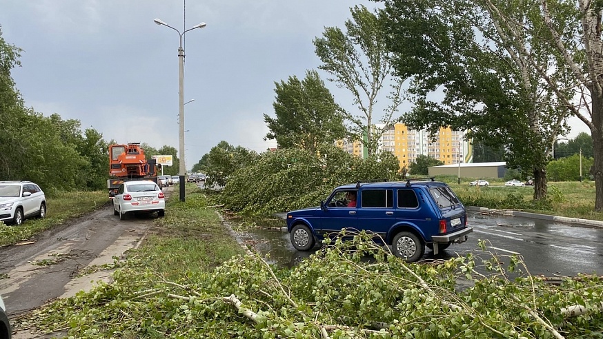
There were 2 regions in Russia with the most reported damages southeast from Moscow and on Black sea coast. Next 2 regions in Europe with severe damages before were northern Baltic area (Estonia and Finland) and line in Central Europe from northern Italy to the Poland. Here were reported mainly hailstorms, strong wind gusts and heavy rain events last week.
With low pressure, but in cold air, potential risk of storms is predicted from ESTOFEX to Wednesday-Thursday mainly for Alps region, Italy and Northern Africa. Any disastrous storms in cold air /https://mkweather.com/2020/07/14/greenlands-air-hit-europe-coldwave-in-the-middle-of-summer-next-3-days-temperatures-5-10c-below-average-hot-summer-then-will-return-slowly-from-the-southwest// aren´t expected.


Heatwaves still in the game, but with the peak later
Someting is cooking for Europe but for now, we dont see clearly what it will be. During the fifth pentade of July (21.-25.7.) can be hot air pushed from northern regions (S England, N France, Benelux, N Germany and Poland) to the south, therefore are heatwaves sure only for southern half of Europe. But – good news is, that air over +15°C in 850 hPa had to hit southern parts of France, Germany and Central Europe at first, and then, in sixth pentade (26.-30.7.) too northern parts of area, with possible temperatures in 850 hPa above +20°C even in northern regions and supertropical days over +35°C, in southern regions up to +38°C, maybe more. Heatwave forecast we will update already during actual week in our newscast.


