A week-lasting coldwave for New Zealand, with snow on Southern Island, temperatures already dropped to -11,2°C
Despite of the warmest June in New Zealand in history (June 2021), the next powerful Antarctic blast is prepared for the islands.
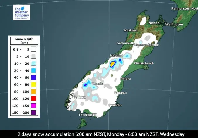
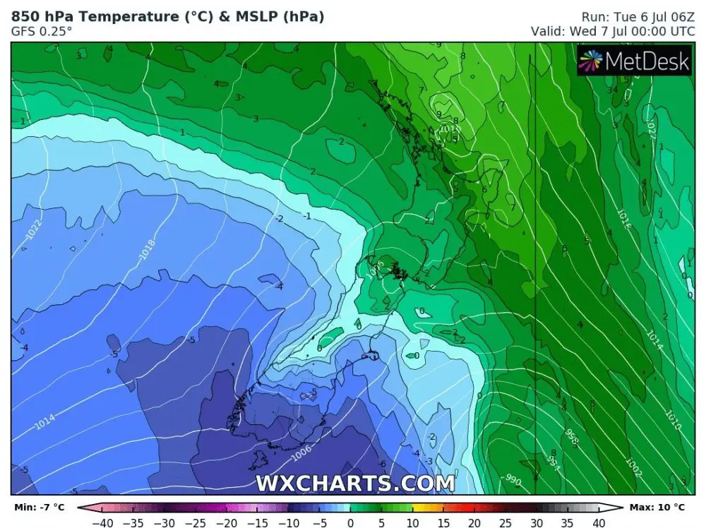
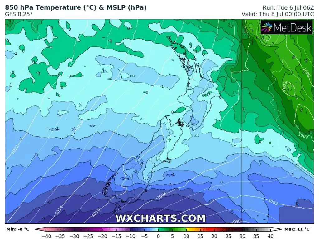
Coldwave should lasting long 7 days until Tuesday, 13. July 2021 and brings the next frosts and snowfall, mainly in Southern Island.
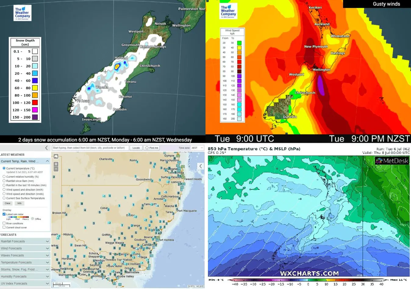
Large parts of the Southern Island will be covered by snow until Wednesday, 8. July 2021 and minimum temperatures should again drop locally below -10°C.
Already during the previous coldwave from the end of June and the start of July 2021, temperatures up to -11,2°C were reported from Waiouru.
Moreover, very strong winds are forecasted in the next days above New Zealand and where won´t be snowing, heavy rainfall is expected.
Southeastern Australia forecasts cold times during the next days, too, with below-average temperatures and possible temperatures in the coldest mountainous parts up to -10°C.
In Perth, powerful windstorm is forecasted already to the next hours.
Southern Hemisphere was in June 2021 very cold and contributed into negative temperature global anomaly, significantly /https://mkweather.com/2-different-worlds-june-2021-extremely-hot-in-the-northern-but-anomalously-cold-in-the-southern-hemisphere//. Antarctica is thanks to global warming extremely cold and in the future, will be producing more extreme cold blasts for Australia, New Zealand, South Africa and South America, mainly during ongoing La nina phases.

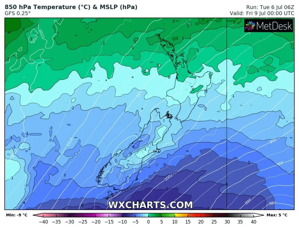
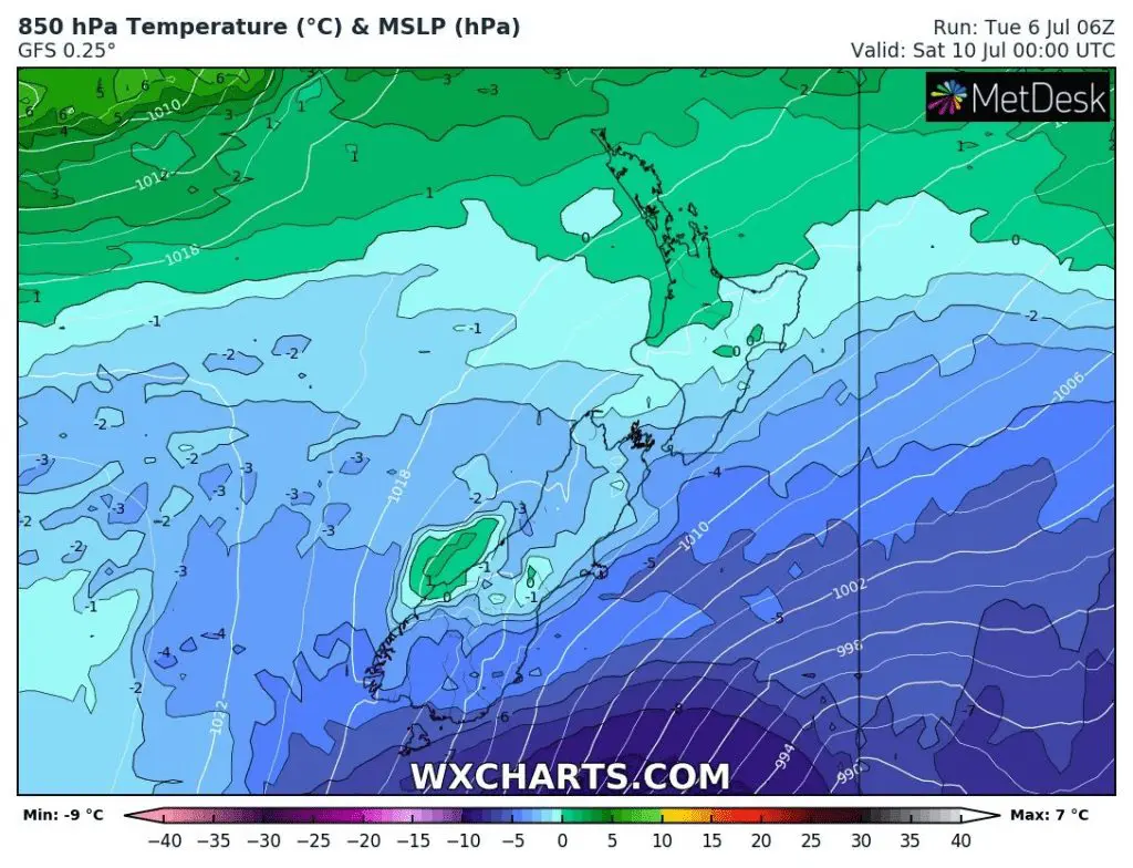
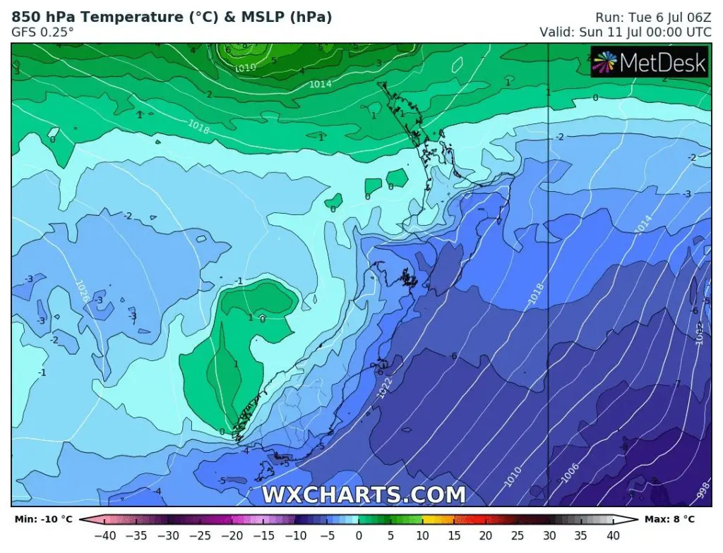
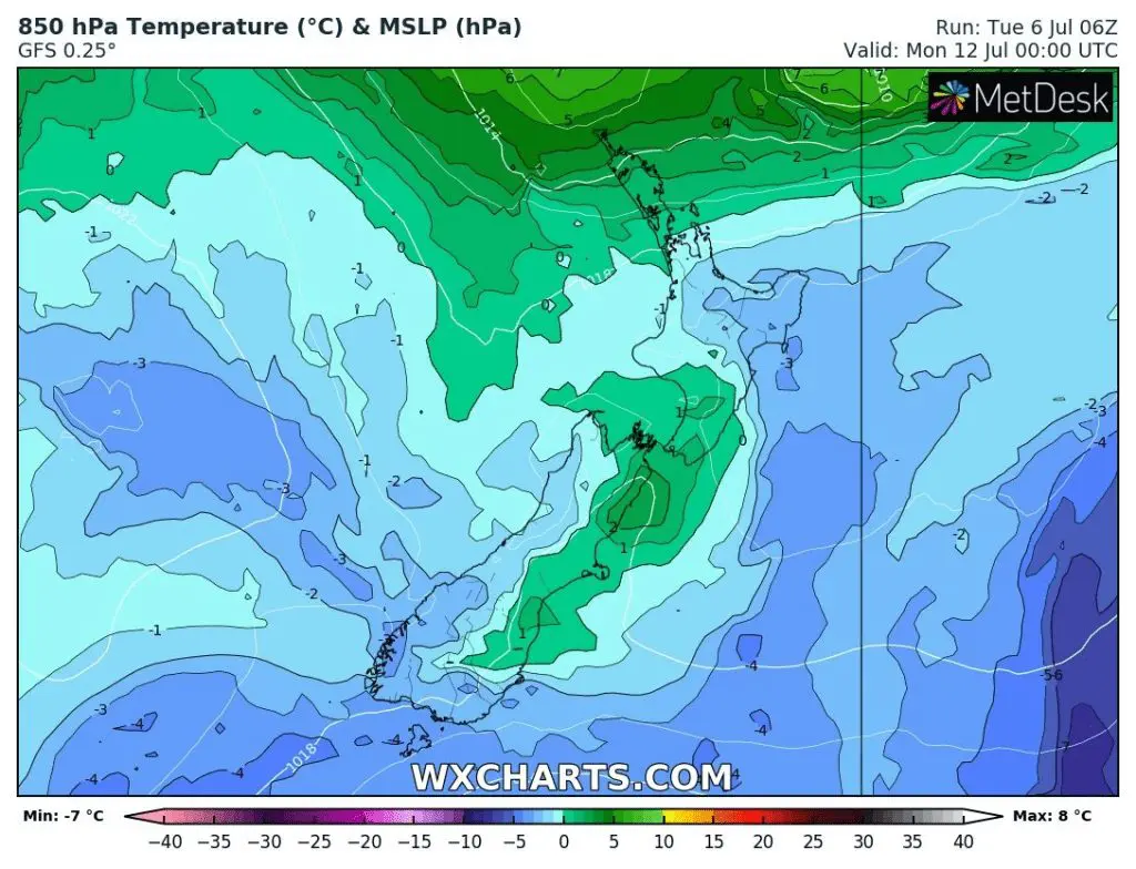
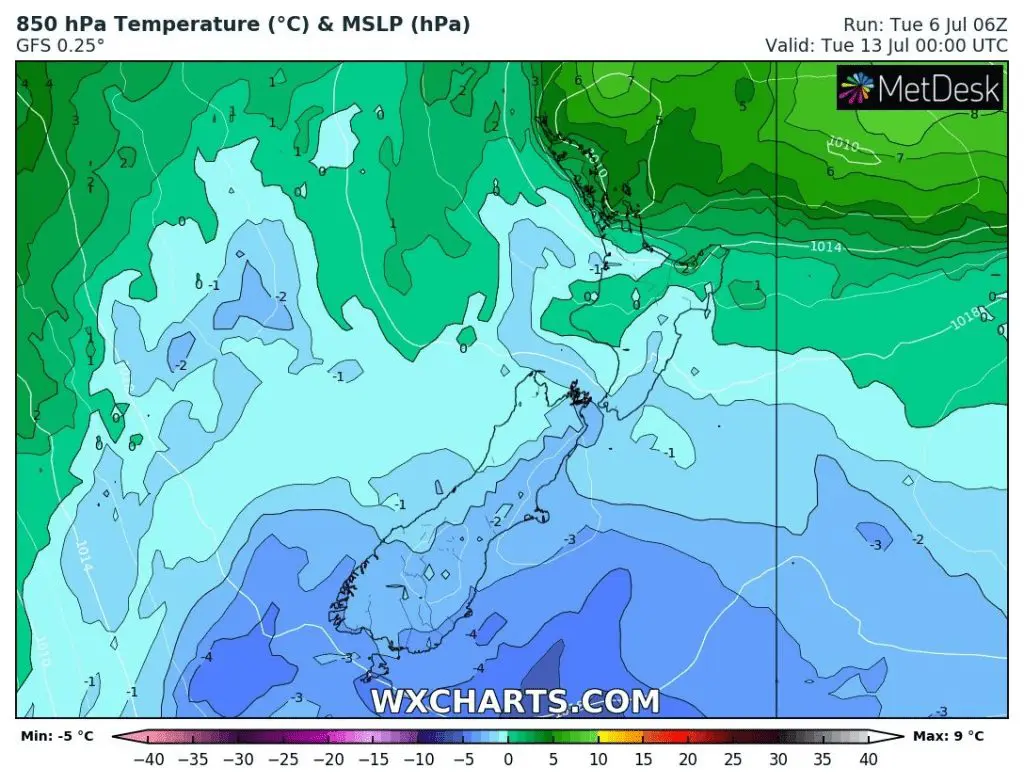
Source: wxcharts.com


