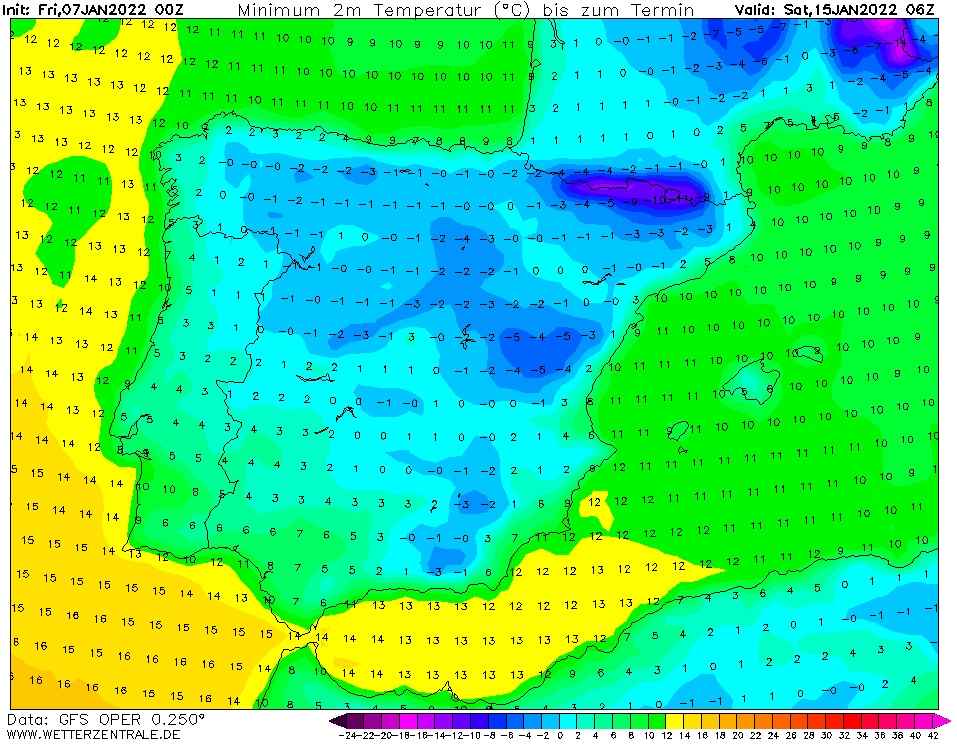
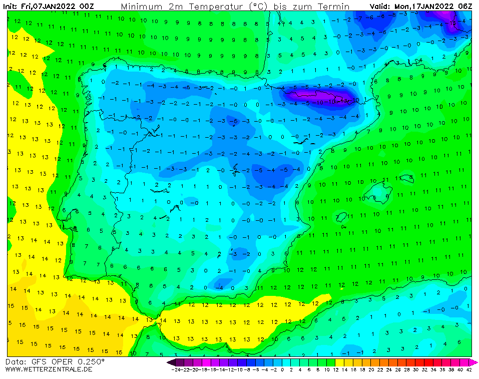
Spain (-10°C) and Portugal (-5°C) with a long-term, 10-day coldwave ahead
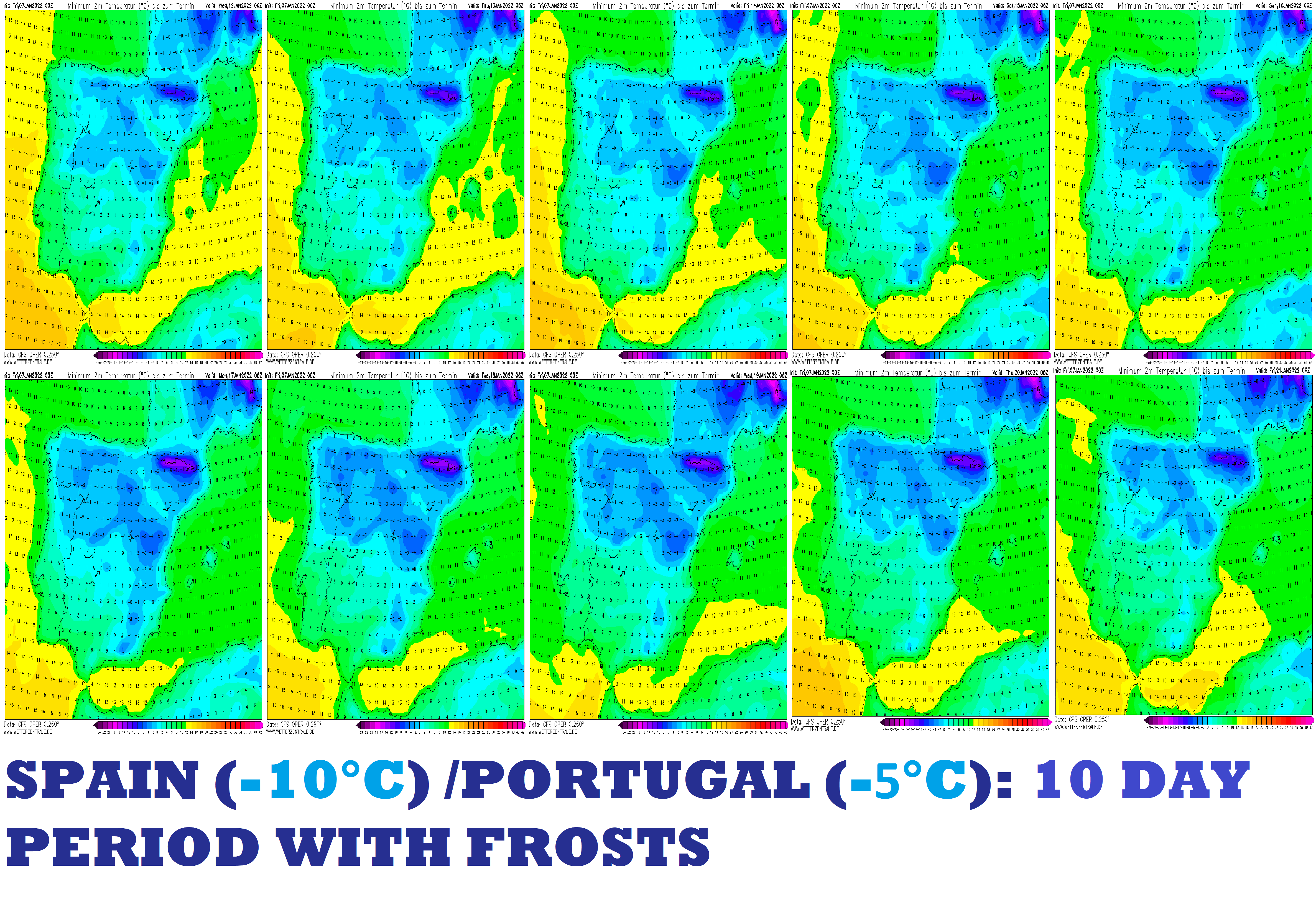
An upcoming Greenlandic, Arctic, and Siberian blasts above Europe should according to the latest runs of GFS persist above Europe long 10 days and bring the next anomalously cold period and snowfall.
In the next series of articles, we will look gradually at predicted temperatures and snowfall in Continental (Central) Europe, British Islands, France, Iberia, Italy and Balkan, Eastern Europe, Turkey, and Scandinavia.
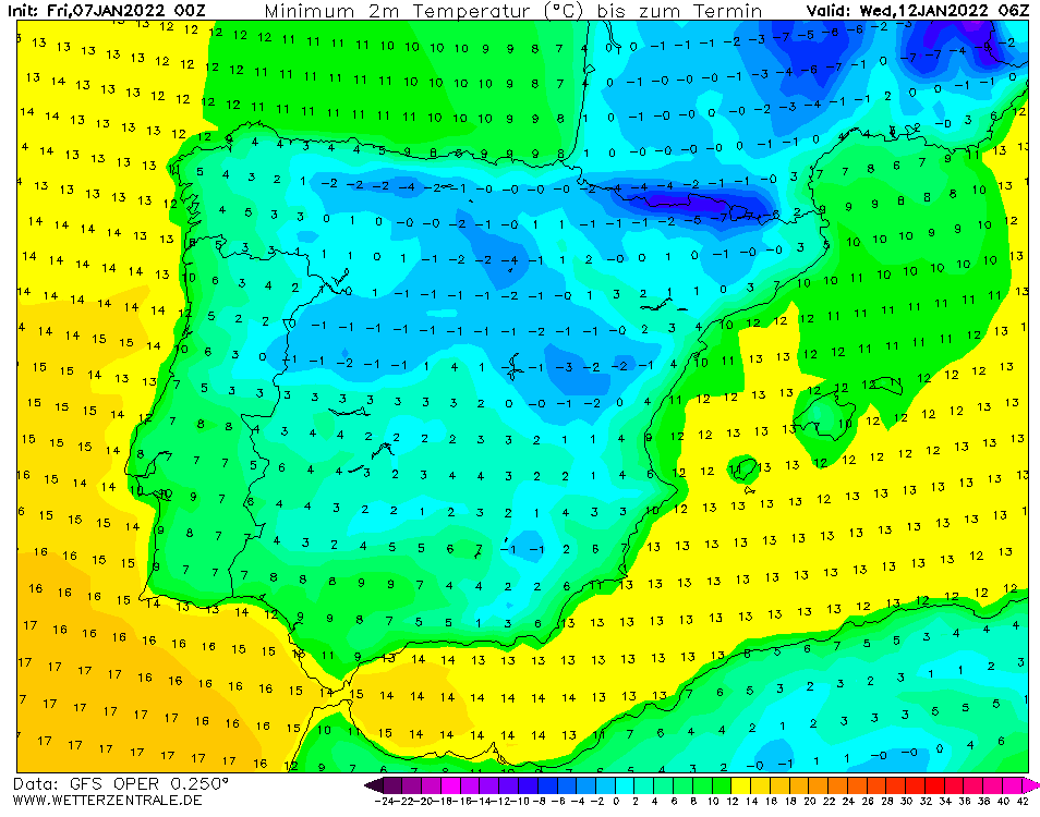
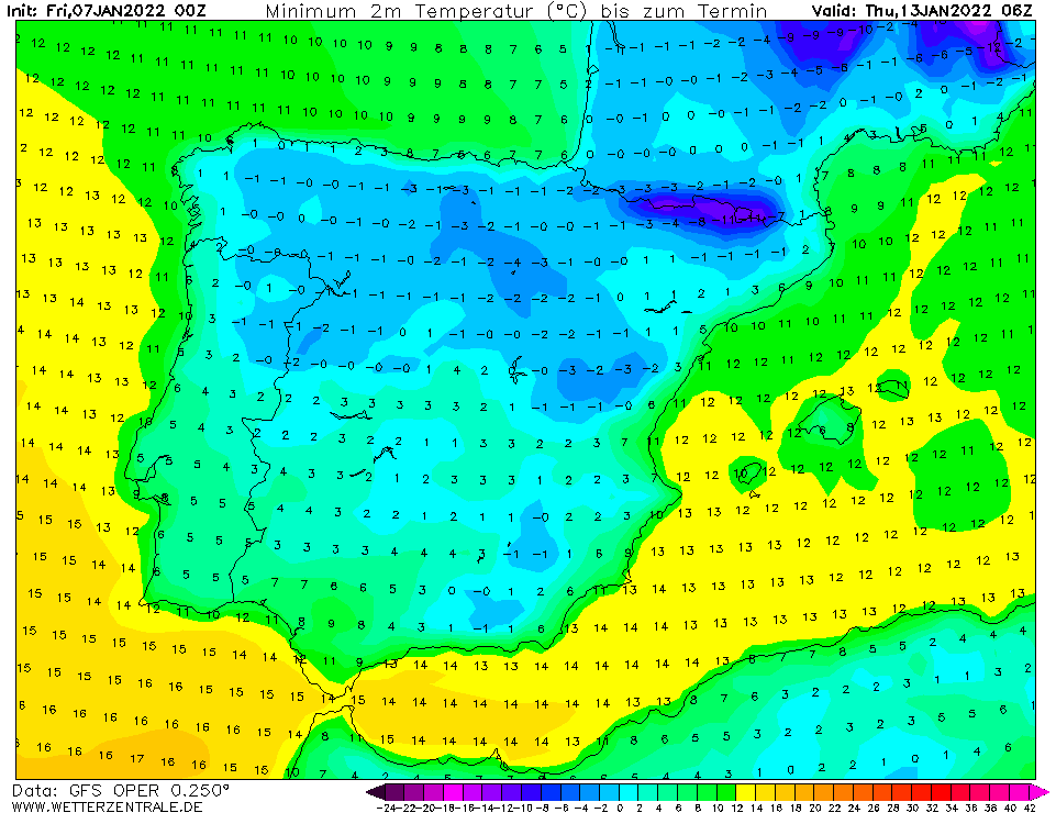
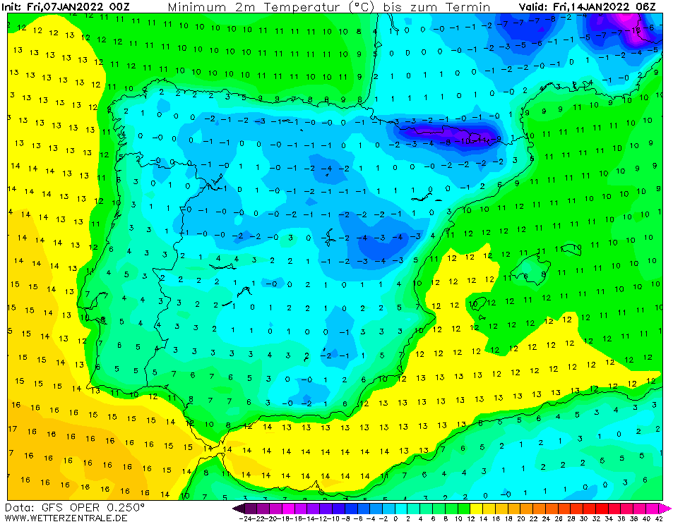
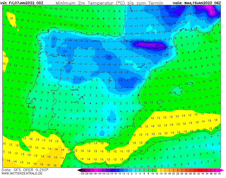
For Spain and Portugal, GFS in the last runs has seen a severe coldwave between 12.-21. January 2022 , in basins and valleys below 1000 MASL with frosts below -10°C in Spain (in the Pyrenees below -15°C) and -5°C in NE Portugal.
Maximum temperatures should rarely drop below 0°C, with ice days (all-day frosts) in frost valleys will be possible.
Approximately half of Iberia should again see snow cover or at least snow flakes.
Prolonged extremely cold weather should have an effect on health, power outages, or problems in travel, especially in mountainous regions.
In metropolitan cities, minimum temperatures will be higher, around 0/-5°C°C, bigger cities in basins and valleys however should attack -5/-10°C, and villages in mountains below -10°C, maybe in the Pyrenees up to -15°C.
Coldwave will be gradually shifting eastward and in the 3rd decade of December is possible a peak of Winter 2021 in continental and eastern parts of Europe.
Frosts are forecast to start already in around 4 days, therefore mainly forecast for the second half of the next week appears successful, if coldwave will be really (with higher reliability) very long, we will see soon on outputs of forecast models.
Source: wetterzentrale.de
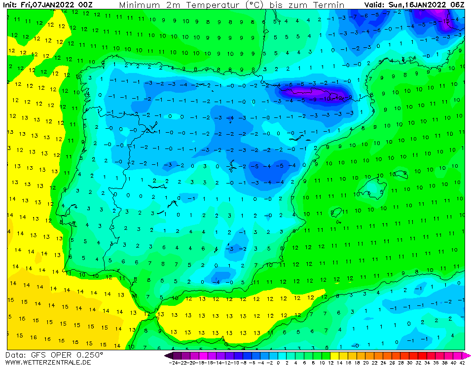
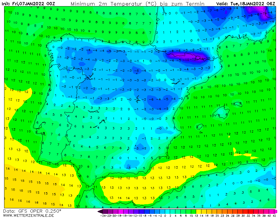
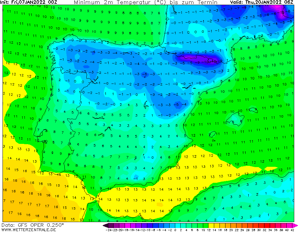

Source: wetterzentrale.de
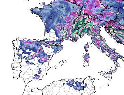
Expected snowfall. Source: tropicaltidbits (6.1. 12Z)


