Severe Weather Alert: Tornado Outbreak Threatens Midwest and Plains in the Next 72 Hours
Residents across the Midwest and Plains are on high alert as meteorologists forecast a significant risk of severe weather, including potential tornado outbreaks, over the next 72 hours. The National Weather Service and the Storm Prediction Center have issued warnings for several states, urging preparedness as conditions become favorable for the development of severe thunderstorms and tornadoes.
Forecast Overview
According to the latest updates, the period from Tuesday, June 3, through Thursday, June 5, 2025, is expected to bring a series of severe weather events to the central United States. A low-amplitude southern-stream shortwave impulse is anticipated to phase with a northern-stream shortwave trough in the Upper Midwest, strengthening mid-level southwesterlies across the northern part of the warm-moist sector, roughly from the Iowa/Illinois border area northward. This process is likely to aid in the development of severe thunderstorms, including the potential for tornadoes.
The national outlook for the coming week indicates a variable severe weather threat:
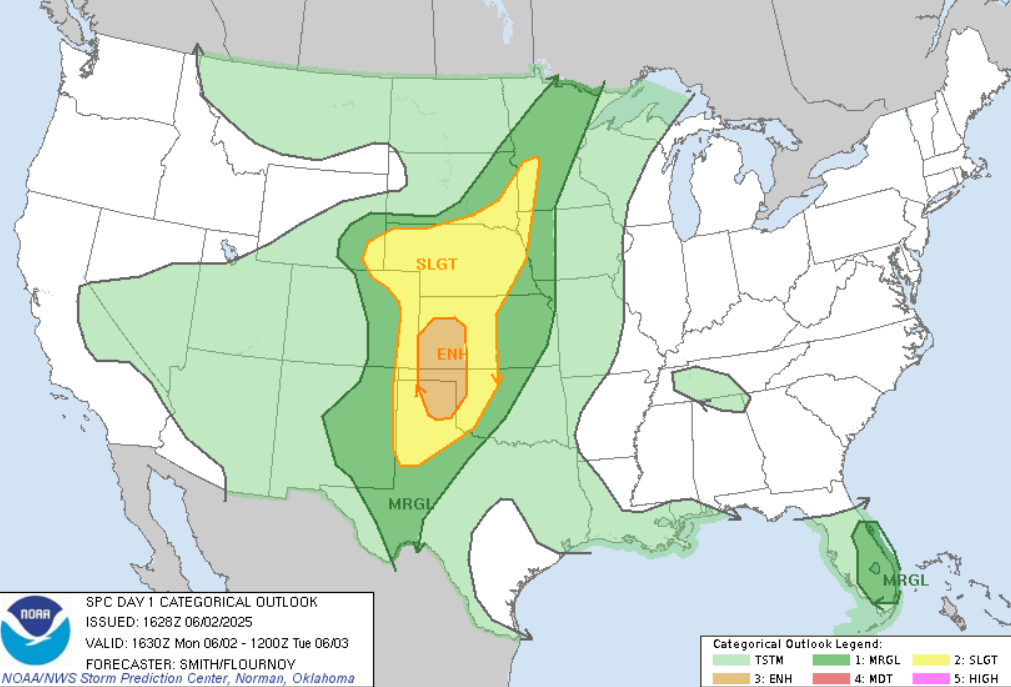
- Monday, June 2: Enhanced risk of severe thunderstorms in the Texas Panhandle, northwest Oklahoma, and western Kansas. Primary hazards include severe wind gusts (60–75 mph), with localized gusts up to 90 mph.
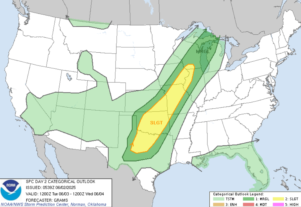
- Tuesday, June 3: Slight risk of severe thunderstorms from the southern Great Plains to the Midwest. Potential hazards include a couple of tornadoes, damaging winds, and large hail.
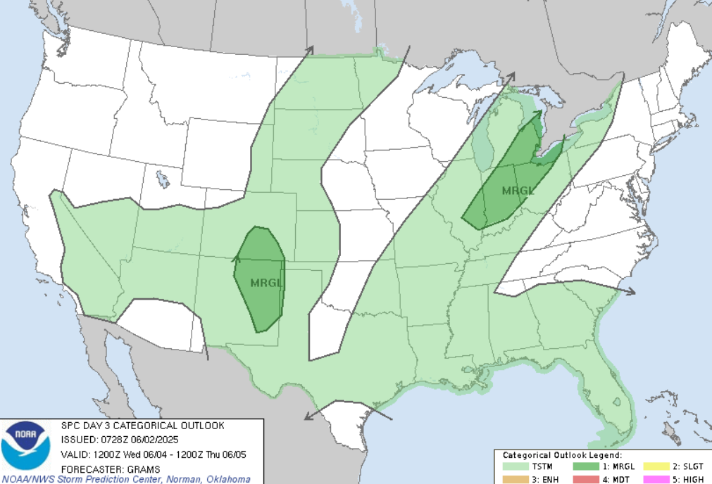
- Wednesday, June 4: Marginal risk of severe thunderstorms in southern Colorado and eastern New Mexico. Isolated damaging winds may occur across the eastern Midwest to Lower Great Lakes.
- Thursday, June 5: 15% probability of severe thunderstorms from the Texas Panhandle into southern Kansas.
More information at https://www.severeweatheroutlook.com/everything/?


