Hazy, Polluted Skies over North America, Canadian Wildfires and Saharan Dust Causing Severe Disruptions.
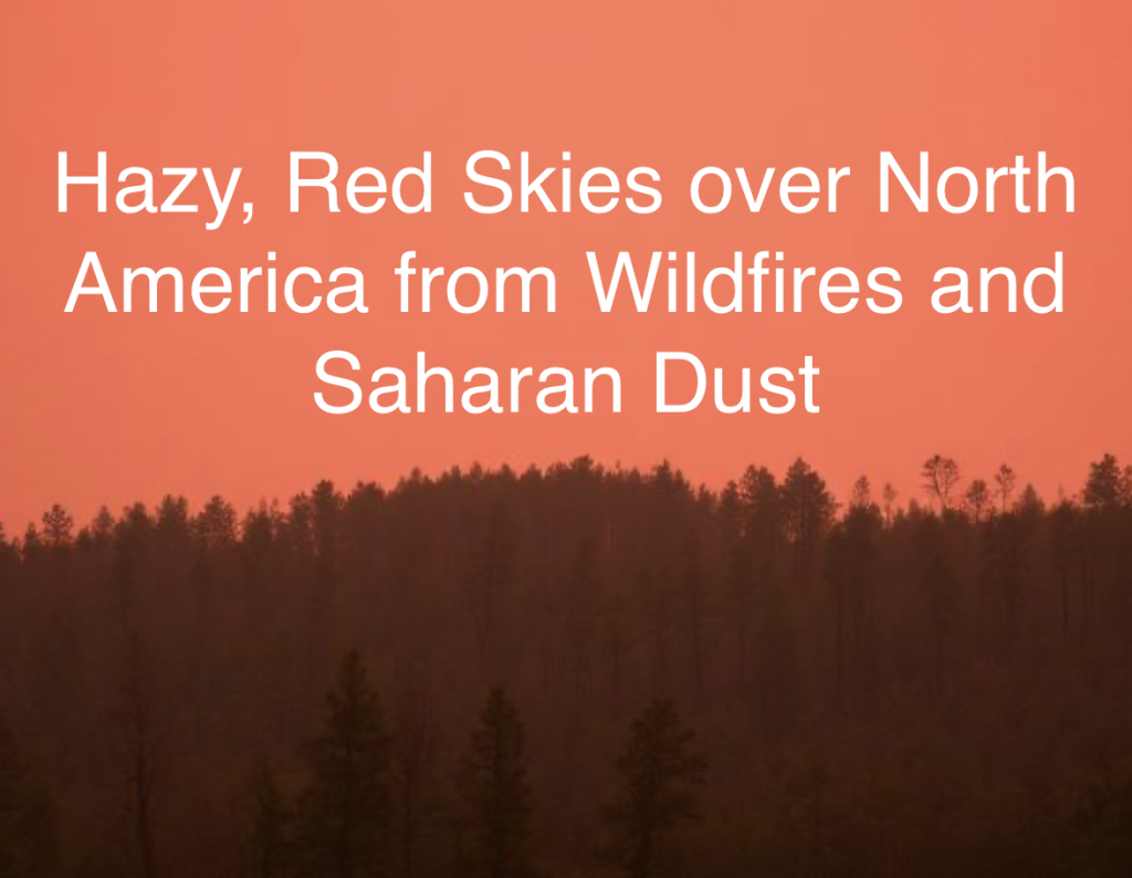
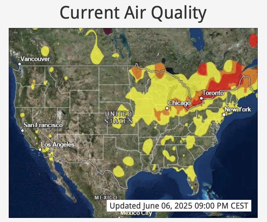
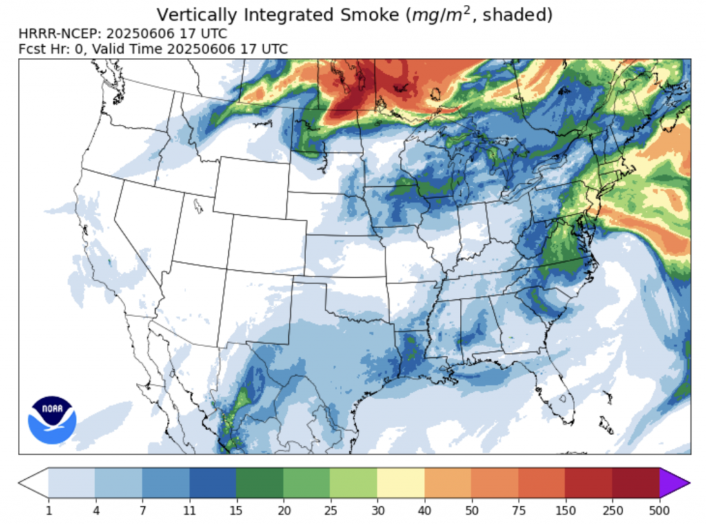
Across North America, hazy skies have blanketed huge swaths of the continent from June 4th–6th, 2025, due to a combination of dense Canadian wildfire smoke and Saharan dust. Smoke from more than 1,700 active fires—primarily in Manitoba and Saskatchewan—has been lofted high into the atmosphere, drifting southeastward into the U.S. Midwest and Northeast. Satellite data show plumes extending across the Great Lakes into New England, where cities like Chicago and Detroit reached AQI values above 140 on June 5th, categorizing conditions as “very unhealthy” (washingtonpost.com, washingtonpost.com). At the same time, a robust plume of dust originating from the Sahara Desert has funneled over the Gulf of Mexico and up the Eastern Seaboard, causing a second layer of haze over Florida, Georgia, and the Carolinas (accuweather.com, ksat.com). Together, these two distinct sources have produced an orange‐tinged sky from Texas to New York, with peak visibility reductions reported in the Upper Midwest and parts of Quebec.
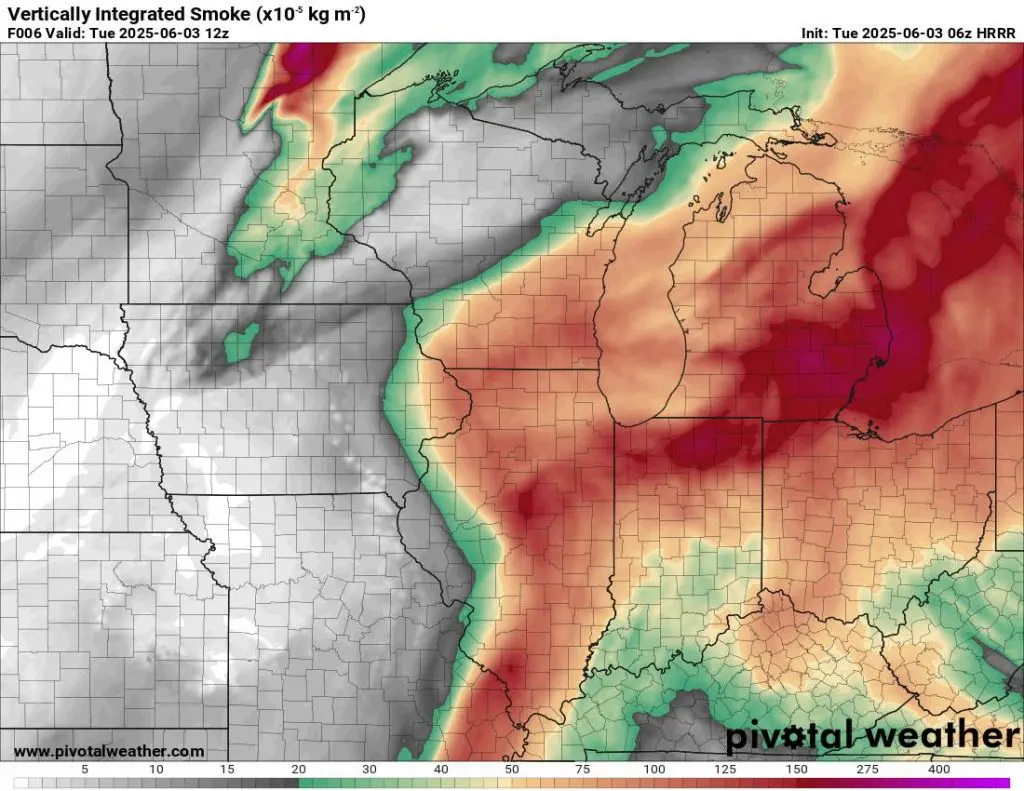
Air quality has deteriorated to hazardous levels in several major metropolitan areas. On June 4th, Minneapolis‐St. Paul recorded PM2.5 concentrations near 160 µg/m³, far above the “unhealthy” threshold, prompting pediatricians to report a surge in asthma and respiratory complaints among children (apnews.com, accuweather.com). In Michigan, the Mackinac Bridge was obscured by smoke on June 4th, and Marquette peaked above an AQI of 800, one of the highest readings in the world that day (blockclubchicago.org, travelandtourworld.com). In Canada, Toronto issued “special air quality statements” for June 5th–6th as PM2.5 from Manitoba fires triggered health advisories in the Ottawa–Gatineau region and Montreal (en.wikipedia.org). Even areas typically distant from wildfires felt the impact: New York City and Boston saw AQI values climbing into the “unhealthy for sensitive groups” category on June 5th, owing to a mix of transported smoke aloft and stagnant air at the surface (foxweather.com, fox32chicago.com).
The thick haze also disrupted travel, especially air traffic. On June 5th, nearly 600 flights across the U.S. were delayed and at least six were canceled as visibility dropped below safe operational minima at multiple airports—including Minneapolis-St. Paul International and Chicago O’Hare International (aol.com). Chicago’s Department of Aviation reported that several arriving flights were rerouted to secondary airports in Indiana, while New York’s LaGuardia and Newark both issued ground stops for portions of the afternoon, citing smoke‐induced low ceilings (foxweather.com, cbsnews.com). Ground transportation was also affected: in Chicago and Detroit, speed restrictions on interstates were imposed due to reduced visibility, and Amtrak reported slower schedules between Chicago and Milwaukee as crews encountered smoky platforms and tracks. Many travelers were advised to check with airlines or ground carriers before setting out, as weather analysts projected continued smoke through late June 6th.
Disentangling the contributions of Saharan dust versus Canadian wildfire smoke reveals a clear geographic delineation. In the Southeast—particularly Florida, southern Georgia, and the Carolinas—hazy skies from June 4th–6th were dominated by Saharan dust aloft, evidenced by unusually vivid sunrises and a dry, dusty haze with minimal odor (ksat.com, colitco.com). By contrast, the U.S. Midwest and Northeast felt the more acrid, dense smoke signature from Canadian blazes, complete with a burning‐plastic smell reported in Toronto and Detroit on June 5th (washingtonpost.com, washingtonpost.com). Radar and satellite imagery from June 4th confirmed a bifurcated plume: a southerly dust corridor versus a northwesterly smoke stream. In Canada’s Maritime Provinces, the eastern edge of the smoke plume remained aloft, contributing to “special air quality statements” in Nova Scotia, while ground‐level smoke extended into Ontario and Quebec (en.wikipedia.org, en.wikipedia.org).
Looking beyond North America, the smoke plume is already traveling eastward across the Atlantic. As of June 6th, weather models forecast that thin smoke layers will reach Iceland and the British Isles by June 7th–8th, though at concentrations unlikely to pose major health threats at sea level. The U.K. Met Office and Ireland’s Met Éireann both noted elevated aerosol optical depths on June 6th, consistent with transatlantic transport of Canadian smoke (washingtonpost.com, upi.com). Over continental Europe, France and Germany may see slight haze on June 8th, but Saharan dust remnants are expected to dissipate earlier, leaving clearer skies by June 7th. In North America, the National Weather Service expects the worst of the haze to lift by the evening of June 6th as a cold front pushes smoke and dust eastward and cooler, drier air from the west breaks up the lofted plumes (accuweather.com, foxweather.com). Nonetheless, localized air quality alerts remained in effect for parts of Minnesota, Wisconsin, and Quebec through June 6th, with officials cautioning that any additional Canadian fire activity could prolong smoky conditions into the weekend.


