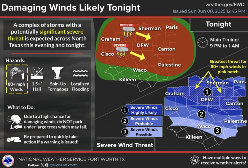
Major Storms Expected Across Northern Texas, up to 130 kph Winds and 4 cm Hail Forecast
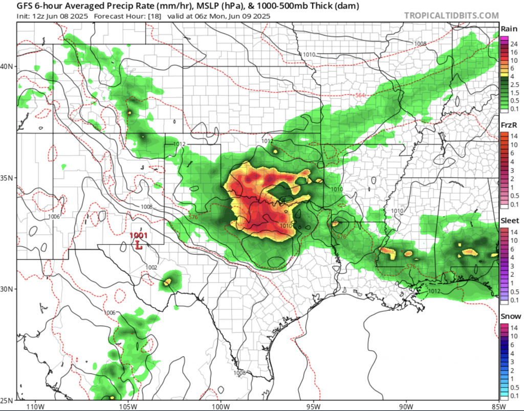
A powerful cold front is sweeping across Texas on June 8th, 2025, bringing with it a wave of intense storms that could significantly disrupt travel and pose hazards across a broad swath of the state. North and Central Texas, including the Dallas–Fort Worth metro area, are under a Level 3 severe weather risk, with strong thunderstorms expected throughout Sunday and into early Monday. Winds are forecast to reach speeds of up to 130 km/h in some storm cells, with the potential for damaging hailstones up to 4 cm in diameter. The National Weather Service has also warned of possible tornado formation in parts of North Texas and the Texas Hill Country, with rotating storm cells already observed near Abilene and Stephenville.
These storms are forecast to deliver significant rainfall totals to major cities, including up to 60–80 mm in Dallas, 50–70 mm in Austin, and 40–60 mm in San Antonio. To put these figures in context, Dallas typically receives about 94 mm of rain for the entire month of June, meaning the metroplex could receive nearly its full monthly average within a single 24-hour period. With saturated soils from earlier showers, this sets the stage for widespread flash flooding, especially in low-lying areas and along urban creek systems. Flash flood watches are currently active for much of Central Texas, and emergency management agencies have advised residents to avoid unnecessary travel after dark due to the risk of submerged roads and rapid water level rise.
Travel disruptions are already being felt. Dallas–Fort Worth International Airport reported multiple flight delays and cancellations due to poor visibility and wind shear on the evening of June 7th, with more likely throughout the day on June 8th. Ground transport has also been impacted, particularly along Interstate 35 and U.S. Route 287, where temporary closures have occurred due to wind-damaged debris and pooling water. Meteorologists warn that evening commuters should expect traffic congestion and reduced travel speeds in affected regions, especially where rain rates exceed 20 mm per hour.
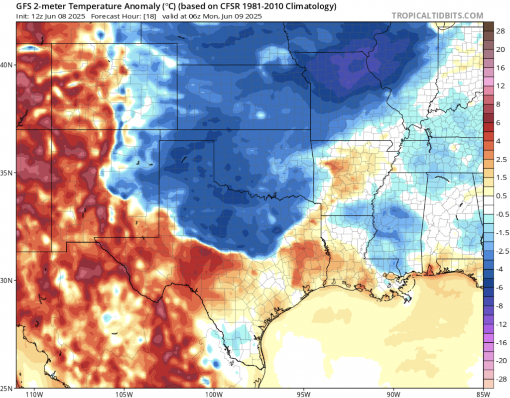
Beyond the severe storm risk, this cold front is also ushering in an unusually cool air mass for early June. In the wake of the storms, daytime high temperatures across North and Central Texas are expected to be 8–12 °C below normal. Dallas, for instance, may only reach a high of 23 °C on June 9, compared to its average high of 33 °C for this time of year. Lubbock and Wichita Falls may even dip into the low teens overnight, making this one of the most significant early-summer cool snaps in recent memory. While welcome relief from recent heat, the rapid temperature change—combined with intense storms—has created a volatile weather setup across the state.