Tropical Storm Barbara is the First Tropical Storm of the Eastern Pacific Hurricane Season, Anticipated to be First Hurricane
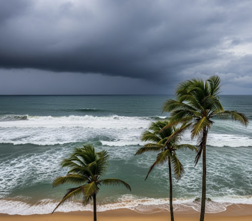
Tropical Storm Barbara continues to churn off the southwest coast of Mexico as of June 8th, 2025, bringing the potential for hazardous weather to portions of the Pacific coastline. According to the National Hurricane Center (NHC), Barbara is currently producing maximum sustained winds of 85 km/h, with higher gusts, and is expected to maintain its strength through the next 24 hours before gradually weakening. Barbara is anticipated to become a hurricane in about 12 hours time, but within 36 hours, Barbara’s movement into cooler waters will weaken further development. The storm is located several hundred kilometers offshore but is still generating significant swells and dangerous surf conditions along the coasts of southern Mexico, particularly near the states of Guerrero and Oaxaca. Rip current risks and rough seas are expected to persist for coastal communities, prompting advisories for beachgoers and small watercraft.
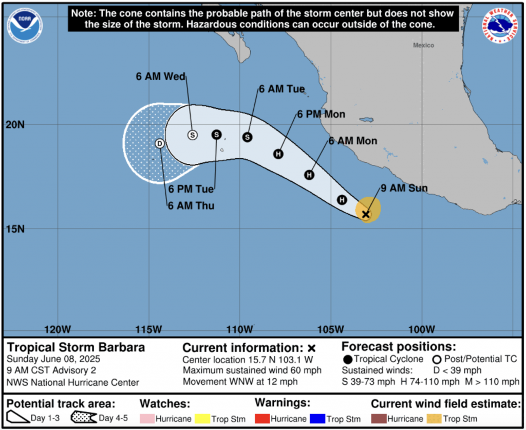
Rainfall totals associated with Tropical Storm Barbara could reach 50 to 100 millimeters in parts of southern coastal Mexico, with localized areas receiving up to 150 millimeters. These amounts could lead to flash flooding in mountainous terrain, and the NHC has issued flood watches for vulnerable areas. Although the storm is not currently forecast to make landfall, its outer rainbands will brush the coastline and may cause temporary disruptions. Shipping lanes off Mexico’s southwest coast are being advised of elevated seas and strong winds, which could reach up to 95 km/h in squalls near the storm’s core, making conditions hazardous for marine traffic.
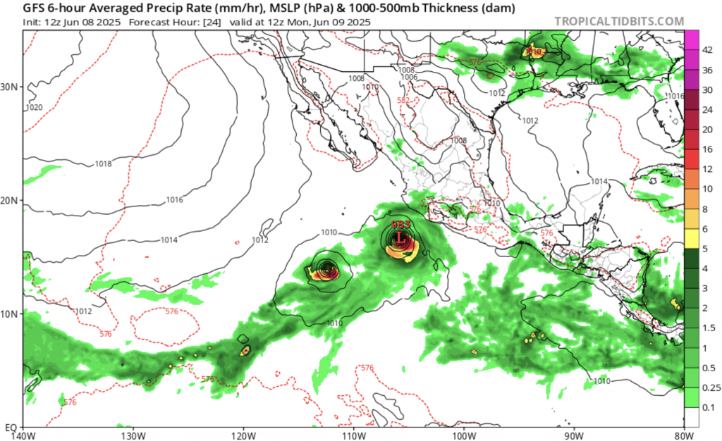
Barbara is the second named storm of the 2025 eastern Pacific hurricane season, following Tropical Depression Adrian, which dissipated before strengthening into a named system. As of early June, Barbara is the first tropical storm of the season to pose a notable hazard to the Mexican coast, and it is also projected to become the first hurricane of the season. The eastern Pacific hurricane season officially began on May 15th, and forecasters are predicting a near-average year in terms of storm activity, with around 14–18 named storms anticipated. However, warmer-than-average ocean temperatures in the equatorial Pacific could still lead to isolated periods of enhanced storm development.
Looking ahead, Tropical Storm Barbara is expected to veer gradually west-northwest, staying offshore and avoiding direct landfall. While currently strengthening and anticipated to briefly reach hurricane status, it is forecast to weaken into a tropical depression by midweek, likely around June 11th. This is due to Barbara’s movement over cooler waters, encountering increased wind shear. By June 12th, the system is expected to become a remnant low, bringing an end to its organized convection. While the storm’s threat to land remains limited, residents and local authorities are being urged to monitor updates and heed any evolving weather advisories. The early formation of Barbara serves as a timely reminder for coastal communities to prepare for the ongoing hurricane season.


