Mount Cook Aero, New Zealand: -12,9°C at 656 MASL, only 2°C from the all-time record!
New Zealand experienced its coldest day of the year as a polar blast swept across the country. This intense cold front brought snow and icy conditions, significantly dropping temperatures in several cities. In the capital city, Wellington, temperatures plummeted to 2.9°C, while Auckland and Christchurch recorded 4.5°C and -2.8°C, respectively. The alpine village of Aoraki/Mount Cook reported temperatures as low as -10°C, with locals claiming it dipped to -13°C overnight, making it the coldest town on Sunday .
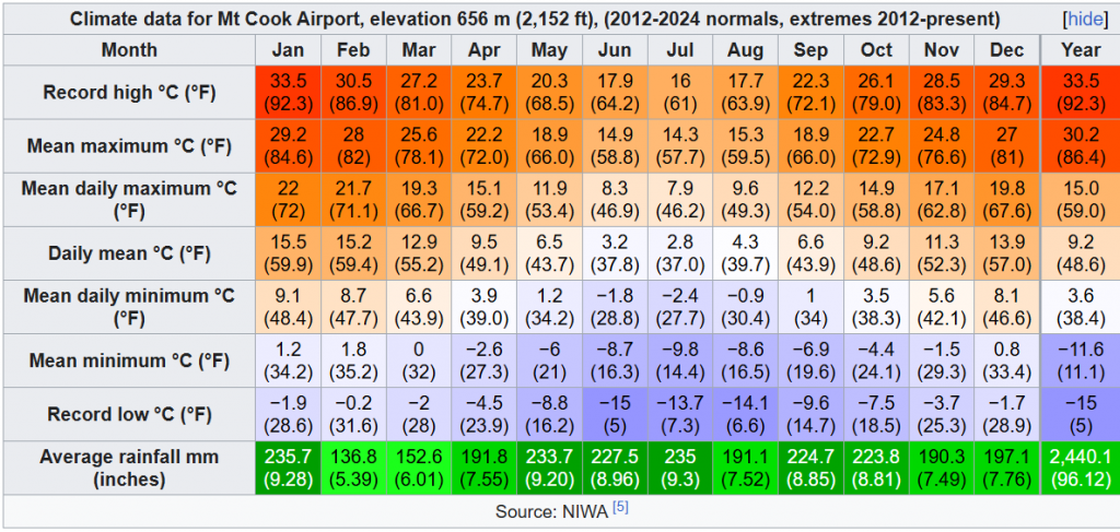
On June 8, 2025, Mount Cook Aerodrome in New Zealand recorded an exceptionally low temperature of -12.9°C, marking a significant early-season cold snap. This temperature is well below the typical early June averages for the region, which usually range between -2.8°C and -5.6°C.
❄️ Snowfall and Road Disruptions
The polar blast led to significant snowfall across the South Island, with areas like Lake Tekapo receiving heavy snow. This resulted in treacherous road conditions, prompting authorities to issue warnings and advise limiting travel. State Highway 8 from Fairlie to Twizel remained closed due to snow and ice, trapping visitors. Fire and Emergency services were deployed to assist stranded motorists and clear the roads .
🌊 Extreme Weather Events
In addition to the cold temperatures and snowfall, the polar blast caused unusually high swells. At the entrance to Wellington Harbour, wave heights reached up to 10 meters, while off Banks Peninsula, they peaked at 8 meters. These conditions led to the cancellation of all Cook Strait passenger sailings by Interislander and Bluebridge ferries due to safety concerns .
⚠️ Ongoing Weather Warnings
Despite the initial fears of an extreme cold snap, the situation has not escalated as anticipated. However, chilly temperatures persist across the country. Authorities continue to monitor conditions and advise caution, especially in areas prone to snow and icy roads .
Historical Context and Records
While -12.9°C is a strikingly cold temperature for early June, it is not the all-time record for Mount Cook Aerodrome. The station’s all-time lowest recorded temperature stands at -15°C, which illustrates the capacity for extreme cold in this alpine region. The all-time record highlights that temperatures in the area can plunge even lower under the right meteorological conditions.
Thus, the -12.9°C measurement is unusually cold for this time of year but still within the historical range of the area’s climate variability.
Climatic and Meteorological Factors
Mount Cook Aerodrome is situated in New Zealand’s Southern Alps, at an elevation of approximately 656 meters. This high-altitude alpine location is prone to rapid weather changes and strong cold air intrusions, especially during winter months.
The cold snap on June 8, 2025, was driven by a polar blast that swept across New Zealand, bringing unusually cold air masses and snow to many regions. This event was part of a larger cold outbreak that led to some of the coldest mornings recorded nationwide this year and in many region in the last several years, with snowfalls and freezing temperatures impacting large parts of the country.
Conclusion
While the -12.9°C temperature recorded on June 8, 2025, is extremely cold and well below normal for early June, it is not totally unprecedented for Mount Cook Aerodrome. The all-time record low of -15°C underscores the potential for severe cold in this alpine region. Such events highlight the dynamic and sometimes extreme nature of New Zealand’s mountainous climate.
Source: https://en.wikipedia.org/wiki/Mount_Cook_Aerodrome
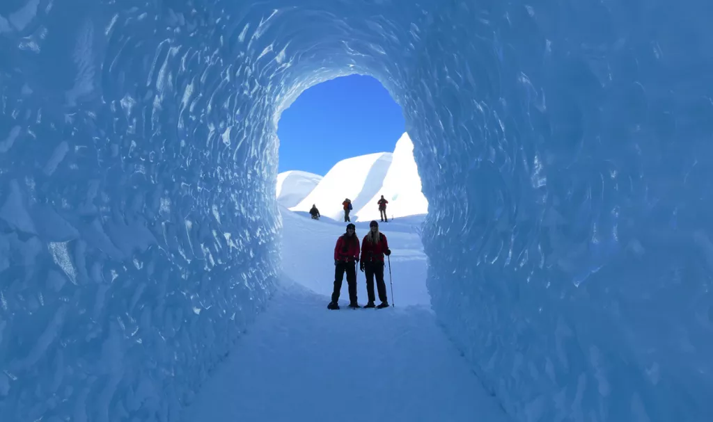
Illustration picture: http://www.mtcook.com/tasman-glacier-heli-hiking


