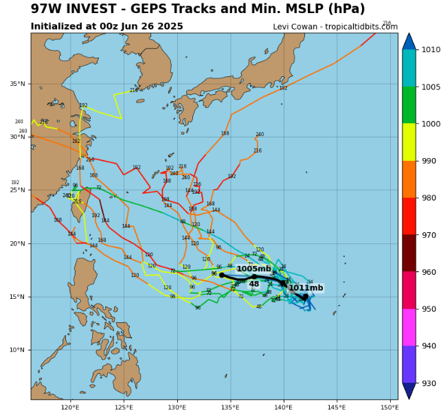
As of 12:00 UTC on June 26, 2025, Invest 97W is being monitored in the Western Pacific Ocean, situated west of the Northern Mariana Islands. While still in its early stages, the system is showing signs of gradual organization and has been given a moderate chance of tropical cyclogenesis within the next 1 to 7 days.
📍 Current System Details:
- Location: 16.1°N, 139.9°E
- Maximum Sustained Winds: 15 knots (28 km/h or 17 mph)
- Minimum Central Pressure: 1009 hPa
- Gusts & Circulation Radius: Not specified
🌀 Development Potential
- The Joint Typhoon Warning Center (JTWC) and regional agencies have highlighted moderate potential for development, particularly if the system remains over warm waters and enters an environment of reduced wind shear.
- Sea surface temperatures in the region are favorable (~29°C), though upper-level conditions may need to improve for intensification to begin.
📢 Marianas Advisory Concludes
- A Special Weather Statement was previously issued for the Northern Marianas, but has now been discontinued, as the immediate threat to the islands has diminished.
- Nonetheless, residents in Guam, the Northern Marianas, and nearby Micronesian islands are encouraged to monitor updates in case the system reorganizes closer to land.
🔭 Forecast Outlook
- Invest 97W is tracking westward to west-northwest, and could gradually consolidate.
- Over the coming days, forecasters will assess potential for the system to strengthen into a tropical depression or tropical storm, depending on atmospheric evolution.
Summary: Invest 97W remains a weak but monitored system in the Western Pacific. Although not currently a threat to land, it has a moderate chance to become a named tropical cyclone within a week.
Source: https://www.tropicaltidbits.com/storminfo/#97W


