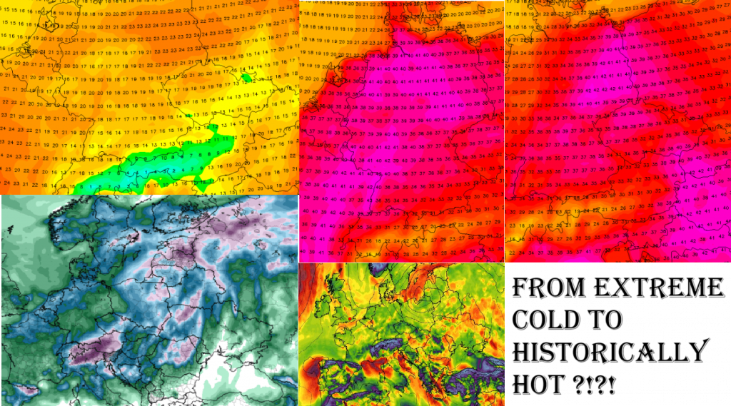
A Wild Ride of Rainstorms, Temperature Whiplash, and Summer Extremes
Central Europe is bracing for one of the wildest weather swings in recent memory: a shocking transition from chilly, rainy 16°C days to searing 42°C heat—all within less than two weeks. What sounds like a meteorological anomaly is now being confirmed by forecast models, pointing toward a dangerous combination of flooding, heatwaves, and climate stress across the region.
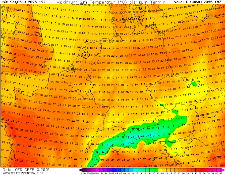
During the following week of July 2025, temperatures have been unusually low. Cities like Vienna, Munich, and Prague experienced daytime highs barely reaching 16–18°C, while persistent rainfall and heavy cloud cover led to a near-autumnal feeling across much of Central Europe. At the same time, saturated soils and swollen rivers increased the risk of localized flooding. A deep trough in the jet stream allowed cold Atlantic air to flow into the continent, creating highly unstable conditions.
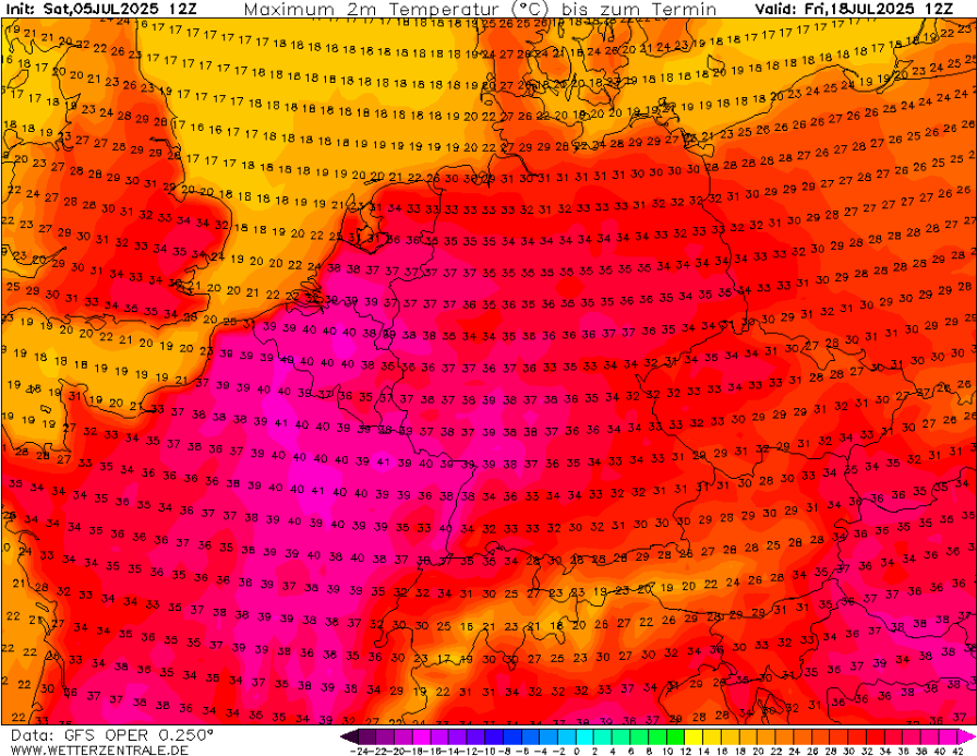
However, this cool phase will be short-lived. From around July 9 to 13, the jet stream is expected to realign, forming a blocking high-pressure system over southern and eastern Europe. This will open the gates for Saharan air to surge northward, creating a classic heat dome effect. The result? Rapid warming, with temperatures rising by more than 25°C in just a few days.
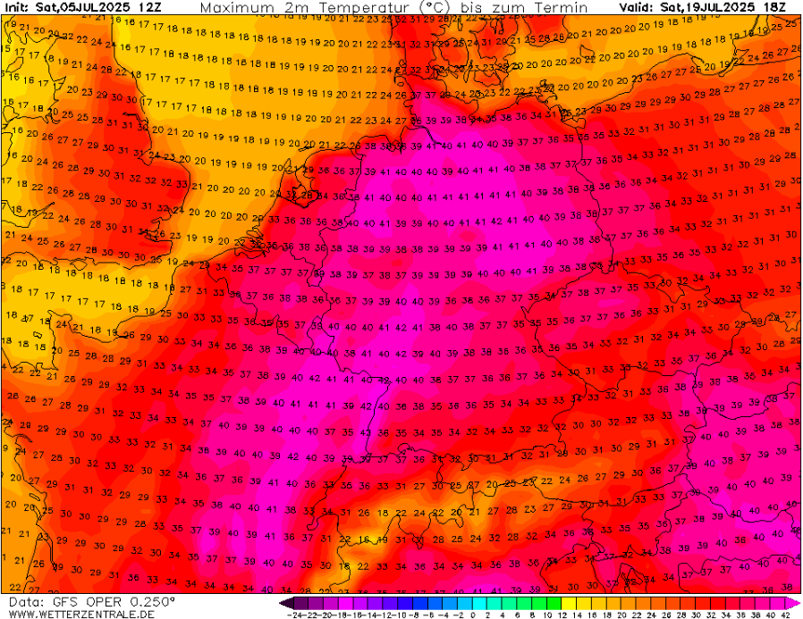
Forecasts for July 14–20 show extreme heat developing over Hungary, Slovakia, Austria, and southern Germany, with some areas likely exceeding 40°C. Cities like Budapest, Bratislava, Brno, and Vienna could see highs between 38°C and 42°C, breaking monthly or even all-time records. This kind of temperature whiplash is not only rare—it is dangerous.
The impacts of such a swift transition are severe. After days of soaking rain, the sudden heat will cause rapid evaporation, leading to oppressive humidity and heat index values above 45°C in some areas. At the same time, vegetation dried out by the sun will be vulnerable to wildfires, especially in forested regions of southern Germany and the Czech Republic.
Health systems are likely to be strained. Cases of heat exhaustion, heatstroke, and respiratory issues may spike, particularly among the elderly, children, and people with chronic illnesses. The transition from floods to fires in just days will challenge emergency response teams, infrastructure, and energy grids, which will be pushed by increased air conditioning demand.
These swings are becoming more frequent and intense in recent years. Scientists point to a weakened and more wavy jet stream as a result of climate change, which allows polar air to plunge southward one week, only to be replaced by tropical air masses the next. Europe’s summers are no longer defined by stable patterns but by sudden, dangerous extremes.
The most likely scenario beyond mid-July is the continuation of the heat dome, particularly in eastern and southeastern Europe. If rainfall remains scarce after the spike in heat, a longer-term drought could take hold. This would affect not just health and safety but also agriculture, with crop yields potentially damaged first by excess moisture, then by heat stress.
A simple summary of this unfolding sequence:
| Date Range | Weather Type | Temperature Range | Main Impact |
|---|---|---|---|
| July 6–9 | Cool & Rainy | 15–19°C | Flood risk, waterlogging |
| July 10–13 | Transition & Storms | 22–28°C | Severe storms, high humidity |
| July 14–20 | Extreme Heatwave | 35–42°C | Health stress, wildfire danger |
This is more than just a bizarre weather event—it’s a warning. Central Europe’s 12-day swing from 16°C to 42°C is a textbook case of weather chaos amplified by climate change. We must prepare not only for hotter days but also for more sudden, extreme shifts that test our ability to adapt.
As Europe’s summer of 2025 continues, it may become one of the most record-breaking, dangerous, and unpredictable on record. What was once rare is now becoming normal—and what’s “normal” is no longer safe.
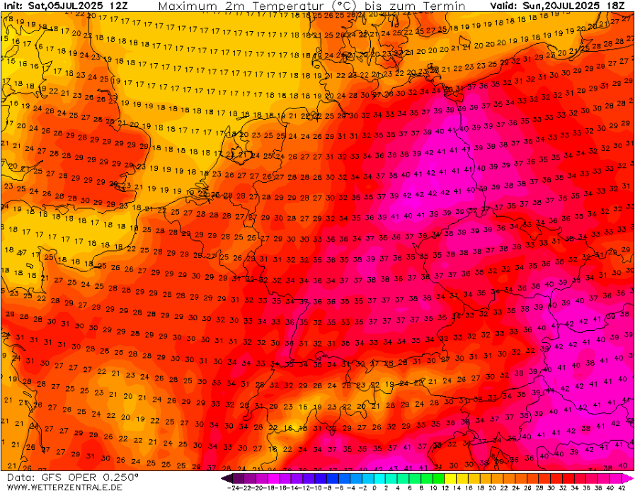
Source: wetterzentrale.de
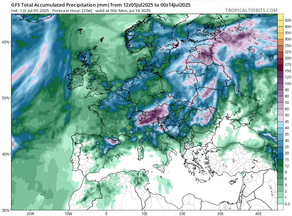
Source: tropicaltidbits.com
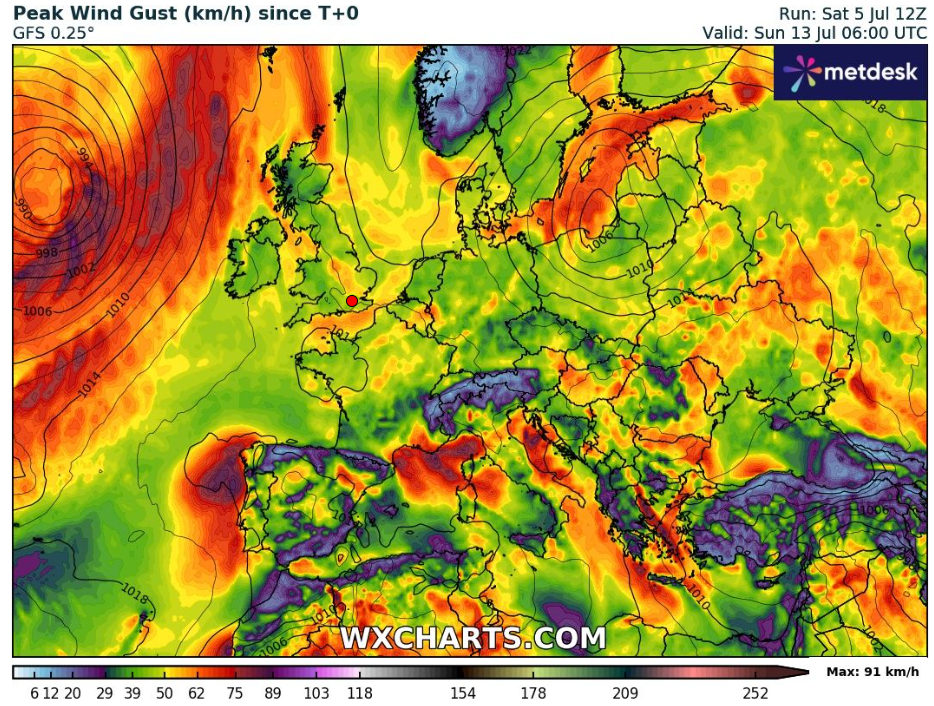
Source: wxcharts.com


