Tropical Storm Chantal hit the Carolinas, continues across Mid-Atlantic and East Coast
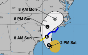
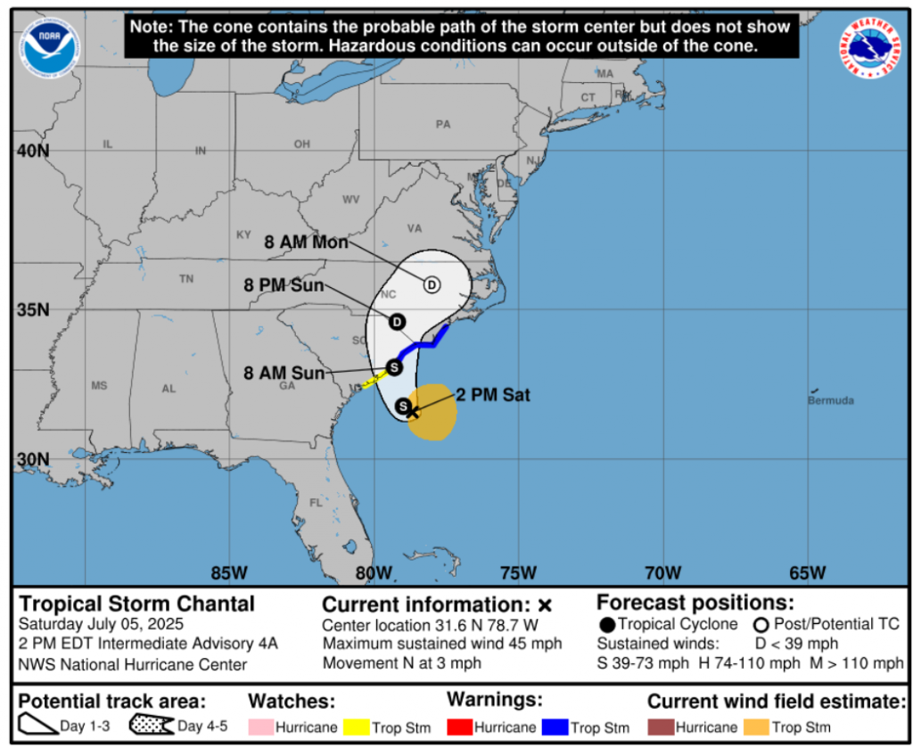
Tropical Storm Chantal, the third named storm of the 2025 Atlantic hurricane season, made landfall near northern South Carolina late Saturday night. With sustained winds of 40–45 mph and gusts up to 50 mph, Chantal brought heavy rainfall, storm surge, and gusty winds to the Carolinas.
Tropical Storm Warnings are in effect along the coast from South Santee River (SC) to Cape Fear (NC), with isolated rainfall totals up to 6 inches causing flash flood concerns. Coastal areas also face storm surge up to 3 feet, rough surf, and dangerous rip currents. There is a risk of isolated tornadoes in the eastern Carolinas.
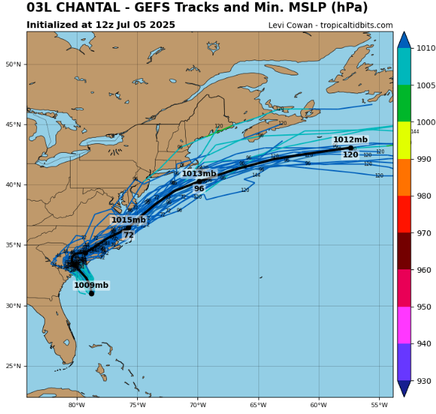
As Chantal moves northeast slowly at 2–3 mph, it will bring heavy rain and wind to the Mid-Atlantic states including Virginia, Maryland, and Delaware early next week. Coastal surf and rip current dangers will extend along the East Coast through the Delmarva Peninsula.
Residents in affected areas should avoid beaches, prepare for flooding in low-lying zones, secure outdoor items, and follow local weather updates.
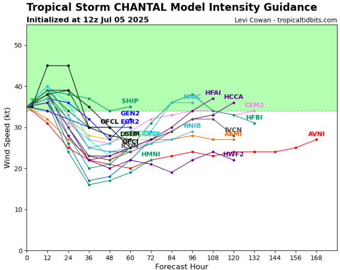
Though not a major hurricane, Chantal’s impacts include flooding, hazardous surf, and gusty winds. Its formation near the coast highlights the risks even modest tropical storms pose to populated areas.
Source: https://www.tropicaltidbits.com/storminfo/#03L
Detail.


