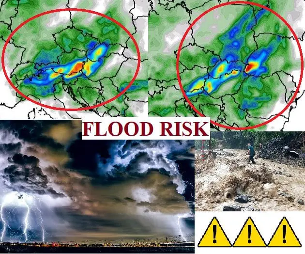
Alpine and Carpathian region at large-scale flood risk in Friday and Saturday, over 100 mm/24 hours of precipitation could fall regionally
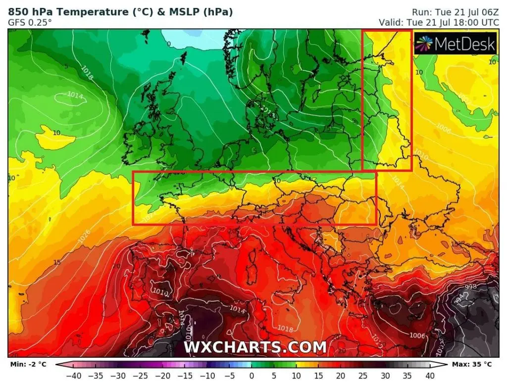
In Tuesday, 21. July 2020, heatwaves peaks in many parts of southern-half of Europe. In Spain, +43,2°C / +43,0°C / 110°F was measured during Monday and Tuesday /http://www.aemet.es/es/eltiempo/observacion/ultimosdatos?k=esp&w=2&datos=img/. In France and Alpine region, temperatures are lower than expected – southern France with +37°C, Switzerland with +34°C and Italy too with only +34°C.
Temperatures are on the other hand high in south of East Central Europe and West Balkan – Croatia is reporting +36,6°C (Knin), Bosnia and Herzegovina +35,2C (Mostar), Albania +35,1°C (Shkodra), Montenegro +34,3°C (Podgorica), Slovenia +32,3°C (Crnomelj), Slovakia +32,2°C (Hurbanovo), Austria +32,1°C (Andau), Hungary +32,8°C (Baja), Bulgaria +31,2°C (Sandanski), Serbia +31,1°C (Negotin) and Romania +30,7°C (Tulcea) in Tuesday. In Greece is up to +34,5°C (Serrai) with severe winds (83 km/h Karpathos). During Wednesday, the hottest places in Europe will shift to whole Balkan peninsula with possible temperatures up to +40°C in 23°C 850hPaT air. Very hot still will stay in Spain and Italy.
Reversely, UK reported even colder morning in Tuesday – Sennybridge in Wales only +2,2°C and Shobdon in England +2,7°C with ground frosts.
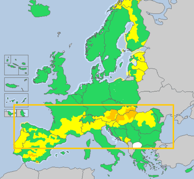
Actually orange (2. level) warnings in many parts Europe, it is nothing against floody and stormy situation (3.level, possible large-scale floods) expected to Friday and Saturday in Alpine and Carpathian region
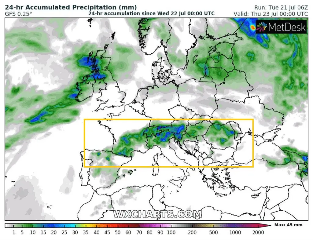
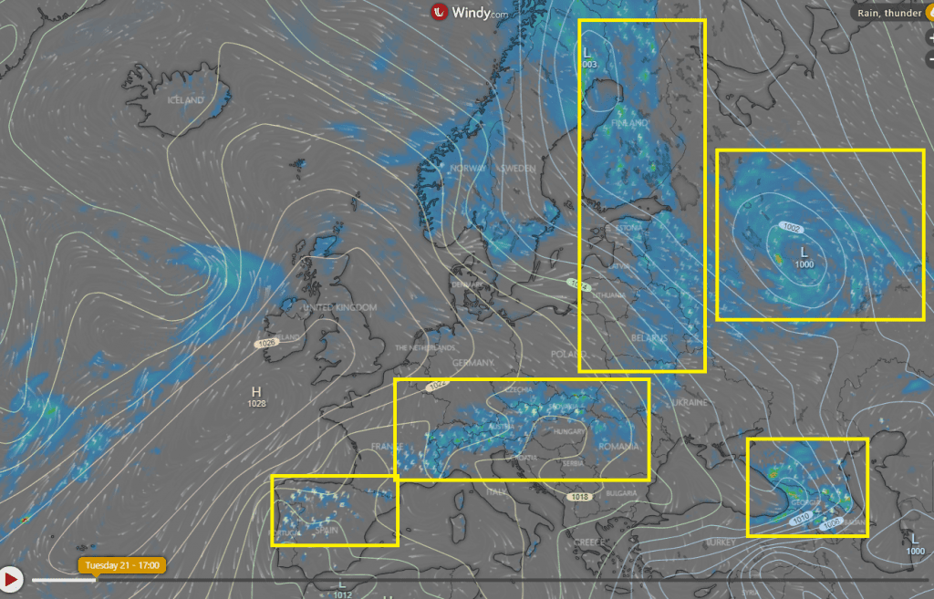
Currently, heavy storms are bothering a line from northern Spain, across southern France, Alpine region (a reason of lower maximum temperatures in air up to +22°C 850hPaT), Hungary, Slovenia and Romania and in the second line in Eastern Europe, Finland and Lapland. There are valid 2.-level warnings before heavy storms and floods regionally, but it isn´t so bad, such is expecting in Friday and Saturday.
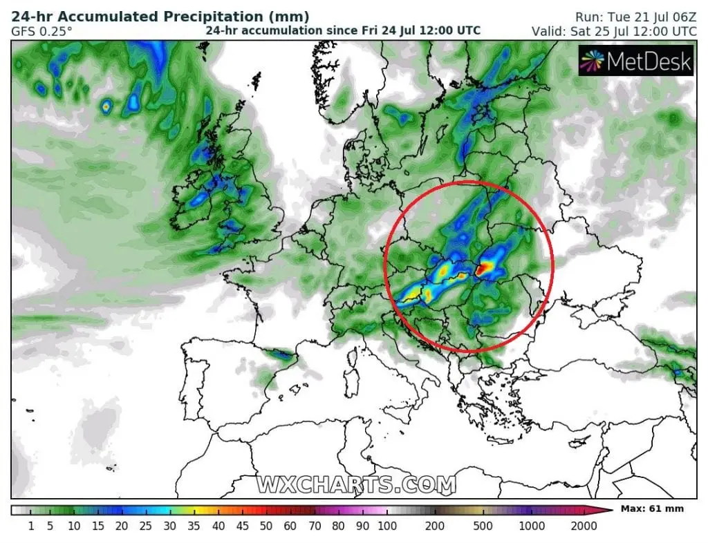
Occlusive front from NW will arrive above humid and warm air masses in region comes in 3 day and meteorological models promises really big theatre – yellow and red areas in the pictures below means 30-70 mm of precipitation / 24 hours. These areas are quite large, and possible flooding effect is very high, with possible more flash floods events in region. Moreover, precipitation in region are expecting during next days too, so ground will be saturated with water. Locally, above 100 mm/24 hours precipitation is in this constellation possible, with damaging and life- and property-threating T-storms.
We will see how will be situation evolving next 3 days, but Friday is too much close to make this severe forecast reliable. Therefore, be careful during these days in mentioned regions and watch current meteorological news in the region.


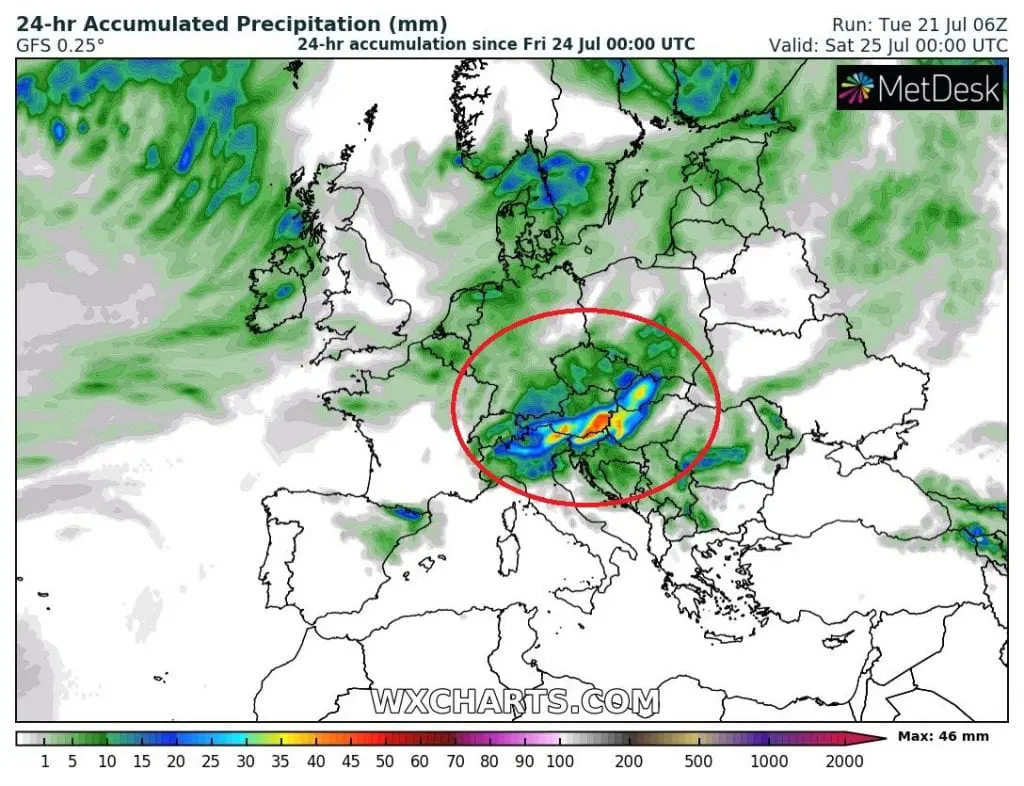
Memories of floods on Danube 2013. Now, line of severe thunderstorms will be situated more southern, except of Bavaria and northern Alpine region.


