Asia-Pacific Weather Report for May 12th-13th, Record High Temperatures in India and Central Asia 40°C in Uzbekistan and Turkmenistan, India with *minimum* temperatures of 30°C

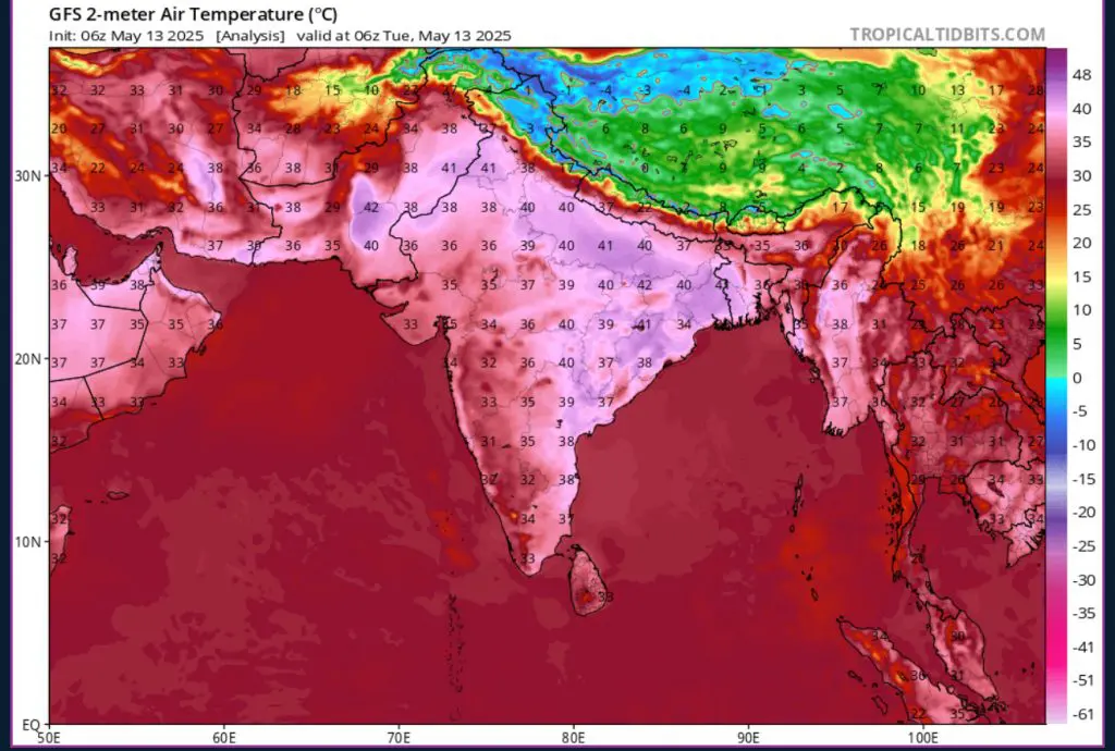
The recent extreme heat in the Sahara is having ripple effects across Central Asia. With a strong and cold low-pressure system loitering over Eastern Europe, heat flow from the Mediterranean and North Africa is being blocked from entering the European continent. You can see from the animation below that the extreme heat from the Sahara has nowhere to go but east towards Central Asia. This is leading to scorching temperatures that could reach record highs for mid-May across Central Asia. Temperatures have already reached 40.6°C in Turkmenistan, 40.1°C in Uzbekistan, 38.8°C in Kazakhstan and 37.8°C in Tajikistan.
Further east, into India, extreme high temperatures persist, reaching 44.2°C in north central India in the state of Uttar Pradesh. What is most shocking are the minimums, reaching just 30.9°C in the state of Chhattisgarh. With the presence of high dew points present 30°C, extremely high minimum temperatures continue to post a very real and dangerous threat. Oppressive humidity from such repressively high temperatures force the human body to expel tremendous energy trying to keep itself cool. Any population suffering from harsh heat all day and night is at increased risk of heatwave related injury, including deadly heatstroke.
The extreme heat in India is stretching out into the Indian Ocean. The highest ever May temperature recorded in the French Southern Territories of the Indian Ocean was set on the 12th at 28.6°C on Juan de Nova island. This warmth isn’t limited to the western Indian Ocean, along its eastern edge, Indonesia is experiencing record high temperatures for May. The capital Jakarta reached 34.5°C and the *minimum* temperature measured across the country was 22.6°C. Certain parts of the country had nightly minimums just below 26°C, which is unprecedented nightly warmth for May in Indonesia and far above historical norms.
Moving along to the Pacific Ocean, a stretch of high pressure all across the center of the North Pacific keeps low pressure to the north in Alaska and to the south nearing the equator, where the low pressure is lofted west by the La Niña Southern Oscillation climate phenomenon. This long band of low pressure across the tropical mid-Pacific eventually becomes a front of rain for western Pacific islands and the East Asian mainland. A front of rain that reinforces itself repeatedly over time, continually pummeling affected areas with rain and just in time for monsoon season.
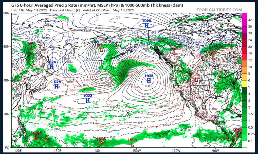
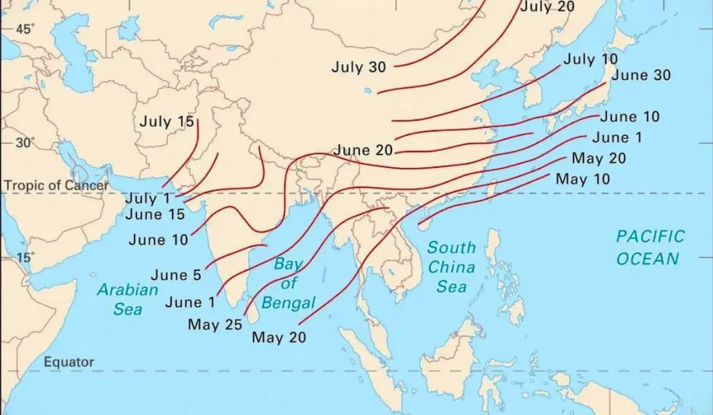
Monsoon season is in full swing around parts of East and Southeast Asia, with heavy precipitation anticipated from Indochina to the Philippines. Global Forecast System (GFS) modeling seems to suggest the possibility for some tropical cyclone formation starting next week, as the animation below depicts. Typhoon season in Vietnam and the Philippines starts in May and runs until November.
Record May warmth continues to grip Australia, with no appearance of typical autumn weather. Across the continent, temperatures several degrees above normal paint a different picture than Australians are used to seeing with the official start of Southern Hemisphere winter a matter of weeks away. Just a few days ago, temperature records for the month of May were broken across the county with over half of the month still remaining (https://www.skynews.com.au/australia-news/weather/perth-set-to-break-118yearold-may-heat-record-amid-historically-warm-autumn-for-nsw-tasmania-and-victoria/news-story/e78fb13075bf240f6307e6e9b0c1e9d7?amp&nk=c6bc707b0cb8a8a60a8833f4a51fab05-1747177415).


11 thoughts on “Asia-Pacific Weather Report for May 12th-13th, Record High Temperatures in India and Central Asia 40°C in Uzbekistan and Turkmenistan, India with *minimum* temperatures of 30°C”
Comments are closed.