Australia’s ski resorts have seen the biggest start to the season for several years: -4,8°C in the lower altitudes and 70 cm of Snow in Australian Alps

Australia’s winter season has kicked off with a notable chill and fresh snow, delivering the most promising start to the ski season in several years. Recent temperatures as low as -4.8°C in lower altitudes and actual snowfall across the alpine regions have energized ski resorts and winter sports enthusiasts alike.
The combination of below-freezing temperatures and moisture has allowed ski areas in New South Wales and Victoria to open their slopes with excellent snow coverage, a welcome respite following several mild and snow-poor winters. This early-season cold spell is generating optimism among resort operators, who rely heavily on natural snow to attract visitors during the key winter months.
Record-Breaking Freezing Temperatures in Inner New South Wales
Inner New South Wales is also experiencing a significant cold snap, with some unusually low minimum temperatures recorded in early June 2025. Notably:
- Hay Airport recorded a frigid minimum temperature of -4.8°C, marking the lowest June temperature in 19 years of records for this site.
- Ballarat, located in the neighboring state of Victoria but often included in broader regional cold spells, experienced a minimum of -4.4°C. This was the coldest temperature recorded at Ballarat for any month since 2015.
These minimums highlight a strong intrusion of cold air over southeastern Australia, contributing to frost and freeze conditions in areas not typically known for such intense cold in early winter.
❄️ Snowfall Totals Across Australian Ski Resorts
Australia’s ski season has commenced with a remarkable surge in snowfall, marking the most substantial start in several years. Between June 7 and June 9, 2025, a significant snowstorm impacted the country’s alpine regions, delivering substantial snow accumulations and revitalizing ski resorts.
According to Snow-Forecast.com, several resorts reported impressive snowfall totals:
- Falls Creek: Accumulated 54 cm of snow over the weekend, with an additional 20–40 cm expected in the following 36 hours.
- Perisher: Received 45 cm of fresh snow by the end of Sunday, June 8, with continued snowmaking efforts enhancing conditions.
- Mount Hotham: Forecasts indicated up to 70 cm of snow accumulation at higher elevations by Tuesday evening.
These snowfalls have significantly improved snowpack levels, which are currently at 139% of the seasonal average.
📊 Summary of Snowfall Totals
| Resort | Snowfall (cm) | Notes |
|---|---|---|
| Falls Creek | 54 | Additional 20–40 cm expected |
| Perisher | 45 | Continued snowmaking in progress |
| Mount Hotham | Up to 70 | Forecasted accumulation at higher elevations |
Meteorological Context and Impact
The cold outbreak is linked to a high-pressure system established over the Tasman Sea, funneling cold Antarctic air northwards across southeastern Australia. This pattern has favored clear skies overnight, allowing temperatures to plunge dramatically in inland areas while also supporting snow formation in the higher alpine elevations.
For ski resorts, the sustained sub-zero temperatures are crucial. They help maintain snowpack and improve natural snowmaking conditions, which benefits resorts that depend on early snow to extend their seasons. This season’s fresh snow and cold air provide optimism for a successful winter tourism period after several years of below-average snow conditions.
For agricultural regions like Hay, these cold extremes pose challenges. Frost can damage crops, and farmers are advised to monitor conditions closely to protect vulnerable plants and livestock.
Looking Ahead
Meteorologists forecast that cold conditions will persist for several more days, with potential for further snowfalls in the alpine regions. However, as with many Australian winters, variability remains high, and a return to milder conditions is always possible.
The strong start to the season is a reminder that Australia’s climate is capable of delivering significant winter cold and snow, despite broader trends of warming. For ski lovers and rural communities alike, the coming weeks will be critical for managing opportunities and risks brought by this chilly spell.
🌨️ Meteorological Overview
The snowstorm driven by a strong cold front originating from the Great Australian Bight, bringing cold and windy conditions to southeastern Australia. The Bureau of Meteorology reported that these conditions were expected to persist over the three-day weekend, contributing to the substantial snowfall.
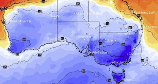
Illustration map: https://thewest.com.au/news/blizzard-conditions-heavy-snowfall-damaging-winds-mark-frigid-start-to-australias-snow-season-c-18954291
Illustration picture. Source: https://x.com/newscomauHQ/status/1931659990286446862/photo/1


