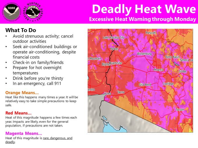
Deadly heatwave across a large part of the southwest United States: 122°F / 50°C, in Midwest coldwave is beginning

Across a large part of desert-climate southwest United States, deadly heatwave is bringing temperatures across populated area up to 122°F / 50°C. Extremely hot is across long belt from Mexico to northern Canada.
This extreme circulation pattern is linked with extreme deep cyclone over Arctic /https://mkweather.com/2020/07/29/the-2nd-deepest-summer-cyclone-in-history-over-arctic-heatwave-starts-on-the-west-near-seattle-109f-43c-is-expected//. Hot air is transitioned over the whole continent, from desert areas in Mexico and southwest US up beyond the Arctic Circle, therefore, northern Canada is extremely hot, too.
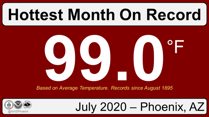
Deadly conditions are mainly in region from California to Colorado. Phoenix, Arizona experienced the hottest July in history in record, with average monthly temperature 99°F / 37.2°C. On Friday, 31. July 2020, in the city was measured 118°F / +47,8°C. Excessive heat warnings are valid in large region across western United States till Monday, 4. August 2020. Record-breaking temperatures hit Washington state, not so far from Seattle were measured temperatures up to 109°F/+43°C. The hottest July – in record measured across many areas in Northeast, too /https://weather.com/news/weather/news/2020-07-30-new-england-new-york-record-hot-summer-so-far?cm_ven=hp-slot-3/.
While West experiences with excessive heat, in Midwest, from Canadian border to Texas, coldwave is excepted during the next period, thanks to hurricane Isaiash, too /https://mkweather.com/2020/07/31/hurricane-isaias-is-stronger-than-was-expected-2nd-category-is-estimated-during-next-hours//. Severe storms in Midwest therefore, will be weakening during the next period. Isaiash however, can bring floods to the coastal areas.
Documentation from Weather Nation / Accuweather / Severe Weather Europe / NOAA:


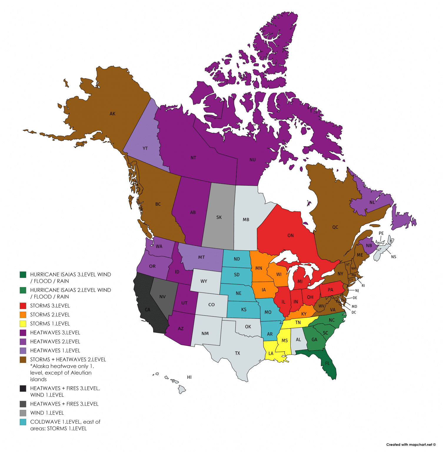
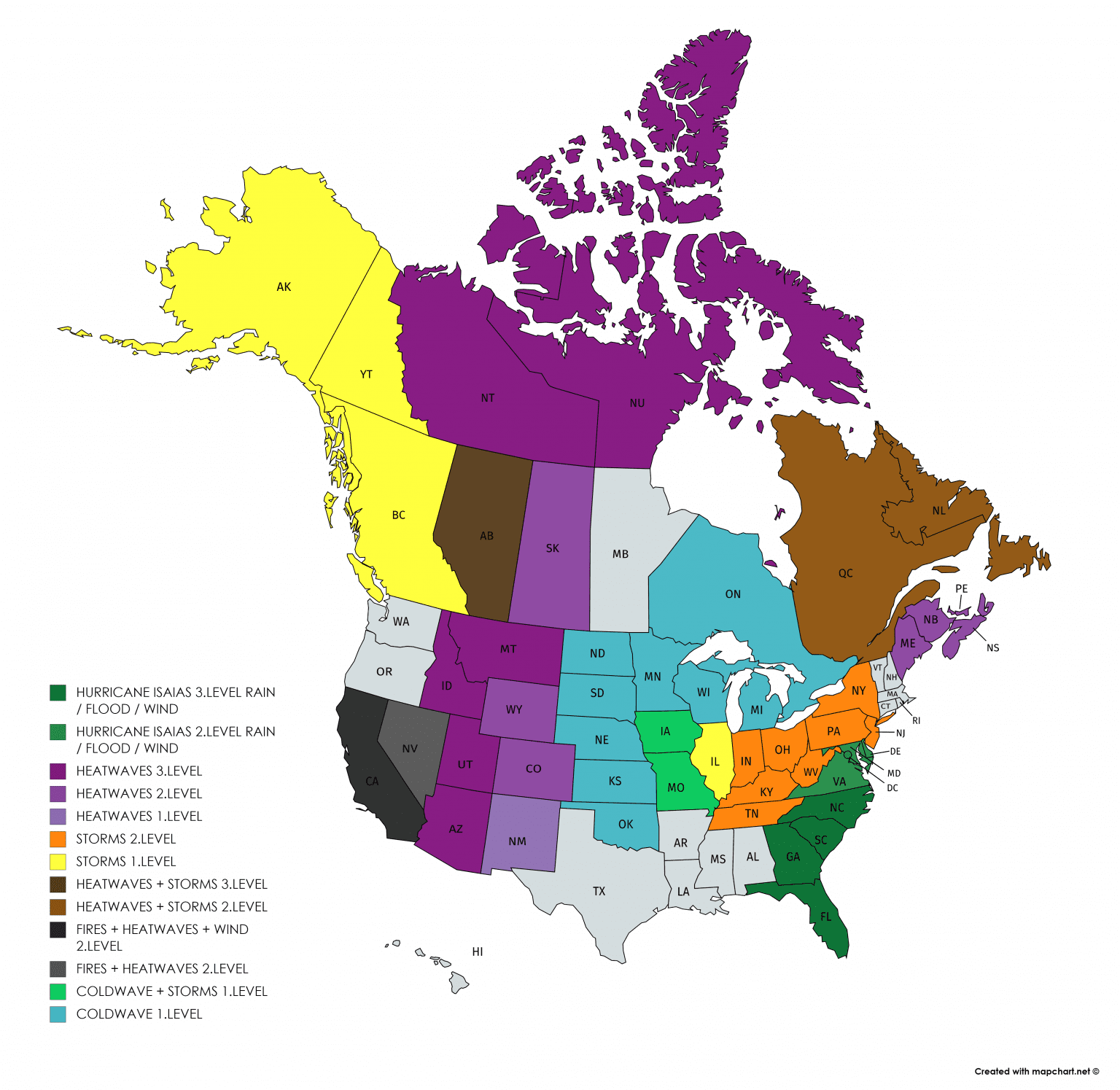
Our warnings for USA and Canada for SAT-SUN-MON 1.-3. August 2020