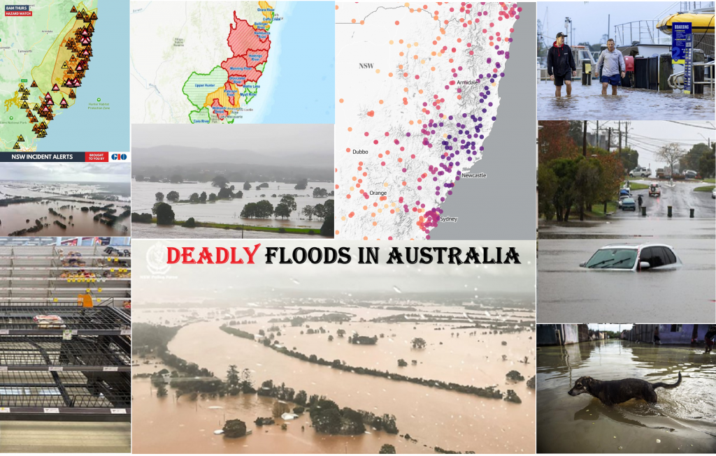
Devastating La Nina floods and cold in Australia: The Manning River a record 6,4 m at Taree (breaking a record set in 1929), Morwell -3,9°C (the coldest May day in 42 years of data)
La Nina winter after the last serious heatwaves up to +38,2°C in Carnavron and +34,4°C in Perth /https://mkweather.com/weather-report-for-10-11-may-2025-almost-all-may-2025-in-europe-cold-heatwaves-are-shifting-to-june-snow-in-romania-hail-in-ukraine-russia-44c-in-hungary-cyprus-373c-dangero// has already come /https://mkweather.com/winter-2025-forecast-for-australia-and-oceania-stormy-snowy-season-strong-cyclone-spider-and-mice-la-nina-season-ahead//, and Australia is fighting with severe floods, including Sydney region.
So far, 3 dead and 1 missing and almost 50,000 isolated in their homes were reported.
The Manning River in Victoria reached a record 6,4 m (21 feet) at Taree, breaking a record set in 1929.
Temperatures dropped to all-time lows across Victoria early this week after a mild autumn. Morwell in eastern Victoria reported a cold -3,9°C – the lowest daily minimum May temperature in 42 years of data.
Extreme floods and cold is expected in New South Wales until 24. May 2025.
Winter has come into Tasmania, with extremely low temperatures.
24 hours rainfall in New South Wales and few more May low records (including Scoresby, Victoria, an old station) in Victoria and South Australia were observed and Western Australia is cooling in the last days, too.
May´s lowest temperature was observed in Melbourne AP, Devonport, or Wynyard. In Melbourne, minimum temperature of -0,4°C was measured.
Instead, Norfolk Island eastward from Australia had its May highest Tmin of +21,9°C.
From rainfall records, e.g. in Majors Creek fell 329 mm and in Wingham 278,8 mm (here rainiest day in 146 years).
Colder and stormy winter season is caused mainly due to La Nina, IOD-, configurations of MJO, or PSA-.
An Antarctic Oscillation is neutral with AAO+ trend in the following 2 weeks /https://www.cpc.ncep.noaa.gov/products/precip/CWlink/daily_ao_index/aao/aao.gefs.sprd2.png/.


12 thoughts on “Devastating La Nina floods and cold in Australia: The Manning River a record 6,4 m at Taree (breaking a record set in 1929), Morwell -3,9°C (the coldest May day in 42 years of data)”
Comments are closed.