Extreme strong storm line is moving over Europe, 5 cm hail and 124 km/h wind gusts are observed
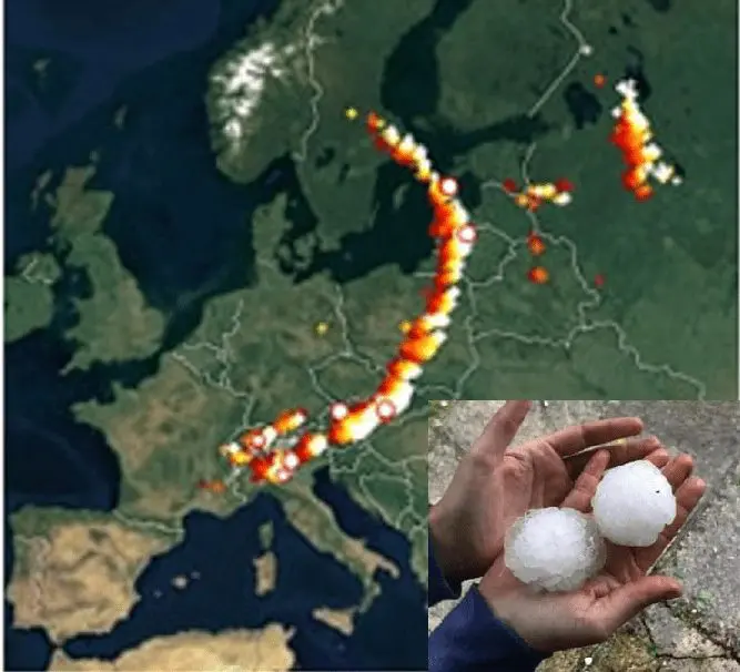
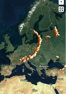
In the evening, severe line of storms on the cold front is long from southern Sweden to northern Italy!
After extreme heatwave (Vienna, +37,2°C, Slovakia +36,0°C and Czechia +35,3°C and Switzerland, +34,5°C) in the region /https://mkweather.com/2020/07/28/heatwaves-will-be-stronger-germany-is-waiting-40c-104f-at-the-weekend-vienna-on-tuesday-372c/; https://www.srf.ch/meteo/meteo-stories/unwetter-hagelgewitter-ueber-der-schweiz/, powerful storm line is moving over Czech republic, Austria and Slovakia on Tuesday around 21-22:00 of Central-European Time.
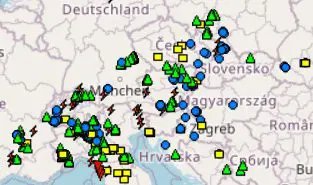
During the day, cold front was bringing severe storms over Alpine region, in the evening, storm activity is shifting to east part of Central Europe.
Line is producing extremely severe wind gusts, up to cca 120 km/h /https://www.polizeiticker.ch/artikel/unwetterwarnung-vorallem-im-sudosten-starke-unwetterartige-gewitter-164434; https://www.ogimet.com/cgi-bin/gsynext?state=Eur&rank=500&ano=2020&mes=07&day=28&hora=22&Enviar=Ver/, hails up to 5 cm in Poland, Czech republic and Austria (and during day Switzerland and Bavaria) – many reports in ESWD is reported. Storm line will be moving during the night over Carpatian area eastward, with possible severe storms in southern Poland, Slovakia and Hungary.
We are bringing a video- and photo-documentation of this powerful storm system – firstly, video from Czech republic, the next observed reports from ESWD, next radar screenshot from shmu.sk, reported hail from hailstorm from Czech republic and wind gusts from ogimet.com.
Severe storms on the cold front are too reported from Scandinavia, northern Italy, Switzerland and southern Germany, but in lesser intensity and the size of affected area than in easterly parts of Central Europe. Central Europe in Tuesday has become a venue of extreme weather in Europe with heatwaves and severe T-storms both.

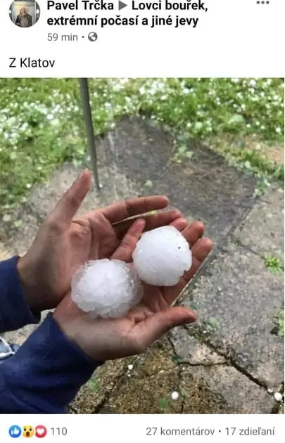
Observed hails in Czechia in Tuesday /FB page on the picture


