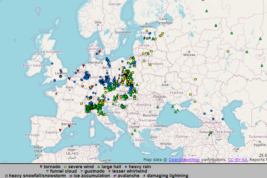
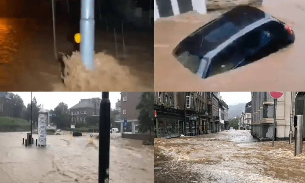
Germany, the Netherlands, Belgium and Luxembourg hit severe storms with floods

Severe storms with floods hit in the first half of the current week including Wednesday, 14. July 2021 parts of Germany, the Netherlands, and Belgium.
The worst situation was reported from western Germany, neighboring Netherlands and Belgium, but too from eastern Germany, near the border with Czechia and southwestern edge of the country, near the border with Switzerland.
Approximately 5 funnel clouds or weak tornadoes appeared in the region in the last few days, too.
Streets of some cities were flooded by 0,5 meters – 1-meter high floodwater and regionally were reported heavy damages.
Hof Hohensaas, Germany reported 117,4 mm in 48 hours, Aachen-Orsbach, Germany 113,4 mm in 48 hours, Koeln 98,4 mm in 48 hours, Trier-Petersberg 84,2 mm in 48 hours, Duesseldorf 78,2 mm in 48 hours.
In Humain, Belgium fell 123,8 mm in 24 hours, in Dourbes 116,1 mm in 48 hours.
In Maastricht, the Netherlands, fell 57,2 mm, in Lachen 48 mm.
Luxembourg reported 78 mm of precipitation.
71 mm was reported even from Charleville, northeastern France.
Extreme rainfall above 200 mm / 48 hours appeared in Switzerland, too /the next Mkweather article/, northern Italy reported widespread hailstorms with diameter up to 7 cm /hailstorm hit Turin, too – the next article/.
Severe storms are suffering parts of Upper Midwest and Northeast, the USA, while in Midwest, severe hailstorms and tornadoes appeared and are still forecasted, in Philadelphia region occurred the worst floods in 100 years /the next articles/.