Greenland´s air hit Europe: coldwave in the middle of summer, next 3 days temperatures 5-10°C below average, hot summer then will return slowly from the southwest

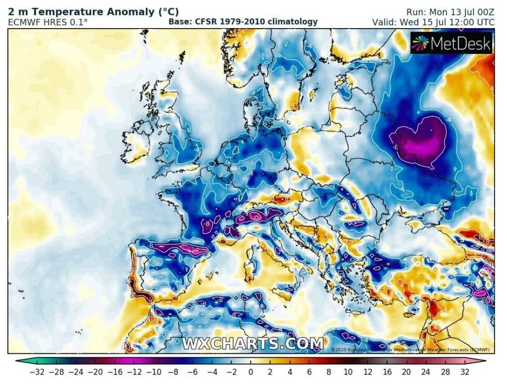
Before potential heatwave in Europe, we are aliving powerful cold spell in many parts of Europe. In Tuesday, in some basin parts of Europe with MASL under 800 meters above sea level cooled up to +3°C (Poprad, Slovakia, +3,6°C), in mountains in United Kingdom it was only +2,2°C (Cairngorm) and in northern Sweden around 400 MASL was frost, only -1,7°C (Bortnan). The coldest times are just ahead of us – during Wednesday, Thursday and Friday cold spell will hit almost all western Europe, northern and eastern Spain, Central Europe and Alps region. In the middle of summer we will alive untraditionally cold weather, cause in the region, after 1990 are cold summers (as a whole) thanks to global warming only rarely affairs.

Temperatures will drop 5-10°C below average, in mountain regions under 10°C below average
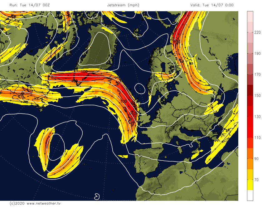
Greenland pressure high hit wit cold blast during the next 3 days many parts of Europe. Cold and bright weather will be alternated by rainy and clody cold times with showers and torrential rain on low pressure system, linked with southerly shifted jet-stream.
During Wednesday, many parts of UK, France, Spain, Benelux and Germany are waiting really cold day, with anomalies -4/-8°C, in mountain regions -8/-16°C. The most coldest will be area from northern Spain across Pyrenees, southern France and Alps. In the southern Spain however, heatwave will be slowly beginning – in Mérida in Spain meteorologist measured +40-1°C in Monday and in Évora in Portugal +39,4°C. Even hotter is in european Russia and Kazakhstan now, in Russia up to +42,1°C, in Kazakhstan up to +43,0°C before arrival of cold front, which caused actuall cold spell above continent.
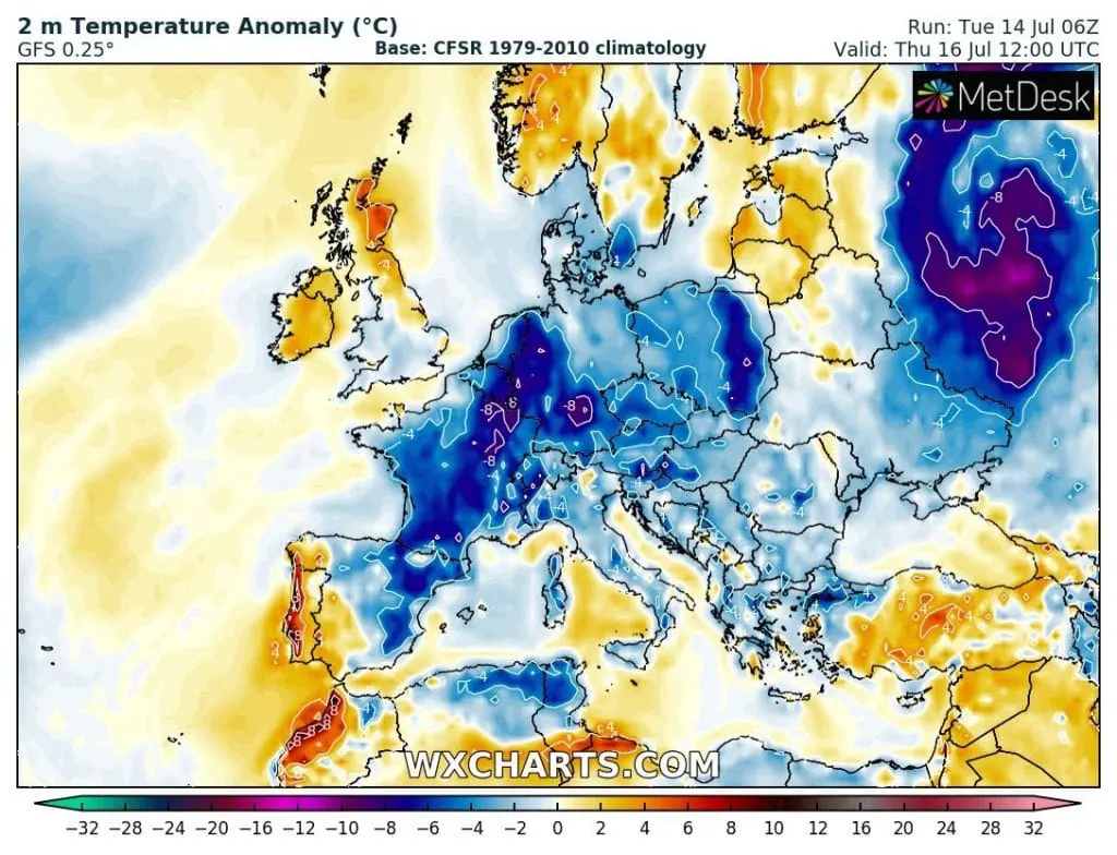
Thursday will be cold in almost whole Europe, the most in Germany, France, Poland, Czech republic, Austria, Switzerland and northeast Spain, with temperature anomalies -4/-8°C, regionally around -10°C.
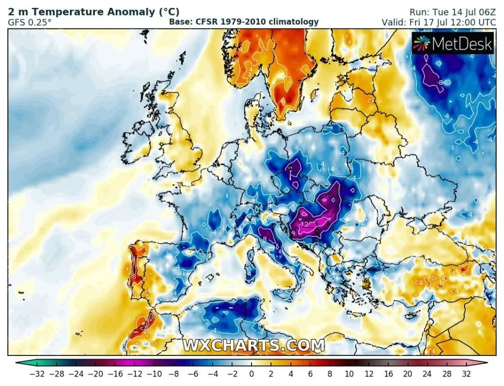
During Friday will hit Central Europe low pressure system from W-NW, which will bring showers and torrential rain in southern and eastern regions too storms, and temperature anomalies -4/-8°C above Poland, Czech republic, Austria, Slovakia, Hungary, Switzerland and Italy. In the Balkan will be even more colder – the most coldest over Croatia, Serbia and Bosnia and Herzegovina territory, with anomalies regionally under -12°C!
After transition of low pressure system can hit cold fresh clear nights.
Heatwaves can arrive little later, in front of deep cyclone over Atlantic
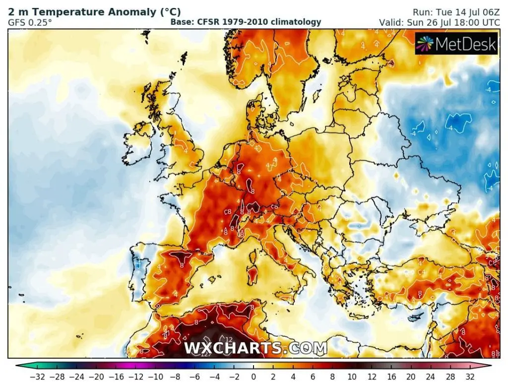
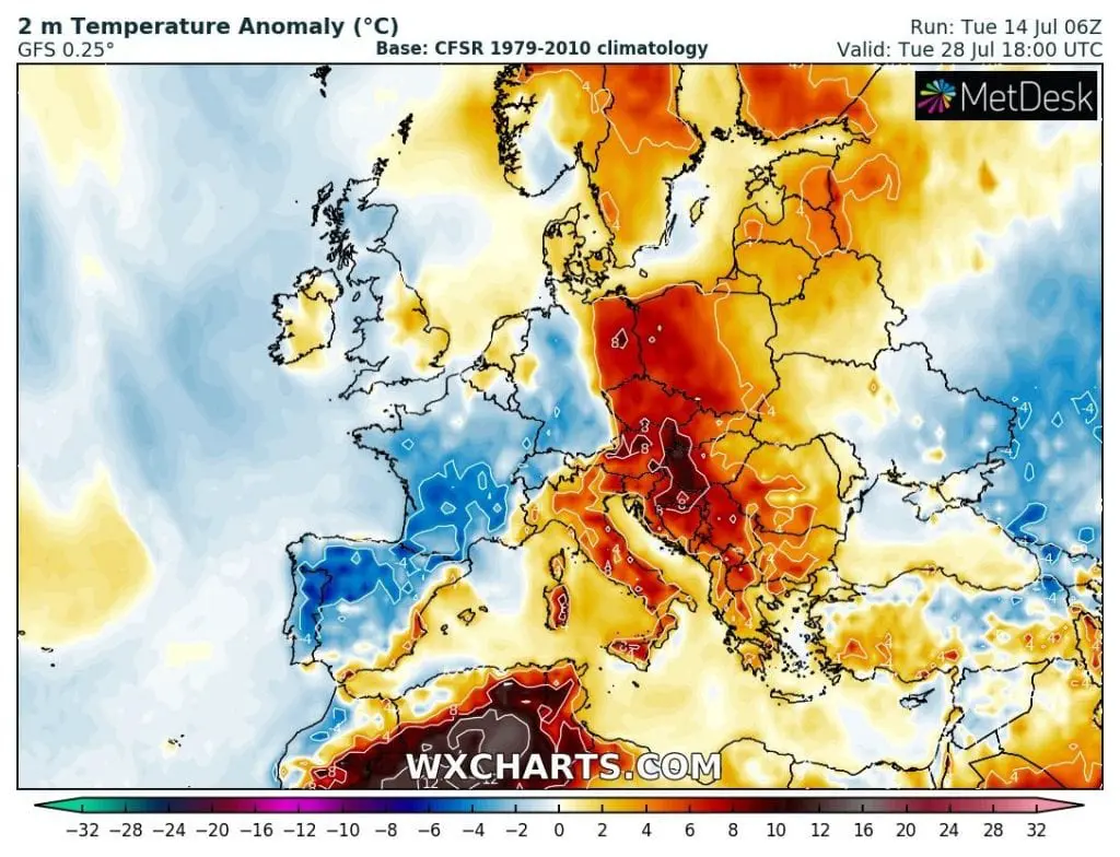
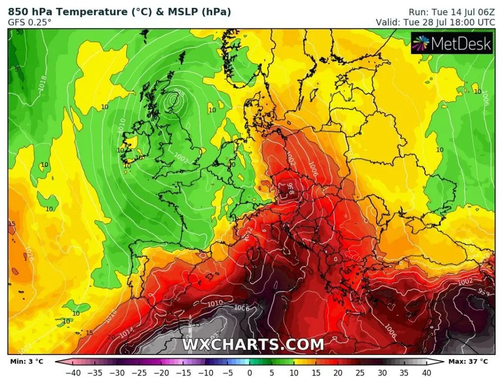
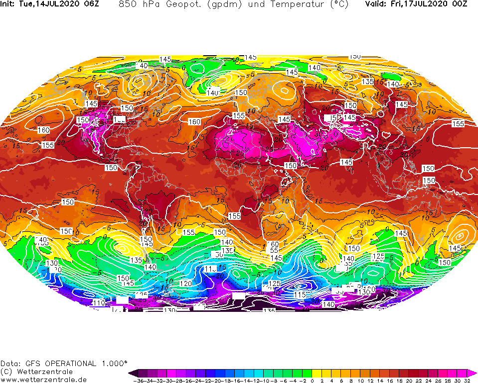
New outputs of GFS are telling, than colder weather can hold out in northern regions more longer, but good news are, that deep cyclone above Atlantic will be linked with robust advection of tropical air above Europe during 3rd decade of July- mainly around 22.-30. July 2020. Heavy heatwaves will suffer mainly Spain in the beggining, but gradually they will extend to France, Germany and eastern Central Europe. We have nothing left, but only to wait for a hot summer during the next and next cold days.