Heatwaves and severe storms everywhere, the most in Western Europe, Europe is waiting next extreme week
Its starting the next week of August 2020, but a lot of things wont change, even, heatwaves and storms could be worse than during previous week, in parts of Europe.
Long duration of heatwaves will be linked with more collapses from heat and in hot air, storm systems will be create. Mainly over west Europe – the UK, France, Germany and Benelux, it could be the strongest storms of summer holidays 2020, with possible MCS (mesoscale convective systems) developing in the afternoon and during evenings of the hot days.
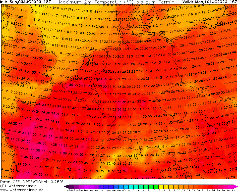
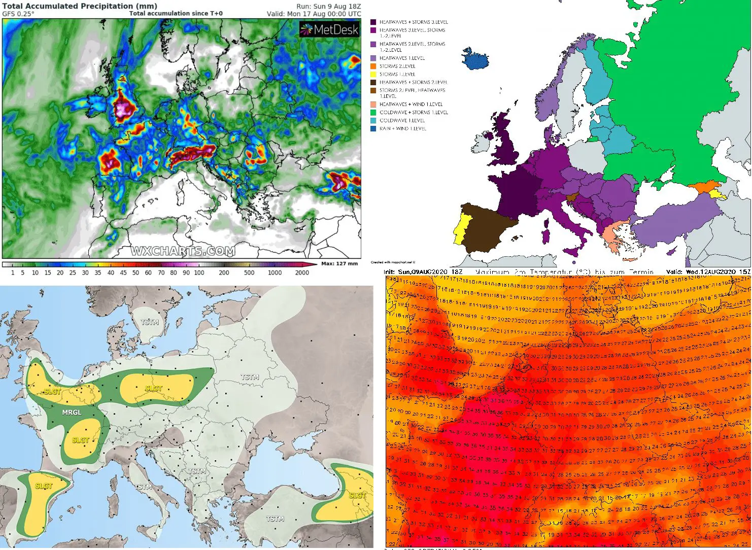
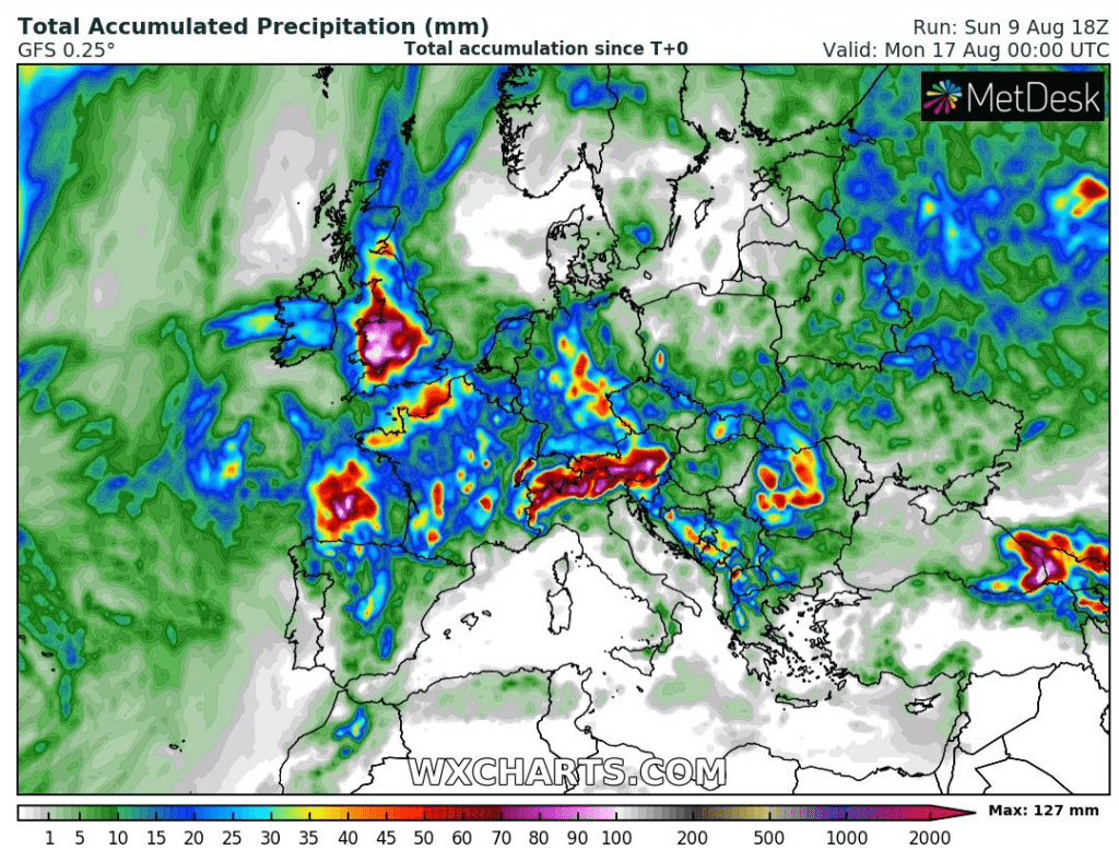
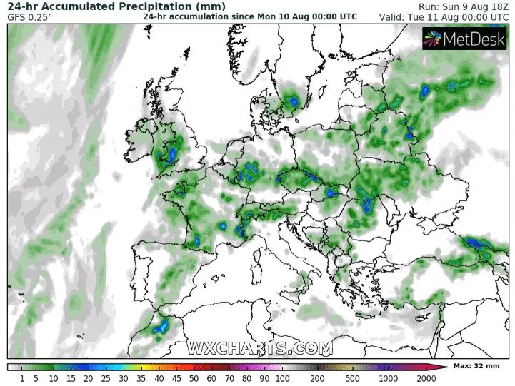
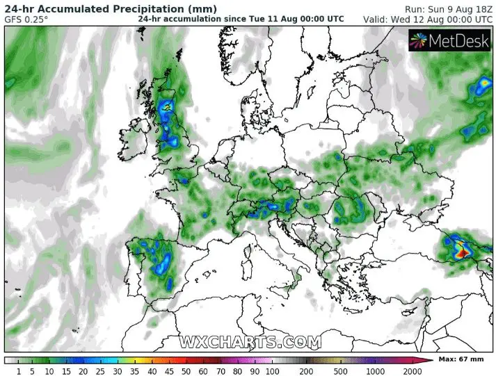
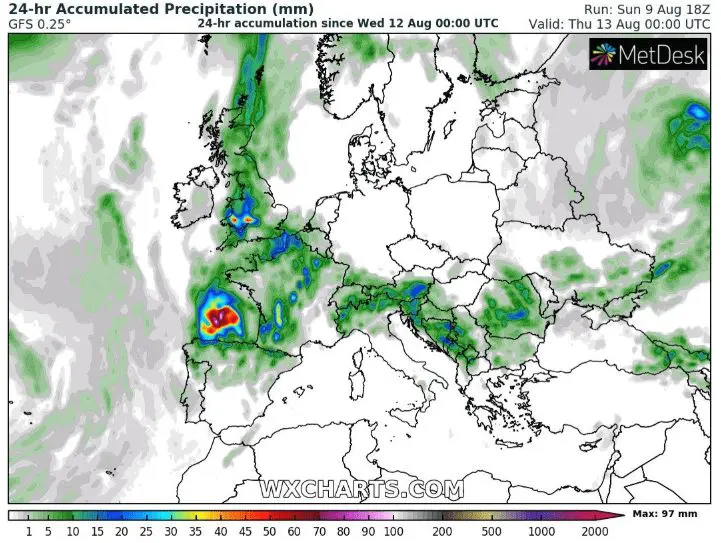
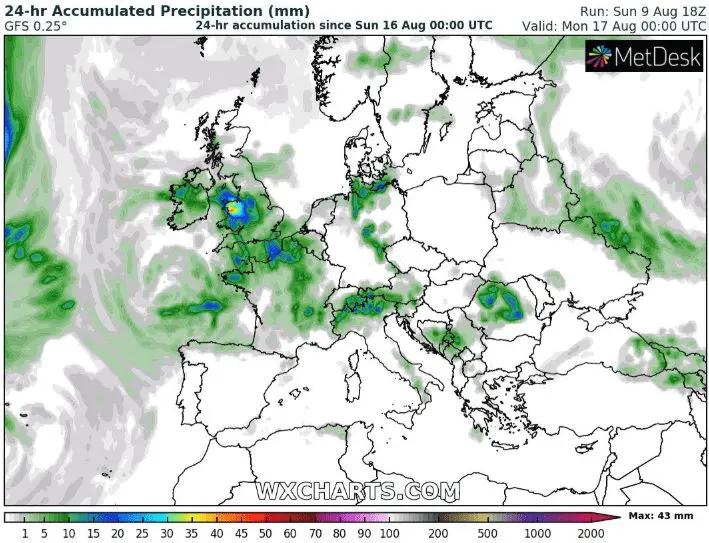
From Monday to Sunday, 10.-16. August, the most rainfall from storms, over England and Wales, France, Germany, Alpine region and Carpathians and Dinare mountains is expected.
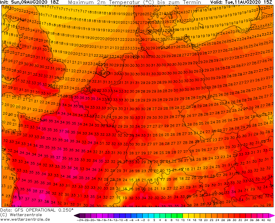
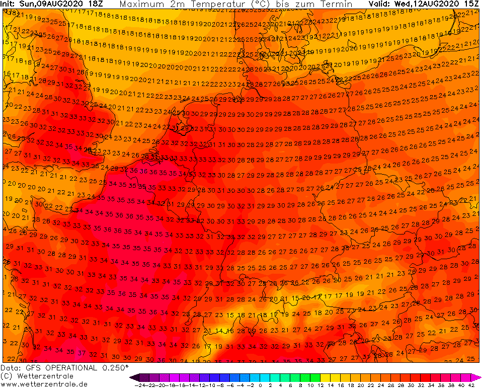
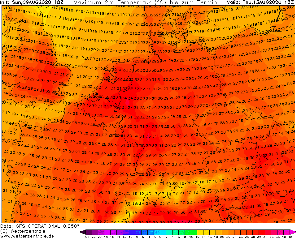
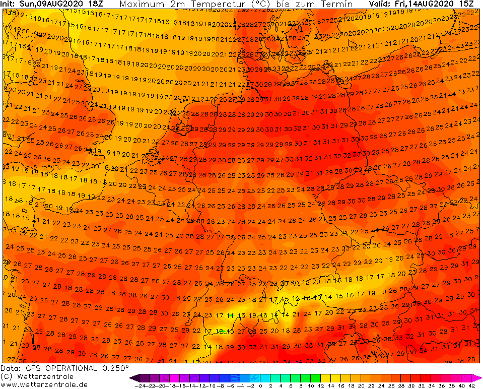
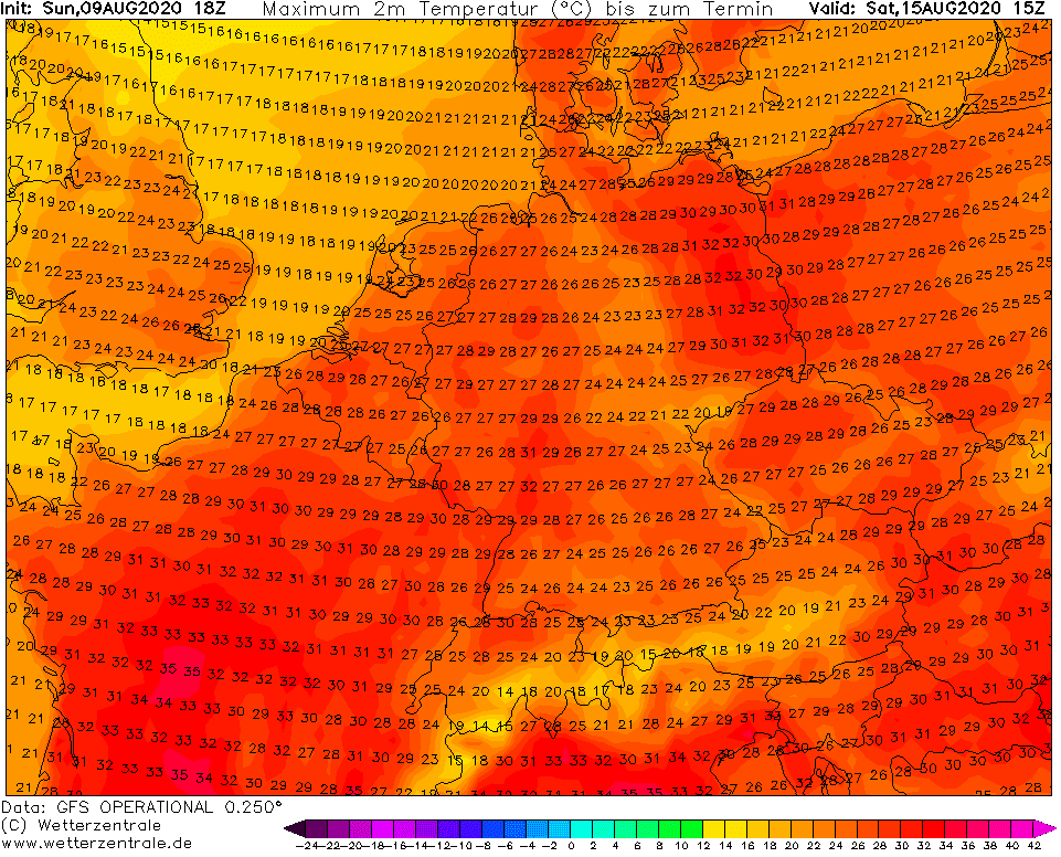
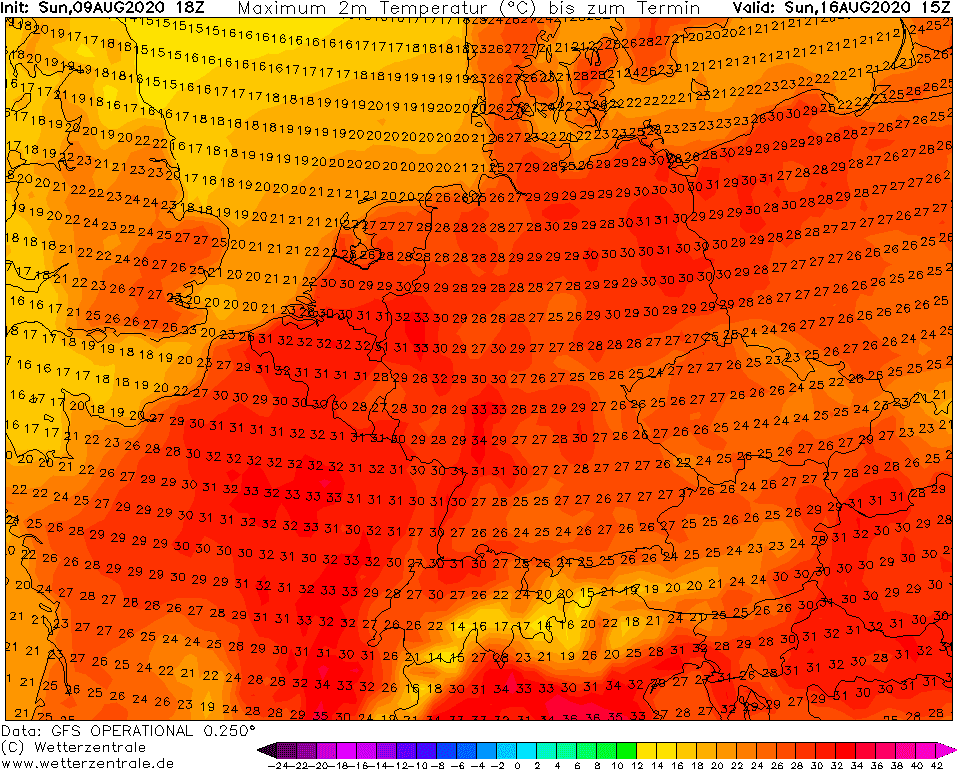
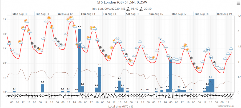
Tropical temperatures in the UK can stay longer than was expected – till Thursday, 13. August, 8 consecutive tropical days together! In parts of central Europe will be tropical the whole week and it will cool down only during the next week.
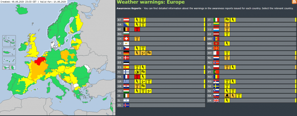
On Meteoalarm, red alerts before heatwaves are valid for Monday in northern France and Belgium, in parts of Croatia too, already and for parts of Germany red alerts before severe storms. Orange alerts before heatwaves are valid for cold Poland and Lithuania too.
Only in Finland and gradually over Baltic states, Eastern Europe and Russia is expecting during Monday, Tuesday and Wednesday 10.-12. August a coldwave from the Arctic. Island is waiting rain and wind and rest of Europe will be sweated in hot air and bothered by T-storms, which could be locally linked with flash-floods.
According to the newest GFS, only after 22. August is expected a big coldwave for the rest of Europe, with maximum temperatures +15/+25°C over the British Isles, France, Benelux, Germany, Alpine region, northern Italy, Central Europe and later parts of Balkan and Eastern Europe too.
Accumulated precipitation (mostly from severe storms) over Europe during week 10.-16. August 2020:
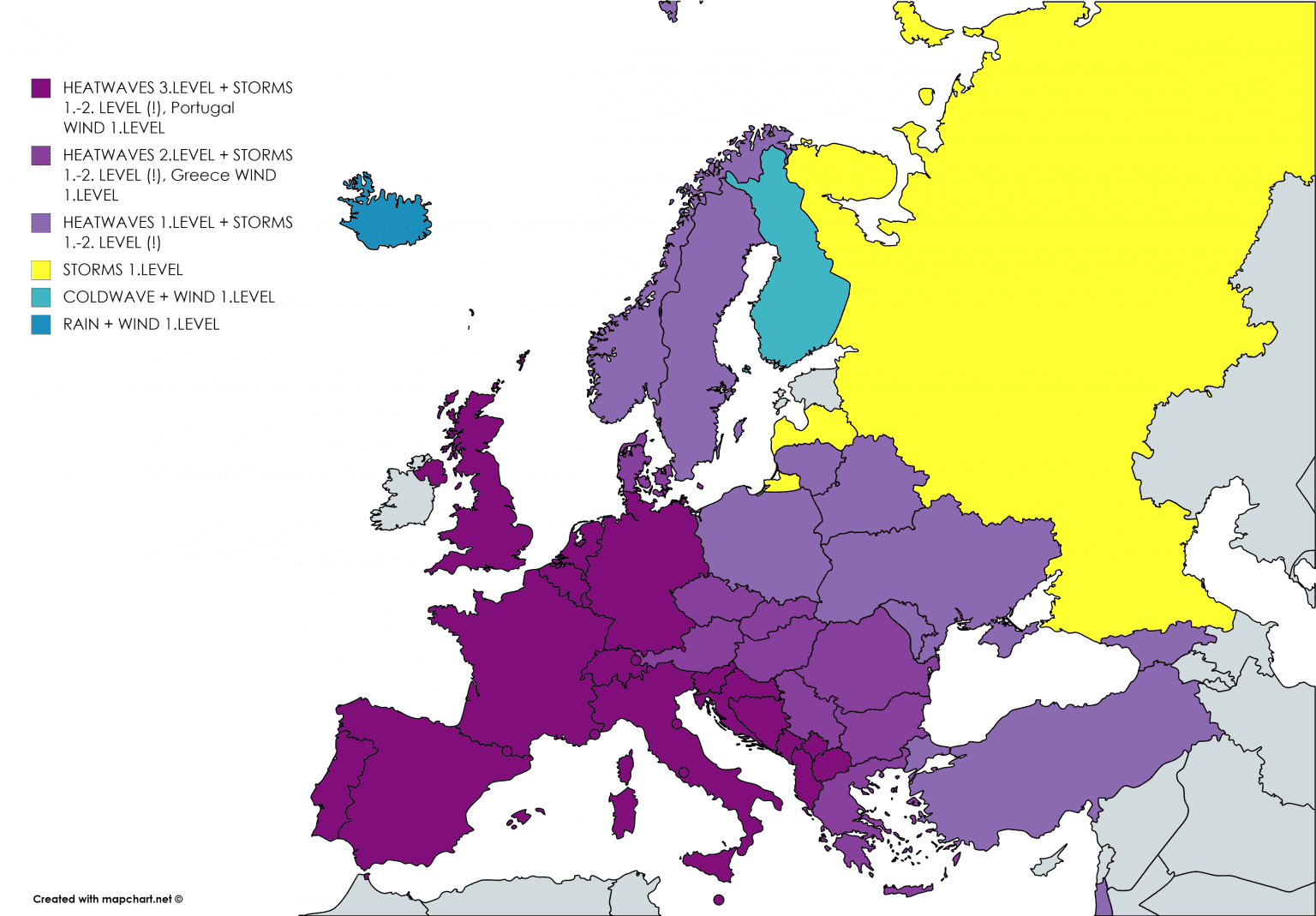
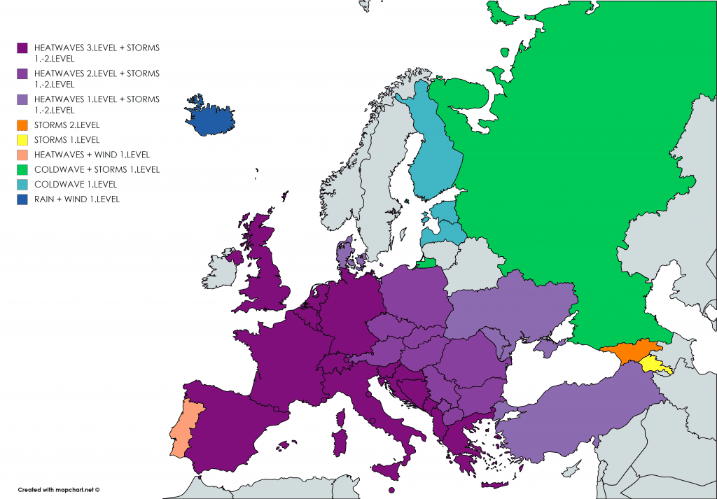
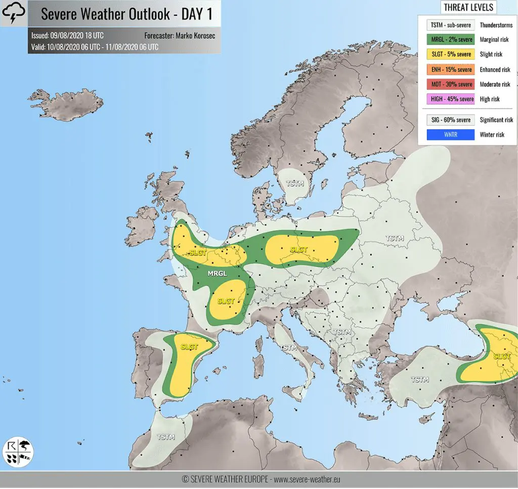
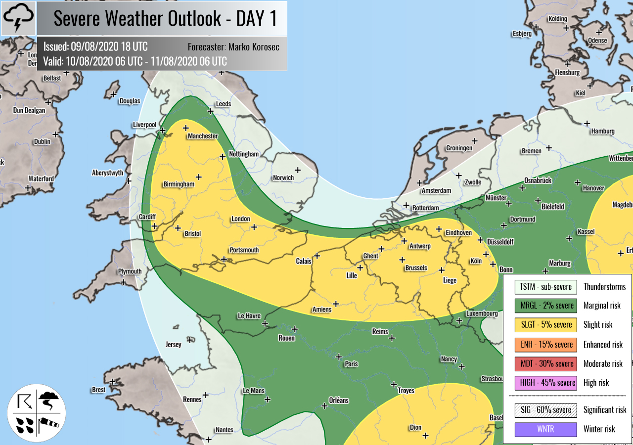
Mkweather warnings for MOD-TUE-WED 10.-12. August 2020:
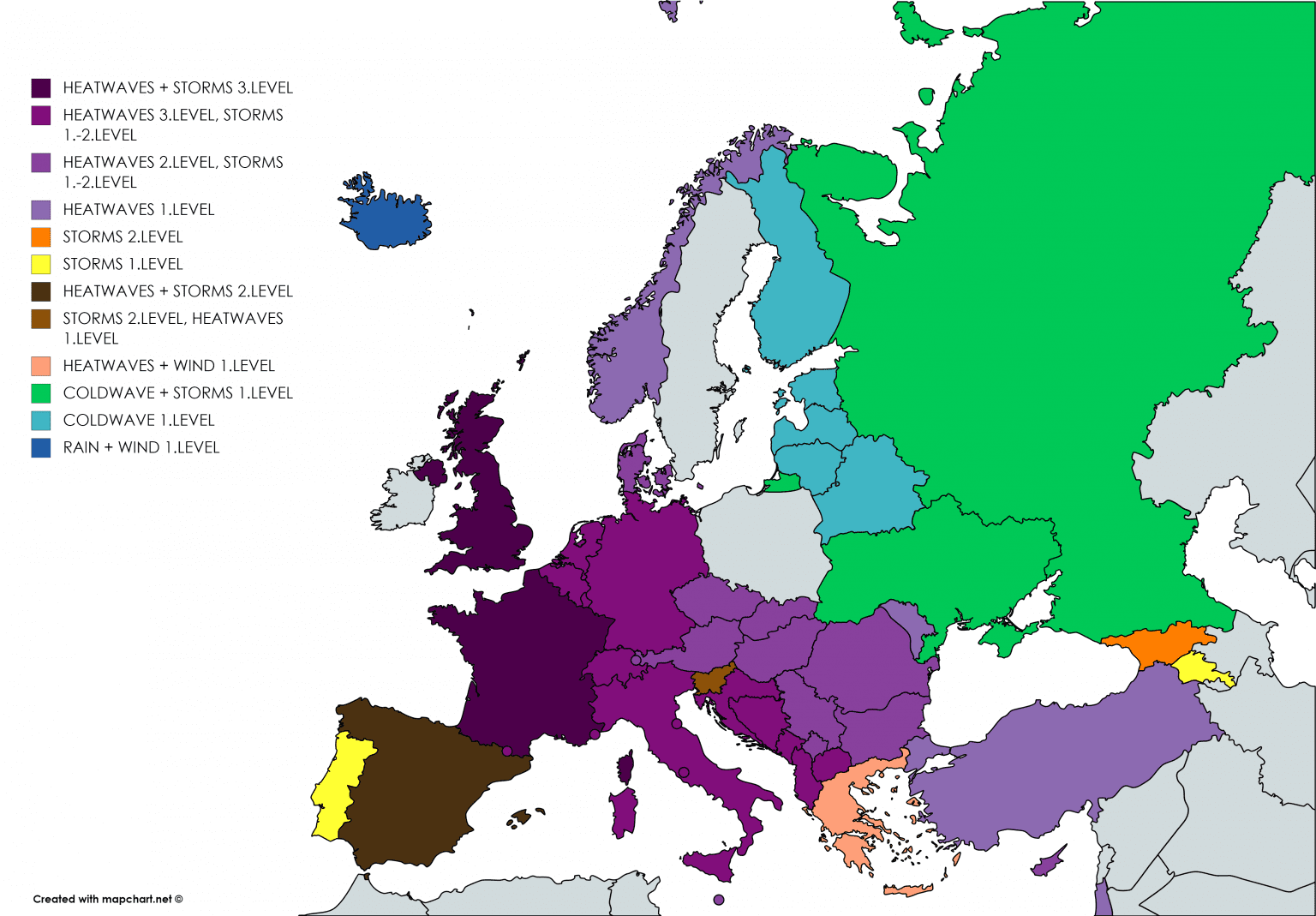
Warnings from Meteoalarm and Severe Weather Europe for Monday, 10. August 2020:
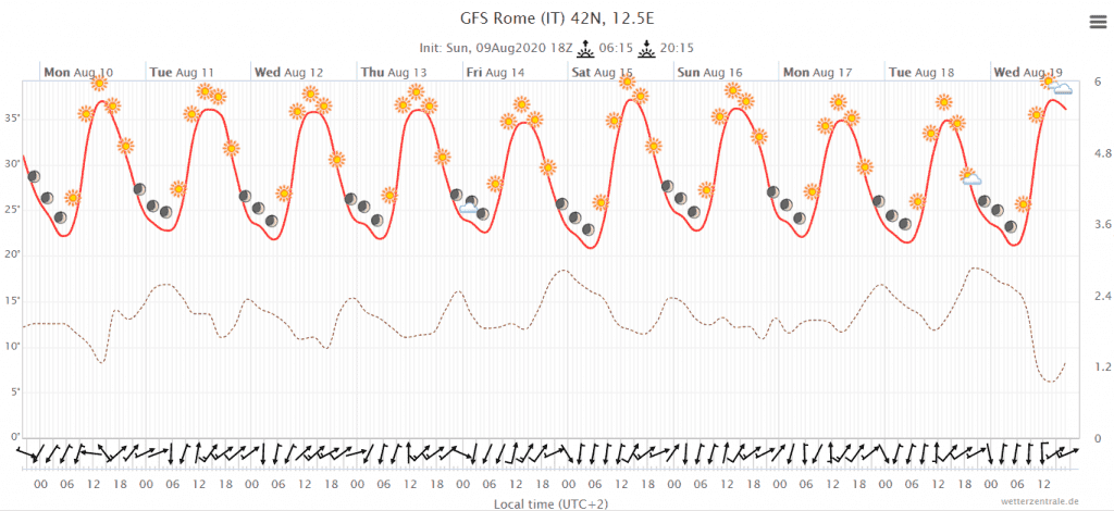
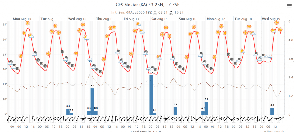
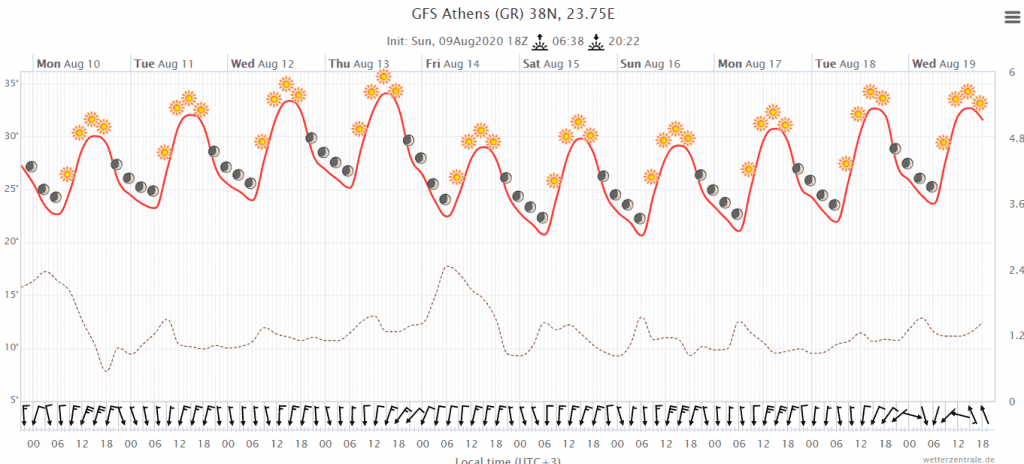
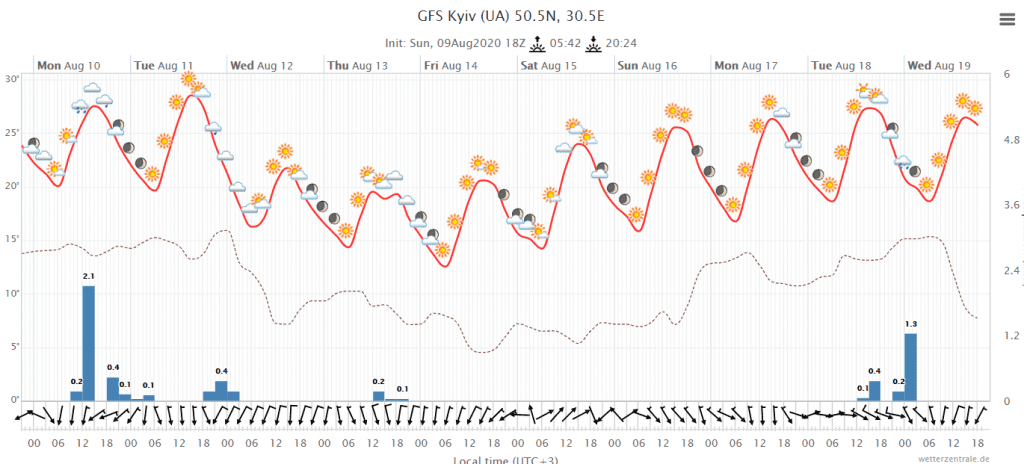
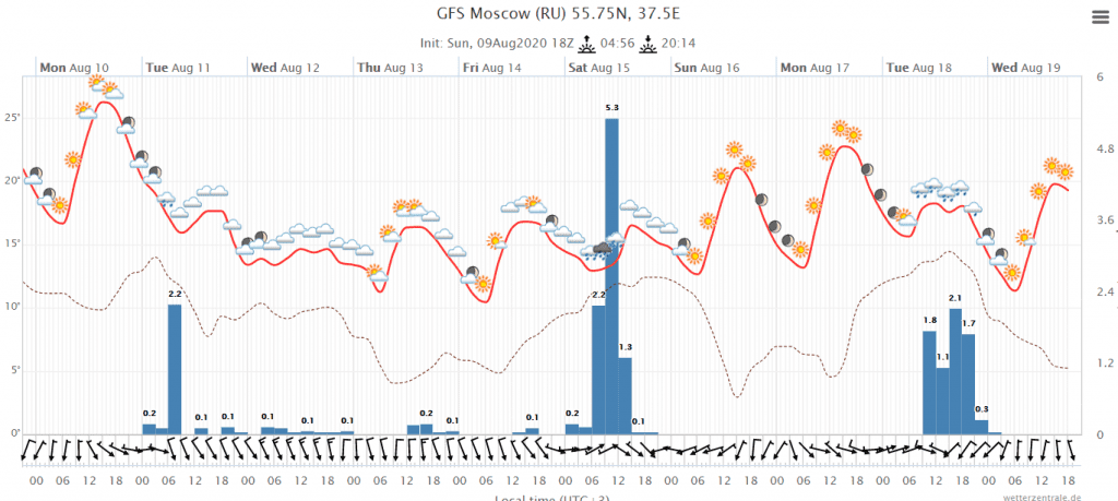
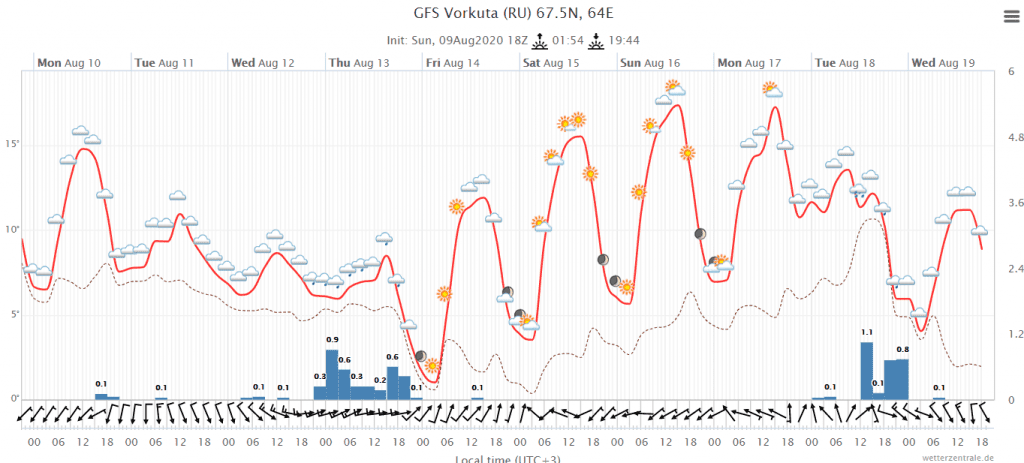
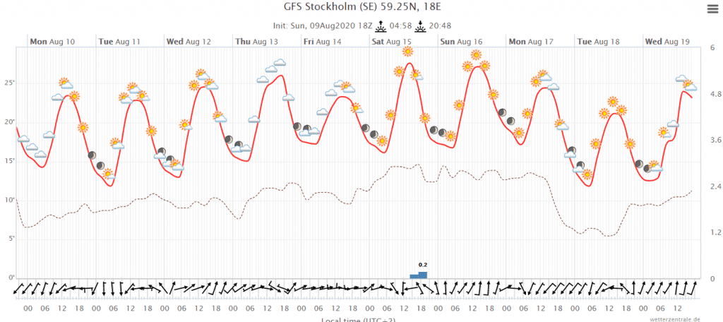
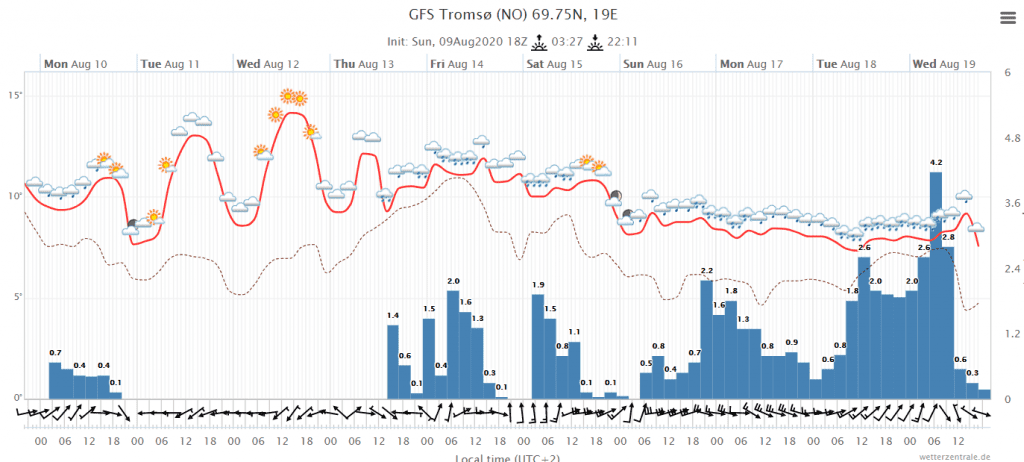
Meteograms for cities of Europe for the next 10 days (GFS):
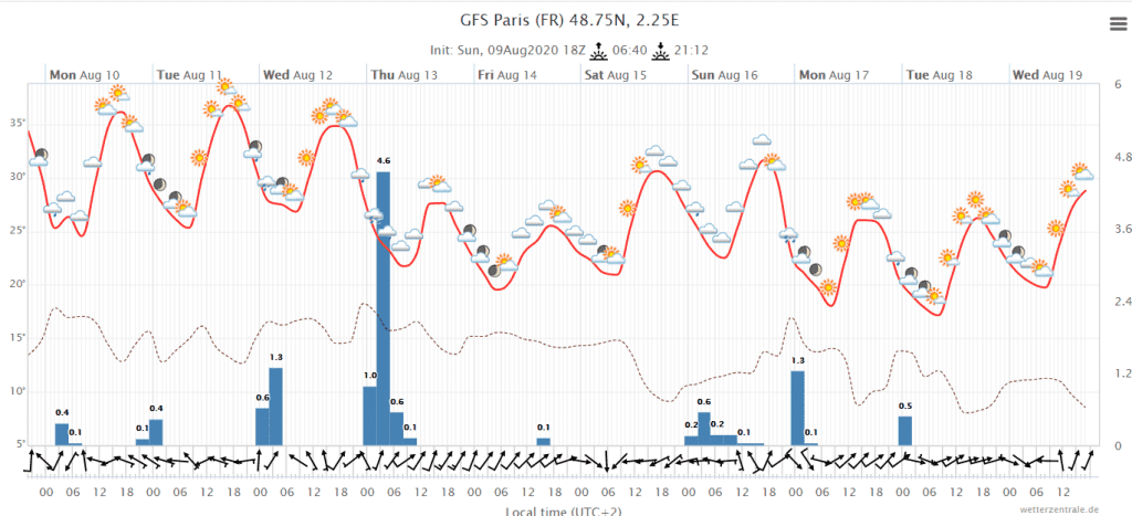
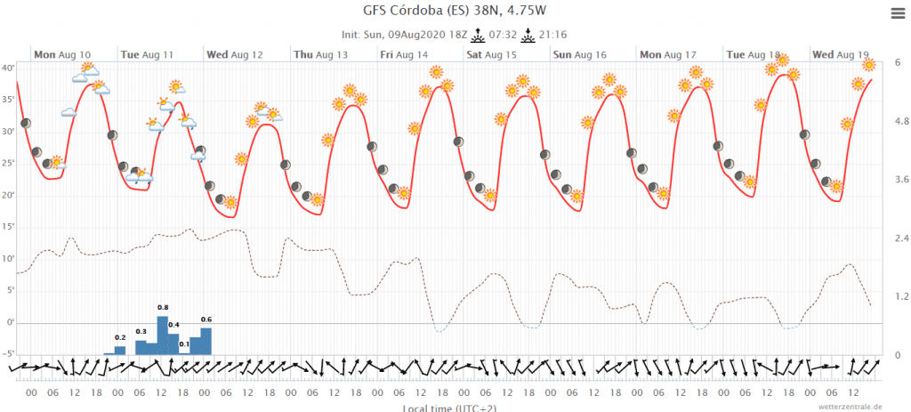
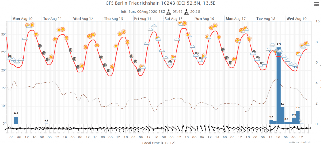
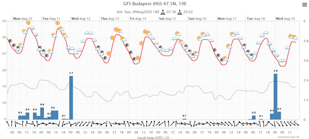
Daily precipitation amounts (storm pattern) during days of the week 10.-16. August 2020 in Europe:


Maximum temperatures during the week 10.-16. August 2020 in Europe (GFS, wetterzentrale.de):