Hurricane Erin: CAT 5 for the Caribbean, then Severe Impact from the Atlantic on the East Coast?
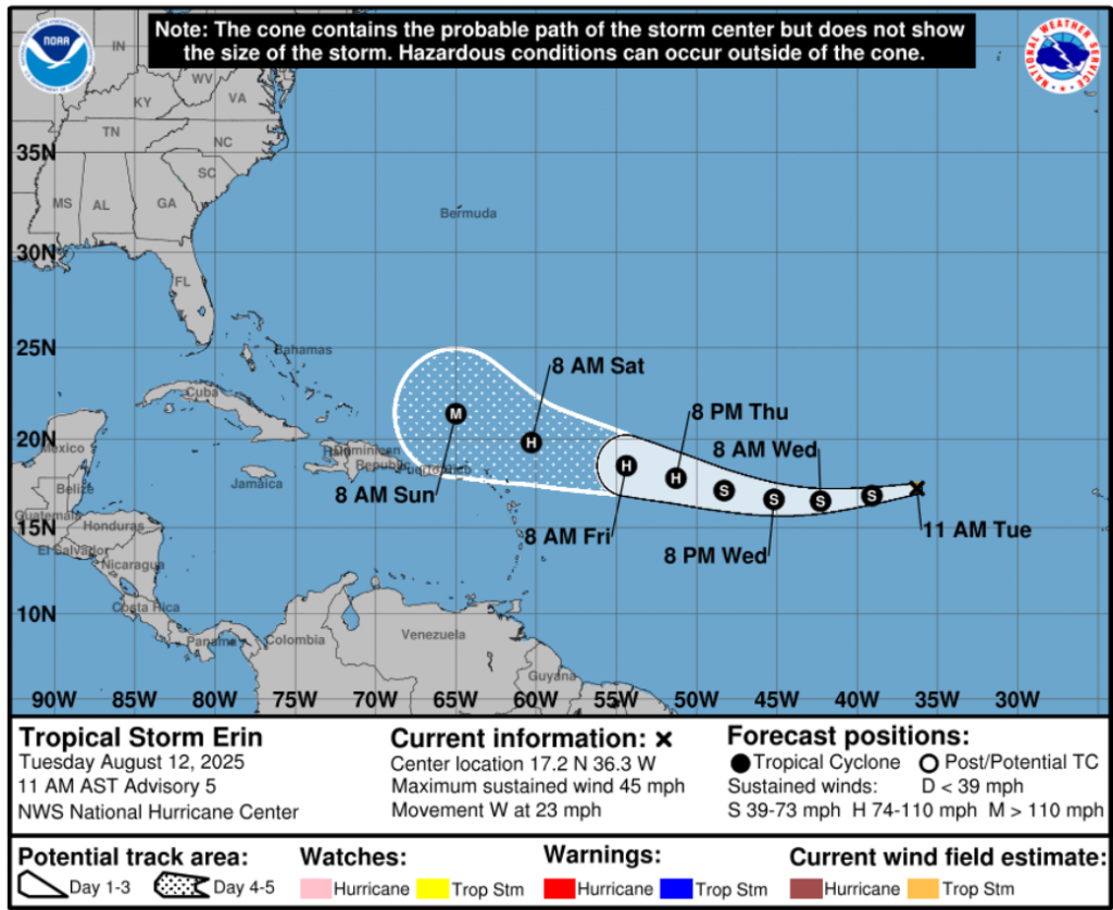
Tropical Storm Erin has formed over the central tropical Atlantic and is showing rapid signs of intensification. As of 12 August 2025, 12:00 UTC, the system was located at 17.3°N, 35.4°W with maximum sustained winds of 40 kt (≈74 km/h) and a minimum central pressure of 1006 mb. The radius of maximum winds is 15 nm, suggesting a tight, potentially explosive core.
Current Meteorological Setup
- Sea Surface Temperatures (SSTs) ahead of Erin are above 29°C, significantly higher than the threshold for major hurricane development.
- Low wind shear in the next 3–4 days will favor rapid intensification.
- Moist mid-level air in the storm’s path will sustain strong convection.
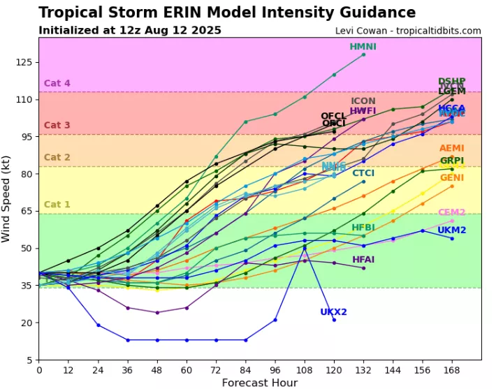
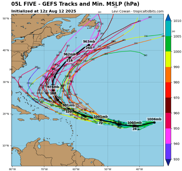
Meteorologists warn that Erin could reach Category 3 or higher before approaching the Caribbean late this week. Model scenarios include a possible Category 5 peak, similar to historic hurricanes that explosively intensified over the central Atlantic.
Forecast Track & Risks
Two main forecast scenarios are emerging:
- Caribbean Impact Route – Erin moves west-northwest, entering the Lesser Antilles as a major hurricane by the weekend, posing a severe wind, rain, and surge threat.
- Recurve to the East Coast – Erin turns northwest, avoids a direct Caribbean hit, but could threaten the U.S. East Coast with high surf, rip currents, and possible landfall next week.
Erin’s Current Stats (12 Aug 2025, 12 UTC)
| Parameter | Value |
|---|---|
| Latitude / Longitude | 17.3°N / 35.4°W |
| Max Sustained Winds | 40 kt |
| Min Central Pressure | 1006 mb |
| Radius of Maximum Wind | 15 nm |
| 34 kt Wind Quadrants | Not fully developed |
| Sea Surface Temp Ahead | 29–30°C |
| Shear | Low |
Potential Intensification Timeline
- 48–72 hours – Rapid strengthening expected, possibly reaching Category 2–3 before weekend.
- 4–6 days – Peak intensity could be Category 4–5 if track remains over open warm waters.
- 7+ days – U.S. East Coast risk window opens, depending on jet stream pattern.
Preparedness
Authorities in the Leeward Islands, Puerto Rico, Bahamas, and U.S. East Coast are urged to monitor official forecasts. Even without a direct hit, large swells and rip currents will pose hazards across the Atlantic coastline.
Source: https://www.tropicaltidbits.com/storminfo/#05L


