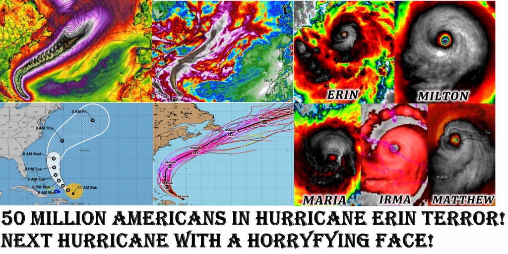
Is it’s Face saying Something Horrifying? USA in the Grip of Terror! 50 Million Americans will feel its Direct Effects! Erin Developed From a Tropical Storm to a Category 5 Hurricane in 24 hours (the fastest strengthening Hurricane before September 1st) !!! Wind Gusts up to almost 200 mph (305 km/h) (!!!)
From a Modest Tropical Storm to a Beast in Record Time
At first, meteorologists barely gave Erin more than cautious attention. It was a tropical storm with sustained winds around 40–45 mph, struggling against some dry air in the mid-Atlantic. But overnight, Erin tapped into an ocean heat reservoir of 30–31 °C (86–88 °F)—several degrees above average. This warm water extended unusually deep, allowing the storm to draw up unending fuel without mixing in cooler waters.
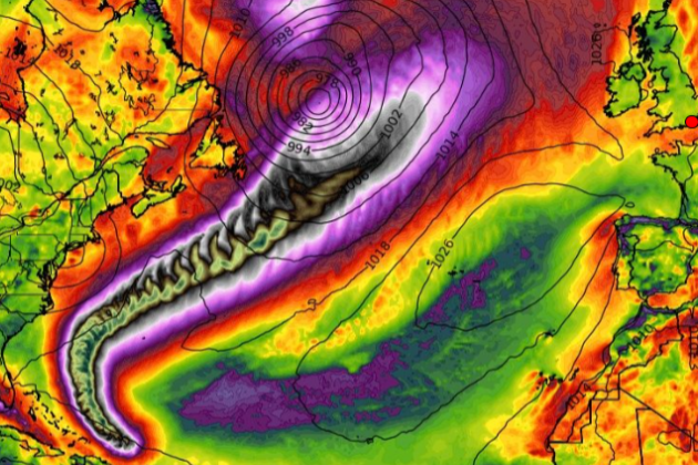
Satellite data revealed a pressure drop of nearly 70 millibars in 24 hours—from around 995 hPa to an astonishing 925 hPa. By the end of that cycle, Erin had transformed into a Category 5 hurricane with sustained winds exceeding 160 mph (260 km/h) and gusts reported above 190 mph (305 km/h).
Meteorological Shock: Explosive Intensification
This kind of rapid strengthening—known as rapid or explosive intensification—is rare but becoming increasingly common. Erin’s leap of 120 mph in wind speed within 24 hours ranks among the fastest ever observed in the Atlantic basin.
Key ingredients in Erin’s growth:
- Sea Surface Temperatures (SSTs): At 30–31 °C, the Atlantic waters were 2–3 °C above average.
- Low Wind Shear: Upper-level winds remained light (less than 10 knots), allowing the storm’s central core to stack vertically without disruption.
- High Ocean Heat Content: Warm water reached down 100+ meters, preventing cooler upwelling from weakening the system.
- Moist Atmosphere: Abundant mid-level humidity prevented dry air entrainment.
- Upper-Level Ventilation: A nearby jet stream helped ventilate the storm, pulling air outward from the top of the system like a chimney.
All these combined to form the perfect engine. Satellite images showed “hot towers”—towering thunderstorm updrafts piercing the stratosphere—signaling fierce energy release.
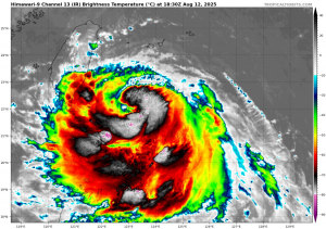
Eye of the Beast
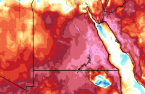
By the time Erin reached peak intensity, its eye had shrunk to just 15 miles across—a pinhole eye, a textbook hallmark of the most violent cyclones. Around it, the eyewall became a nearly perfect circle of convection, with cloud tops colder than –80 °C, an indicator of violent updrafts.
Later, an eyewall replacement cycle began—where the inner eyewall weakens and a larger outer eyewall forms, sometimes temporarily lowering intensity before the storm re-strengthens. This process, detected by radar and satellite, suggested Erin could maintain Category 4–5 intensity for days.
USA in the Grip of Terror
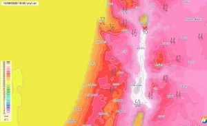
As Erin neared the U.S. coast, buoys recorded waves over 50 feet high. Storm surge projections exceeded 15–20 feet in low-lying areas, a catastrophic scenario for coastal communities.
Meteorological stations reported:
- Sustained winds of 160–165 mph with gusts over 180 mph
- Pressure readings as low as 920 hPa near landfall zones
- Rainfall forecasts of 15–25 inches across wide areas, with isolated totals above 30 inches
- Tornado outbreaks embedded in outer rainbands, driven by extreme wind shear near landfall
Climate Connection
Climatologists emphasize that Erin is more than an isolated “freak storm.” Rising sea surface temperatures, linked to global climate change, provide fuel for hurricanes. The Atlantic Multidecadal Oscillation (AMO), currently in a warm phase, and record-breaking North Atlantic sea surface anomalies, made Erin possible.
Erin stands as a harbinger: storms forming faster, growing stronger, and striking harder. Meteorologists warn that traditional models may underestimate future risks.
The Face of Horror
Is saying “its face” something horrifying? Absolutely. The “face” of Erin is not just a poetic metaphor. It is visible on satellite: a black void in the center of swirling white fury. A perfect circle that looks alive. Inside, calm reigns for a few miles, but just beyond, nature’s most violent winds howl with apocalyptic force.
To stare at its face is to see beauty and terror fused. To live beneath it is to know fragility in its purest form.
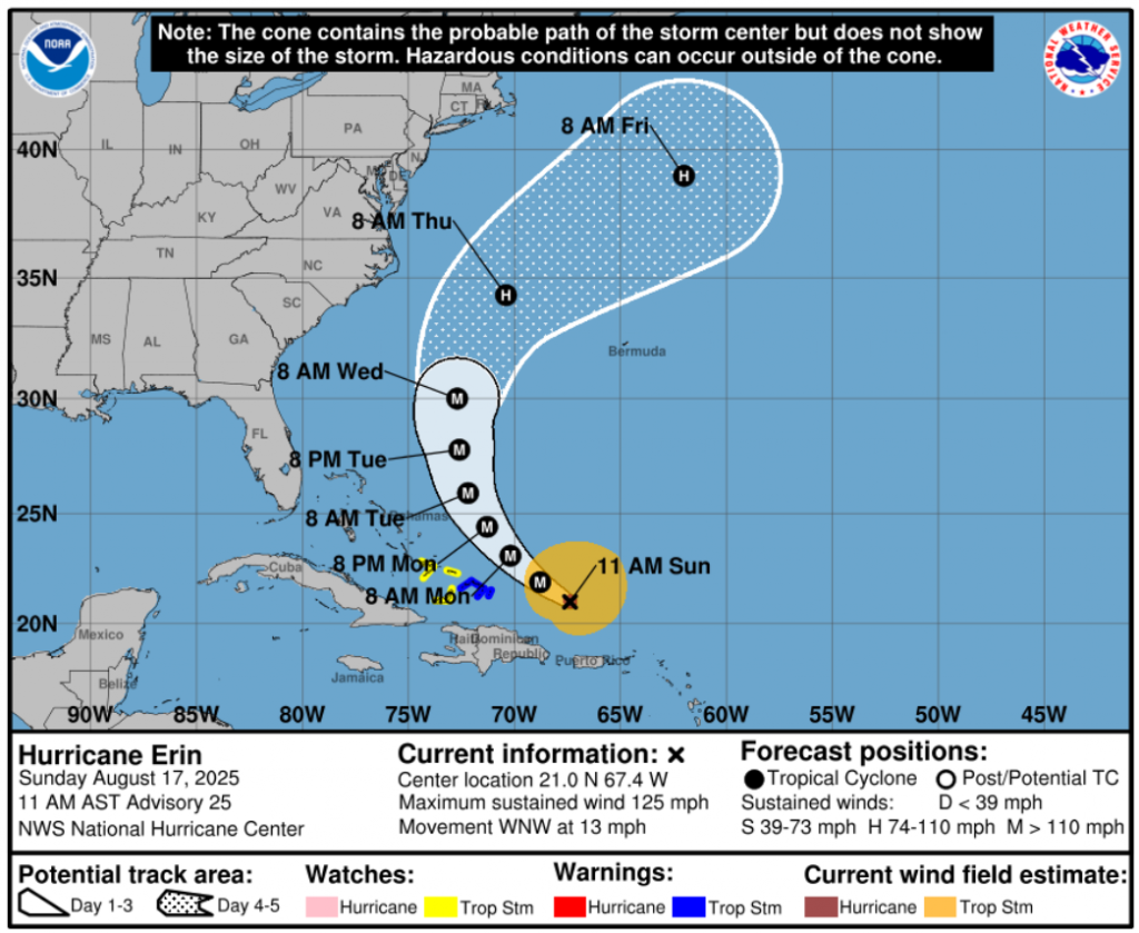
Landfall Projection
- Florida (NE Coast): Landfall expected within 24–36 hours between Cape Canaveral and Jacksonville. Winds near the core could exceed 150 mph (240 km/h) with gusts near 180 mph (290 km/h).
- Georgia and the Carolinas: If Erin follows current tracks, it will ride the coastline northward, maintaining Category 3–4 strength even 48 hours after landfall.
- Inland States (Alabama, Tennessee, Virginia): Even weakened to a tropical storm, Erin’s rains will drench the Southeast, leading to severe flash flooding and river overflows.
Forecast Hazards by Region
- Storm Surge:
- Florida’s Atlantic Coast: 15–20 feet, with locally higher values near inlets and bays.
- Georgia and South Carolina: 10–15 feet, inundating barrier islands and marshlands.
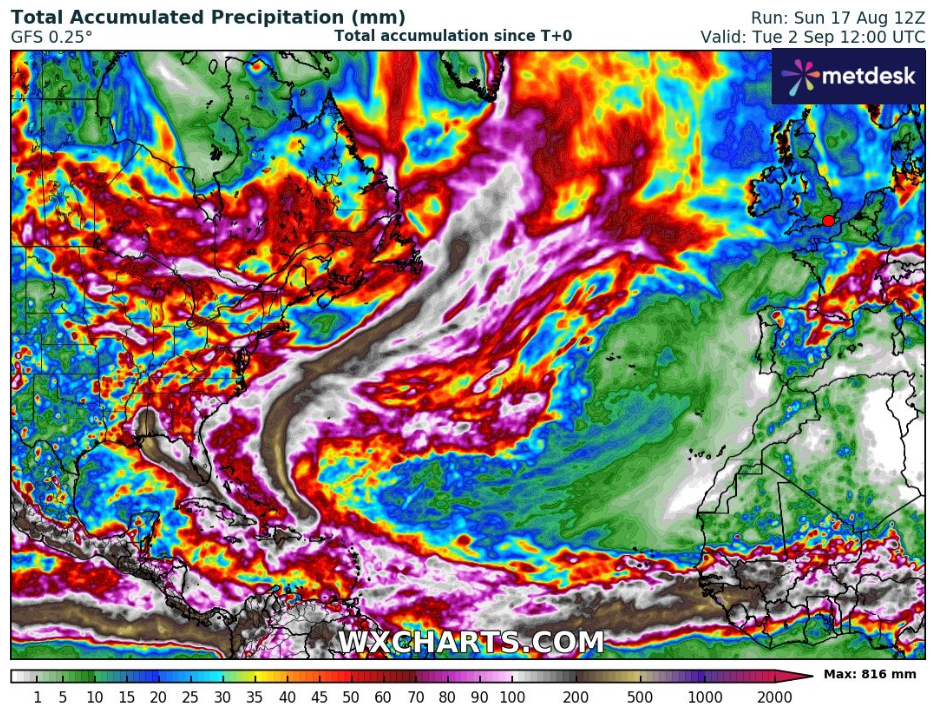
- Rainfall Totals (Next 5 Days):
- Florida & Georgia: 15–25 inches, locally up to 30 inches.
- Carolinas: 10–20 inches.
- Appalachians: 6–12 inches, leading to deadly mudslides and flash floods.
- Wind Impacts:
- Florida: Sustained winds 140–160 mph at landfall, catastrophic damage to homes, infrastructure, and power lines.
- Georgia & Carolinas: Winds 100–130 mph, with widespread structural damage.
- Interior Southeast: 50–80 mph, enough to topple trees and cut power for millions.
- Tornado Risk:
Embedded tornadoes in Erin’s outer bands are highly likely across Florida, Georgia, and South Carolina, especially during the next 72 hours.
Long-Range Forecast
Computer models suggest Erin will curve northward along the East Coast, interacting with a jet stream trough. This will pull the system inland into the Mid-Atlantic by Day 4, likely as a tropical depression but still carrying enormous rain bands.
- Washington D.C., Philadelphia, New York City: Potential for 4–8 inches of rainfall and strong tropical-storm-force winds by Days 4–5.
- New England: Depending on Erin’s forward speed, coastal flooding and heavy rains may extend into Boston and even southern Maine by Day 5–6.
A Nation Under Siege
In total, forecasters warn that 40–50 million Americans will feel direct effects from Erin—whether through wind, rain, or surge. Evacuation orders now cover millions along the Florida and Georgia coasts, and FEMA has pre-positioned disaster response units across the region.
Meteorologists emphasize: Do not focus only on the eye. Erin’s destructive winds and rains extend outward over 200 miles, making this a storm that will punish not just landfall zones but much of the southeastern and eastern United States.
Conclusion: Facing the Face of Erin
Is saying its face something horrifying? Yes—because Erin’s face is now America’s problem. The storm’s forecast reads like a nightmare: walls of water, winds that shred concrete, and rainfall measured not in inches but in feet.
America braces for impact, waiting to see if coastal defenses, emergency planning, and human resilience can stand against the perfect storm of nature’s wrath.
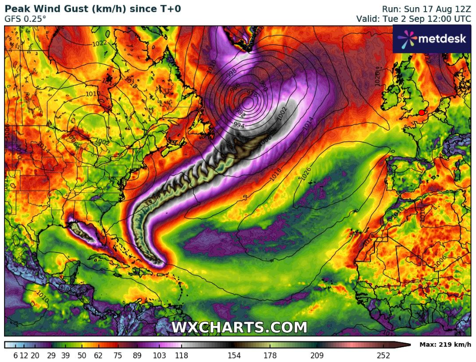
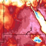
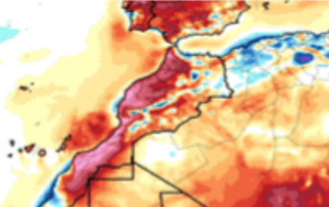
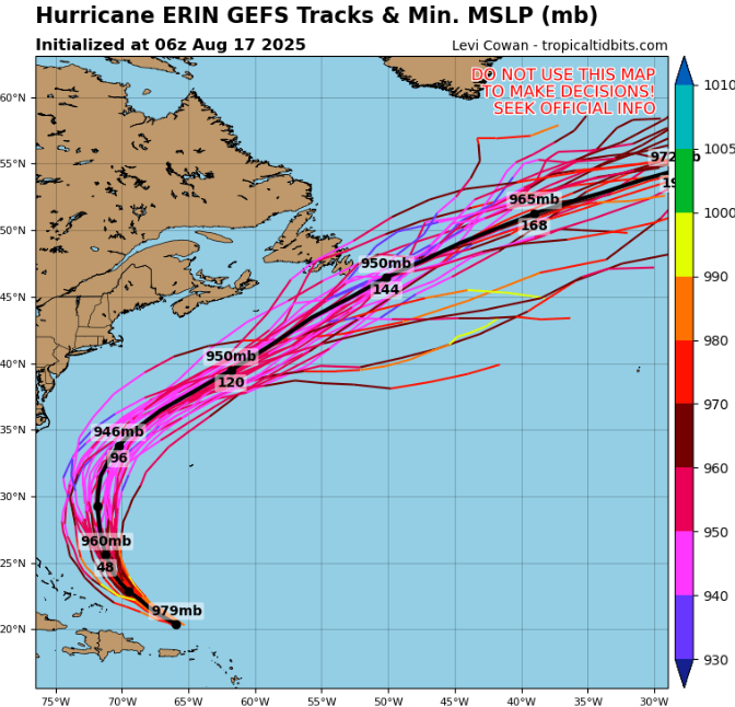
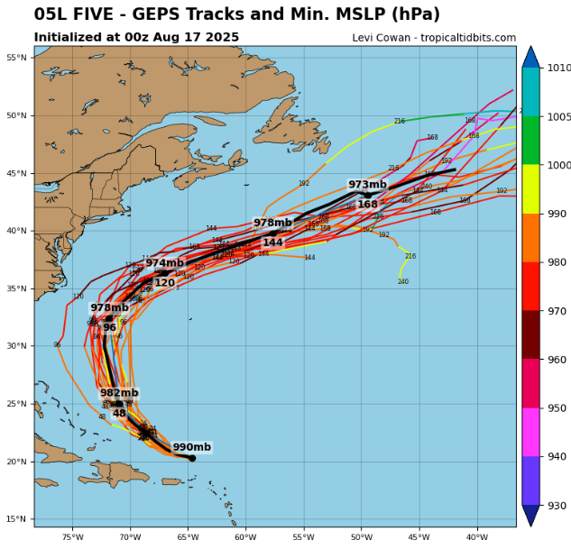
Source: wxcharts.com
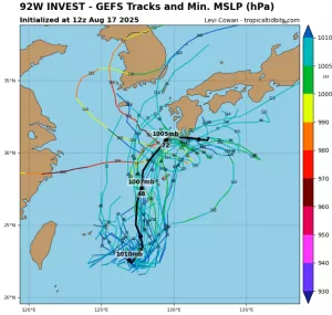
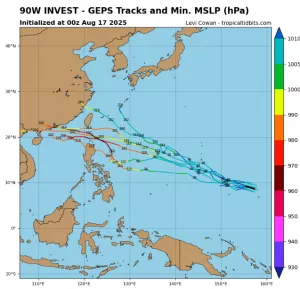
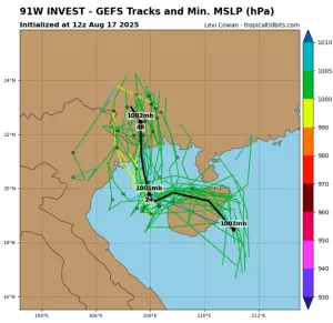
Source: tropicaltidbits.com
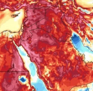
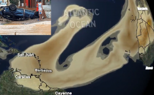
Detail (wxcharts.com)