Major Hurricane Flossie Roars Offshore, Sparking Rainfall Warnings from Michoacán to Jalisco
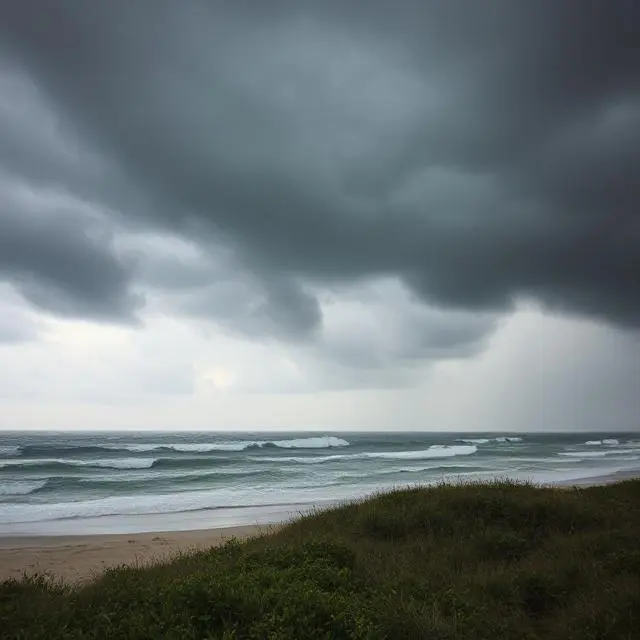
Hurricane Flossie rapidly intensified off Mexico’s Pacific coast beginning July 1st, becoming the sixth named storm and reaching Category 3 strength by the evening of July 1st. With sustained winds of 185 km/h (115 mph) and gusts up to 220 km/h (136 mph), it posed a formidable threat to coastal states including Michoacán, Colima, and Jalisco—though its center remained offshore. Forecasters warned that Flossie’s expansion, combined with swells up to 6 m (20 ft), could inflict coastal erosion and dangerous surf even without a direct landfall. A tropical storm warning was issued for the coast from Punta San Telmo to Playa Pérula, with watches extending from Zihuatanejo northward—a belt covering nearly 500 km of shoreline.
Heavy rainfall was already lashing Guerrero, Michoacán, Colima, Jalisco, and parts of Oaxaca, with authorities expecting 75–150 mm (3–6 in) through July 2nd and isolated totals up to 205 mm (8 in). In steep coastal mountain terrain, that much rain in a single day has a high potential to trigger flash floods and mudslides. Mexico’s National Water Commission highlighted the risk of river swelling and landslides in vulnerable rural communities, prompting evacuation orders in the most at-risk areas. These rainfall estimates approach historical single-event records for late June in this region.
Local municipalities stocked up on emergency supplies and reinforced riverbanks along small waterways. In Acapulco and other coastal towns, fallen trees and washed-out roads were reported along rural mountain slopes, though no major casualties have yet been reported (). Ferry services along the coast were suspended due to high swells, and several beachside hotels activated hazard protocols, restricting guest access to offshore waters. The destructive combination of wind-blown debris and floodwaters resulted in scattered power outages, with utility crews mobilized for rapid restoration.
Flossie’s swift growth can be traced to an unusually favorable environment of low wind shear and ocean temperatures near 30–31 °C (86–88 °F)—about 2 °C above normal for late June in the eastern Pacific—fueling rapid intensification. Satellite and buoy data showed a sharp warm anomaly in Flossie’s path, explaining its jump from tropical storm to major hurricane within 24 hours. This rapid strengthening highlights how even early-season systems can become formidable when the oceanic “fuel” is unusually abundant.
Despite its strength, Flossie is expected to remain offshore and begin weakening by mid-Wednesday as it moves north-northwest into cooler waters and faces increasing wind shear. By Thursday or Friday, it should degrade to a tropical storm or depression, though rainbands could still deliver heavy showers and swells to coastal regions. Residents are warned not to lower their guard—dangerous surf and flash flooding risk could linger for days after the hurricane weakens.
The appearance of a Category 3 hurricane this early in the Eastern Pacific season—just weeks after its May 15th official start—reinforces predictions of an above-average 2025 Eastern Pacific hurricane season from agencies such as NOAA and SMN. While early formation doesn’t guarantee direct impacts later in the season, forecasters emphasize that warm sea-surface temperatures and vigorous tropical waves remain in place. Residents from Guerrero to Baja California Sur are advised to maintain readiness—stocking emergency kits, reinforcing structures, and staying alert to updates from SMN, Conagua, and the U.S. National Hurricane Center.


