May 12th, 2025 Weather Report for North and South America, Europe and Africa
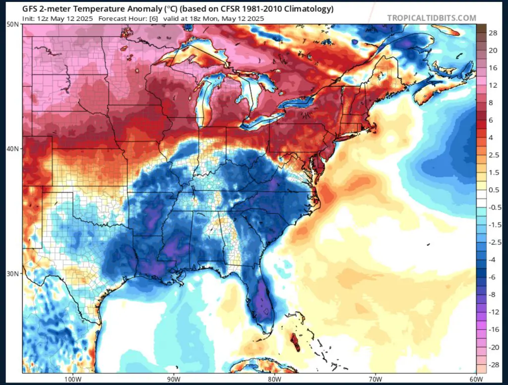
In North America, a front of very warm temperatures is moving through the upper American Midwest of North Dakota, South Dakota and Minnesota today along with the bordering regions of the Canadian provinces of Manitoba and Ontario. The highest figures were felt in Fargo, North Dakota at 35°C, International Falls, Minnesota at 35.6°C and Bismarck, North Dakota also at a balmy 35.6°C. These are temperatures some 20°C above normal for mid-May. The Minnesotan twin cities of Minneapolis-St. Paul broke a 125-year temperature record on Sunday, May 11th and the exceptionally unseasonal heat is expected to hold for the next few days (https://bringmethenews.com/minnesota-weather/twin-cities-breaks-125-year-old-temperature-record-100-in-northwest-minnesota).
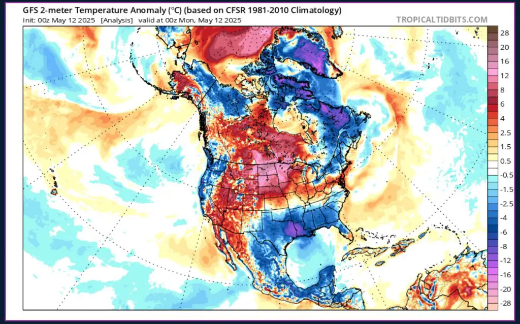
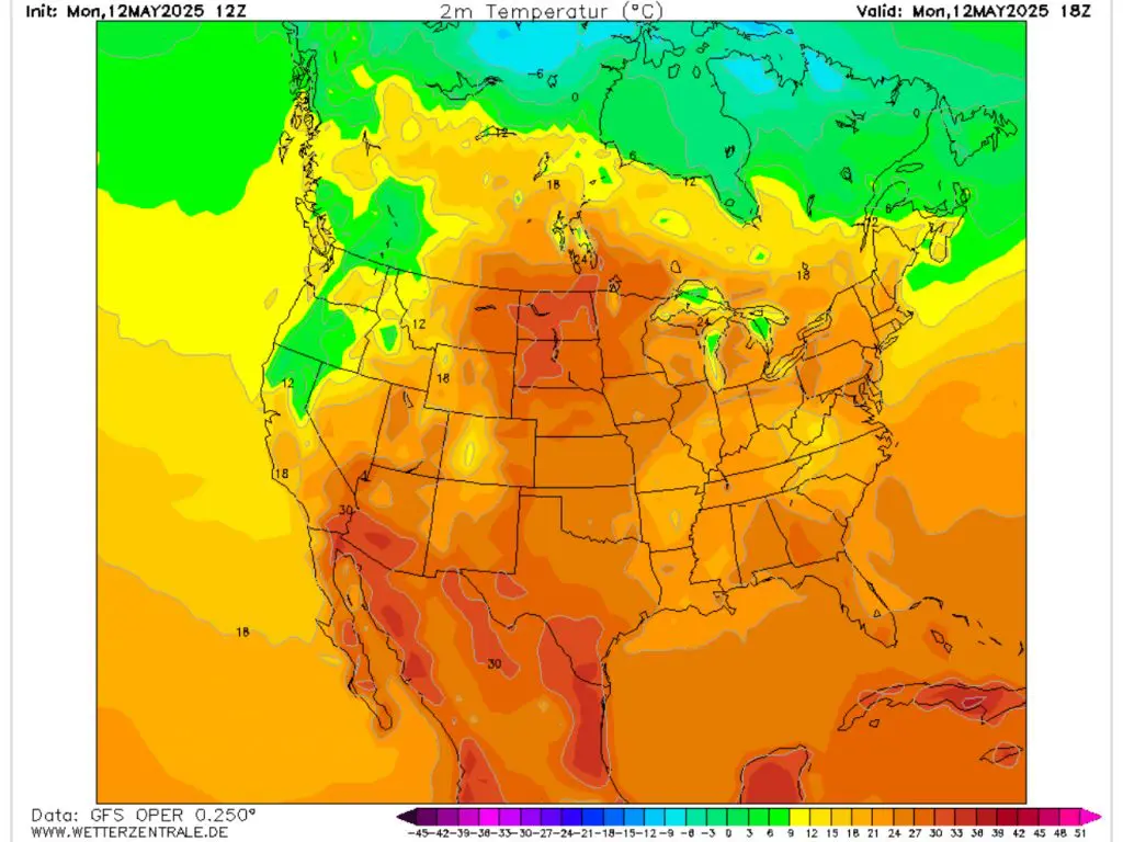
This heat in north-central North America is in contrast to temperatures far below normal for the season across the American South. Significant rainfall occurred in the region with over 100 mm 24-hour totals in Miami and Orlando, Florida, a 98 mm 24-hour total in Columbia, South Carolina and a 78.5 mm total in Savannah, Georgia. As a cold and wet front of air passes from west in Texas all the way east to the Atlantic seaboard of the Carolinas, temperatures in the area are dropping some 6 to 8°C below normal. This can temporarily put a damper on the vacation plans of those along the Gulf Coast and southern Atlantic coast of the United States until seasonal averages temperature are due to return to the area on Wednesday.
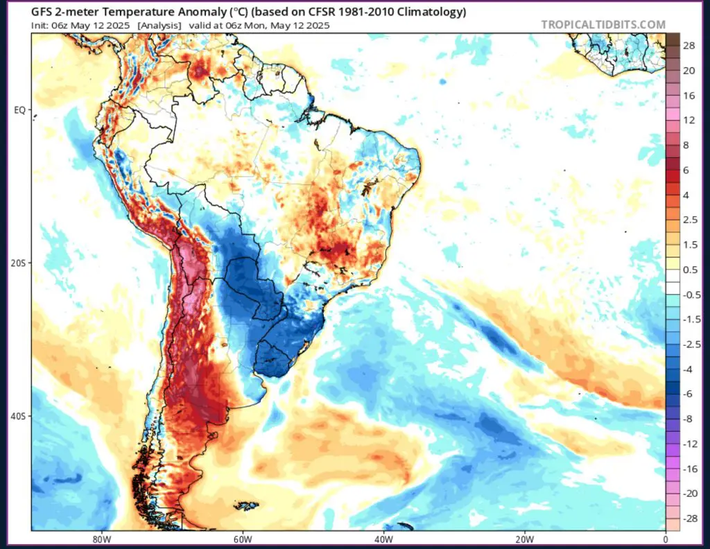
In South America, a mass of warm air stretching from Puru to the southern tip of the continent contrasts with a cold front to the east in eastern Argentina, Paraguay and Uruguay. The highest temperatures in this front can be found in the area of the Andes mountain range encompassing southeastern Peru, southwestern Bolivia, northeastern Chile and northwestern Argentina. Here, temperatures reached figures some 10-12°C above normal. In contrast, cooler temperatures dropping below 10°C at night were experienced in Montevideo, Uruguay as the cooling effects of the Southern Hemisphere autumn are in full swing.
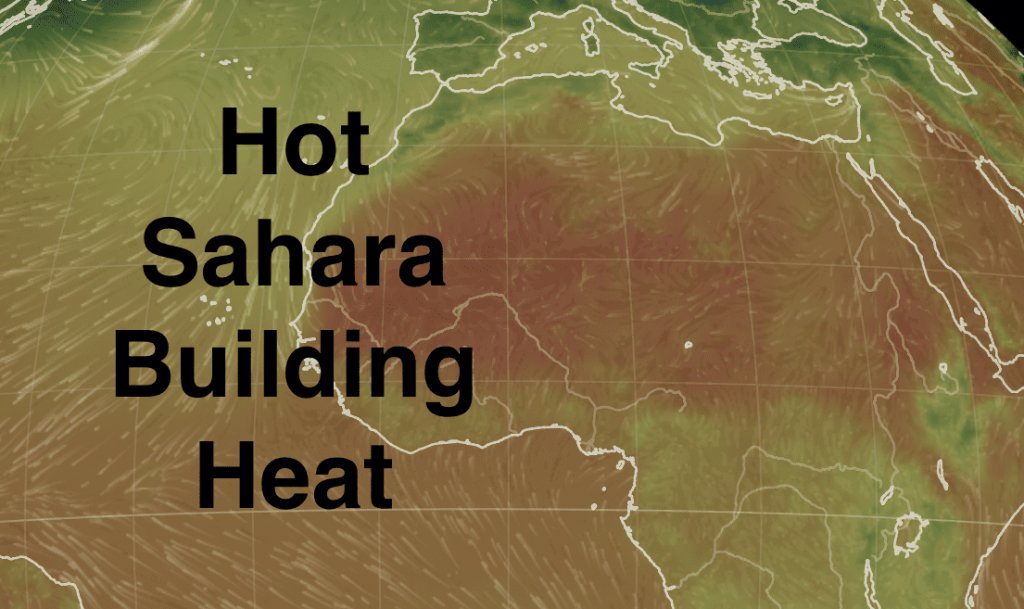
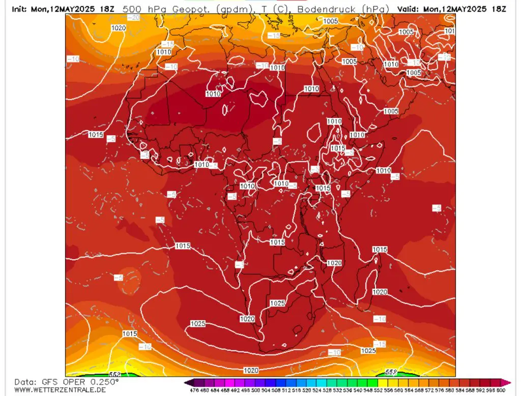
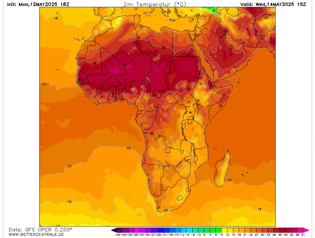
Moving along the Southern Hemisphere, high air pressure continues to linger over virtually the entire continent of Africa. With little else to affect this massive pressure system, extreme high temperatures in the Sahara have allowed to form. These temperatures reached up to 46.5°C in Algeria and 46.4°C in Niger. This intense Saharan heat is slowly escaping to the north and east, but not enough to have an appreciable impact on Continental European weather, which is currently dominated by low-pressure systems as a result of the seasonal changes of Arctic meteorological phenomena. There does not seem any respite in the forecast for sufferers of this North African front.
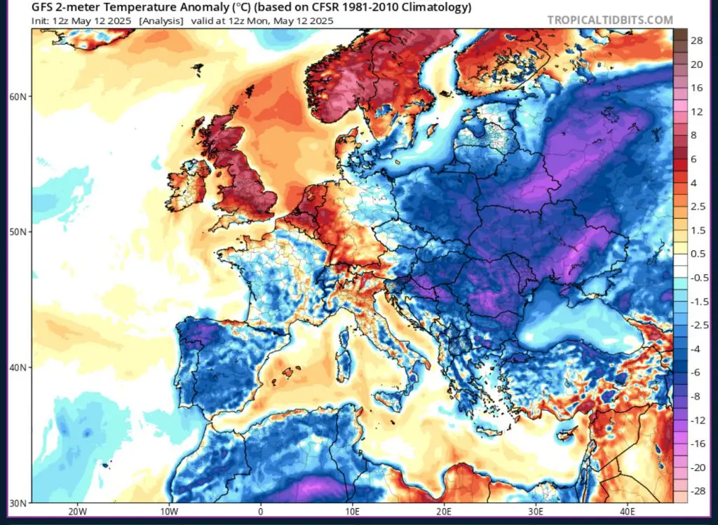
Europe, affected by a significant low pressure from a disrupted polar jet stream as well as an early final warming of the northern polar vortex, is in rather a state of flux. Cold temperatures are expected to continue affecting Central and Eastern Europe. The entirety of Lithuania and almost the entire country of Poland is under a freeze alert by their local respective meteorological services for the night of May 12th to the 13th. Other countries and their areas at risk of freezing temperatures include eastern parts of Germany, northern Czechia, northern Slovakia and the western half of Ukraine. This has the potential to severely affect early seasonal crops already planted, seeded or sprout. Even a single night’s freeze could negatively affect crop yields, causing economic disruption and inflationary pressure on groceries and other products of agriculture.


14 thoughts on “May 12th, 2025 Weather Report for North and South America, Europe and Africa”
Comments are closed.