Recent Severe Weather Events (May 28–31, 2025)
Between May 28 and May 31, 2025, the central and eastern United States were impacted by a series of intense severe weather outbreaks, featuring large hail, damaging winds, heavy rainfall, and tornadoes.
- May 29, 2025: A powerful storm system swept through the Midwest, producing large hail up to 2.75 inches in diameter reported in Missouri, Kentucky, and Georgia, with wind gusts exceeding 70 mph causing damage to homes and infrastructure. The National Weather Service issued multiple severe thunderstorm warnings across these states.
- May 30, 2025: As the system progressed into the Southeast, heavy rainfall led to localized flooding, particularly in Alabama, Mississippi, and Tennessee, where precipitation totals exceeded 3 inches over 24 hours. Flood alerts were issued by the Federal Emergency Management Agency (FEMA) and local emergency management agencies.
- May 31, 2025: Although the storm system weakened moving eastward, isolated severe thunderstorms persisted along the East Coast, especially in Florida and the Carolinas. Reports included damaging wind gusts and a few brief tornado touchdowns, resulting in power outages and minor property damage.
GFS 16-Day Forecast Outlook (June 1–16, 2025)
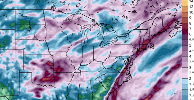
The Global Forecast System (GFS) model continues to indicate an active and dynamic weather pattern affecting the central and eastern United States through mid-June, confirmed by meteorological analysis from the National Oceanic and Atmospheric Administration (NOAA).
- June 1–5, 2025: GFS forecasts predict several low-pressure systems moving across the Midwest and Northeast, bringing potential for heavy rainfall and severe thunderstorms. The Storm Prediction Center (SPC) has already issued a Day 4–8 Convective Outlook warning of heightened severe weather risk from June 3 to 5, especially in the southern Great Plains and Midwest.
- June 6–10, 2025: A brief period of high pressure is expected to bring drier weather to parts of the central US. However, model guidance points to the arrival of a new low-pressure system from the west by June 9, which will likely trigger additional thunderstorm activity with severe potential.
- June 11–16, 2025: The GFS model shows multiple low-pressure systems crossing the central and eastern states, resulting in widespread thunderstorm development. These storms could produce heavy rainfall and localized flooding, particularly impacting the Southeast and Mid-Atlantic regions.
Conclusion
The past few days from May 28 to May 31, 2025, have brought significant severe weather to large swaths of the central and eastern United States, with damaging hail, wind events, and flooding reported. Forecast models and expert outlooks from NOAA and the SPC indicate continued active weather with periodic severe thunderstorm threats through mid-June.

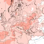
A total accumulated precipitation over the region until 16. June 2025 in inches. Source: https://www.tropicaltidbits.com/analysis/models/?model=gfs®ion=us&pkg=apcpn&runtime=2025053106&fh=384

