Severe Storms in Texas, Oklahoma and Arkansas on Wednesday, on Line from Montana to Oklahoma on Friday
The central United States is bracing for a significant period of severe weather this week, as dynamic atmospheric conditions set the stage for intense thunderstorms and possible severe storms. Meteorologists are closely monitoring a developing severe weather event, beginning Wednesday with focused activity across Texas, Oklahoma, and Arkansas, and expanding into a larger storm system stretching from Montana all the way south to Oklahoma by Friday.
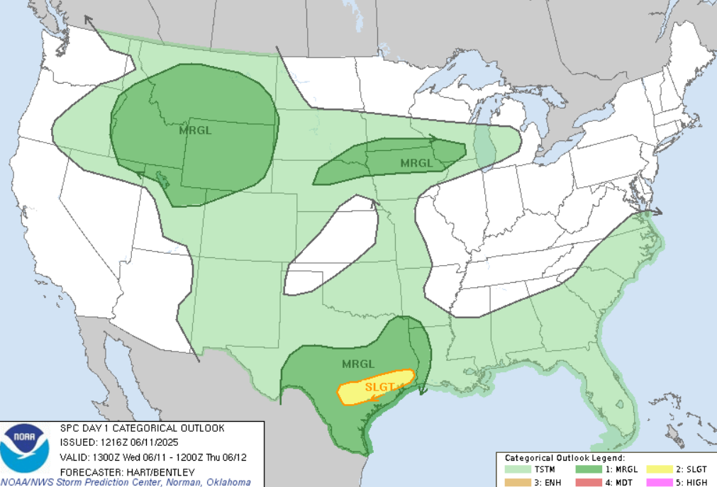
Wednesday’s Severe Weather Threat: Texas, Oklahoma, Arkansas
On Wednesday, the primary threat area will be concentrated in the southern Plains, particularly across Texas, Oklahoma, and Arkansas. These states are expected to experience a volatile combination of warm, moist air from the Gulf of Mexico colliding with a strong cold front advancing from the northwest. This clash of air masses creates an environment highly conducive to severe thunderstorms.
Forecasters anticipate large hail, damaging wind gusts, and isolated tornadoes as the main hazards. The atmosphere will be sufficiently unstable, with high convective available potential energy (CAPE) values fueling strong updrafts within developing storm cells. The wind shear – the change in wind speed and direction with height – is expected to be moderate to strong, which supports storm organization and rotation. This raises concern for supercell thunderstorms capable of producing tornadoes, particularly in Oklahoma and northern Texas.
Additionally, heavy rainfall may lead to localized flooding in low-lying areas, especially where storms train over the same region repeatedly. Residents and travelers should remain alert for rapidly changing weather and heed any warnings issued by the National Weather Service.
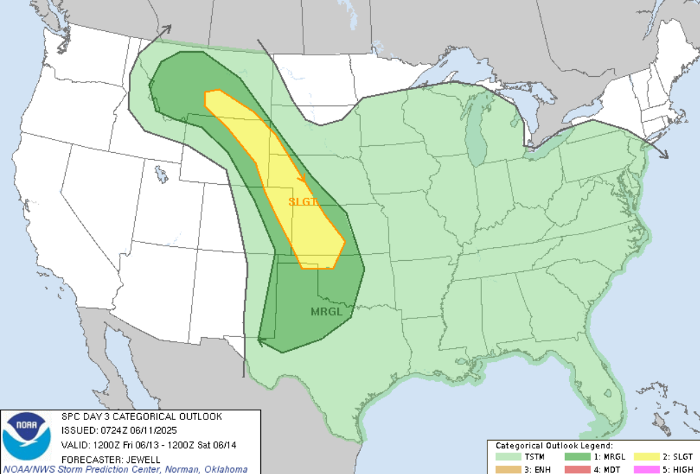
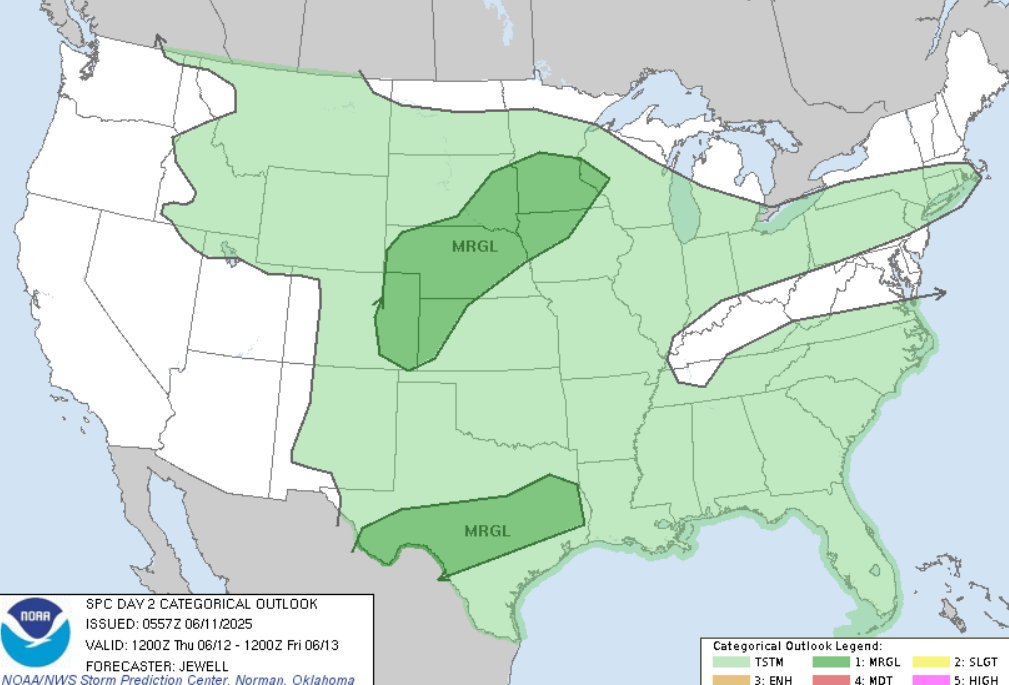
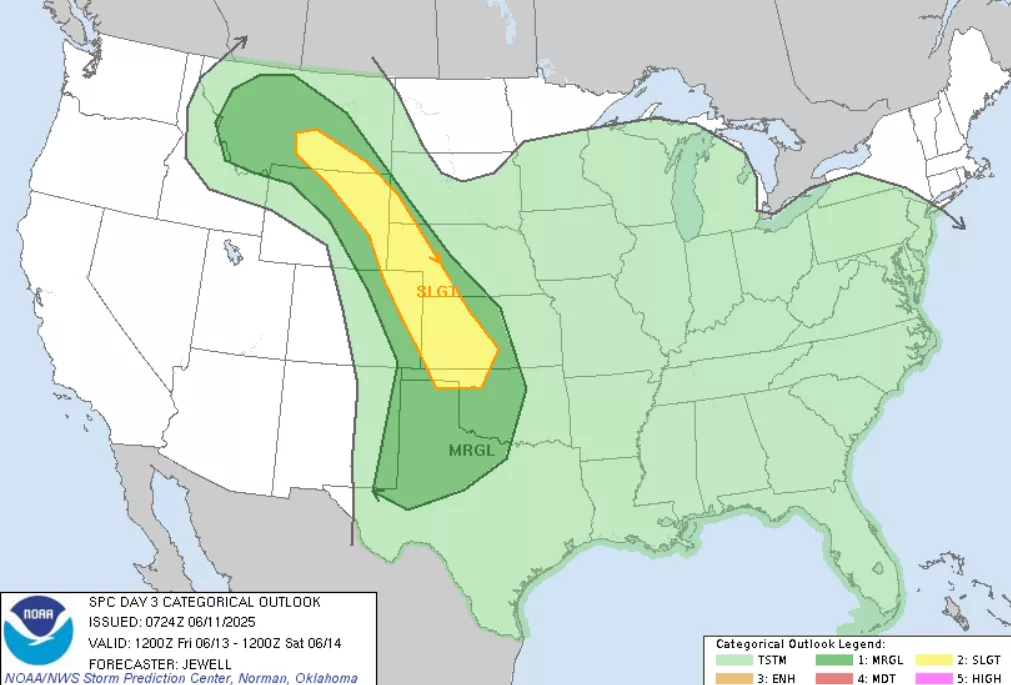
Friday’s Expanding Storm Line: From Montana to Oklahoma
By Friday, the severe weather threat is expected to broaden significantly, forming a long squall line extending from Montana in the north, down through the Dakotas, Nebraska, Kansas, and into Oklahoma. This expanding storm line is associated with a strong mid-latitude cyclone and its trailing cold front, sweeping eastward across the central U.S.
As this line intensifies, damaging straight-line winds will become the primary hazard, with embedded tornadoes still possible, especially near the southern portion of the line. Large hail may accompany the strongest cells along the line, which could extend hundreds of miles. The forward speed of the squall line will contribute to the severity of the wind threat, with gusts potentially exceeding 70 mph in some areas.
Given the extent of this system, the risk of flash flooding also increases, as heavy rains may fall over saturated or slowly draining soils. Emergency management officials across these states are likely preparing for potential power outages, travel disruptions, and property damage.
Preparedness and Safety Recommendations
Residents within the affected areas should review their severe weather safety plans and ensure that they have access to reliable weather updates. Mobile phone alerts, NOAA weather radios, and trusted weather apps can provide timely warnings. During severe thunderstorms, individuals should seek shelter indoors, preferably in a basement or an interior room away from windows. Avoid travel if severe weather is imminent, and be prepared for sudden changes in conditions.
Farmers and outdoor workers should also take precautions, as large hail and damaging winds can pose risks to crops, livestock, and equipment.
Outlook and Forecast Updates
Weather models continue to show some variability in timing and exact storm placement, but the overall threat of severe weather in the central U.S. over the next several days remains high. Meteorologists will keep a close eye on the evolving system and issue updated forecasts and warnings as needed.
In summary, the next several days bring an active and potentially dangerous severe weather pattern to the heart of the United States. The combination of warm, moist air, strong cold fronts, and dynamic wind patterns will fuel thunderstorms capable of producing hail, damaging winds, tornadoes, and heavy rain from Texas and Arkansas northward to Montana to Oklahoma. Staying informed and prepared will be key to weathering this challenging stretch of weather safely.
Source: https://www.severeweatheroutlook.com/


