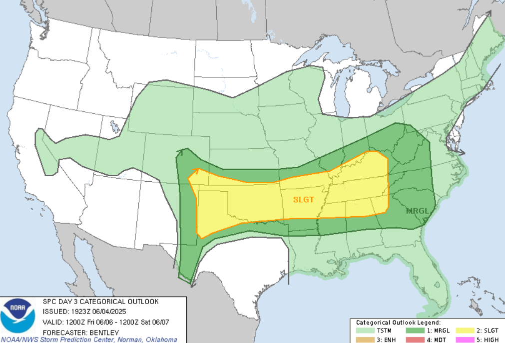
Severe Storms in the U.S. will continue, on Friday along the line from New Mexico to Virginia
As of early June 2025, the United States is experiencing a notably active severe weather season, with multiple regions facing heightened risks of thunderstorms, hail, and tornadoes. Forecasts indicate that the southern High Plains, particularly areas from eastern New Mexico into the Texas Panhandle, are under a slight risk for severe thunderstorms. These storms are expected to develop this afternoon into the evening, with primary threats including large hail and severe wind gusts.
The atmospheric setup contributing to this severe weather includes a midlevel shortwave trough moving eastward across Arizona, accompanied by a 40-knot speed maximum. This system is promoting scattered thunderstorm development from the Southwest into the southern Rockies, eventually spreading eastward into the southern High Plains. Enhanced storm intensity and organization are possible as these storms move into east-central New Mexico and the Texas Panhandle, supported by effective shear values of 40-50 knots and steepening deep-layer lapse rates.
Further south, over the Trans-Pecos region of Texas, storm development is less certain due to lingering atmospheric inhibition and weaker large-scale ascent. However, any storms that do form in this area could produce isolated large hail and severe gusts, aided by moderate surface-based instability and around 50 knots of effective shear.
In addition to the High Plains, a quasi-stationary cold front extends from Lake Huron southwestward across the Ozarks into East Texas. This frontal boundary is expected to be a focal point for thunderstorm development, with locally damaging winds possible from the southern Great Lakes through the Ohio Valley and into East Texas. While the potential for organized severe weather exists, factors such as weak instability and front-parallel deep-layer flow may limit the overall threat.
Looking ahead, forecasts suggest continued severe weather risks in the coming days. Scattered severe thunderstorms are anticipated from late Thursday afternoon into Thursday night, particularly from the southern High Plains across southern Kansas and Oklahoma. These storms may produce a few tornadoes, large to isolated very large hail, and severe gusts.
Residents in the affected areas are advised to stay informed through official weather channels and be prepared to take necessary precautions as conditions evolve. The active severe weather pattern underscores the importance of vigilance during this time of year.
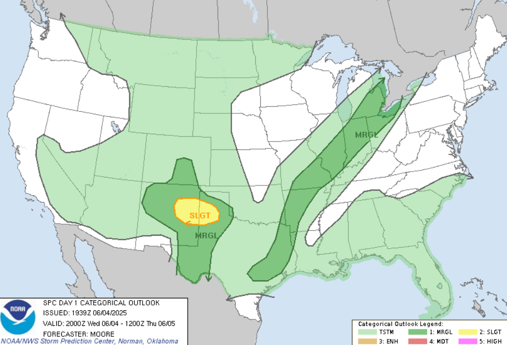
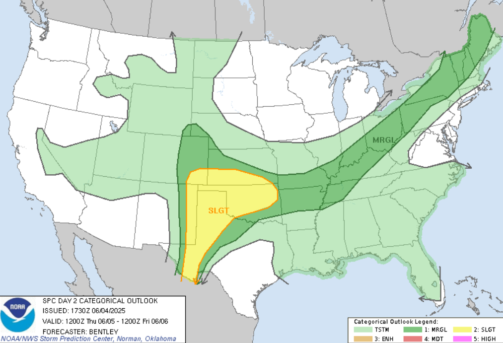
Forecasts for June 4.-6th 2025. Source: https://www.severeweatheroutlook.com/everything/?utm_source=chatgpt.com#2025-06-05


