Slovenia -3,6°C, Austria -2,1°C, France -2,0°C, Poland -1,3°C, UK -0,8°C, Bosnia -0,4°C, Germany -0,3°C…frosts in Europe under 1000 MASL last 24 hours

Is Tuesday, the 5th day of current coldwave in Europe and on the back side of Mediterranean storm system, first frosts has appeared in many parts of Europe.
Mediterranean system alone, has shifted from Monday from Italy and Balkan /https://mkweather.com/2020/10/12/mediterranean-system-floods-winds-and-tornadoes-in-italy-montenegro-greece-austria-bosnia-and-croatia-on-monday// above East-Central Europe, where caused regional floods (mainly in Czechia and Slovakia) and the first snowing in lower Carpahian basins /https://mkweather.com/2020/10/13/first-snow-of-winter-season-2020-21-in-slovakia/; https://mkweather.com/2020/10/11/the-first-snowfall-in-large-parts-of-slovakia-and-moravia-from-tuesday-to-wednesday-13-14-october// from 500 MASL on Tuesday and already from 300 MASL on Wednesday!
Snow has appeared between 500 – 1000 MASL in Alpine region and NW Balkan too, but more interesting should be regional frosts in altitudes under 1000 MASL across Europe, locally with help of snow cover.
In Slovenia, Ratece, 864 MASL, near 3 cm snow temperature has dropped to -3,6°C in Tuesday morning, on the bask side of robust Mediterranean storm system. In Austria, Dellach im Drautal, 627 MASL, has been measured -2,1°C, in France, Le Puy, 832 MASL, -2,0°C, in Poland, Cewice, 154 MASL, -1,3°C, in the UK, Eskdalemuir, 242 MASL, -0,8°C, in Bosnia and Herzegovina, Ivan Sedlo, 970 MASL, -0,4°C, in Germany, Cottbus, 69 MASL, -0,3°C, in Czechia, Doksany, 158 MASL, +0,3°C, in Slovakia, Liesek, 692 MASL, near snowing, +0,3°C, in Montenegro, Plevlja, 784 MASL, +0,3°C, in Croatia, Parg, 863 MASL, +0,5°C or in Belgium, Elseborn, 564 MASL, +0,6°C.
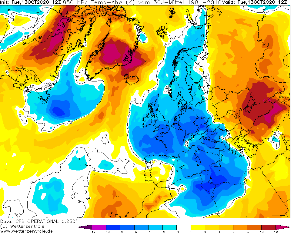
According to forecasting tools, very or extremely cold has been all western half of Europe including the UK, France, Germany and Italy, with temperature records mainly in southern regions of cold mass.
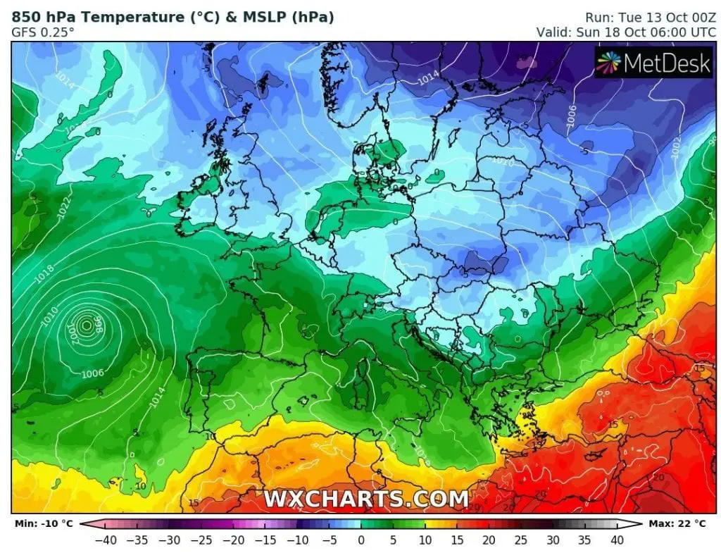
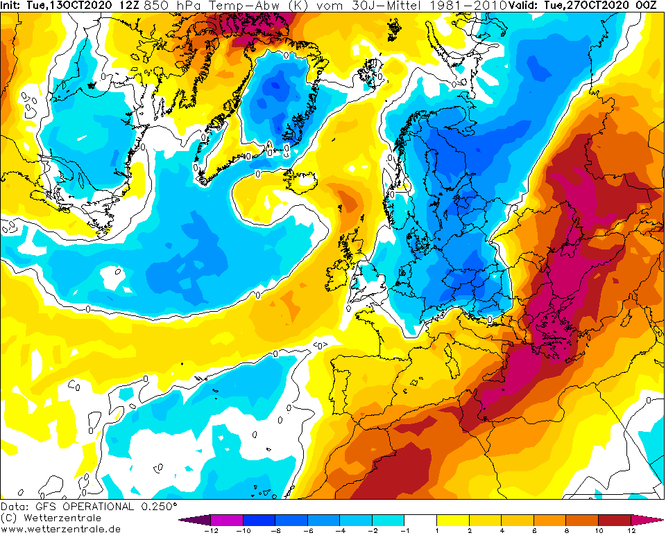
According to the newest forecasts, extreme coldwave stays in Europe until 20. October and then, extremely cold air below -5°C in 850 hPa will shift over Eastern Europe, with possibly week-lasting warmer period between 20.-27. October 2020. However, at the end of October and at the beginning of the November 2020, next and more severe coldwave should hit Europe according the same runs of GFS.
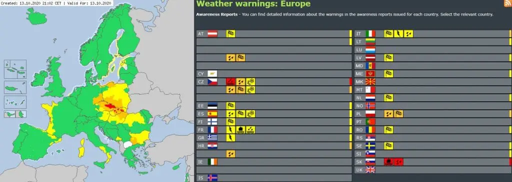
Tuesday in Europe /meteoalarm.eu, wxcharts.com, wetterzentrale.de:
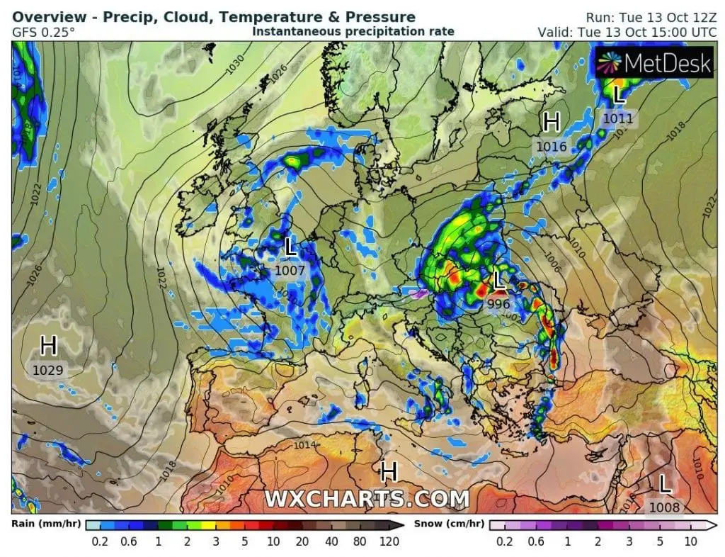
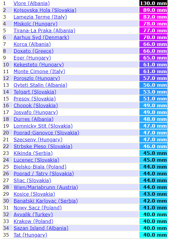
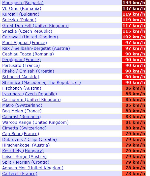
Measured extreme rainfall and wind gusts in Europe on Tuesday, 13. October 2020 /ogimet.com:
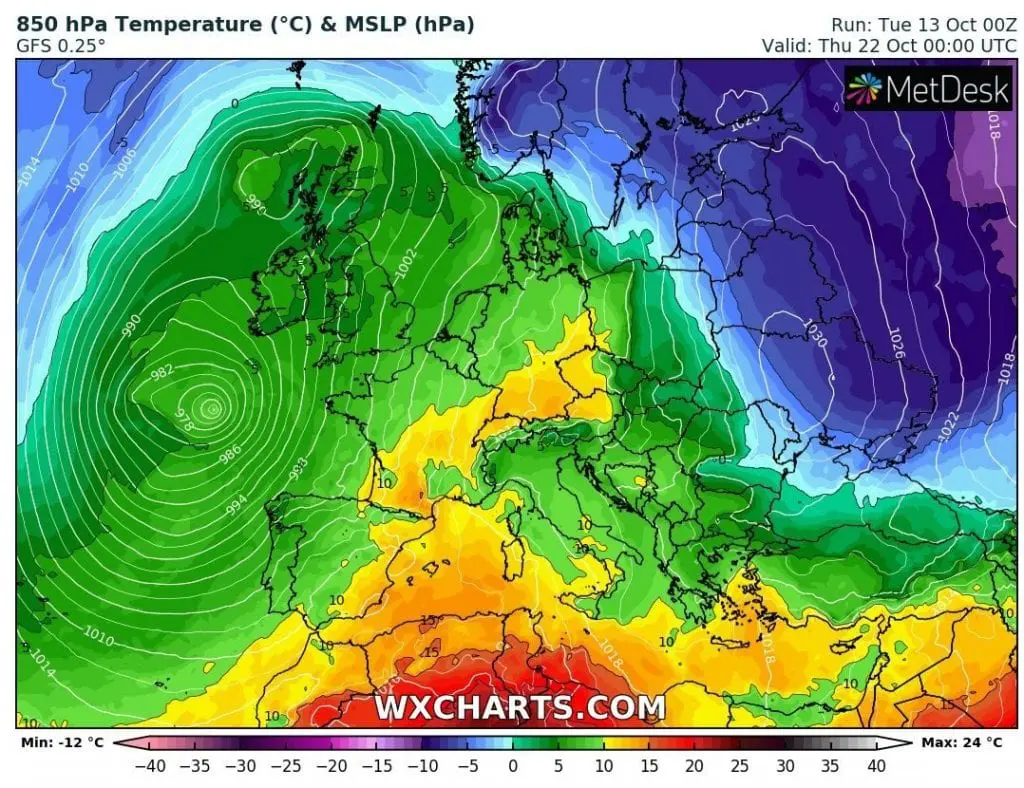
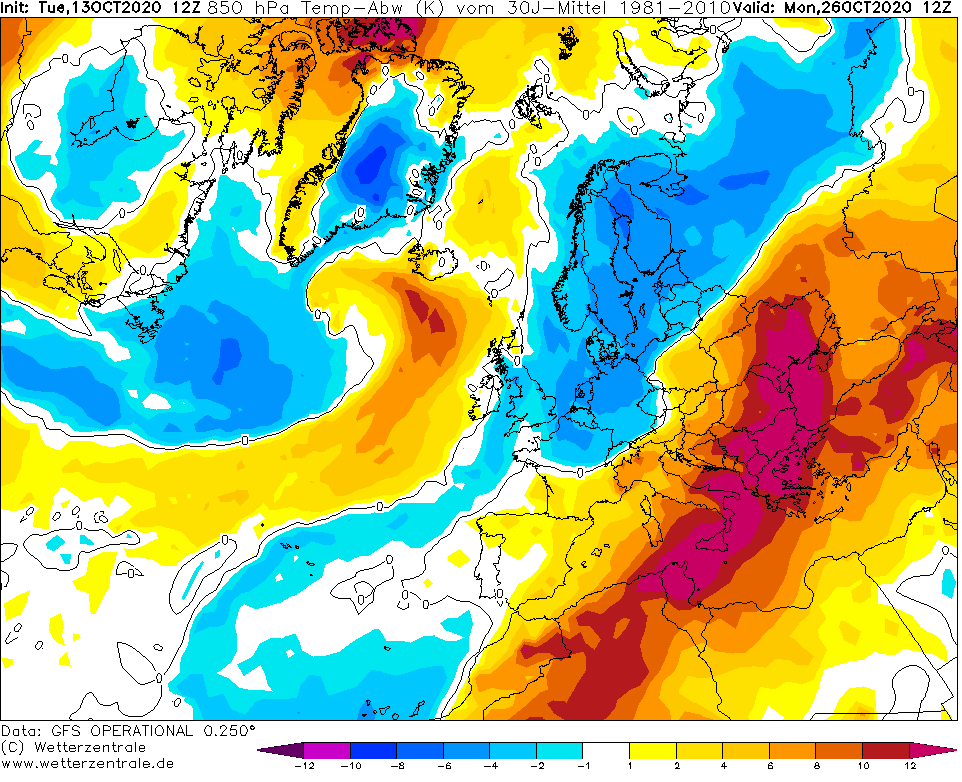
Interesting possible situation after 25. October /wetterzentrale.de:
Extremely cold air over Europe on Wednesday and Sunday, 14. and 18. October 2020 and over Eastern Europe on 22. October 2020 /wxcharts.com: