Storm forecast: Between 8.-15. July 2021 is waiting for Central Europe a storm hell!

In the last period appeared in Europe many violent T-storms with large hail, gusting winds, flash floods, and deadly tornadoes /many stories on our homepage/, but it appears, that July 2021 prepared for us the next hard times.
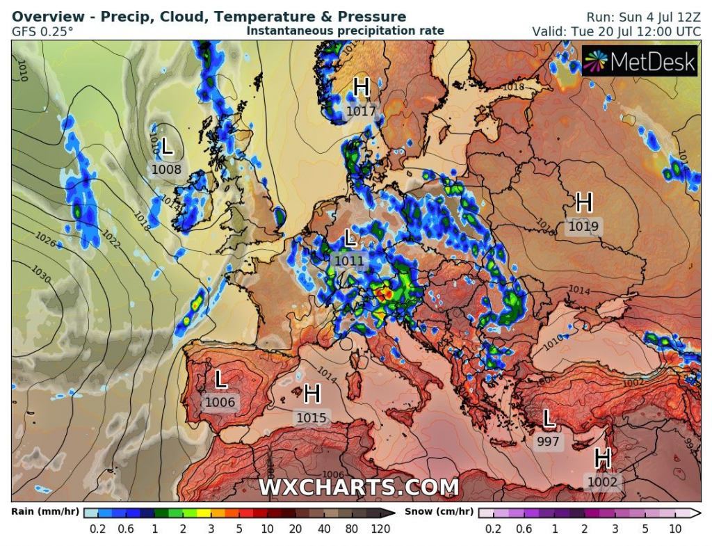
The worst storm situation is until 20. July 2021 forecasted for Central Europe and partially for parts of Eastern Europe, eastern France, and northern Balkan.
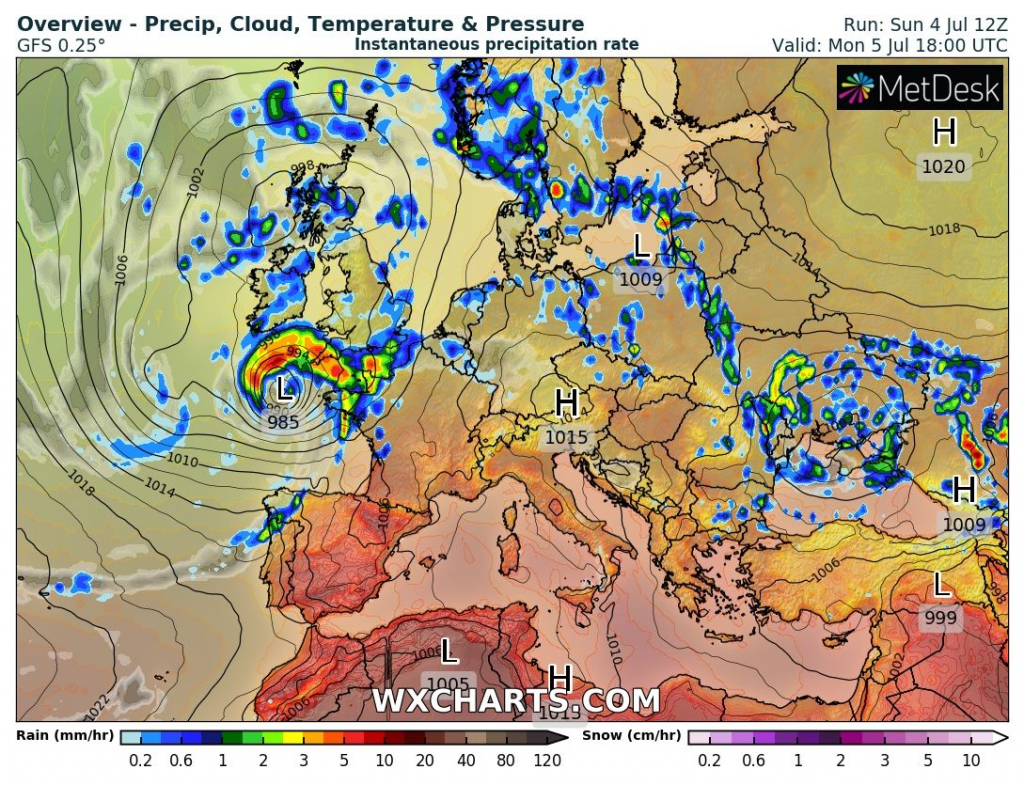
While severe storms are bothering region from northern Adriatic to northern Germany already from Sunday to Monday, 4.-5. July 2021, with the next regional devastating impact, the worst will only come, yet.
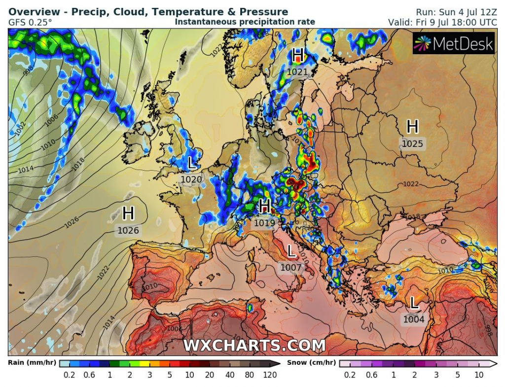
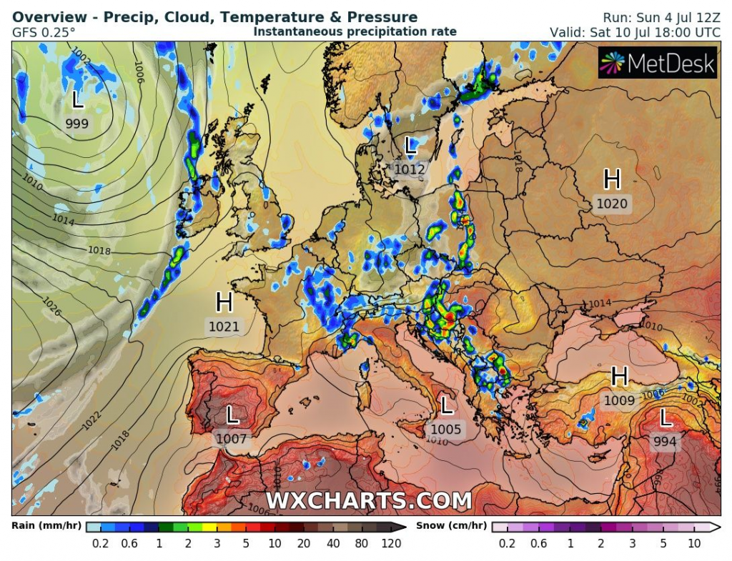
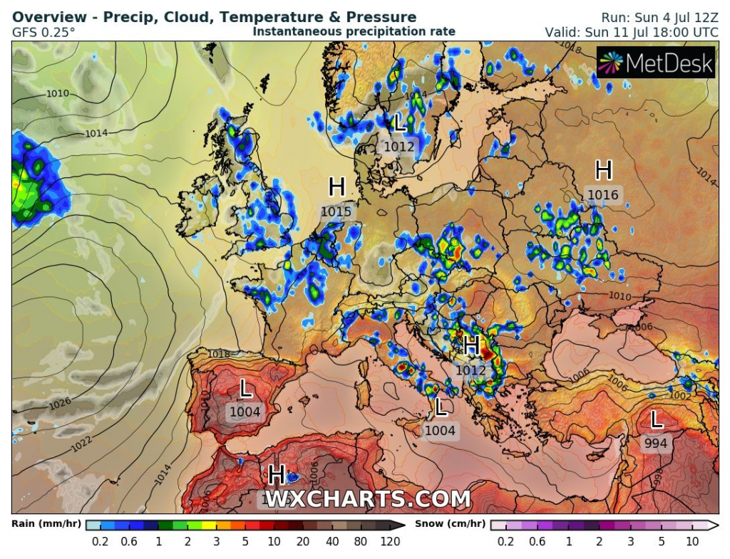
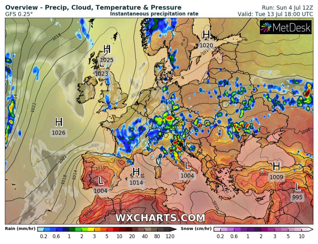
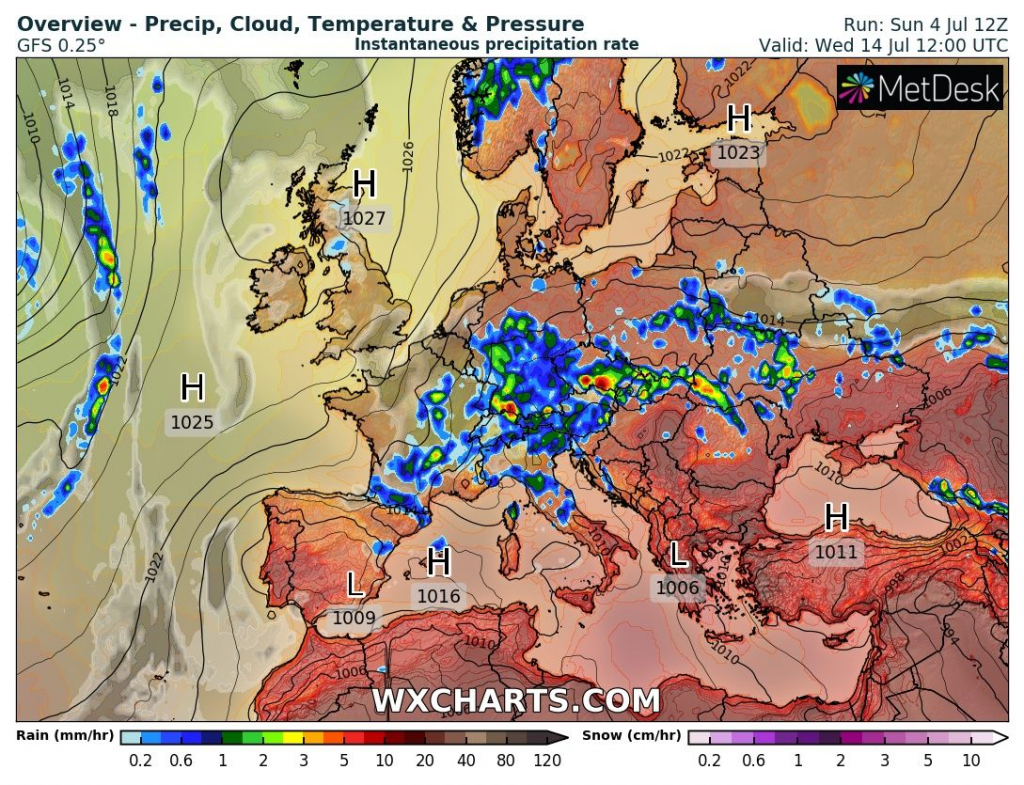
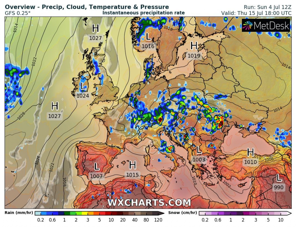
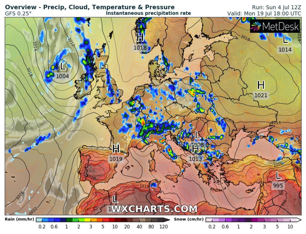
After extreme heatwave, which will come above the southern and eastern half of the continent already during the next workweek, an extreme round of storms is predicted for central parts of Europe between Thursday and Thursday, 8.-15. July 2021 and then, until 20. July 2021, severe storms will be only partially weaker.
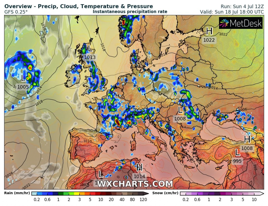
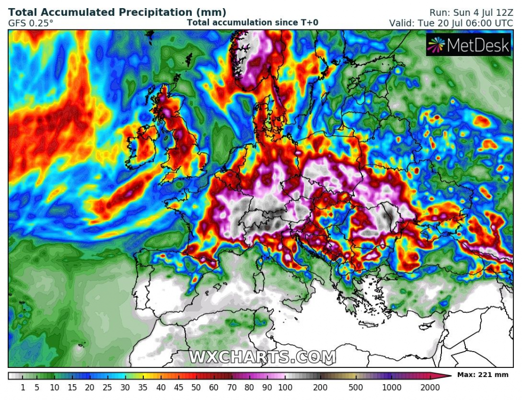
Wxcharts forecast tool provides a detailed look at predicted fields of heavy rainfall from storm activity and a week-lasting period between 8.-15. July 2021 will be definitely extreme, with the next possible floods (100 mm+ rainfall / 24 hours), 10cm+ hails, 100km/h+ winds and EF1+ tornadoes.
The worst situation is forecasted for eastern France, southern Germany, Luxembourg, Belgium, Switzerland, Austria, northern Italy, Slovenia, central Croatia, Bosnia and Herzegovina, western Serbia, Czechia, southern Poland, western Ukraine, Moldova, and Carpathian Romania, but extreme storms should hit practically everywhere.
We strongly recommend watching current forecasts, news, warnings, and advisories – mainly in continental Europe and northern Balkan – storms should be regionally devastating and life-threatening.

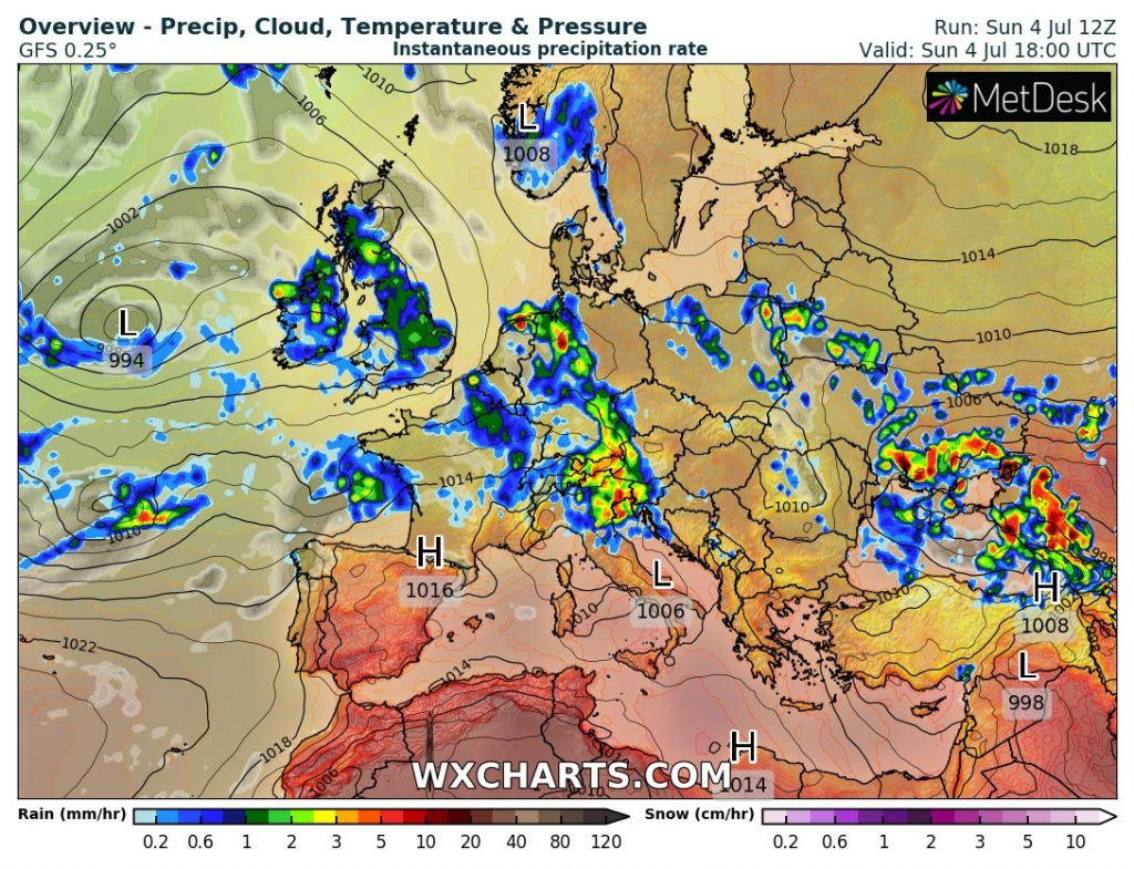
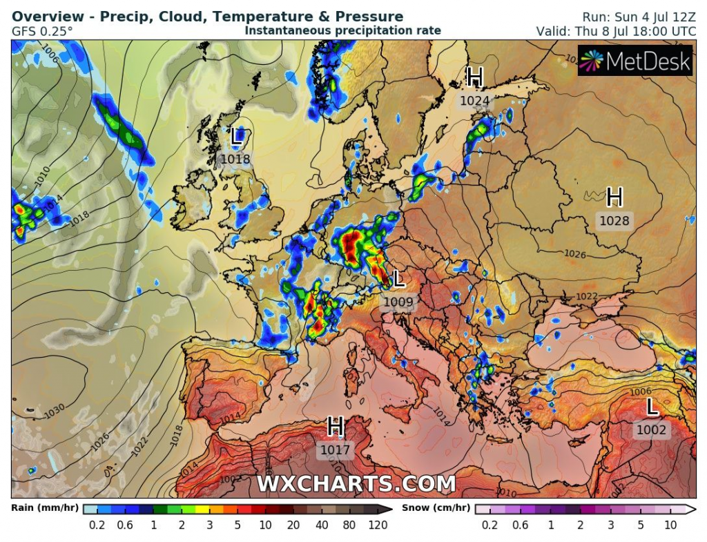
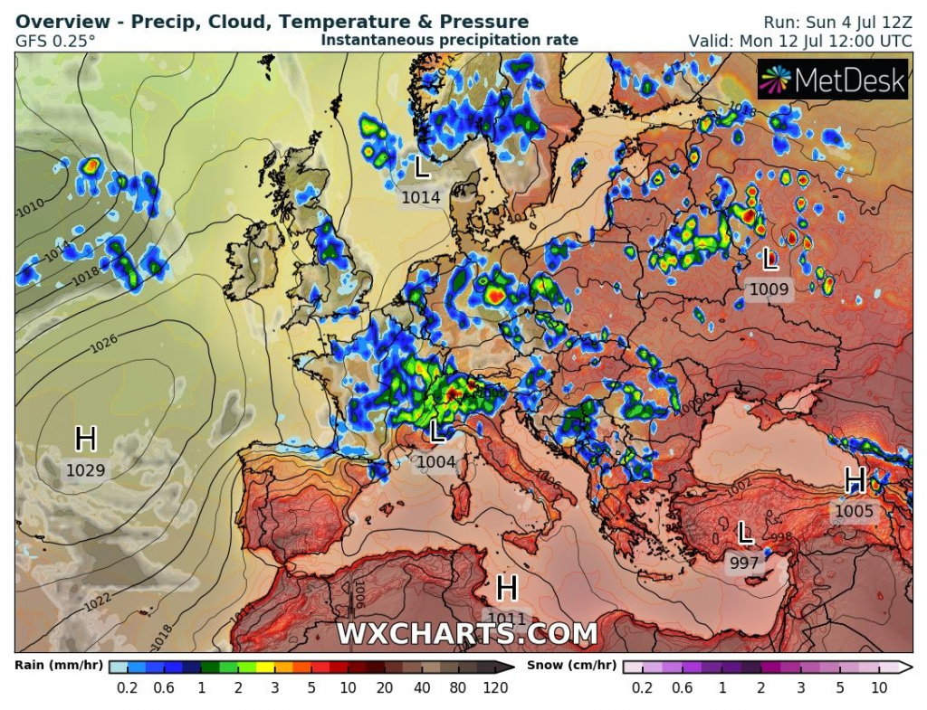
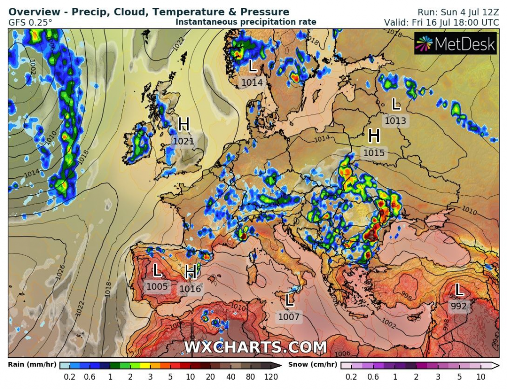
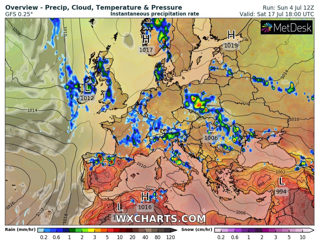
Source: wxcharts.com
Source: wxcharts.com


