Storm forecast for Europe until the end of July 2021: Continental Europe under a storm attack
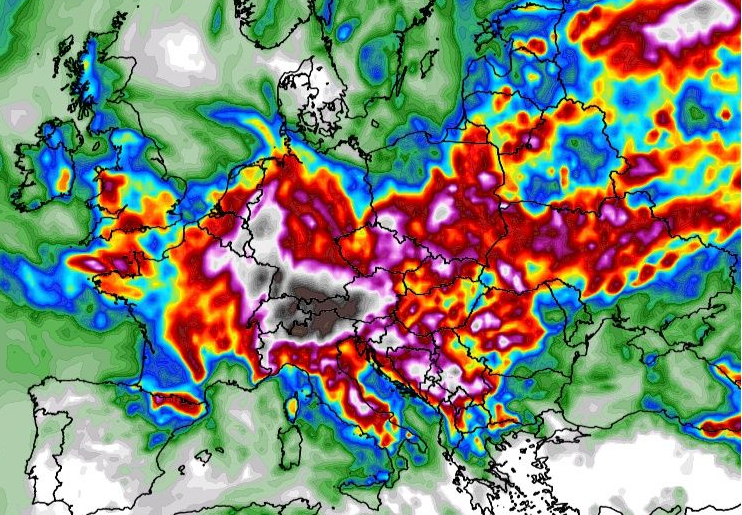
While at the start of a current week, the next severe storm round in western parts of continental Europe is bringing heavy rainfall, hails, flash floods, or weaker tornadoes, and in eastern parts of continental Europe, such as Balkan again are experiencing extreme heatwaves, during the next period, storms will be shifting more eastward and southward.
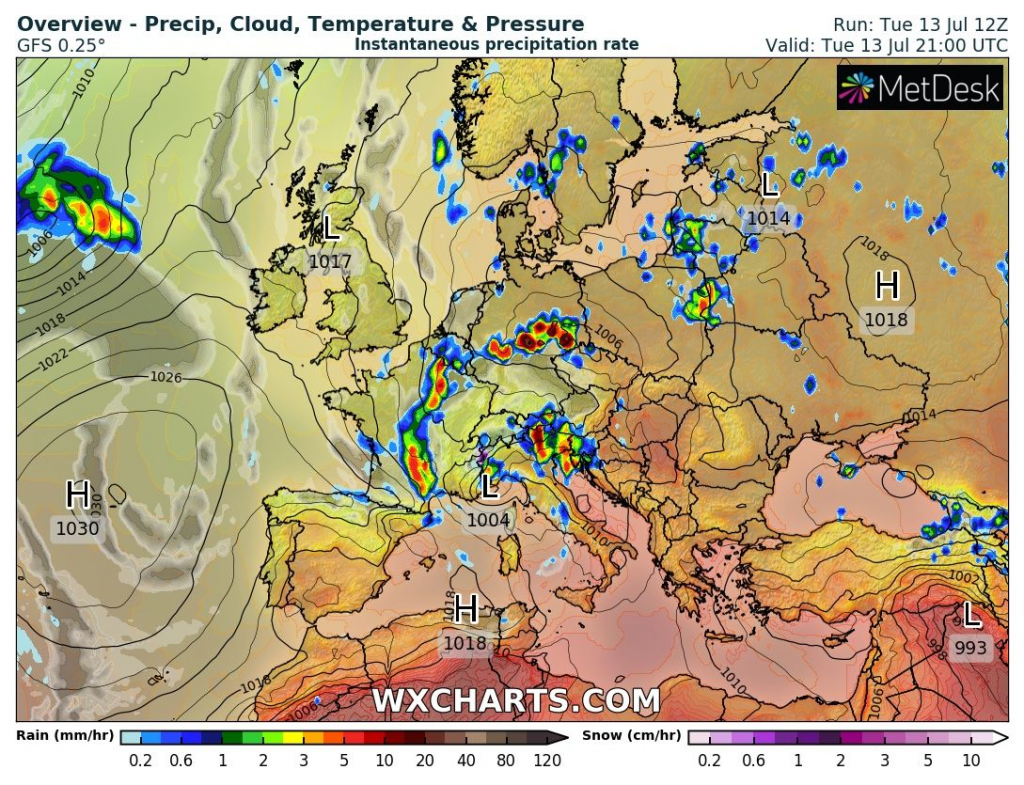
On Tuesday, 13. July, severe storms are reported from France, Germany, Switzerland, Austria, northern Italy, Slovenia and northern Croatia.
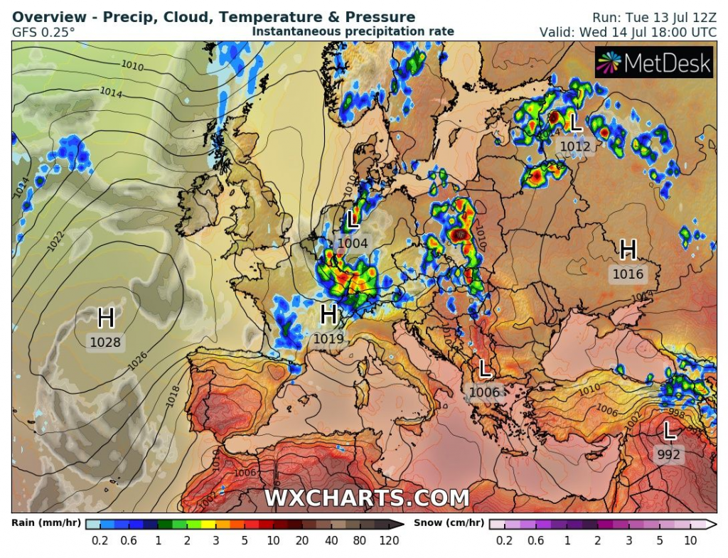
On Wednesday, 14. July, the most severe storms are forecasted for eastern France, Germany, Belgium, Switzerland, Czechia, Poland, Slovakia, northern Belarus, Latvia and Lithuania.
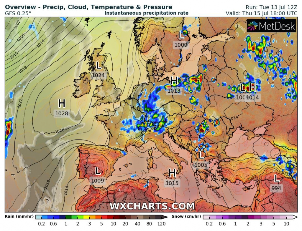
On Thursday, 15. July, severe storms will be limited mainly to Poland, Romania, the Kaliningrad region, Russia, Belarus, Lithuania, or the Alps.
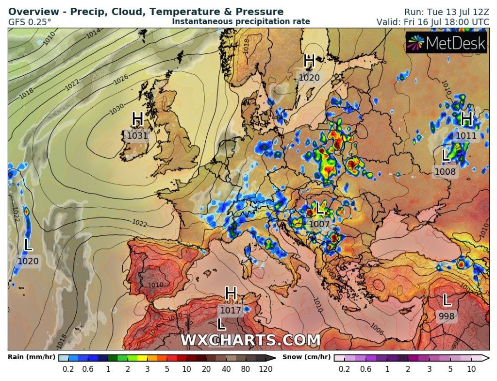
On Friday, 16. July, storms will shift above Hungary, Poland, Belarus, Ukraine, and Balkan.
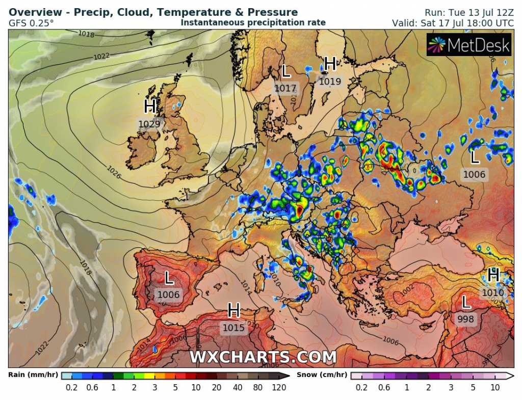
On Saturday, 17. July, severe storms should again appear in all East-Central Europe, but too western Balkan, Lithuania, Belarus, Ukraine and even, Italy.
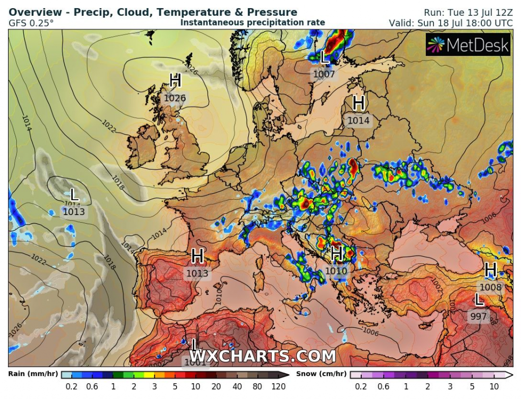
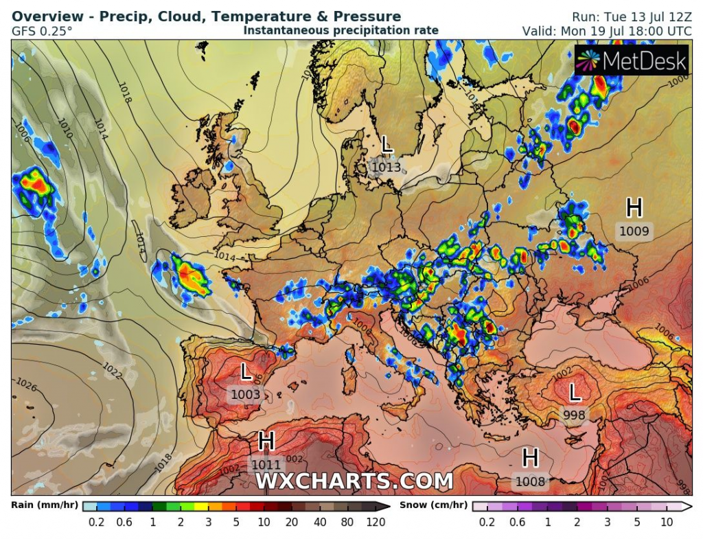
On Sunday, 18. July, powerful storm activity is still forecasted for East-Central Europe, western Balkan, Italy, and Ukraine.
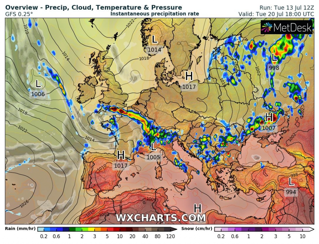
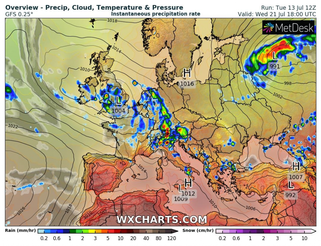
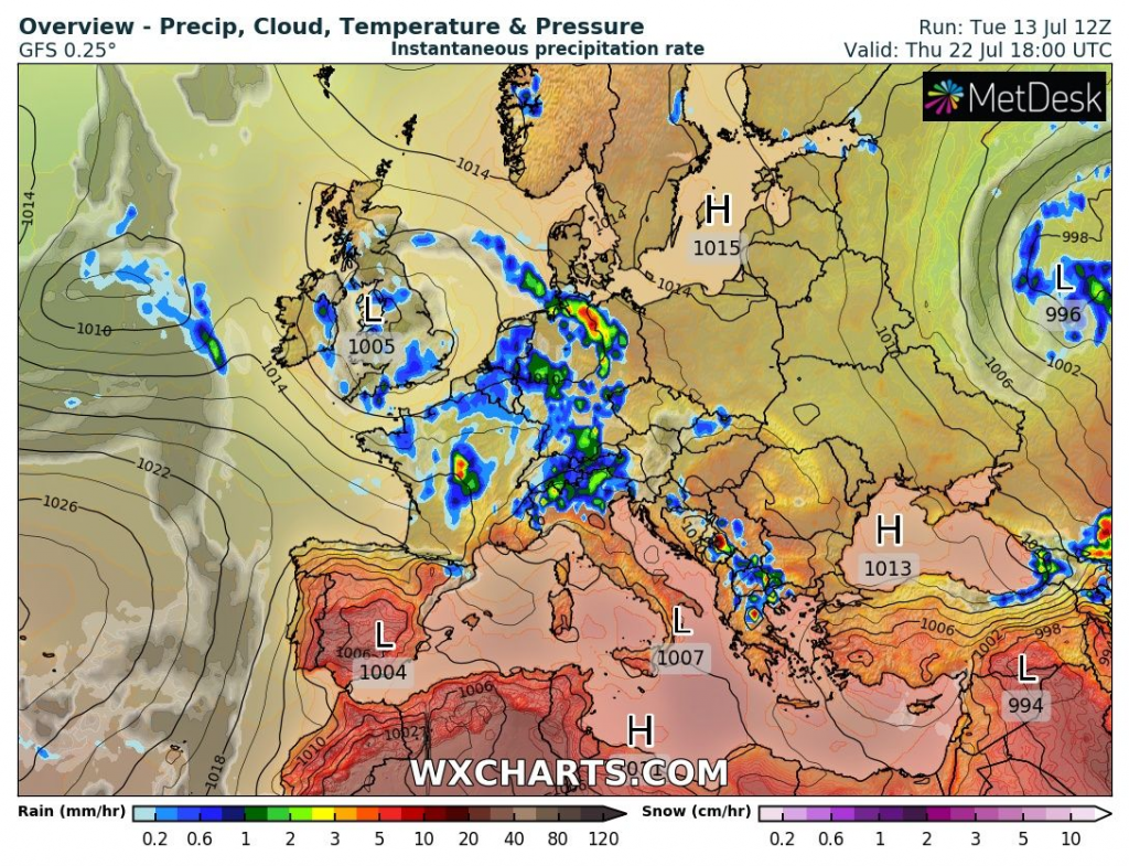
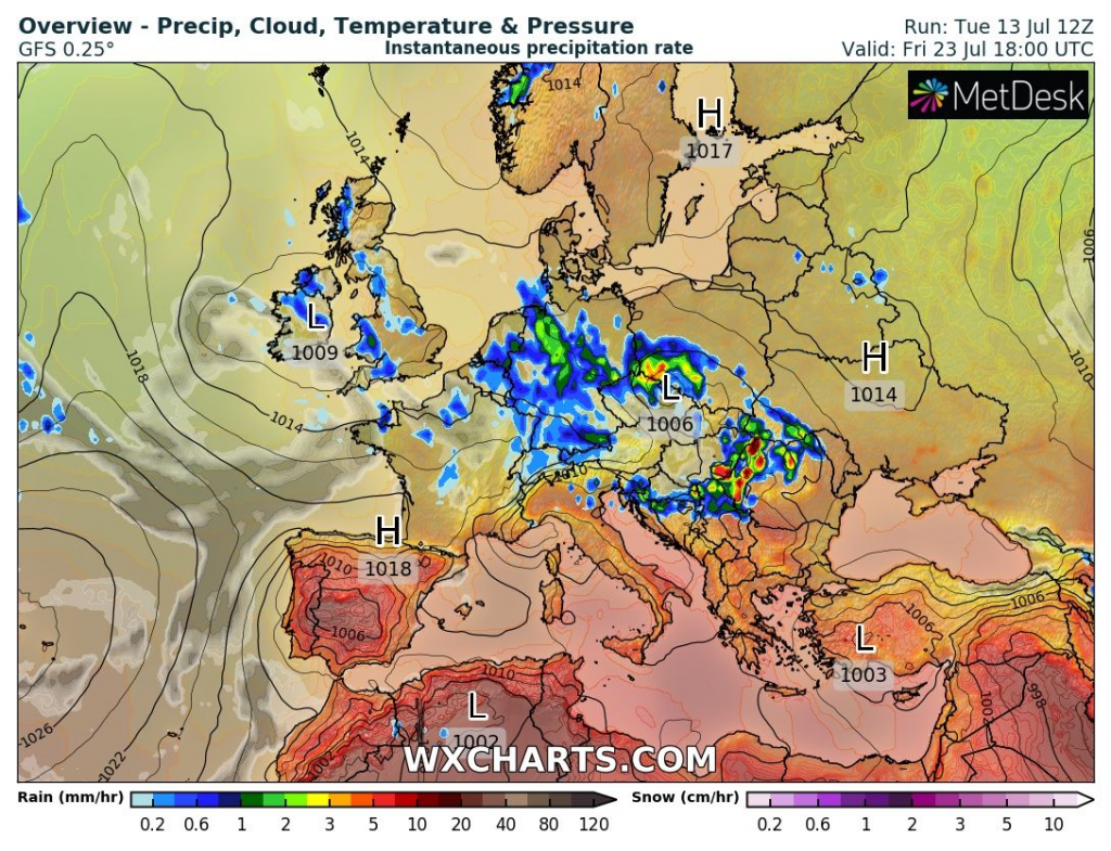
A new week will start with storm activity from the Alps to Ukraine and southward from this line up to Greece. Gradually, however, above western continental Europe will start a new storm round, until mid-workweek. Storms will gradually until Friday, 23. July should shift above the wider Carpathian region and later Eastern Europe.
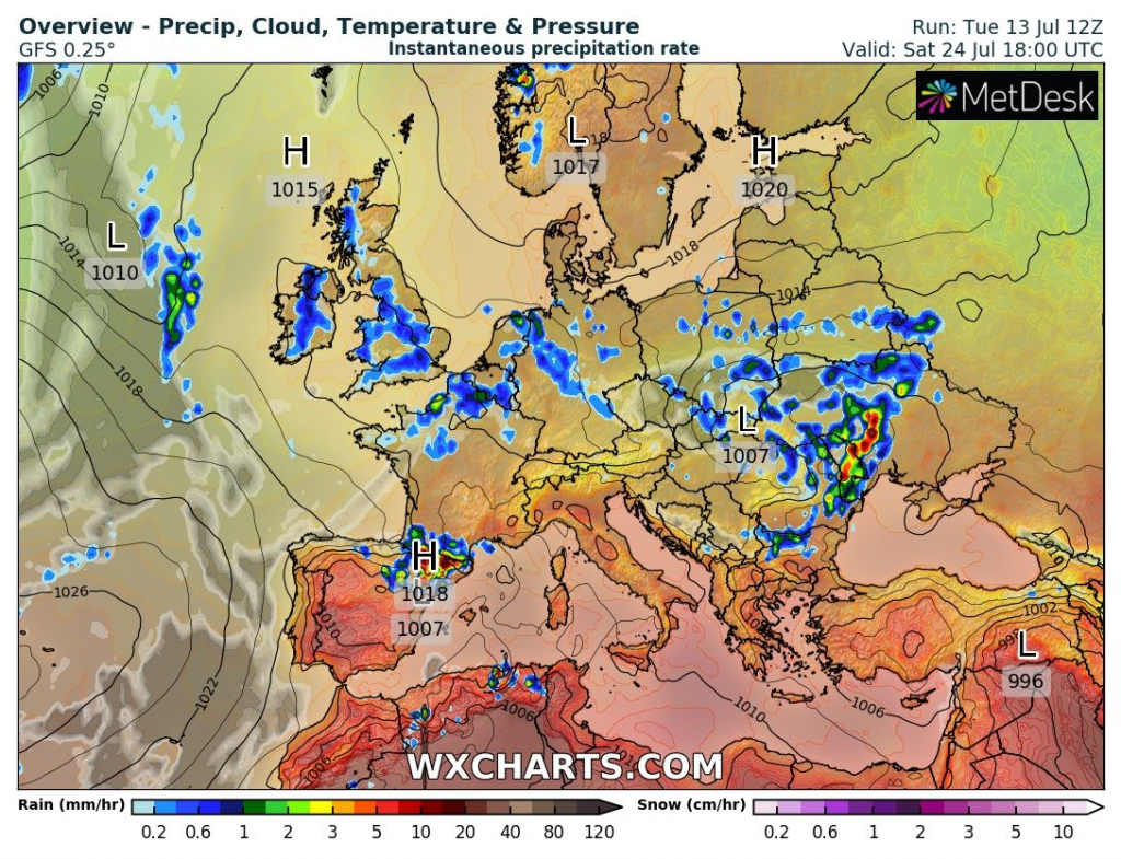
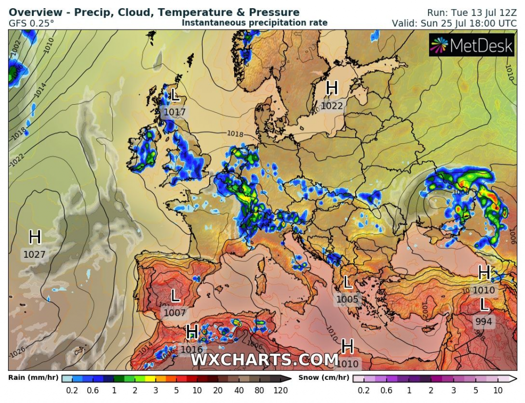
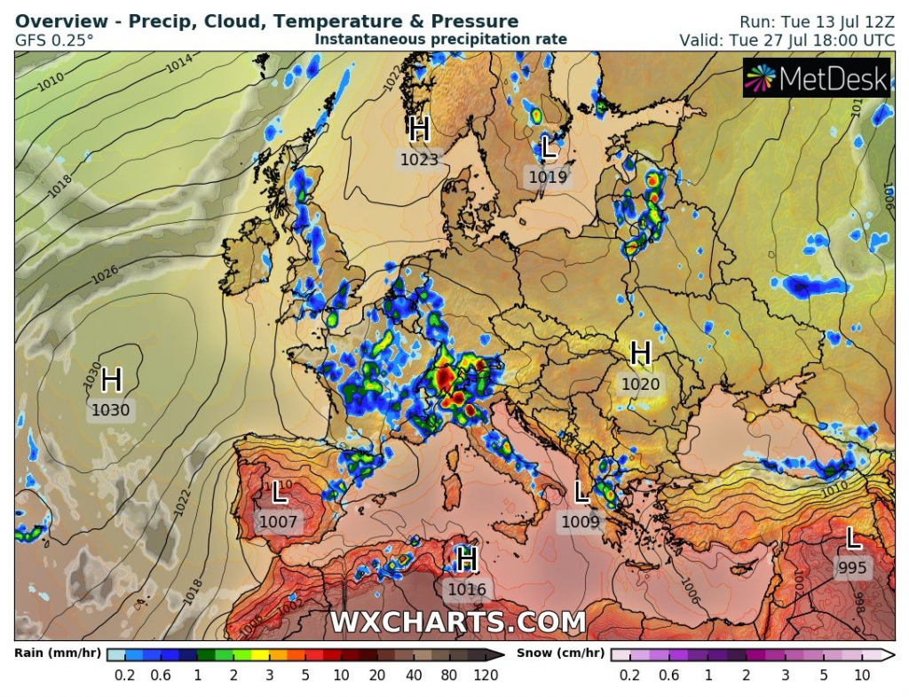
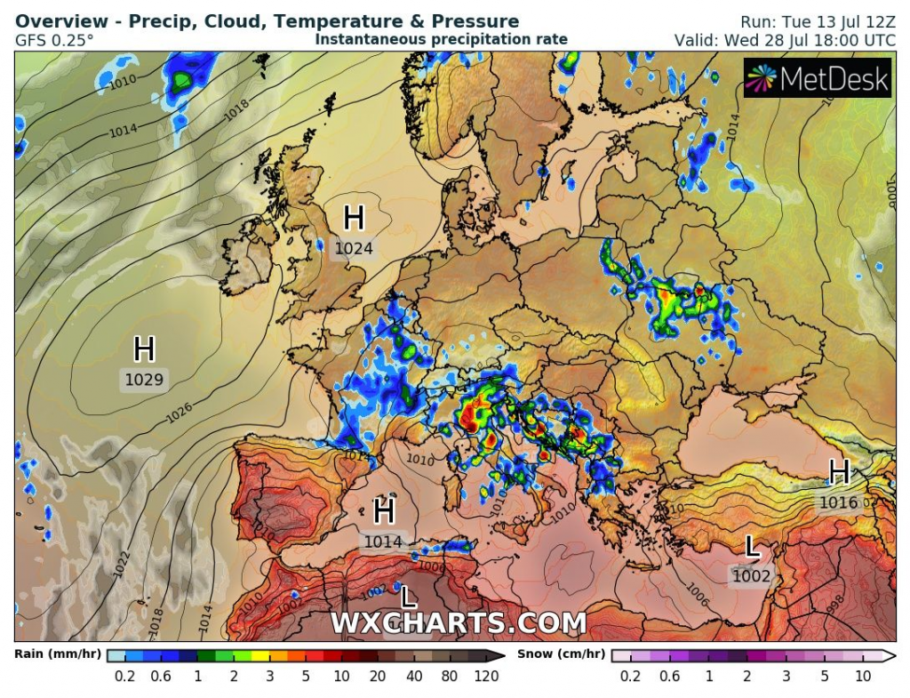
Then, a dry period is forecasted to peak above Europe, with some stronger storms in Alpine region and then Adriatic and western Balkan after 25. July 2021.
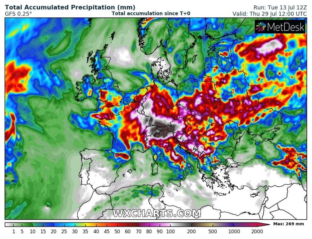

Source: http://wxcharts.com/


