The 1st Typhoon of Pacific Season, Wutip, Followed by Tropical Depression 94W Invest hit Vietnam, China, Koreas and Japan
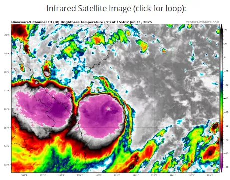
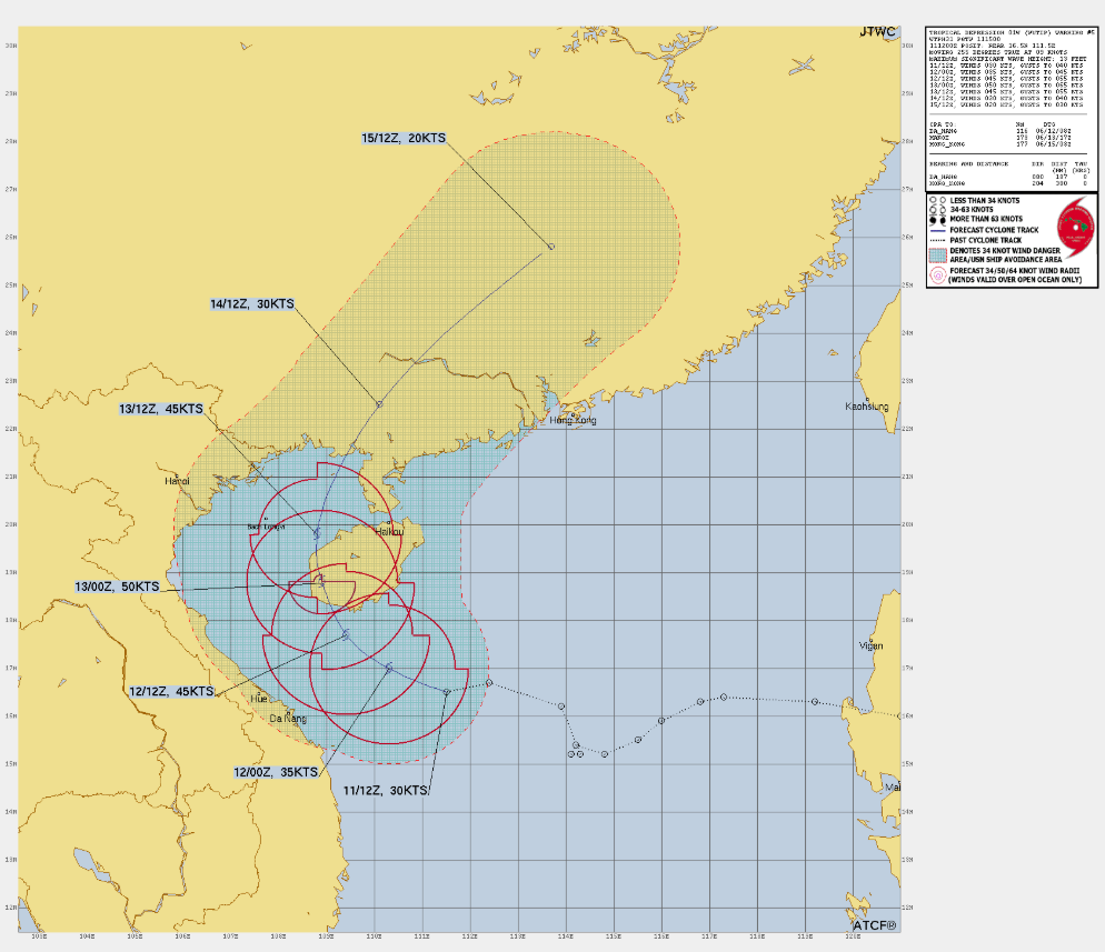
Tropical Cyclone Wutip, the first typhoon of the 2025 Pacific season, formed over the South China Sea on June 10. It intensified into a tropical storm and is expected to make landfall in Vietnam, southern China, including Hainan Island and Guangdong province, by June 13.
Simultaneously, Tropical Depression 94W (also known as Invest 94W) developed near the Paracel Islands. It is projected to move west-northwest, bringing heavy rain and potential flooding to parts of Taiwan and coastal areas of China.
Both systems are expected to bring significant rainfall and strong winds to the affected regions, with Wutip potentially reaching typhoon strength and 94W causing localized heavy rain and thunderstorms.
Residents in the impacted areas are advised to monitor local weather updates and prepare for possible disruptions.
Typhoon Wutip Track
- Origin: Wutip formed over the South China Sea around June 10, 2025.
- Initial movement: The system moved generally northwestward toward the southern coast of China.
- Expected landfall: Forecasts indicate Wutip will make landfall on or near Hainan Island, then move into Guangdong province.
- Further track: After landfall, Wutip is likely to weaken but may continue moving inland across southern China towards South Korea and Japan.
- Impacts: Coastal areas along its path can expect strong winds, heavy rainfall, and possible flooding.
Tropical Depression 94W Invest Track
- Origin: Developed near the Paracel Islands, east of Vietnam, shortly after Wutip’s formation.
- Movement: Moving generally west-northwest or northwest toward the coast of southern China and possibly Taiwan.
- Intensity: Currently a tropical depression, it may bring localized heavy rain, thunderstorms, and flooding.
- Impact areas: Taiwan’s northern and eastern regions and coastal provinces of China may experience significant rain. Then it aims towards Koreas and Japan.
- Potential development: The system’s intensification remains uncertain but warrants close monitoring.
Both systems are relatively close but following slightly different tracks, affecting overlapping but distinct regions. The South China Sea is currently active with these storms posing threats primarily to southern China, Hainan Island, Taiwan, and possibly the Koreas and Japan with peripheral effects depending on their evolution.
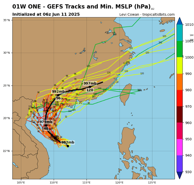
Source: https://www.tropicaltidbits.com/storminfo/#01W
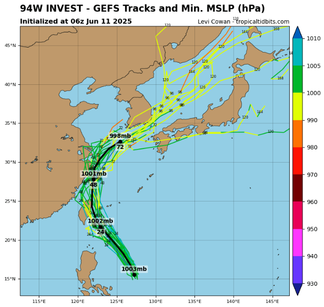
Source: https://www.tropicaltidbits.com/storminfo/#94W


