The Polar Jet Steam and Current Effects on European Weather in May of 2025
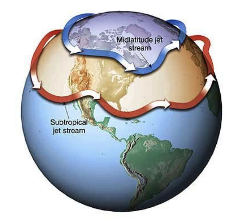
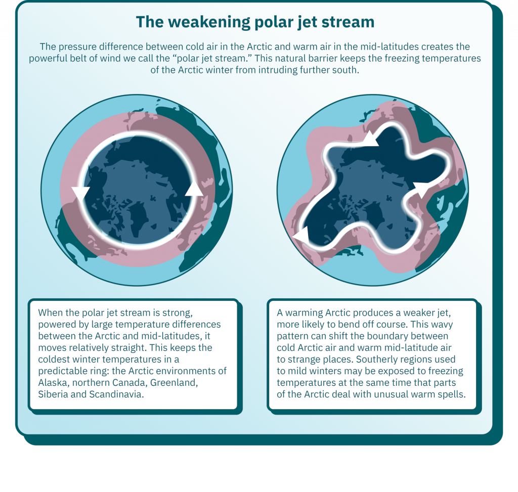
The northern polar jet stream is a narrow, fast moving mass of air that flows from west to east and has a significant impact on the movement of pressure and temperature systems across the Northern Hemisphere. Its flow can be disrupted and altered by the warming of arctic air during the Northern Hemisphere spring. The image below from the Massachusetts Institute of Technology’s Office of the Vice President for Climate illustrates this phenomenon.
In the animation below simulated with Global Forecast System (GFS) data, we can see the high pressure system in the mid-Atlantic slowly fade south before recovering and settling back into the northern ocean around the Azores on the 20th of May. This high pressure system will push the polar jet stream north into colder air before the jet stream intersects with Europe. As the winds of the jet stream go cold, they dump their contents over the European continent as they move east.
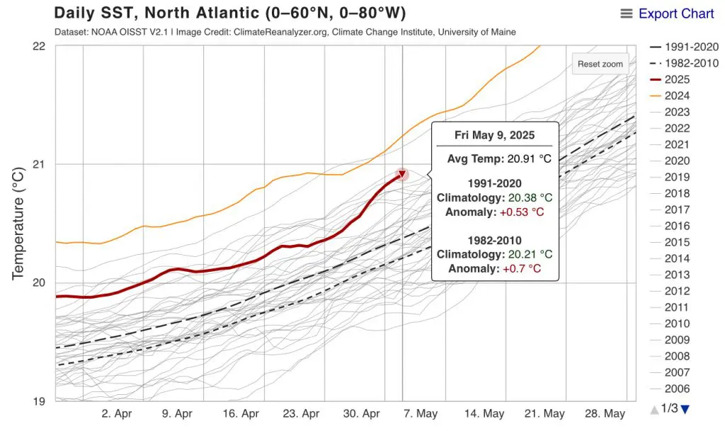
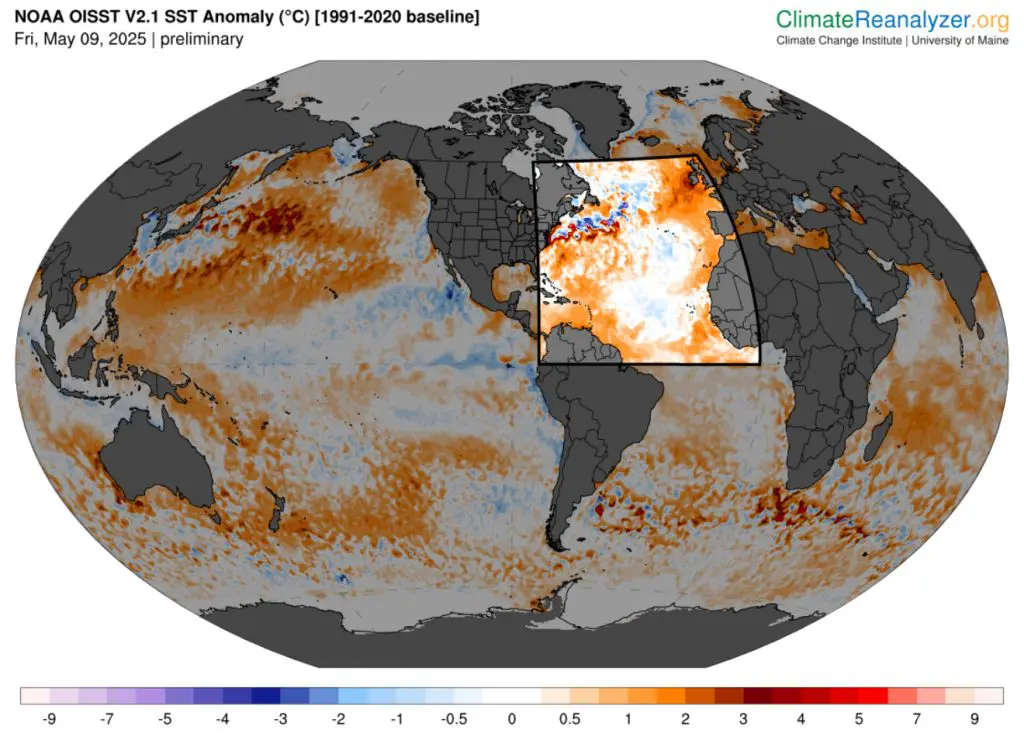
One main factor affecting the flow of the jet stream that makes 2025 notable is the high temperature of the North Atlantic. On the 9th of May, 2025, the North Atlantic’s average temperature reached the 4th highest ever recorded with data going back to 1981.
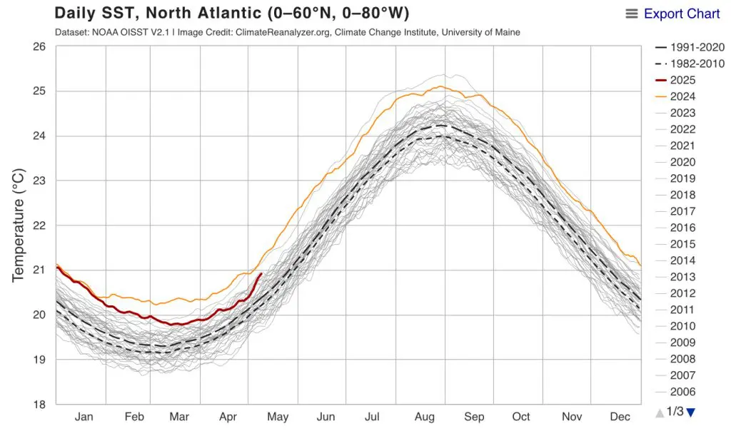
What is intriguing about right now is that just last week on May 2nd, the average temperature of the North Atlantic was the 10th highest recorded since 1981, 6 places lower. The rate of increase in the average temperature of the sea is accelerating. At the current rate of the month-over-month increase, as ocean temperatures in northern latitudes warm up due to seasonal changes, 2025 could become the 2nd warmest year for sea temperates in the North Atlantic by the end of May.
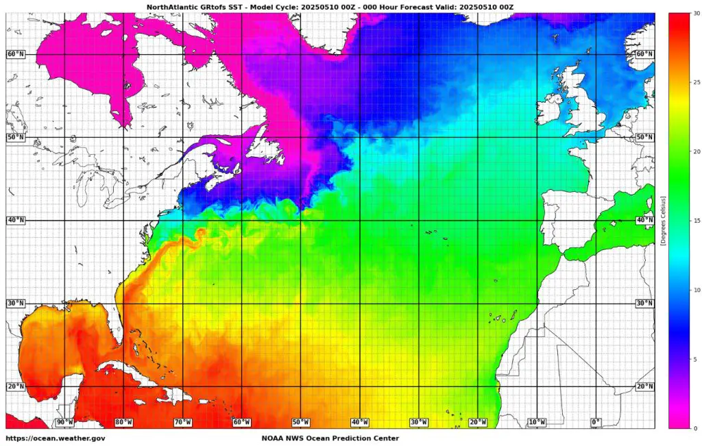
These higher sea temperatures as much as 3 or 4 degrees Celsius above what is normally expected for the time, with regions such as Atlantic Canada and the British Isles experiencing the brunt of the increased temperatures. In the image below, we can see the approximate line of flow for warm Gulf Stream waters, stretching diagonally from North Carolina to Ireland. These warmer waters cause low pressure systems to form because the warm air near the ocean’s surface can heat up and rise. The extent of the water temperatures of the Gulf Stream influences the extent of the jet stream and where low-pressure systems can form.
In the animation below compiled according to current GFS forecast data, expect low pressure systems to return to northwestern Europe before the end of May. This will bring cool and damp air over Western Europe, potentially spoiling the late spring vacations of many a tourist or traveler.
In Central and Eastern Europe, there remains a lingering low-pressure system caused by a mass of cool air of Arctic origin. This stubbornly persistent system keeps high pressure systems further west, while low pressure in the North Atlantic keeps at bay the high pressure to the east. In the animation below, you can see the area of high pressure seemingly stuck in place over the UK, France, western Scandinavia and the Benelux countries. Until the low pressure systems fade, there will not be much respite for the residents of Eastern Europe, while residents of Northern and Western Europe will enjoy temperatures above seasonal norms for a period of time until the end of May as shown by the second animation below showing temperature deviance from normal according to GFS meteorological simulation.


14 thoughts on “The Polar Jet Steam and Current Effects on European Weather in May of 2025”
Comments are closed.