Tropical Depression 03W (Three) Hit Southern China and Northern Vietnam
🌀 Tropical Cyclone THREE Develops in the Northern South China Sea
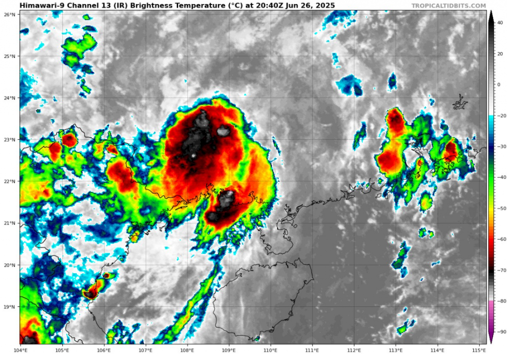
As of 12:00 UTC on June 26, 2025, Tropical Cyclone THREE is a developing tropical disturbance situated over the northern South China Sea, beginning to organize under moderately favorable atmospheric conditions.
📍 Current Position & Stats:
- Location: 21.7°N, 109.8°E
(Just southwest of China’s Guangxi coastline and near northeastern Vietnam) - Maximum Sustained Winds: 25 knots (46 km/h or 29 mph)
- Minimum Central Pressure: 1003 hPa
- Radius of Maximum Winds (RMW): 105 nautical miles (~195 km)
No gust data or environmental pressure has been officially provided yet, and radius of circulation remains undefined, indicating a still-weak, broad circulation typical of early-stage cyclones or monsoonal gyres.
🧭 Forecast & Conditions
- The cyclone remains poorly organized, with broad low-level rotation but lacking a defined core or sustained deep convection.
- Located over warm waters (~29–30 °C) and low-to-moderate vertical wind shear, the system may gradually intensify in the next 24–48 hours.
- Steering flow suggests a slow westward or west-northwest drift, potentially affecting southern China or northern Vietnam by the weekend.
⚠️ Potential Impacts
- Heavy rainfall could impact coastal regions of southern China (especially Guangxi and Guangdong) and northern Vietnam regardless of tropical storm classification.
- Flash flooding and landslides may occur in mountainous inland areas if the system moves onshore.
- Maritime conditions in the northern South China Sea are expected to deteriorate, with increasing wave heights and localized squalls.
This system was being monitored for potential development into a tropical storm. Given its proximity to land, even minimal strengthening could result in impactful weather for densely populated coastal areas.
Source: https://www.tropicaltidbits.com/sat/satlooper.php?region=03W&product=ir


