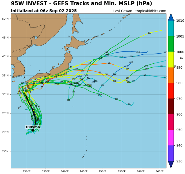
Invest 95W, currently classified as a tropical depression, is gaining attention in the western Pacific as it drifts toward Japan. As of 12:00 UTC, September 2, 2025, the center of the system was analyzed near 21.5°N, 132.6°E with maximum sustained winds of 20 kt (25 mph / 37 km/h) and a minimum central pressure of 1005 mb. Despite its weak classification, the system has an unusually large radius of maximum winds – nearly 180 nautical miles, which makes it a broad circulation capable of producing widespread impacts even without hurricane intensity.
Satellite imagery shows a sprawling envelope of cloud cover and convection, though the low-level center remains poorly defined. The system’s large size allows it to pull in abundant tropical moisture, which is expected to stream northward toward the Japanese islands in the coming days. While the winds are relatively weak at present, the expansive structure ensures that heavy rainfall and gusty squalls will cover a wide geographic region.
Forecast models indicate that Invest 95W will move generally northwestward under the steering influence of the subtropical ridge to the east. This trajectory places the depression on a direct path toward the Ryukyu Islands and eventually the main islands of Japan. Even if the system does not strengthen significantly into a tropical storm, its moisture shield and broad wind field will create a major rainfall threat. Rainfall totals could easily exceed 200 mm (8 inches) in some regions, raising the risk of flash flooding, landslides, and river flooding across Kyushu, Shikoku, and southern Honshu.
The size of the circulation means that coastal regions will also be affected by long-period swells and rough seas, with conditions deteriorating well before the center makes its closest approach. Ports and shipping lanes across the East China Sea and Philippine Sea are already monitoring the situation closely, as vessels may encounter gale-force gusts in outer rainbands even at large distances from the core.
Historically, large tropical depressions and invests in the western Pacific often evolve into more organized systems as they near Japan, especially when upper-level conditions align. Current indications suggest that 95W will remain a sprawling but relatively weak depression, though the possibility of gradual strengthening into a tropical storm before landfall cannot be ruled out. Regardless of its classification, the primary hazard remains torrential rainfall over densely populated areas.
In summary, Invest 95W is a tropical depression with winds of 20 kt, a pressure of 1005 mb, and an exceptionally large radius of maximum winds of 180 nm. The system is expected to impact Japan with heavy rain, flooding, and rough seas, regardless of whether it intensifies further. Its sheer size makes it a serious hydrological threat, and preparations across southern Japan should focus on flood protection and landslide prevention rather than purely on wind damage.
Source: tropicaltidbits.com


