Tropical Disturbances 10W Ten, 98W Invest and 99W Invest Hits Philippines, Taiwan, China, Japan and Koreas
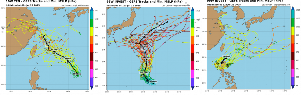
TROPICAL SYSTEMS IN THE WESTERN PACIFIC: THREE DEVELOPING THREATS ON JULY 22, 2025
The Western Pacific is active once again, with three notable tropical disturbances spinning across the region: Tropical Depression TEN, Invest 98W, and Invest 99W. Each of these systems is at a different stage of development, but all are being monitored closely for potential strengthening and future impacts across East and Southeast Asia.
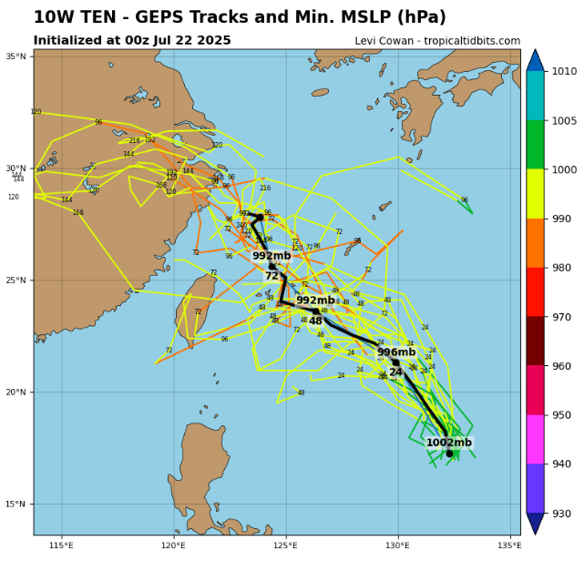
🌀 Tropical Depression TEN: Steadily Organizing East of the Philippines
As of 12:00 UTC on July 22, 2025, Tropical Depression TEN was located at 19.6°N 131.6°E, slowly moving westward over the open ocean.
- Maximum sustained winds were reported at 25 knots
- Minimum central pressure: 1003 mb
- The radius of maximum winds was estimated at a broad 105 nautical miles
Although currently weak and disorganized, this depression has ample room for intensification due to relatively warm sea surface temperatures and moderate vertical wind shear. Forecast models hint at possible development into a tropical storm as it approaches the Philippine Sea later in the week. Local maritime interests and coastal authorities across northern Luzon and the Ryukyu Islands should stay alert.
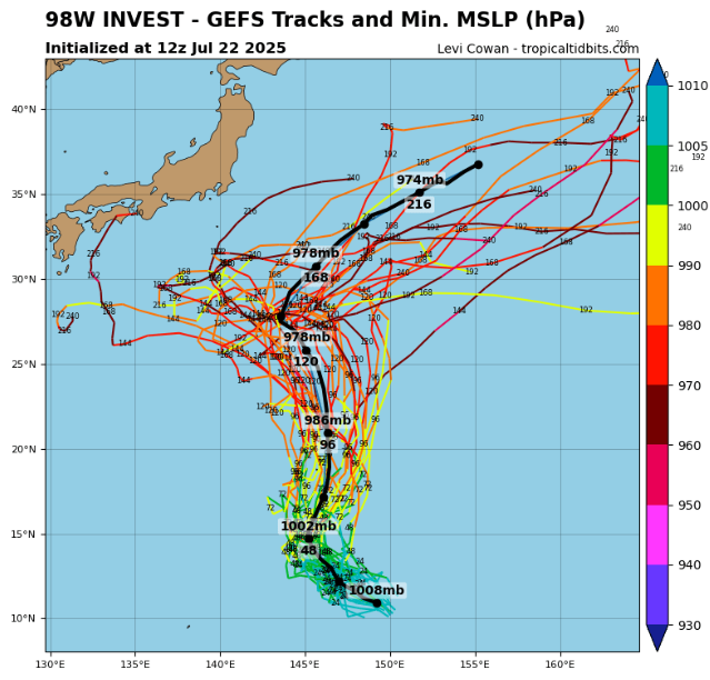
🌊 Invest 98W: Broad Circulation Southeast of Guam
Meanwhile, Invest 98W remains an area of concern in the central-western Pacific.
- As of the same 12:00 UTC update, it was located at 11.1°N 149.0°E
- Winds are currently 20 knots
- Pressure sits at 1007 mb
- The radius of maximum wind is large — estimated at 180 nautical miles
This wide circulation is struggling to consolidate but could gradually organize as it tracks west-northwest toward Guam and the Marianas. Atmospheric conditions are marginally favorable for development in the next 2–3 days, with slow strengthening possible if the center can become more defined.
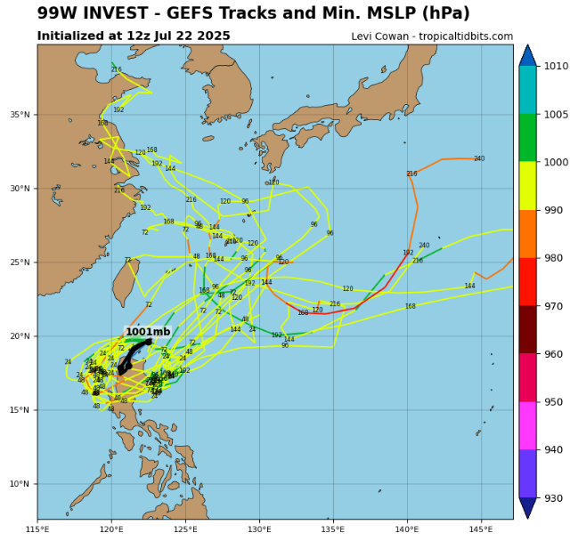
🌧 Invest 99W: Watch Near the Northern Philippines
Further west, Invest 99W is the closest system to land, positioned near northern Luzon at 19.2°N 121.8°E as of 18:00 UTC.
- Winds are 20 knots
- Central pressure is down to 1000 mb, the lowest among the three
- Other structural details remain unavailable
Despite lacking a clear low-level center, the low pressure and proximity to land make Invest 99W a notable rainfall threat to northern Luzon, possibly bringing localized flooding, especially along mountainous terrain. If the system drifts westward into the South China Sea, it may organize further under favorable oceanic conditions.
🔍 Summary and Outlook
The tropical basin remains active with three systems in various stages:
- TD TEN could become the next named storm with continued westward motion.
- Invest 98W is a broad and slowly organizing tropical area near Micronesia.
- Invest 99W threatens the Philippines with rain and may later develop in the South China Sea.
Close monitoring is advised, as rapid intensification or interactions between systems can alter forecast scenarios quickly.
Source: tropicaltidbits.com


