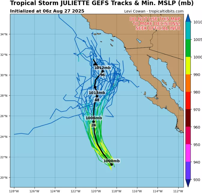
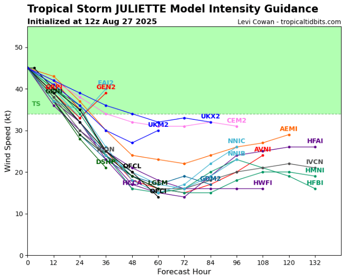
Tropical Storm 10E Juliette formed in the eastern Pacific Ocean in late August 2025 and rapidly intensified to a moderate tropical storm. As of its peak over open waters, Juliette had sustained winds near 45–50 knots (≈85–95 km/h) and a central pressure around 1004–1006 mb. The storm’s radius of maximum winds was approximately 35–40 nautical miles, while tropical storm-force winds extended outward, producing significant oceanic swells.
The storm tracked north-northeastward along the Baja California Peninsula, maintaining tropical storm intensity due to warm sea surface temperatures (>28 °C) in the Gulf of California. Its movement brought heavy rainfall and strong gusty winds to western Mexico, particularly Sinaloa, Sonora, and Baja California Sur. Rainfall totals in affected regions reached 100–200 mm, triggering flash floods, landslides, and localized road closures, especially in mountainous terrain. Coastal winds gusted up to 80–90 km/h, causing minor structural damage, uprooted trees, and temporary power outages.
As Juliette approached southern California, it underwent slight weakening over cooler waters and interaction with a high-pressure ridge along the U.S. West Coast. Despite not being a hurricane, the system generated large swells along California’s southern and central coastlines, with wave heights of 2–4 meters, leading to coastal erosion and dangerous rip currents. Rainfall was lighter than in Mexico, averaging 20–50 mm in southern California, but was locally enhanced in mountainous areas of San Diego, Los Angeles, and the Sierra Nevada foothills, increasing the risk of flash flooding and mudslides in burn-scarred regions.
Meteorologically, Juliette retained a well-defined tropical structure for much of its east-northeast track. Moisture from the storm interacted with local mid-latitude systems over California, enhancing precipitation and gusty winds. Offshore, shipping lanes experienced reduced visibility, high seas, and gusty winds, requiring precautionary navigation measures.
Summary of Impacts:
- Mexico: Heavy rainfall (100–200 mm), flash floods, landslides, gusty winds up to 90 km/h, minor coastal and urban damage.
- California: Moderate rainfall (20–50 mm), mountainous flash flooding, rip currents and coastal erosion, gusts up to 60–70 km/h in exposed areas.
- Oceanic Impacts: 2–4 m swells along California, Gulf of California, and southern Baja coasts, hazardous for shipping and recreation.
Though Juliette was not a major hurricane, its combined rainfall, gusty winds, and wave action made it a significant tropical storm hazard for both western Mexico and southern California, demonstrating how eastern Pacific tropical storms can impact regions far from the storm’s tropical core.
Source: https://www.tropicaltidbits.com/storminfo/#10E


