
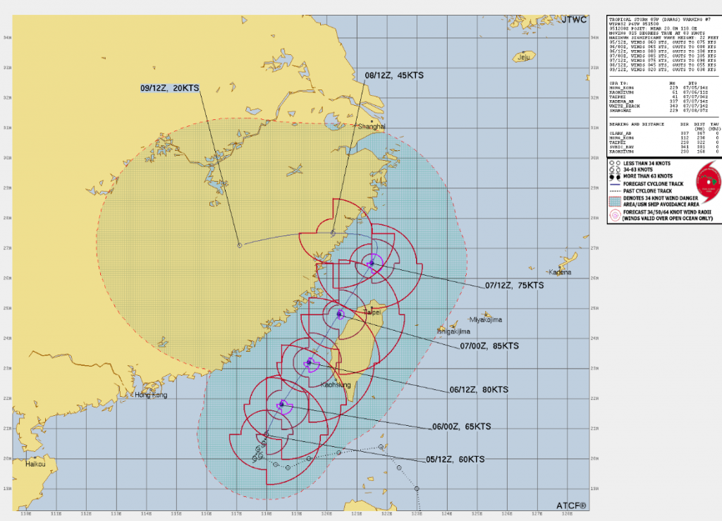
Tropical Storm Danas made landfall in southern Taiwan on Sunday, July 6, 2025, bringing heavy rain, strong winds, and coastal hazards to the island. The Central Weather Administration (CWA) issued land warnings for Tainan, Kaohsiung, Chiayi, Pingtung, and Penghu counties, as the storm’s outer bands began affecting these areas.
As of 8:30 p.m. on July 5, Danas was located approximately 330 kilometers west-southwest of Cape Eluanbi, Taiwan’s southernmost point, moving north-northeast at 10 to 20 kilometers per hour. The storm had maximum sustained winds near 83 km/h, with gusts up to 108 km/h. Despite not making a direct landfall, Danas’ outer bands brought extremely heavy rain, thunderstorms, and strong winds to southern and eastern Taiwan. The CWA warned of localized flash floods, dangerous surf conditions, and possible tornadoes in affected areas.
In preparation for the storm, schools and offices in Tainan, Kaohsiung, Chiayi, Pingtung, and Penghu counties were closed on Sunday. Airline and ferry services were also disrupted, particularly at Kaohsiung International Airport. The CWA advised residents to stay indoors, avoid coastal areas, and monitor official weather updates.
After passing through the Taiwan Strait, Danas is expected to make landfall in mainland China, likely south of Wenzhou, within the next 48 to 72 hours. The storm is projected to weaken rapidly as it interacts with the terrain, with complete dissipation expected within four days.
While Danas is not expected to reach typhoon strength, its impacts highlight the vulnerability of coastal regions to tropical storms. Residents in Taiwan and China are urged to remain vigilant and prepared for potential flooding, strong winds, and other storm-related hazards.
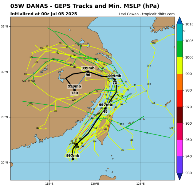
Source: tropicaltidbits.com


