Tropical Storm Fernand formed in the central Atlantic and, as of 12:00 UTC on August 27, 2025, was located at 38.2°N, 50.4°W, with maximum sustained winds of 40 knots and a central pressure of 1007 mb. The storm’s structure remained compact, with a radius of maximum winds of 40 nautical miles. While relatively weak, Fernand was well-organized and steadily moving northeastward, carrying a moisture-rich tropical plume toward Europe.
Forecasts indicate that Fernand is expected to reach the British Islands and northern France in roughly 72 hours, with its tropical characteristics transitioning to a post-tropical cyclone as it interacts with the mid-latitude westerlies. Despite the weakening of maximum winds, the system is expected to produce gusty winds, heavy rainfall, and localized flooding across multiple regions.
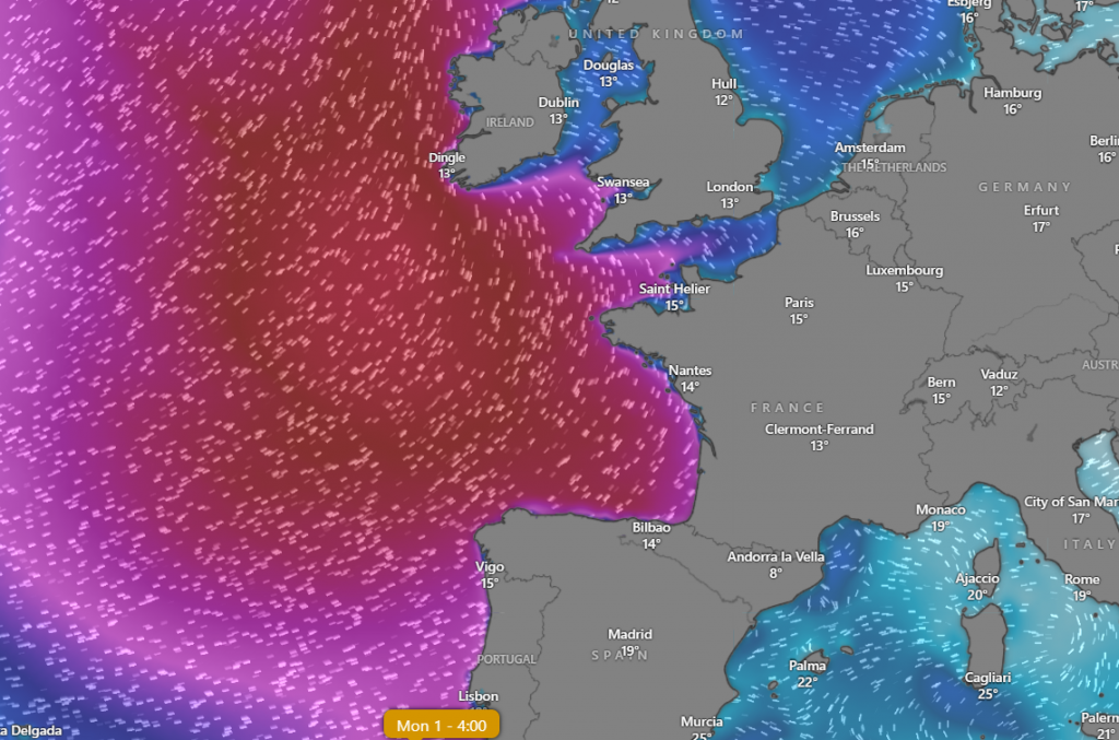
In the British Islands, forecasts predict southerly to southwesterly gusts of 60–80 km/h, with moderate coastal wave activity. Rainfall could accumulate 30–60 mm over 24 hours, particularly affecting western coasts of Ireland, Scotland, and northern England. Urban areas may see localized flooding, while transport and power infrastructure could experience minor disruptions.
For northern France, Fernand’s remnants are expected to bring 40–80 mm of rainfall to Brittany, Normandy, and the Channel coast, accompanied by gusts up to 70 km/h. Minor storm surge is possible along exposed Atlantic-facing coasts, but significant damage is unlikely given the storm’s weakening intensity. Inland regions may see scattered gusty winds that could impact roads and outdoor activities.
Meteorologically, Fernand’s tropical moisture interacting with existing frontal systems may enhance rainfall totals in localized areas. Northern Europe, including the Low Countries and southern Scandinavia, may experience secondary rainfall events and gusty conditions as the system accelerates northeastward. The post-tropical transition is expected to increase the storm’s horizontal extent, spreading moderate wind and rainfall impacts across a wider area than the original tropical circulation.
While not a hurricane-force event, Fernand demonstrates how even a modest tropical storm can affect Europe by transporting tropical moisture into mid-latitude systems, producing rainfall, gusty winds, and minor coastal impacts in the late summer period.
Forecasted Impacts of Tropical Storm Fernand Across Europe
| Region | Forecasted Peak Gusts (km/h) | Forecasted Rainfall (mm) | Forecasted Storm Surge / Waves | Main Expected Impacts |
|---|---|---|---|---|
| Ireland (west & north) | 60–80 | 30–60 | 2–3 m waves along Atlantic coast | Localized flooding, minor power outages, fallen trees, travel disruption |
| UK (Scotland, Northern England) | 60–75 | 25–50 | 1–2 m surge, waves 2–4 m | Wind damage to trees & light structures, flash flooding in urban areas |
| Northern France (Brittany, Normandy, Channel coast) | 60–70 | 40–80 | 1–2 m surge, 2–3 m waves | Coastal flooding, moderate wind damage, travel & ferry disruptions |
| Belgium & Netherlands | 50–65 | 20–40 | Minor surge, waves 1–2 m | Urban flooding, gusty winds affecting transport |
| Northern Spain (Basque Country, Galicia) | 50–65 | 30–60 | 1–2 m waves | Coastal erosion, localized landslides in mountains, flooding of rivers |
| Portugal (North Coast) | 50–60 | 20–40 | 1–2 m waves | Minor coastal flooding, scattered road disruptions |
| Western Germany | 45–60 | 25–50 | N/A | Gusty winds impacting trees, power lines, and minor flooding |
| Switzerland (western lowlands) | 45–55 | 40–70 | N/A | Localized river flooding, wind gusts in exposed valleys |
| Scandinavia (Norway, Denmark, Sweden) | 50–65 | 20–50 | 1–2 m Baltic & North Sea surge | Gusty winds, coastal flooding, disruption to ferry services |
| Northern Italy (Alps foothills) | 40–55 | 30–60 | N/A | Orographic rainfall leading to flash floods and minor landslides |
| Central Europe (Poland, Czechia, Slovakia, Hungary) | 40–50 | 20–40 | N/A | Scattered rainfall, minor flooding, gusty winds in exposed areas |
| Baltic States (Estonia, Latvia, Lithuania) | 40–50 | 20–40 | 0.5–1 m surge in coastal areas | Minor coastal flooding, gusty winds, transport delays |
| Finland | 35–45 | 15–30 | 0.5–1 m surge | Gusts over lakes, minor flooding, disruption to small craft |
| Eastern Europe (Romania, Bulgaria) | 35–45 | 15–30 | N/A | Isolated rainfall, minor flash flooding in mountainous regions |
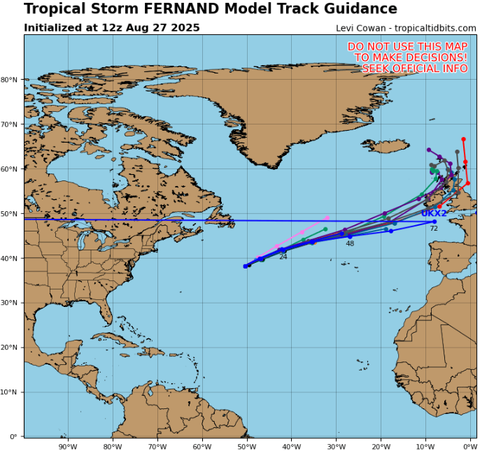
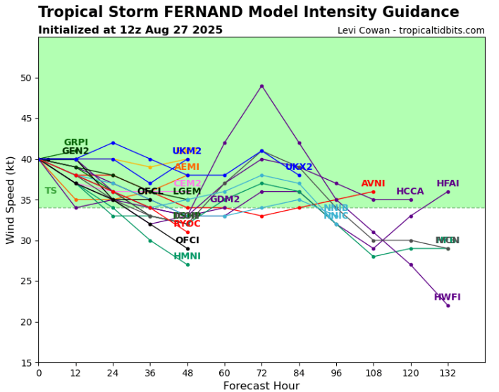
Source: https://www.tropicaltidbits.com/storminfo/#06L
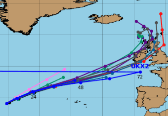
Detail.
Source: https://www.windy.com/-Waves-waves?waves,2025-09-01-02,47.437,-0.914,5


