Tropical Storm Kajiki is a strong tropical storm in the South China Sea that has made landfall along the central coast of Vietnam. As of the latest observations, Kajiki is producing sustained winds near 50–60 knots (≈90–110 km/h) with a central pressure around 995–998 mb. The system’s tropical storm-force winds extend roughly 50–60 nautical miles from the center, while heavy convective bands are delivering intense rainfall to coastal and inland areas.
Kajiki’s landfall has caused deadly impacts in central Vietnam, particularly in the provinces of Quang Nam, Quang Ngai, Thua Thien-Hue, and Da Nang. Rainfall totals are estimated at 200–350 mm, with localized accumulations exceeding 400 mm in mountainous terrain, leading to flash floods, river overflow, and landslides. The storm’s gusty winds, reaching 90–110 km/h, have caused roof damage, uprooted trees, and widespread power outages. Coastal communities have experienced storm surge and wave heights of 2–3 meters, inundating low-lying areas.
As Kajiki moves inland, it is expected to weaken gradually but will continue to bring heavy rainfall and strong winds across central and northern Vietnam. Flooding is likely to affect rice paddies, urban areas, and river systems, with secondary impacts in Laos and Cambodia as moisture spreads inland. Emergency services have been mobilized, and evacuations of vulnerable coastal populations are underway to reduce casualties.
Summary of Impacts:
- Central Vietnam: Heavy rainfall (200–350 mm, locally >400 mm), flash floods, landslides, river flooding, gusty winds 90–110 km/h, coastal flooding, structural damage, power outages.
- Northern Vietnam / Laos / Cambodia: Continued heavy rainfall (50–150 mm), river flooding, gusty winds 50–70 km/h, urban and agricultural impact.
- Coastal & Oceanic Hazards: 2–3 m waves and storm surge along the South China Sea, hazardous for small craft and low-lying coastal settlements.
Regional Impact Table for Tropical Storm Kajiki
| Region | Forecasted Peak Gusts (km/h) | Forecasted Rainfall (mm) | Forecasted Storm Surge / Waves | Main Expected Impacts |
|---|---|---|---|---|
| Central Vietnam Coast (Quang Nam, Quang Ngai, Thua Thien-Hue, Da Nang) | 90–110 | 200–350, locally >400 | 2–3 m surge | Flash floods, landslides, river flooding, roof damage, power outages |
| Central Highlands, Vietnam | 70–90 | 150–250 | N/A | Landslides, river flooding, urban and rural inundation |
| Northern Vietnam (Red River Delta, Thanh Hoa, Nghe An) | 50–70 | 80–150 | Minor surge along coast | Flooded roads, river overflow, gusty winds affecting structures |
| Laos (northern regions) | 45–60 | 50–120 | N/A | Mountainous flooding, landslides, river swelling |
| Cambodia (northwestern regions) | 40–55 | 40–100 | N/A | Flash flooding, minor agricultural and urban impact |
| South China Sea (offshore) | 60–80 | N/A | 2–3 m waves | Dangerous seas, hazardous for shipping and fishing vessels |

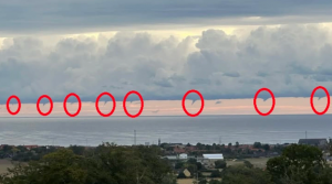
Illustration picture. Source: https://www.nationthailand.com/news/general/40054568

