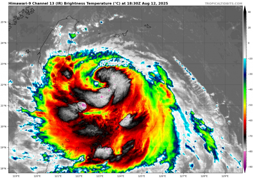
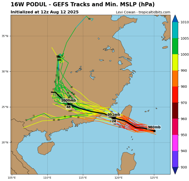
Typhoon Podul, a powerful tropical cyclone, is making landfall between Taiwan and China with maximum sustained winds of 80 kt (148 km/h) and a minimum central pressure of 975 mb. As of 12:00 UTC, Aug 12, 2025, Podul’s center was located at 21.6°N 125.0°E, moving northwest toward heavily populated coastal regions. The storm’s radius of maximum wind is 60 nautical miles, with gale-force winds extending far into all quadrants, bringing intense rainfall, storm surge, and destructive winds.
Threats
Power outages expected in multiple provinces.
Damaging winds capable of uprooting trees and damaging infrastructure (sustained winds of 150 km/h)
Flooding rains exceeding 300 mm in some mountain regions.
Coastal surge raising sea levels 1–2 meters above normal tides.
- Taiwan: Coastal flooding, wind gusts >150 km/h, risk of landslides in mountainous terrain, and 100–300 mm rainfall in 24 hours.
- China’s Fujian & Zhejiang provinces: Major storm surge, extensive agricultural damage, disruption of shipping routes, and power outages expected.
- Maritime zones: Hazardous waves exceeding 8 meters, dangerous for all vessels.
Forecast Outlook
Podul is expected to retain typhoon strength as it brushes Taiwan’s northeast before making final landfall in southeastern China. Rapid weakening will occur inland, but flooding risks will persist. Authorities have issued red alerts for both wind and rainfall, urging residents to prepare for full-scale typhoon impacts.
Current Status (Aug 12, 2025)
| Parameter | Value |
|---|---|
| Location | 21.6°N 125.0°E |
| Maximum Sustained Winds | 80 kt (148 km/h) |
| Minimum Central Pressure | 975 mb |
| Radius of Maximum Wind | 60 nm |
| Movement | NW toward Taiwan/China |
| 34 kt Wind Radii | All quadrants affected |
Source: https://www.tropicaltidbits.com/storminfo/#16W


